• Blog
  • Blog Index
  • Video Work
  • About
Menu

Thomas Bardenett

Urban Planning - Writer - Filmmaker
  • Blog
  • Blog Index
  • Video Work
  • About

Bus Rapid Transit: A Response

April 13, 2023

Public transit is at a precarious moment in time with ridership still significantly below pre-pandemic levels, a significant driver shortage, and the approaching depletion of federal funds meant to shore up operating budgets. While some newspapers are looking for answers to how transit agencies might approach solving these issues (funding more frequent service, reducing fares, reforming construction procedures), others, including my hometown paper, have chosen to openly question one of the first significant investments in transit in my lifetime.

On April 6, 2023, the largest news outlet in Syracuse published an article titled, “Centro has millions of dollars and a new idea. Will anyone ride it?” The article aims to inform readers of the upcoming implementation of bus rapid transit (BRT) but instead frames the investment as a boondoggle that is unlikely to attract riders and does not provide service to the areas that truly need it. Well, as you can imagine, it sparked a lot of conversation amongst advocates and planners who see BRT for what it truly is: a major step in the right direction. So let us look at some of the issues raised in the report, what they got wrong, what they oversimplified, and how we should be looking at this investment.

First, let’s begin with a key fact that the report chose to omit - the BRT plan currently moving forward is based on an extensive study completed by the SMTC in 2018 (SMART 1). This is not a new scheme, but instead a thoroughly researched plan based on best practices seen in cities across the world, including in nearby cities such as Albany and Cleveland. The plan identified the two routes, which form an X across the city due to the high demand of ridership already seen along those corridors. They connect the three largest employment centers within the region (Downtown Syracuse, Destiny USA, and University Hill), some of the densest neighborhoods in the city, along with four large college campuses (Syracuse University, SUNY ESF, SUNY Upstate, SUNY OCC) and a fifth satellite campus (SUNY Oswego’s metro campus in Downtown Syracuse). As the vast majority of City residents commute within the City, not just for work but for their daily needs, improving access to these key destinations is vital. BRT will become the backbone of the transit system.

View fullsize  Many bus stops in Syracuse currently lack shelters, sidewalks, or even a flat piece of ground to wait.
View fullsize  Walking conditions along bus routes vary, with some in unpleasant areas beneath highway overpasses. BRT stations must be located in key, centralized areas to promote easy acces.

Now the article does bring up the valid concern of individuals who must reach far flung suburban jobs or medical appointments. Over the past 70 years, Onondaga County has promoted suburban sprawl through zoning and land use policies that have resulted in a decentralization of services and jobs. Shopping centers, office parks, and medical campuses now sit on the fringes of our county, making themselves difficult to reach for anyone who does not own a car. This form of development also makes transit difficult as every mile added to a route means the frequency of that service will decline. This is why many routes in our region are lucky if they have a bus more than once an hour. Spreading service thin to serve a handful of individuals or workplaces is not a sustainable model for mass transit. This has led to difficult decisions in the past. In 2017, the Town of DeWitt built a new public library, moving away from its long time location in Shoppingtown Mall as that property was slowly abandoned all together. The library’s new location is roughly a mile away from an existing bus route. Instead of the Town working with Centro to identify a location along existing routes, the library was built and then service was demanded. Centro, understanding that this additional mile would throw off the rest of that route’s service, made the difficult decision not to serve the library. This same story could be written for many employers who choose to be located in suburban communities but rely on workers from the City who in turn rely on Centro. 

Riders are right to voice their frustration with old routes that no longer make sense, or routes that result in longer trips than needed. Central Current, a start-up news outlet, wrote a tremendous series on rider experiences that reflect these issues, but also showcase what the service means to them. There are models of service that can help fill these gaps experienced by a more suburban oriented growth pattern. The individuals quoted in the article who provide van and shuttle services to specific employment centers are following more realistic models for how to serve these locations. Sending a 40 or 60 ft bus to carry one or two people just does not work. This is why Centro is also exploring the use of vans for on-call services in more suburban locations, something mentioned in passing in the article but given no explanation. LA Metro, RTS in Rochester, and CDTA in Albany have all begun experimenting with similar services to supplement their fixed route systems. Riders can either travel door to door within specific zones, or from a fixed route stop to their final destination, calling a van with an app similar to Uber. These are not replacements for fixed route services, but instead help boost flexibility in areas that are not conducive to mass transit services.

View fullsize CDTA Flex.png
View fullsize Metro Micro.png

So what should we be looking for in a BRT system?

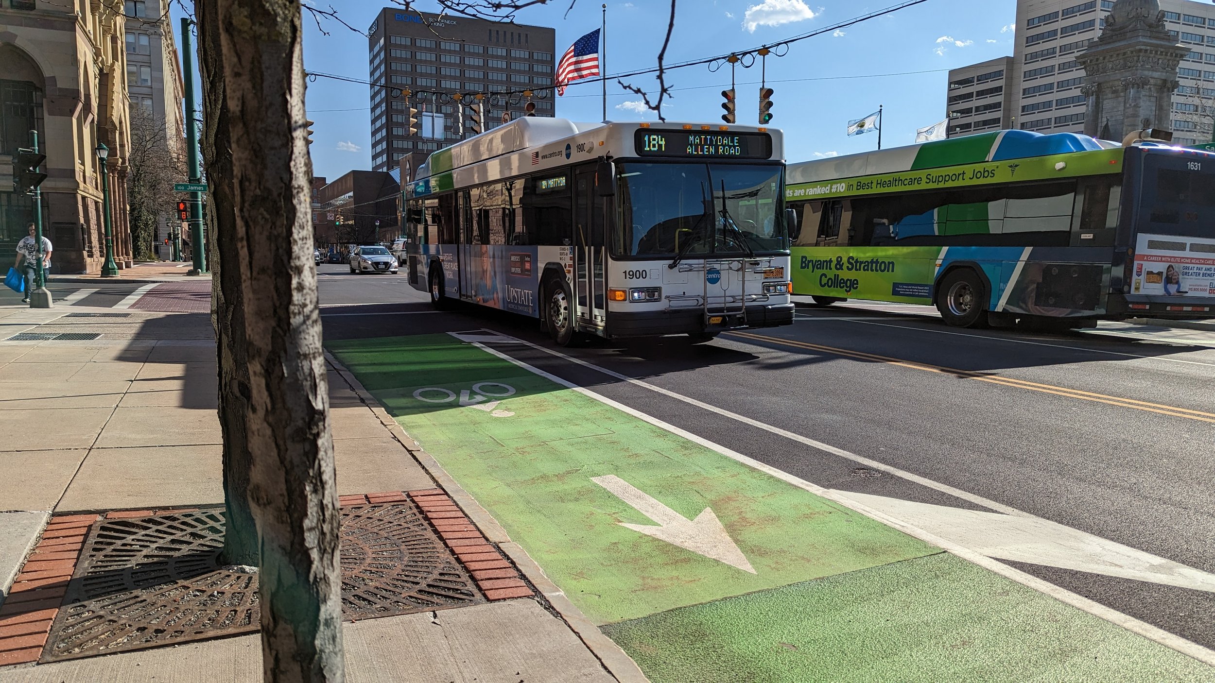
As noted in the SMART 1 report, BRT in Syracuse will run mostly in mixed traffic, as Syracuse does not experience much congestion. This may need to be reevaluated in the future if development spurred by the Micron development leads to the job growth anticipated, but it holds true today. Stops will be spaced out further, closer to 1/3 or 1/2 mile apart, allowing buses to move faster between each instead of stopping nearly every block. Buses arriving every 15 minutes makes traveling predictable and easy to use. This is one of the reasons people prefer subways and streetcars as they feel more predictable, and often arrive far more frequently than buses do.

The article notes, “The new bus rapid transit lines won’t have … raised station platforms …,” and later continues, “Centro could used the $35 million to build infrastructure for the bus lines, including new curb cuts and bigger bus shelters that may be equipped with kiosks of customers to pay their fares in advance.” There’s a lot in those two sentences, but this is where we do need Centro to step up - the stations. While BRT will result in shorter wait times overall, providing comfortable spaces for riders to wait is still important. It shouldn’t just be a slightly larger bus shelter. Raised platforms would speed up boardings by reducing the number of times buses must “kneel” to allow individuals with reduced mobility to board. Instead, those same individuals can easily walk or roll across the platform and onto the bus. Stations should also have kiosks for fare payment along with real-time countdown clocks to inform riders of when the next bus is expected. These simple amenities both help speed up boarding and provide peace of mind to those waiting.

A standard bus shelter in Downtown Syracuse. BRT stations must be more robust and contain more amenities as a way to improve its service quality.

One note on the pre-pay kiosks and payments in general, we should also be encouraging the faster deployment of tap systems throughout our transit services. Utilizing a tap system (either through using a credit card, phone, or prepaid transit card) helps simplify the process of using transit. No longer must you have exact change or a pre-purchased transit pass. It will allow casual riders to take a trip when they see a bus coming without having to plan ahead, especially as more and more of life goes cashless.

The last piece of the equation I must mention, and that I have covered more thoroughly in my Growth in CNY series, is the need to develop around the stations. Encouraging dense development, both residential and commercial, will help promote the use of the system. The BRT planned for Syracuse already has ridership levels to sustain it, but to see growth we must build for growth. This goes for future extensions as well. In the Salt City has already written about what future BRT expansions may look like, with some pretty excellent maps to go along with it. But this goes for developments along all major transit corridors in our region. Building more sprawl will only make it more difficult to serve our region successfully with transit. Dense nodes of activity (town centers, villages, urban cores) lend themselves to transit in a way our current development pattern does not. We must look at BRT as the backbone of the system, and it will only get stronger as we build denser along it. 

To end this piece before I go on for too long, I just want to summarize my thoughts in this way: BRT in Syracuse will improve the lives of thousands of people and may even encourage others to take advantage of its services, even if it does not solve all of our transit issues. We should not let perfection be the enemy of good, scratch that, great.

In Transportation, Urban Planning, Syracuse
Comment

Water Street to Linear Park

February 24, 2023

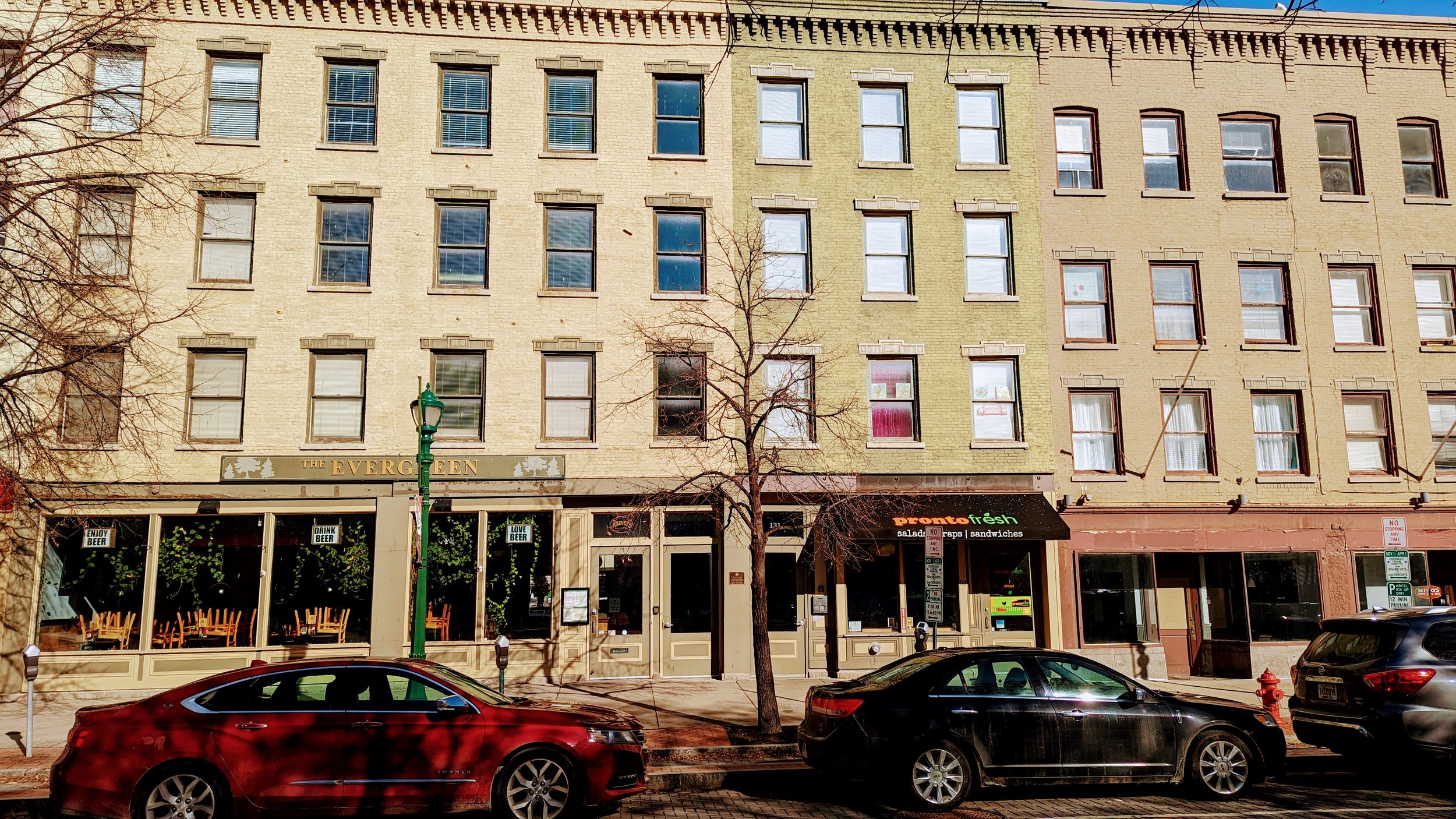
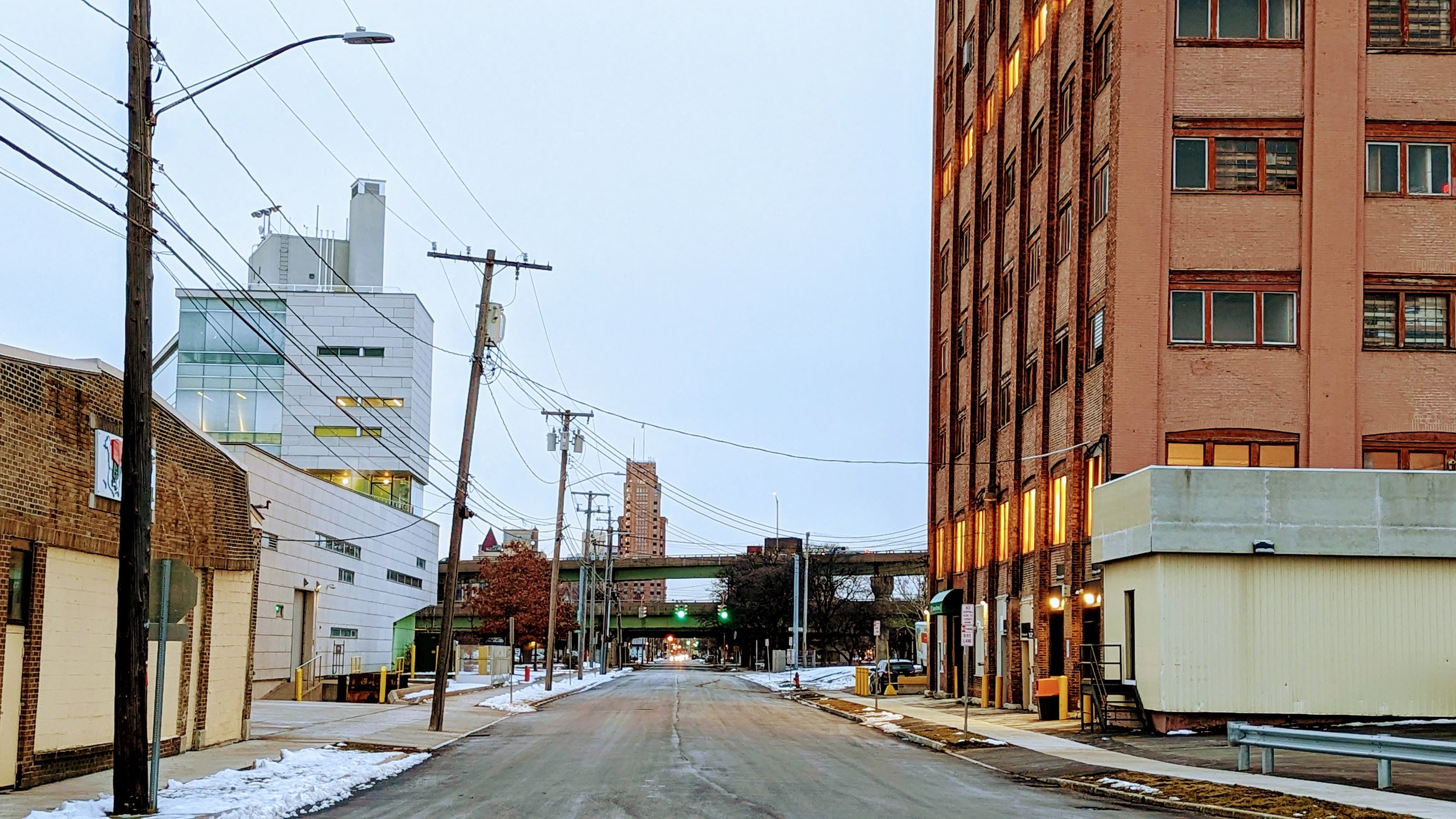
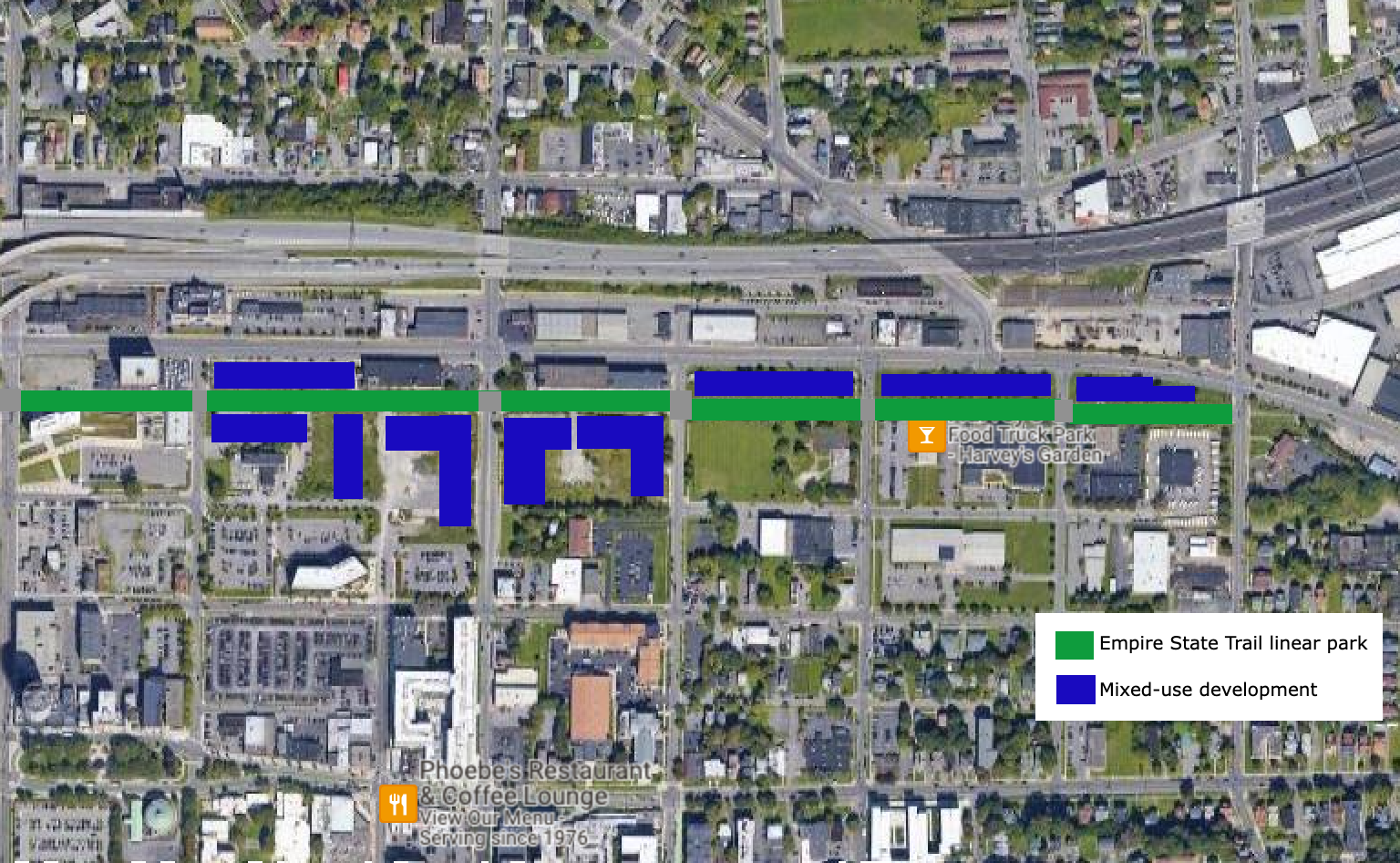
The street grid through Downtown Syracuse continues to be built around a canal that was removed nearly 100 years ago. At that time, Water St acted as a vital access road for the many businesses that lined the Erie Canal. Many of the remaining buildings from that time still front Water St with more utilitarian doors and windows facing Erie Blvd. Today, outside of the blocks around Hanover Square, Water St is a minimally used street surrounded by parking lots, underused and vacant parcels, and open green space. At the same time, it is a key portion of the Empire State Trail (EST), a premiere 750 mile bicycle trail that connects the entire state. It is time to rethink Water St and the area around it.

View fullsize Business fronts on Water St
Business fronts on Water St
View fullsize Business backs on Erie Blvd
Business backs on Erie Blvd

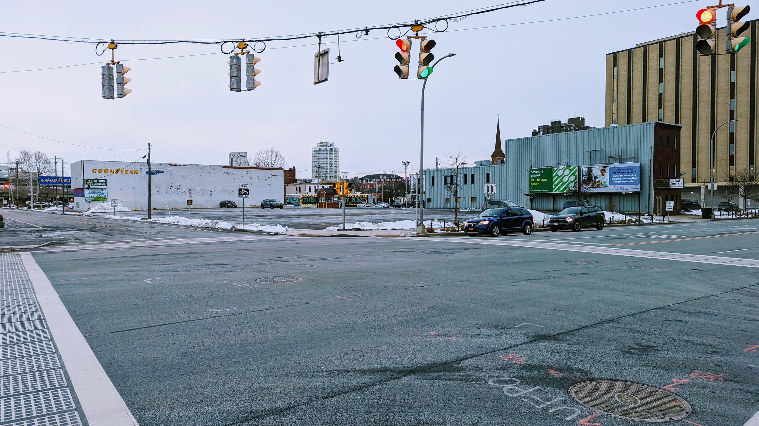
First let’s look at the street’s current use. According to NYSDOT’s Traffic Data Viewer, an average of 700 to 2,000 vehicles use the street on a daily basis, which is a fairly light volume. Most of these vehicles are utilizing the parking lots that front the corridor. To accommodate the EST, standard painted bike lanes function for the majority of the corridor, with sharrows occupying the three blocks between State St and S Salina St, with the block off of S Salina St utilizing a protected contra-flow bike lane as well. For people on foot, there’s even less infrastructure. The sidewalk network is in pieces, with parts overgrown as you move further away from Downtown Syracuse. The street may attempt to serve all users but it struggles to serve any of them well.

So what if we decided to focus on just the active modes of transportation?

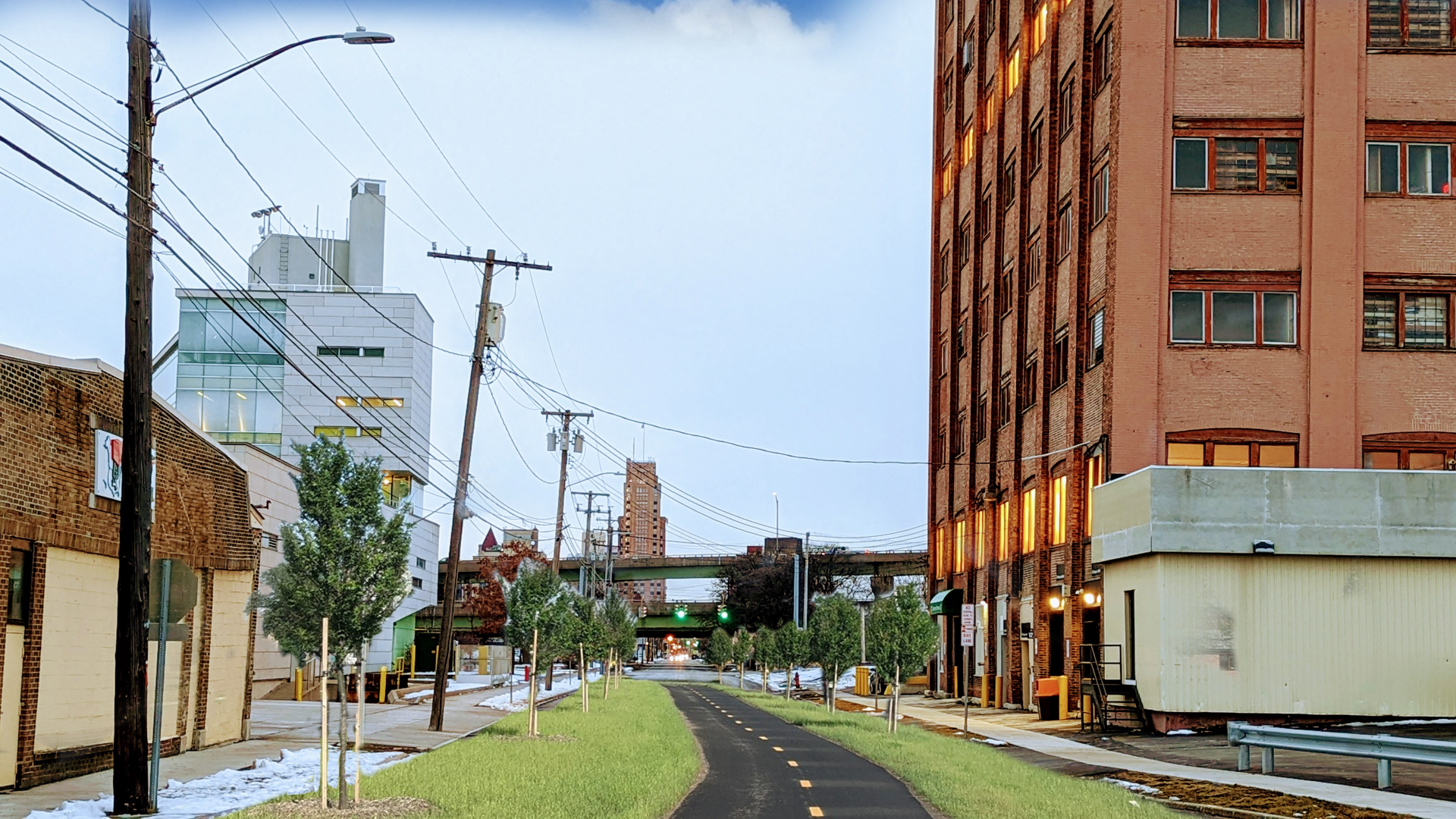
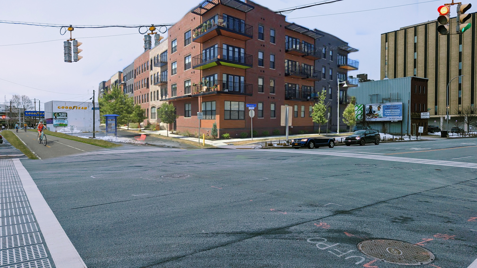
By removing cars from Water St, the corridor opens up to possibilities. A shared use path, typically 10 to 12 feet wide, could be shifted to the center of the corridor while the rest of the right-of-way is filled with greenery, similar to the characteristics of the EST further east down Erie Blvd. This change creates the opportunity for a truly urban linear park, similar to portions of the Onondaga Creekwalk, but more ambitious in some ways.

PXL_20230128_221459363.jpg
EST near Uhaul.png
PXL_20230128_221459363.jpg EST near Uhaul.png

The Onondaga Creekwalk through Downtown Syracuse leaves a bit to be desired. It forces cyclists off of their bikes as they must share sidewalks instead of having a dedicated off-road path. Its circuitous route, a necessity due to the space constraints associated with trying to follow the path of the creek, is less desirable than the straight shot that Water St offers. Instead, we will look more towards the second phase of the Creekwalk which runs through primarily park-like conditions and minimizes street crossings. While a Water St linear park will require far more street crossings, we can alter the function of those intersections through the use of raised intersections, which help to slow drivers as they pass, as well as switching many of them from signalized intersections to stop signs. As Jeff Speck notes in Walkable City, stop signs are preferable to traffic signals from a safety perspective, for all mobility methods.

With a linear park in place, the conversation turns to development along its path. Looking at ReZone Syracuse, most of the land fronting Erie Blvd will be zoned as MX-3, which encourages mixed-use development. Large portions of the land fronting Water St on the southside of the street is zoned as MX-4, again mixed-use but at a higher level of density. Three blocks, between University Ave and S Beech St are zoned for open space. While this open space preservation makes sense with the current configuration of the street network, by shifting Water St into open space, the narrow lots currently zoned for it should be converted for mixed-use development.

The development along Water St will be unique in that they can be built truly for car-free households, opening up to the linear park and providing ample access to transit along Erie Blvd. To ensure this opportunity is seized, secure bike parking should be thoughtfully included in every development along the route, both for residents and visitors to the commercial spaces. As the major entryway into Downtown Syracuse along the EST, providing ample accommodations for cyclists is vital to attracting cycling tourists into the City. It is also a way to make it easier for city residents to embrace a car free or car light lifestyle, saving each thousands of dollars per year.

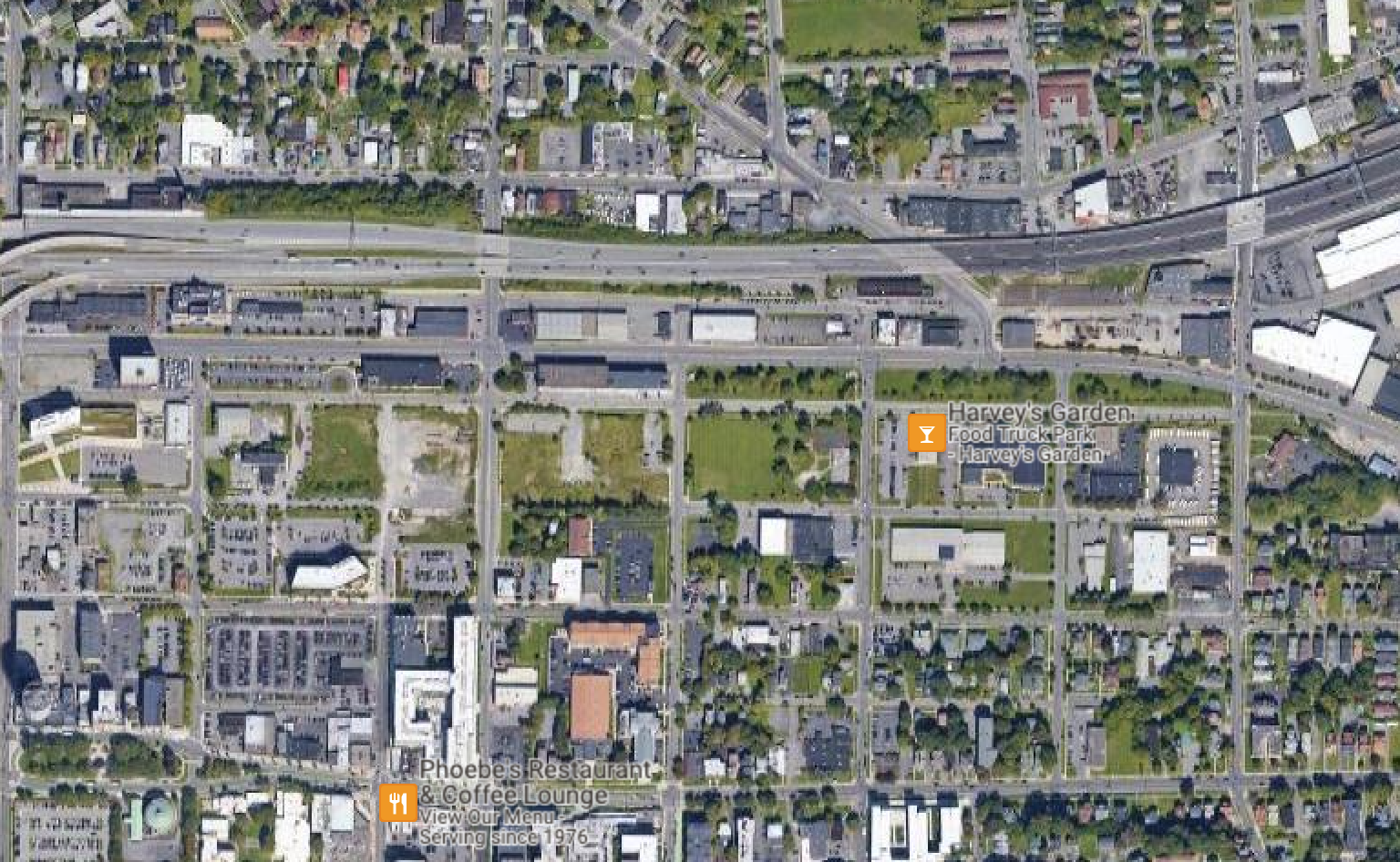
Google Maps Overview.png
Google Maps Overview Future.png
Google Maps Overview.png Google Maps Overview Future.png

Some parking lots and car centric businesses currently line the corridor, including the Syracuse Center for Excellence. While the Center for Excellence is an experiment in sustainable building practices, as well as energy and water use, it does not fully embrace more sustainable transportation methods, with the building utilizing a large parking lot and only providing a handful of bike racks. Some businesses, including the U-Haul rental and storage office, may need to be completely rethought to encourage more desirable uses near our city’s center. The building currently used by U-Haul is structurally deficient on many floors, which might make demolition a requirement for redevelopment. 

View fullsize PXL_20230128_220750498.jpg
View fullsize PXL_20230128_221021587.jpg
View fullsize PXL_20230128_221025050.jpg
View fullsize PXL_20230128_221033506.jpg

The area currently covered by I-81 will also be open for development once the viaduct is removed. Auto-oriented businesses must be avoided in this area. Drive-thrus, automotive repair shops, and car sales should be excluded in favor of street fronting businesses, which may still include chain restaurants and businesses, but utilizing more urban oriented designs. College Town in Rochester, NY is a good example of this style, but the development still relies heavily on an inner parking lot. Some parking will need to be built to make this corridor function, but it should be minimized.

PXL_20230128_220545800.jpg
Water St and State NEW.png
PXL_20230128_220545800.jpg Water St and State NEW.png

A Water St linear park is a chance for Syracuse to embrace a unique development style and encourage car free / car light living. It's time to rethink our streets and there’s no better place to start than a street whose purpose has been reduced over the last 100 years.

In Walkability, Transportation, Syracuse
3 Comments

In Defense of an Aquarium and the Future of the Inner Harbor

February 28, 2022

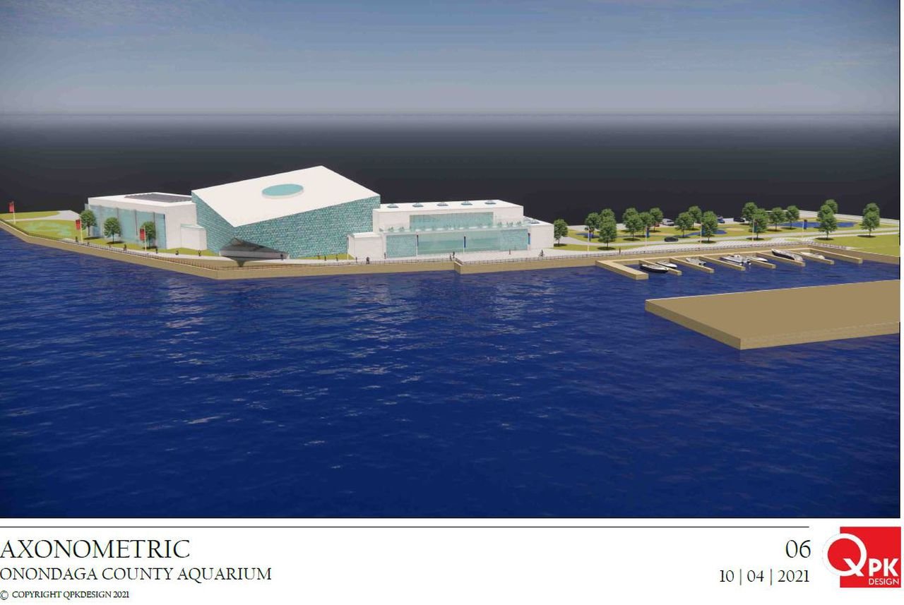
In the fall of 2021 a surprise proposal for an $85 million aquarium at the Syracuse Inner Harbor was announced. The project would be paid for using a large budget surplus Onondaga County experienced as a result of federal pandemic funding and stronger than expected tax collections. This proposal also sparked a heated debate over what those funds should be used for and whether an aquarium is truly a viable project for this community. Should these funds instead go towards improving roads, starting new assistance funds, creating community programs, or simply stowed away for future uses? Should we bond for the required funding instead of paying for it in cash? If we are to build an aquarium, does it need to be so large?

Each of these questions are valid and should be considered, but I also think we should be looking at this project as part of a grander plan for the Inner Harbor. The Inner Harbor has been stuck in development Hell for decades (including the current legal troubles of the developer who purchased most of the land), which has resulted in an area ripe with opportunity sitting mostly vacant and overgrown. Perhaps it’s time to really consider what that future could be, with an aquarium as the spark.

Addressing Some Key Questions

First, we need to look at some of the key questions opponents and skeptics of the aquarium project bring up, since they are valid concerns. We’ll begin with the other possible uses for the funds.

Road construction is always a favorite issue to point to by critics, noting the many potholes and other issues we experience on a yearly basis in the northeast. But overall, the roads that Onondaga County is in charge of are kept in fairly good condition, as noted in SMTC’s annual pavement rating report. While this report only documents the federal aid eligible roadways, those same roads have the most impact on people’s day-to-day movements. Some of the funding could be pushed to the City of Syracuse to improve their roadways, but even then, the City has made some significant progress over the past decade of maximizing their paving budget. We must also remember that the City will also receive $123 million in federal funds as part of the pandemic relief fund, with some of that focused on improving roadways.

Others often point to providing additional services that are needed within our community, including social and health services. While I think we need further investment in those areas, it is not wise to start programs of that nature with a one-time surplus. Once those funds are gone, the services that may have become vital to some will be stripped away. We should instead look at our recurring costs and see where we can shift funding to better represent the needs of our communities. Additionally, we should be looking for ways to build our economy and create opportunities, which will help increase funding for future programs that will be more reliable than recovery funds.

View fullsize Aquarium Rendering
View fullsize Aquarium Site Plan
View fullsize Aquarium Rendering
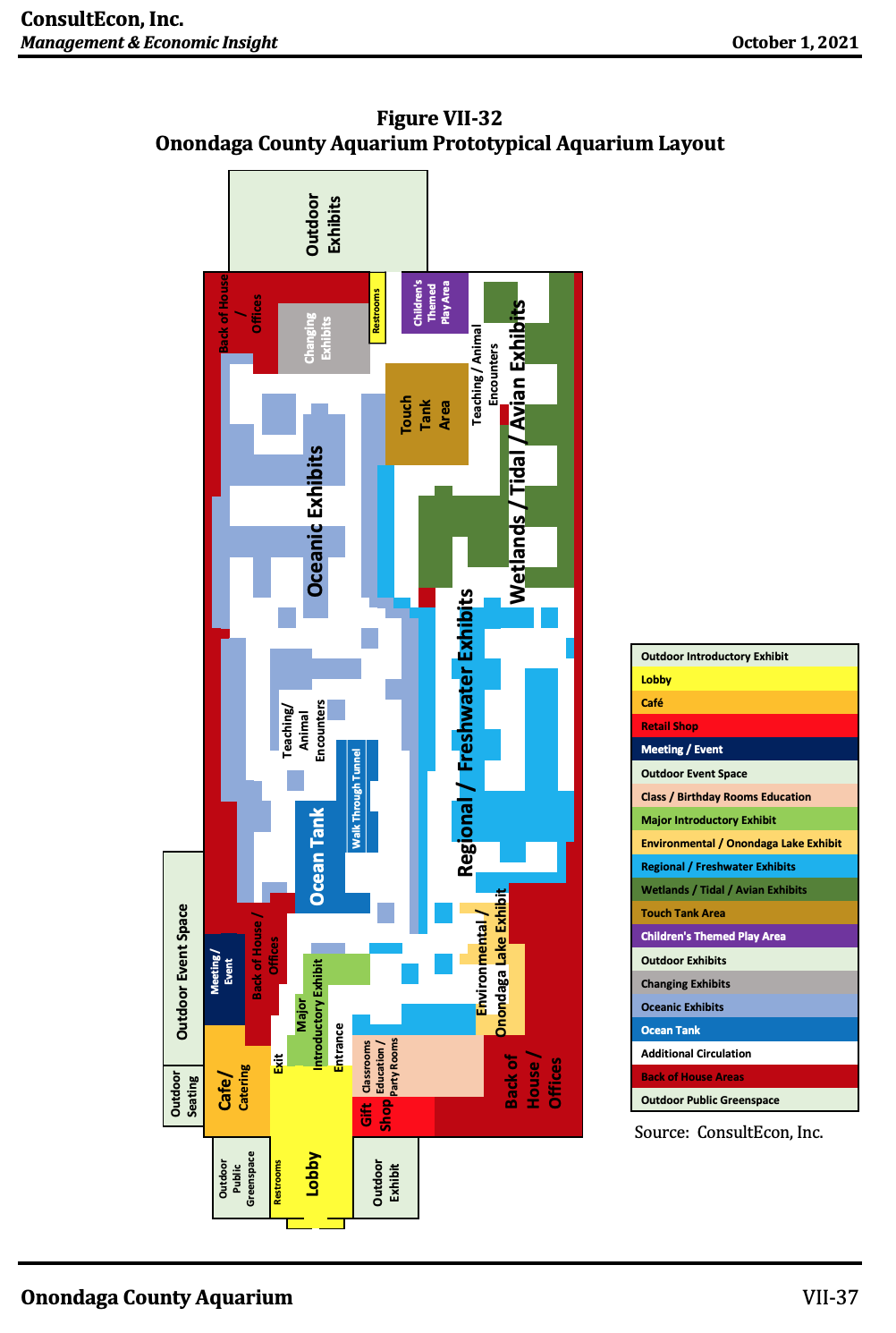
View fullsize Typical Aquarium Layout

But that still leaves questions on the specifics of the aquarium itself. Should we bond for it instead of paying for it with the surplus funds? And just how big should an aquarium be? The easier question to answer here is about the size. Did you know Niagara Falls has an aquarium? If you did, you’re probably one of the many visitors who was disappointed by how small the facility is. If you’re looking to build a regionally significant project, the size and scope of the project should fit that criteria. The proposed project would be the largest aquarium in the northeast, immediately bringing it attention throughout the larger region. While few people travel places just for an aquarium, the presence of a high quality aquarium might sway some to take a chance, or keep those already traveling to the area here longer. Think of fans of teams at SU or Canadian shoppers at the mall or visitors to the State Fair during the summer who might decide to extend their trip by a day to explore the aquarium. Those extra days can be a huge boon for businesses within Syracuse and leave people with a more positive view of the City as a whole, hopefully leading to return visits.

When it comes to bonding over using the surplus funds, the nice thing about using the surplus funds is that you already have them and you can act now with them. That can be subject to a larger debate on how best to fund a project of this scale, but sometimes its good to just rip off the bandaid. 

The Inner Harbor’s Future

Now let’s look at some ways that the aquarium can play into the future of the Inner Harbor, and some ways we can improve upon this plan to give it a real chance at success.

First, it is an investment in the quality of life for the community. Aquariums provide an educational experience that is unique, which students at all age and grade levels can benefit from. One way we can push the current proposal to a new level is by creating a larger learning/ laboratory annex that is supported through partnerships with colleges throughout Central New York. Syracuse University, LeMoyne College, as well as the nearby SUNY campuses (Cortland, Oswego, and ESF) all have biology and environmental studies programs, which could benefit through more in-depth research opportunities at the aquarium. Providing these unique connections could encourage the expansion of these types of programs in the region as well as attract students who value this type of hands-on education. These partnerships will also provide financial support for the aquarium, which could ultimately support reduced price or free admission for City residents or low-income families. One of the main sticking points has been the proposed fee for admission, $21 per adult with reduced prices for many different groups. The financial support of colleges and universities could be geared towards creating a more equitable fee structure that ensures everyone access to this unique attraction.

Let’s also look at the accessibility of the proposed aquarium site. The Inner Harbor sits in a unique location in terms of access by residents across the City and the greater region. Yes, it sits between I-690 and I-81, providing easy access to visitors driving to the site from outside the City, but increasing access by bus, bike, and on foot are possible and already somewhat in place.

View fullsize Community Grid Bike Connections
Community Grid Bike Connections
View fullsize SMART1 Preferred Option
SMART1 Preferred Option

The BRT network that is considered the locally preferred option in the SMART 1 study would run nearby on North Salina Street. A slightly different route that runs up Solar Street, where the aquarium would be built, was considered but was not selected due to higher ridership demands on the Salina Street corridor. Even though the BRT system would not run directly to the aquarium site, improved pedestrian and bicycle facilities in the area would help create the needed connections. The I-81 Community Grid would help produce these new connections as wider sidewalks and new bike lanes that connect the Inner Harbor to North Salina Street are proposed across multiple bridges. This would not only help connect the Northside to the Inner Harbor, but also connect it to the Onondaga Creek Walk and Empire State Trail, making the location one of the easier places in the City to reach without a car.

For those who do choose to reach the aquarium and Inner Harbor by car, minimal parking should be built directly surrounding the site, and instead a partnership with Destiny USA should be forged to use the large swaths of overbuilt parking lots across Bear Street. We should be focused on creating a walkable neighborhood surrounding the Inner Harbor, filled with apartments, townhouses, shops, restaurants, and parkland. This can only be accomplished by reducing the amount of parking available directly on site and utilizing the already existing lots across the street.

View fullsize Inner Harbor Site Plan
Inner Harbor Site Plan
View fullsize Inner Harbor Rendering
Inner Harbor Rendering

And on that note, we should be looking to use the development of the aquarium as leverage to force COR to continue their proposed build out at the Inner Harbor or sell the land to others who will develop it. The original proposal would have created a mixed-use neighborhood that finally provided the City a chance to fully connect with the waterways of its history. With the introduction of townhouses at the Harbor,  we should require that at least half of them are for sale to own, providing a new homeownership opportunity in a denser development style than most of the City offers. An additional thing to note is that even if the original plan was fully built out, the land needed for the aquarium would remain open according to the site plan above. This would allow the aquarium to become an anchor institution at the Inner Harbor and pull the development currently occurring in Franklin Square northward.

While the Inner Harbor development shouldn’t hinge on whether an aquarium is built or not, I still think there are some unique benefits that an aquarium brings to the City that should encourage us to make the investment. The last point I’ll make, and this one can sometimes be overlooked, is that we should invest in quality of life amenities that can be enjoyed by all. The Amphitheater, while an amazing amenity, is often geared towards adults over kids. Restaurants and bars in Downtown Syracuse emphasize alcohol consumption as part of the experience (with many local breweries producing top notch beers and drinks). Destiny USA is a closer example to an amenity that can be enjoyed by all, but only if you want to spend and consume. An aquarium, like the zoo and the museums Downtown, can provide an afternoon or even a full day of fun for all ages without the pressure to consume. You’re truly there for an experience, whether to learn or to be calmed by the presence of nature, and that is truly a benefit to the community.

Note: The Central New York Regional Planning Board was involved in the aquarium study. While I have worked on the CNY Broadband Study with the agency, I have had no involvement in this study and this blog post is entirely my personal feelings on the proposal.

In Syracuse, Civic Pride
Comment

Downtown Syracuse after a heavy snowfall

Cities Don't Have to be Loud

January 31, 2022

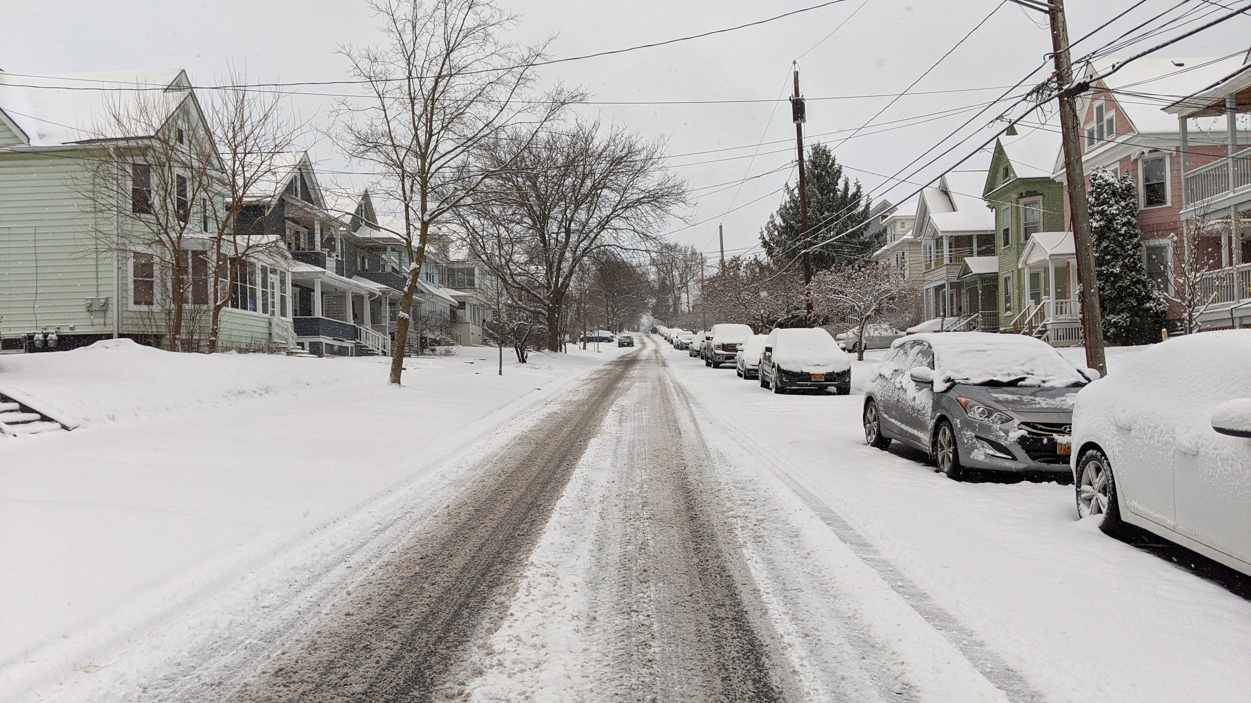
One of the things that stands out after a heavy snowfall is just how quiet the whole world becomes. You can hear the gentle crunches of the snow beneath your feet when you walk outside. The first run of the plows breaks the stillness, but they still feel muted. The rest of the world is still waking up and those that are up often choose to stay home until the roads are clear. It’s as if the world is covered in a blanket, resting.

Snow acts as a natural muffle as it absorbs noise, but it is not the only reason these snow days help to quiet a city. By choosing to stay home to avoid the snow covered streets, we help remove one of the biggest audio nuisances around; your car. 

View fullsize original_96cc2c14-b514-443b-9abc-1da2984159ff_PXL_20210202_123457176.jpeg
View fullsize original_d355aa14-3a93-4573-b437-4a8673505043_PXL_20210202_124251947.jpeg
View fullsize PXL_20201229_130158921.jpeg
View fullsize PXL_20220108_002420946.jpeg

We often think of cities as noisy places filled with traffic and construction, but we forget that there are plenty of cities that are snow storm quiet all year round. The one thing they have in common is that they de-prioritize cars in their transportation networks. To see why this policy matters, we first need a quick run down of how decibels are measured.

Decibels are measured logarithmically, which means that if something is 10 decibels louder, it is in fact 10 times louder. If something is 20 decibels louder, it is 100 times louder, and so on. Extended exposures to sounds over 70 decibels can lead to hearing damage.

 So let’s take a look at some decibel levels of common occurrences in an urban setting:

  • Normal conversation: 60 decibels

  • Busy street: 75-85 decibels

  • Lawn mower: 94 decibels

  • Motorcycle: 105 decibels

  • Car horn: 110 decibels

  • Ambulance siren: 112 decibels

  • Diesel truck accelerating: 114 decibels

If you’re driving through a city you may not notice your contribution to this urban noise pollution as cars have become a sort of isolation chamber on wheels, but when you’re walking or riding a bike you notice the increase in noise immediately. Adding more cars on the road also increases the likelihood of emergency vehicles finding themselves stuck in traffic, resulting in prolonged exposures to dangerous decibel levels for everyone outside of a car.

Cities don’t have to be this way. Cities in the Netherlands are dramatically quieter than their American counterparts, primarily due to their transportation policies. By emphasizing pedestrians, cyclists, and public transit while slowing down the private cars that are in use help reduce the amount of noise pollution on an average city street. You can see this in more detail in the video below by Not Just Bikes on YouTube.

While larger changes to our transportation network may take time, there are plenty of things we can do now to start the transition and bring down the noise.

Street trees and other urban vegetation help to absorb sound. They have also been shown to slow down vehicles by visually confining the space, forcing drivers to increase their attentiveness. On top of all of that, they make walking a much more pleasant experience by providing shade, cover from rain, and a visually interesting journey. Cities should ensure that all street and sidewalk improvements are coupled with an evaluation of their street tree canopy. 

Prioritize clearing sidewalks and bike paths during winter storms to encourage their usage. Walking through the snow can be a challenge for many people, especially if it’s deeper than a couple inches. Cities like Syracuse and Rochester, NY are making serious strides when it comes to clearing sidewalks during the winter, but they still play second fiddle to the roadway clearing programs these cities have had in place for the better part of a century. If we begin elevating sidewalks and bike lanes to the same level as vehicle lanes, we may get closer to the Finnish ideal of prioritizing the most efficient forms of transportation over personal vehicles. 

We might not want to be stuck in a snow globe all year round, but there’s no reason our cities can’t get closer to the peace and quiet we hear during those early winter mornings. Quiet cities let us enjoy the little things just a bit more.

About 27 percent of Syracuse is covered by tree canopy, which is below average for cities east of the Mississippi River.

In Syracuse, Urban Planning, Walkability
Comment
Hey, look, it’s me.

Hey, look, it’s me.

Bike Share is Back in Syracuse!…And We Need to Fix It

October 2, 2021

Every city should have a bike share program as part of their transportation network. I’ve discussed it in the past on this blog noting that bike share should be seen as an integral part of creating access and freedom for people. Syracuse’s bike share program, originally run by Gotcha and now operated by Veo Ride, is a success story in its own right and I am personally excited for its return. In fact, the cover photo for this story is me on one of the bikes as soon as I got out of work after hearing they had officially returned. But there are some glaring issues with the system that, if not corrected, will keep it from being a true alternative transportation option for many people.

First, let’s take a look at the system we have in Syracuse. In 2019 the City launched the first, by a few days, all e-bike bike share program in the country. Committing to an e-bike program was a unique option at the time, but one that made complete sense for a city as hilly as Syracuse is. Riding a traditional bike share bike, which tend to be heavier than most bikes people own for safety reasons, up to Tipp Hill or to Syracuse University would be exhausting for most riders. With an e-bike those hills become manageable and you can arrive at your destination without breaking much of a sweat. 

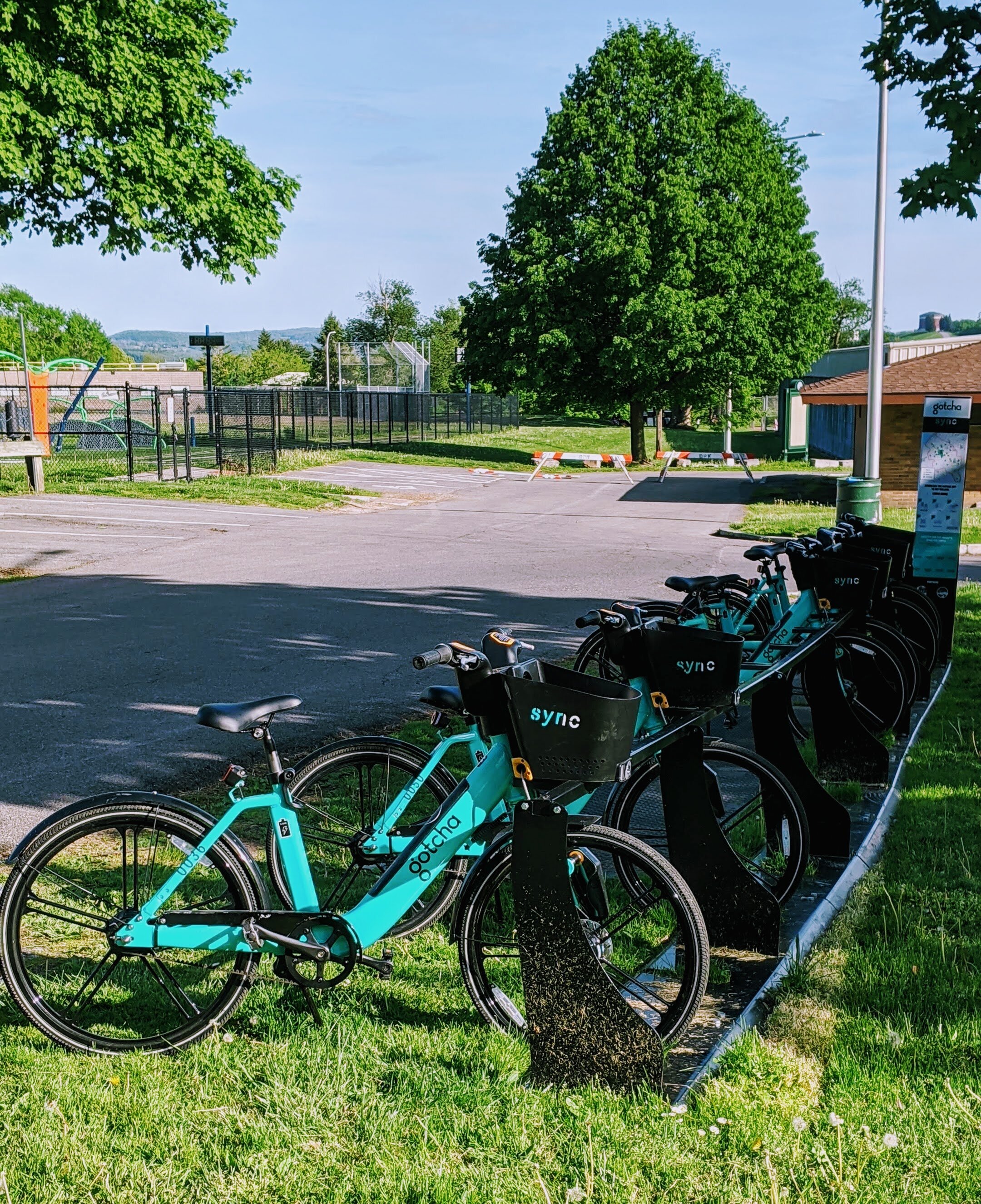
Gotcha’s Sync bikes in Burnet Park.

Gotcha’s Sync bikes in Burnet Park.

At its launch, Sync (the name for Syracuse’s bike share program) offered individual ride purchases but also offered a monthly and yearly pass. Monthly passes, which ran for $12 per month, offered a free 30 minutes per day with $0.10 a minute after 30 minutes, while yearly passes, which were $50 per year, offered one hour of free riding per day with $0.10 a minute for any additional minutes. While these weren’t as generous as the unlimited rides of up to 45 minutes offered by CitiBike in New York, the price came in at a fraction of the $180 for the annual pass, and the service area in Syracuse can easily be covered in under 30 minutes.

While Sync was successful, including seeing a large bump in usage during the Covid-19 pandemic, financial strain on Gotcha resulted in the program ending in the fall of 2020. The City rightfully decided to seek a new vendor to provide this service and accepted a bid by Veo Ride at the beginning of summer 2021.

So now that we’re caught up on the history, let’s take a look at the system we have now and ways that we can improve it so it can become a true alternative option for people to get around Syracuse.

The Pricing

The original Sync program was priced in a reasonable way that would be an extremely affordable alternative for most people within the City of Syracuse. Under Veo Ride, the system no longer lives up to that ideal. 

Monthly and yearly passes have not been implemented at this point in time, requiring all users to pay for individual rides. E-bike rides are charged a $1 unlocking fee and $0.20 per minute, while scooters are charged a $1 unlocking fee and $0.31 per minute. For low-income users you can have the $1 unlocking fee waved. On the first day of operation I took a 15 minute ride from Downtown Syracuse to Destiny USA which cost around $5, so a $10 round trip. An Uber ride in Syracuse is usually not much more expensive, and a bus ride is $2 each way. By contrast, CitiBike costs $3.50 per ride up to 30 minutes, with $0.18 per minute after 30.

Now we may not be able to have prices and offerings at the same level as CitiBike, but if we want bike share to be a true option for people we need to provide affordable monthly/yearly passes so people feel empowered to take a ride as frequently as possible. 

The Network Geography

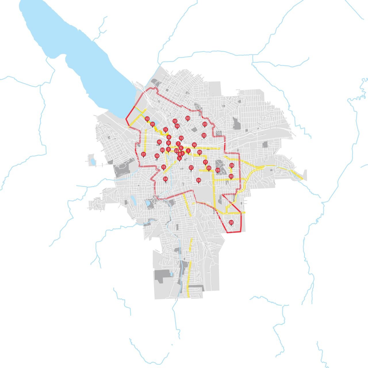
The original bike station map for Sync. Station locations did not change in the switch over from Gotcha to Veo Ride.

The original bike station map for Sync. Station locations did not change in the switch over from Gotcha to Veo Ride.

In the transition between Gotcha and Veo Ride the geography of Sync’s service stations did not change. Stations are located primarily around Downtown Syracuse and the surrounding neighborhoods. While the bikes and scooters utilized are dockless in nature, the stations remain key locations for individuals to look for bikes/scooters and can become transit hubs. The end goal for Sync is to eventually cover the entire city and hopefully convince some of the inner most suburbs to become part of the system as well. But we are currently leaving out important destinations in the network that should’ve been included as stations from the beginning.

The most obvious omission in the system is the lack of station access at Destiny USA. The nearest station to the mall is still around a 10-15 minute walk up the Creekwalk. As one of the largest employment centers in Onondaga County, let alone the City of Syracuse, missing this connection is a huge missed opportunity. This is especially glaring since the Creekwalk, which connects to Destiny USA’s property, is one of the premiere bike routes in the City and continues to grow into the Southside providing access to large population centers. 

Near Destiny USA, we also miss connections to the Regional Market, Regional Transportation Center, and NBT Bank Stadium. A recent study by SMTC identifies ways to make this area more accessible for individuals on foot and on bikes, and is an important destination for many people who don’t have, or choose not to have, access to a car.

We should aim to have bike share stations at major bus stops in the region, helping it become a true last-mile option for many people. Even if the system is somewhat dockless, we need to provide hubs so residents can expect reliable access to a bike or scooter and not go searching near someone else’s house. 

Bike share is back and we should all be excited about it. But we need to make sure its a system that is affordable and truly connects people. Let’s get to work!
In Syracuse, Transportation
Comment
← Newer Posts Older Posts →

Recent posts

Featured
Carousel.jpg
May 27, 2025
Destiny USA and the City
May 27, 2025
Read More →
May 27, 2025
PXL_20240805_141743149.jpg
Jan 1, 2025
All Cities Are Beautiful
Jan 1, 2025
Read More →
Jan 1, 2025
PXL_20241005_135224129.jpg
Nov 6, 2024
A Healthy Future for the Regional Market
Nov 6, 2024
Read More →
Nov 6, 2024
PXL_20240728_191254239.jpg
Jul 31, 2024
Renters Matter, Too
Jul 31, 2024
Read More →
Jul 31, 2024
Vista view.jpeg
Mar 21, 2024
The Valley of the Sun - A Land of (Sub)Urban Extremes
Mar 21, 2024
Read More →
Mar 21, 2024
Manlius Cinema.jpeg
Jan 31, 2024
The Movie Theater at the Urban Core
Jan 31, 2024
Read More →
Jan 31, 2024
Clinton Square Christmas Tree at night.jpeg
Nov 30, 2023
The Case for a Holiday Village
Nov 30, 2023
Read More →
Nov 30, 2023
PXL_20230817_220739294.jpg
Oct 31, 2023
The Walk: To Middle Ages
Oct 31, 2023
Read More →
Oct 31, 2023
Ballpark.jpeg
Sep 7, 2023
The Walk: To the Ballpark
Sep 7, 2023
Read More →
Sep 7, 2023
PXL_20230813_213112525.jpg
Aug 14, 2023
The Walk: To Tipperary Hill
Aug 14, 2023
Read More →
Aug 14, 2023
Arts and Crafts Festival 2023.jpeg
Jul 31, 2023
The Walk
Jul 31, 2023
Read More →
Jul 31, 2023
PXL_20230515_144325643.jpg
Jun 21, 2023
Lessons from the North
Jun 21, 2023
Read More →
Jun 21, 2023

Powered by Squarespace