• Blog
  • Blog Index
  • Video Work
  • About
Menu

Thomas Bardenett

Urban Planning - Writer - Filmmaker
  • Blog
  • Blog Index
  • Video Work
  • About

An extra wide Clinton Street allows for cars to travel faster than needed, often resulting in cars coming to a stop on top of the crosswalk.

Let's Talk About Intersections, Part One

June 30, 2022

If you’re like me, seeing a truly well designed intersection is exciting. More than likely you’re not as nerdy as I am and you’ve got other things that keep your attention, only noticing an intersection when there’s an issue. But intersections are the most important thing for a city to get right if they want to keep people safe. This goes for people in cars, on bikes, or simply walking across the street. And for most intersections, we have a lot of room for improvement.

We could look across the Atlantic for inspiration, and some of that will come in later in this piece, but I think it’s more instructive to look at positive examples right here in America.Towards the end of June 2022, articles began to appear celebrating Hoboken, NJ for reaching four years of zero traffic deaths. For comparison, Syracuse, NY, whose population of 148,000 is just under 3x Hoboken’s 54,000, experienced over 40 traffic fatalities in the same timespan. 

So what is Hoboken doing right? 

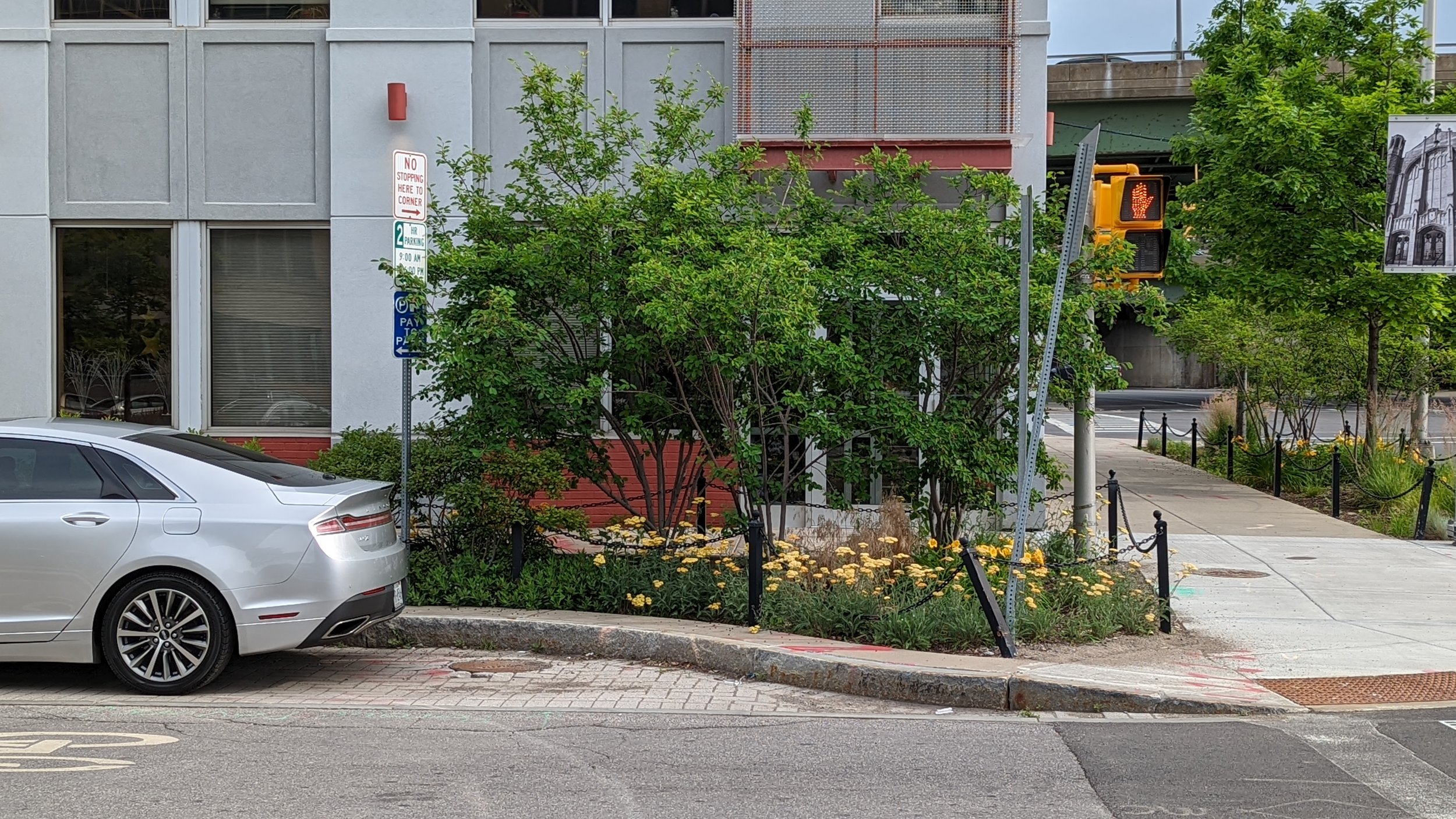
When it comes to intersections, the City has focused on ensuring that everyone has the ability to see everyone else. This may seem like a simple concept, yet you can walk out to most intersections and find barriers. Signs clutter the corners, cars are parked far too close to the intersection, curb radii are too large forcing pedestrians to cross long distances where they may not be seen by oncoming vehicles, etc. A key way to improve this issue is through “daylighting.”

Daylighting is the process of moving obstructions away from the intersection. You’ll often see signs that state “No Stopping Here to Corner.” These signs are an attempt at daylighting, but with very little influence on driver behavior. Walk in a busy neighborhood and you’ll often see a car parked exactly where it’s told not to. Hoboken has taken the task of daylighting more seriously through their extensive use of curb extensions. This might be paint paired with flex posts to define the space, or, better yet, concrete extensions of the sidewalk. Curb extensions not only enhance visibility of pedestrians and cars, they also slow vehicles down as they enter a tighter space. As humans, we naturally slow down in confined spaces being extra cautious not to hit the sides built up around us. This is why highway lanes are wider than local streets, or at least should be. 

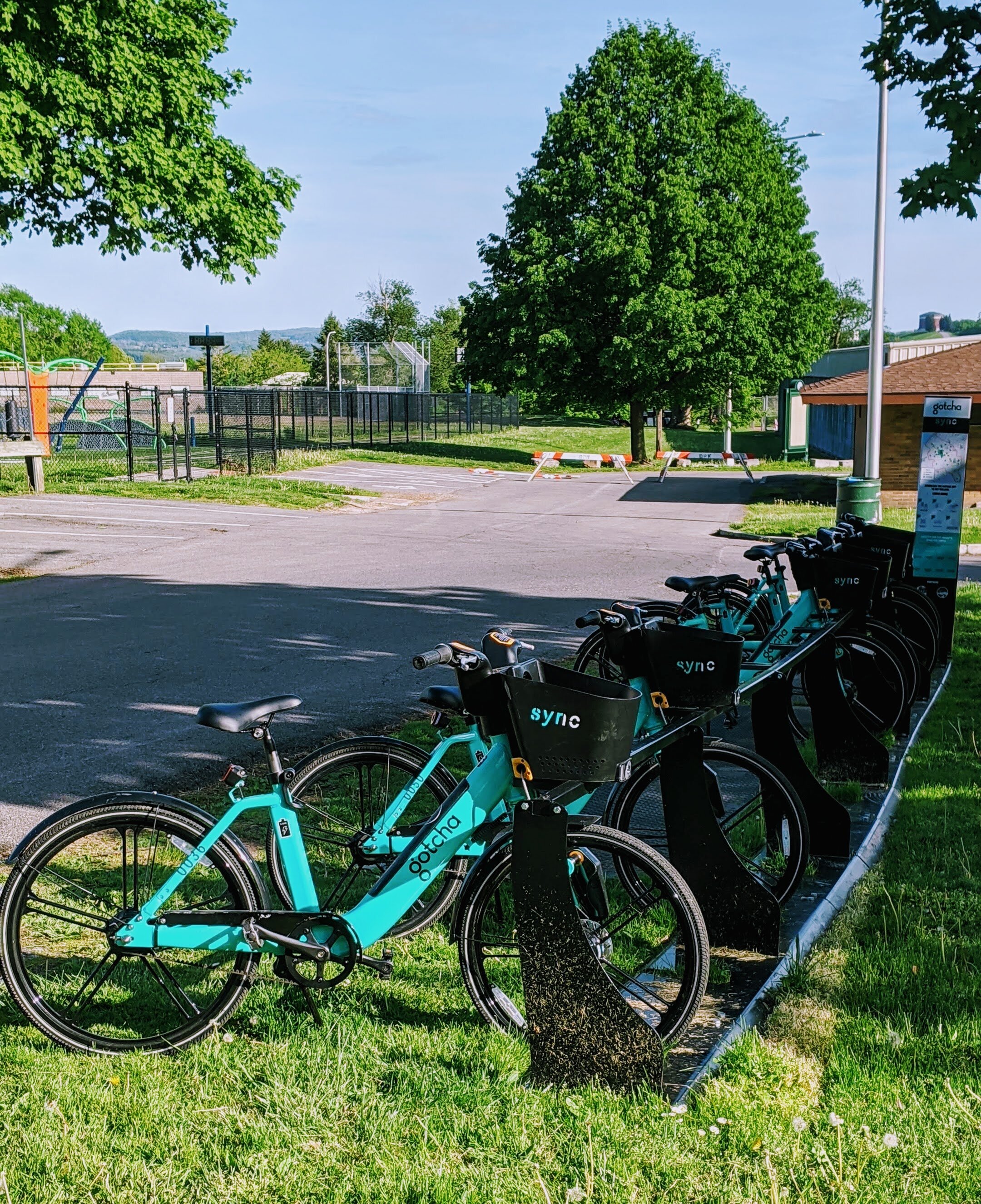
Bike racks and corrals have also been used to daylight intersections, clearing sitelines for drivers and pedestrians while creating a convenient space for cyclists to park.

View fullsize Water Street Bump Out
Water Street Bump Out
View fullsize Water Street Pinch Point
Water Street Pinch Point

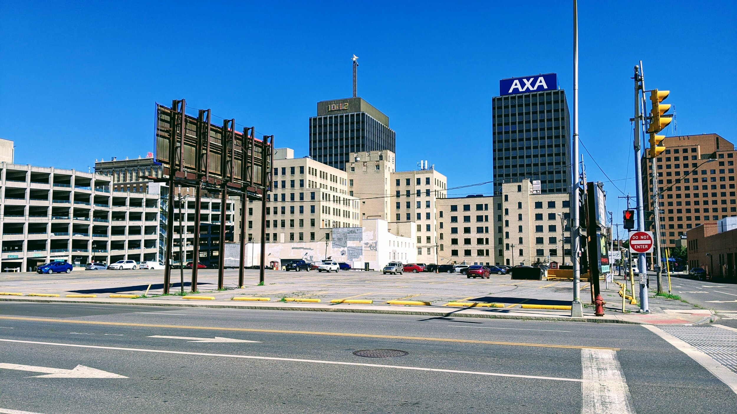
Syracuse has some great examples of curb extensions too, they’re just few and far between. But where they are placed, they make a significant difference. A prime example is right outside City Hall on Water Street; concrete curb extensions paired with a planted furnishing zone to provide shade and extra definition to the space. 

Just down the road, Syracuse has made use of another traffic calming technique, the pinch point. While this isn’t at an intersection, its worth noting how the same principles of a curb extension can be applied mid-block where people have a reason to cross, such as getting to a museum or their office.

View fullsize Raised Intersection
Raised Intersection
View fullsize Raised Crosswalk
Raised Crosswalk

Going back to Hoboken, and several other communities across the country including Philadelphia, there have been intersections that have been taken up a notch, literally. Raised intersections, as seen in the above photo found on Streetsblog, bring cars up to the height of the sidewalk, similar to a speed bump. These intersections enhance visibility for people on foot while slowing drivers down. A narrower version of this approach is the raised crosswalk, which keeps people on foot at the higher level of a sidewalk while drivers are forced to slow down to go over the sidewalk. This can be seen in the photo from Cincinnati above.

In the Netherlands, specifically Amsterdam, combinations of raised intersections and crosswalks are seen throughout, typically forcing drivers on the main street to slow down as they turn onto residential side streets.

Now that we’ve made the jump to some international examples, let’s take a look at probably the best design for intersections for all users; the Dutch intersection. A more universal name for it is the protected intersection, as it creates barriers that protect both cyclists and pedestrians as they use the intersection.

View fullsize Syracuse Bike Intersection
Syracuse Bike Intersection
View fullsize Dutch Intersection
Dutch Intersection

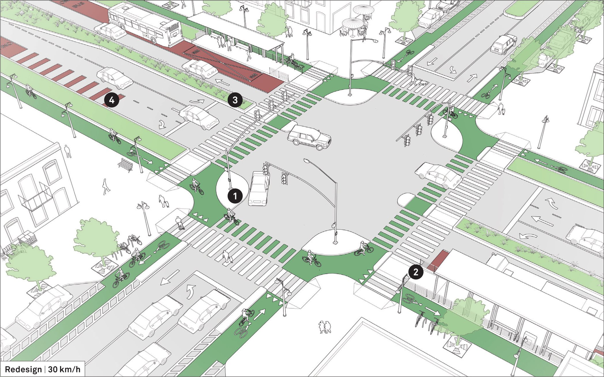
Let’s take a look at the two photos above. The one of the left is from Syracuse where two bike lanes meet in Downtown. This is typically how American cities handle this type of intersection, with both lanes starting and ending at the intersection with no real separation between cars and bikes. Now when you look at the graphic on the right, you’ll see an extra level of separation. Not only is the bike lane protected, but a concrete island stretches between the two crosswalks forcing drivers to take wider, safer turns. At the same time, cyclists and pedestrians are moved up further in front of drivers before they cross. This gives them a chance to begin crossing before cars get into the intersection. Ottawa, Canada has been at the forefront of this style of intersection in North America, with some even appearing before bike lanes are installed.

One thing these intersections require is the removal of curbside parking, either by eliminating parking all together or creating floating parking lanes, which Syracuse has struggled to embrace in the past. But things are changing and the City is putting forth a true effort to create safer bike infrastructure. 

While you may not find intersections as interesting as I do, it's important to recognize when they’re done well and what benefits they bring. Create spaces where people of all ages and abilities feel safe to move around the city. Quiet your streets by slowing down cars and encouraging other modes of travel. Embrace an all around healthier city and self by creating safe spaces. We may not officially have a Vision Zero policy in Syracuse, but advocating for and implementing these improvements can get us on our way there.

In Part Two, I’ll take a look at some specific intersections to explore what we might be able to do to improve them for everyone.

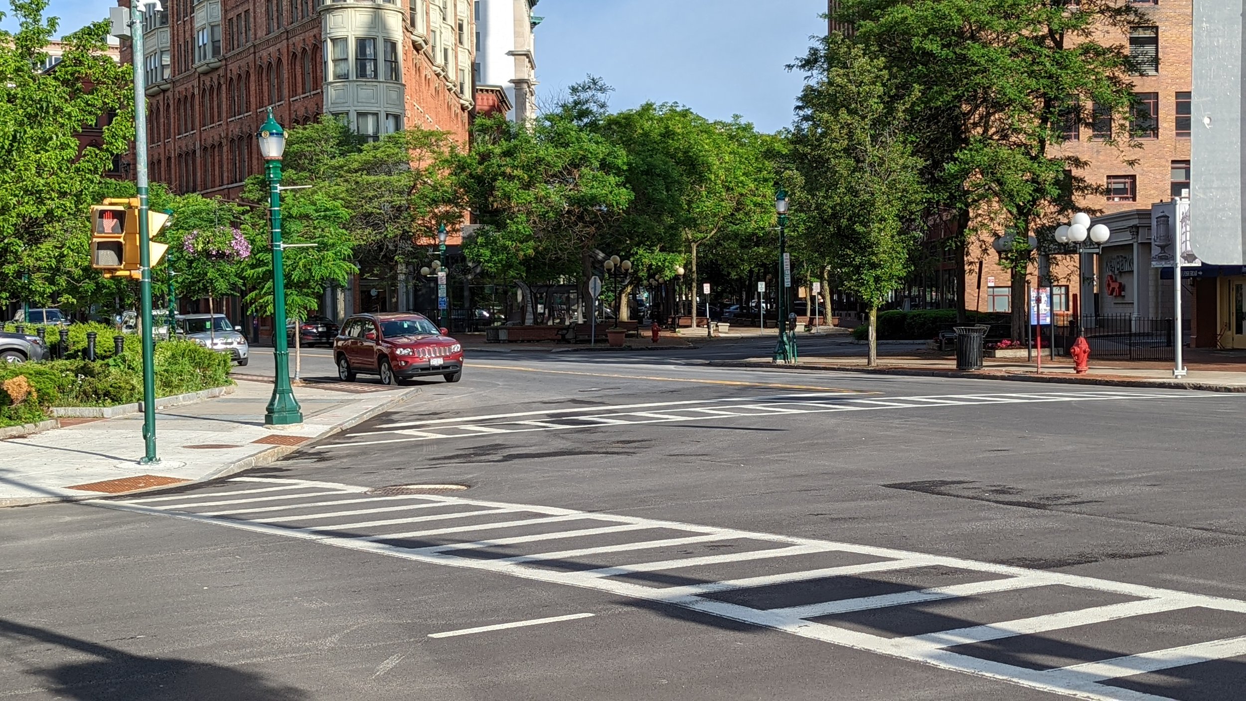
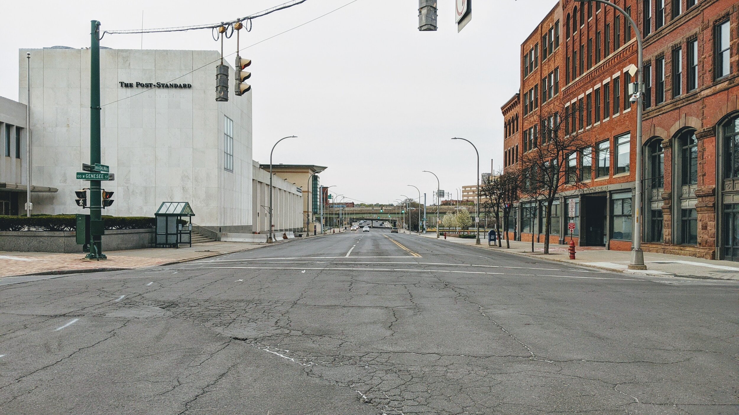
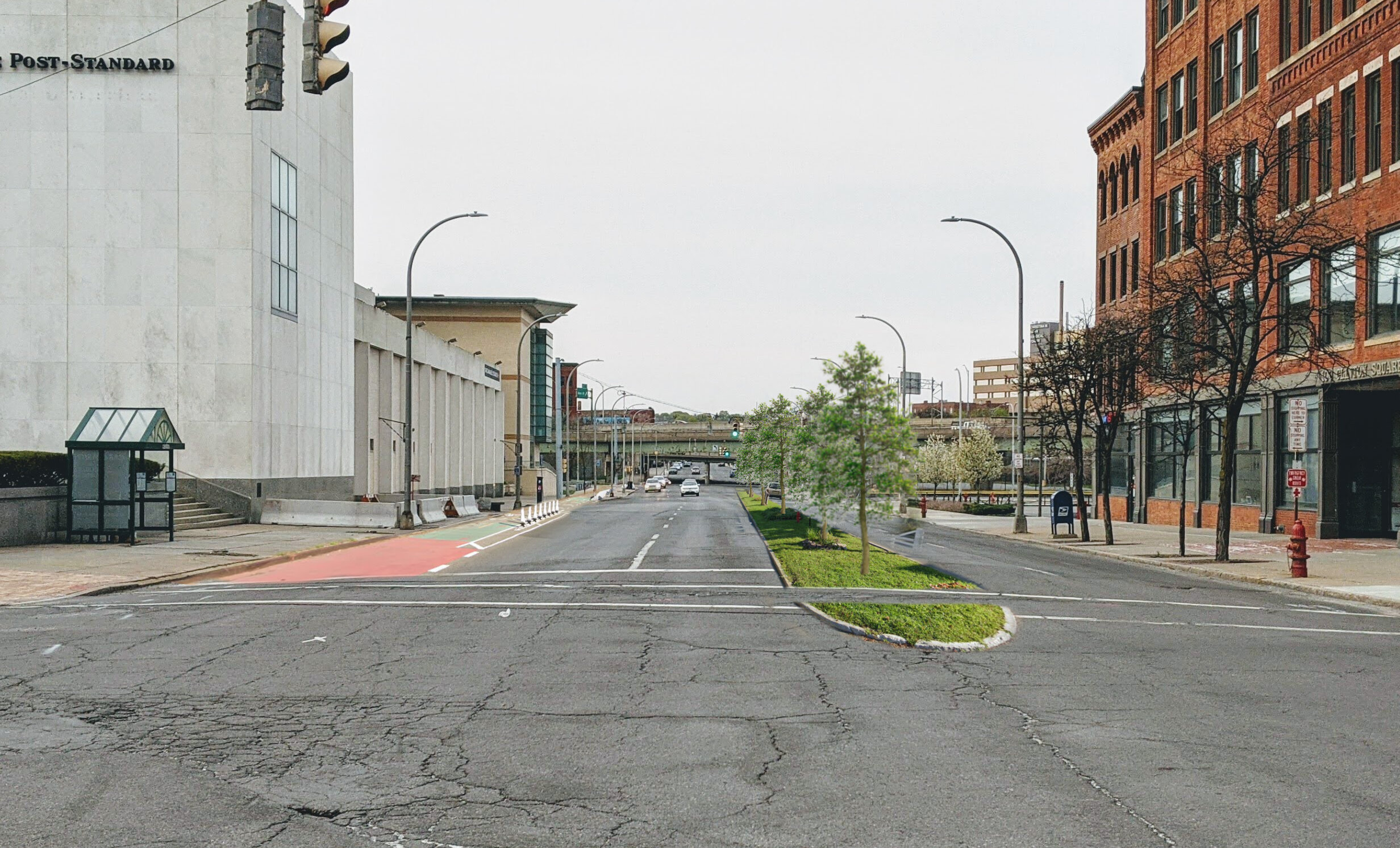
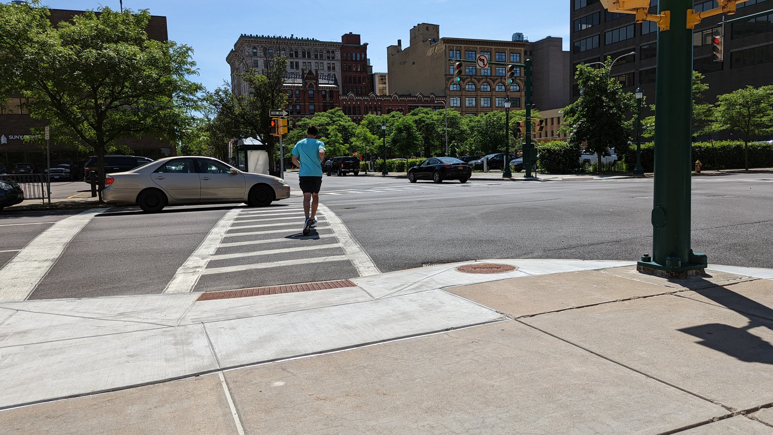
The intersection of Washington and Montgomery in Downtown Syracuse was originally due to train tracks that ran down the center of the street. Now pedestrians are pushed off to the side as the prepare to cross, out of sight of cars and obstructed by trees, lamps, and signage.

In Transportation, Walkability, Urban Planning
Comment
Hey, look, it’s me.

Hey, look, it’s me.

Bike Share is Back in Syracuse!…And We Need to Fix It

October 2, 2021

Every city should have a bike share program as part of their transportation network. I’ve discussed it in the past on this blog noting that bike share should be seen as an integral part of creating access and freedom for people. Syracuse’s bike share program, originally run by Gotcha and now operated by Veo Ride, is a success story in its own right and I am personally excited for its return. In fact, the cover photo for this story is me on one of the bikes as soon as I got out of work after hearing they had officially returned. But there are some glaring issues with the system that, if not corrected, will keep it from being a true alternative transportation option for many people.

First, let’s take a look at the system we have in Syracuse. In 2019 the City launched the first, by a few days, all e-bike bike share program in the country. Committing to an e-bike program was a unique option at the time, but one that made complete sense for a city as hilly as Syracuse is. Riding a traditional bike share bike, which tend to be heavier than most bikes people own for safety reasons, up to Tipp Hill or to Syracuse University would be exhausting for most riders. With an e-bike those hills become manageable and you can arrive at your destination without breaking much of a sweat. 

Gotcha’s Sync bikes in Burnet Park.

Gotcha’s Sync bikes in Burnet Park.

At its launch, Sync (the name for Syracuse’s bike share program) offered individual ride purchases but also offered a monthly and yearly pass. Monthly passes, which ran for $12 per month, offered a free 30 minutes per day with $0.10 a minute after 30 minutes, while yearly passes, which were $50 per year, offered one hour of free riding per day with $0.10 a minute for any additional minutes. While these weren’t as generous as the unlimited rides of up to 45 minutes offered by CitiBike in New York, the price came in at a fraction of the $180 for the annual pass, and the service area in Syracuse can easily be covered in under 30 minutes.

While Sync was successful, including seeing a large bump in usage during the Covid-19 pandemic, financial strain on Gotcha resulted in the program ending in the fall of 2020. The City rightfully decided to seek a new vendor to provide this service and accepted a bid by Veo Ride at the beginning of summer 2021.

So now that we’re caught up on the history, let’s take a look at the system we have now and ways that we can improve it so it can become a true alternative option for people to get around Syracuse.

The Pricing

The original Sync program was priced in a reasonable way that would be an extremely affordable alternative for most people within the City of Syracuse. Under Veo Ride, the system no longer lives up to that ideal. 

Monthly and yearly passes have not been implemented at this point in time, requiring all users to pay for individual rides. E-bike rides are charged a $1 unlocking fee and $0.20 per minute, while scooters are charged a $1 unlocking fee and $0.31 per minute. For low-income users you can have the $1 unlocking fee waved. On the first day of operation I took a 15 minute ride from Downtown Syracuse to Destiny USA which cost around $5, so a $10 round trip. An Uber ride in Syracuse is usually not much more expensive, and a bus ride is $2 each way. By contrast, CitiBike costs $3.50 per ride up to 30 minutes, with $0.18 per minute after 30.

Now we may not be able to have prices and offerings at the same level as CitiBike, but if we want bike share to be a true option for people we need to provide affordable monthly/yearly passes so people feel empowered to take a ride as frequently as possible. 

The Network Geography

The original bike station map for Sync. Station locations did not change in the switch over from Gotcha to Veo Ride.

The original bike station map for Sync. Station locations did not change in the switch over from Gotcha to Veo Ride.

In the transition between Gotcha and Veo Ride the geography of Sync’s service stations did not change. Stations are located primarily around Downtown Syracuse and the surrounding neighborhoods. While the bikes and scooters utilized are dockless in nature, the stations remain key locations for individuals to look for bikes/scooters and can become transit hubs. The end goal for Sync is to eventually cover the entire city and hopefully convince some of the inner most suburbs to become part of the system as well. But we are currently leaving out important destinations in the network that should’ve been included as stations from the beginning.

The most obvious omission in the system is the lack of station access at Destiny USA. The nearest station to the mall is still around a 10-15 minute walk up the Creekwalk. As one of the largest employment centers in Onondaga County, let alone the City of Syracuse, missing this connection is a huge missed opportunity. This is especially glaring since the Creekwalk, which connects to Destiny USA’s property, is one of the premiere bike routes in the City and continues to grow into the Southside providing access to large population centers. 

Near Destiny USA, we also miss connections to the Regional Market, Regional Transportation Center, and NBT Bank Stadium. A recent study by SMTC identifies ways to make this area more accessible for individuals on foot and on bikes, and is an important destination for many people who don’t have, or choose not to have, access to a car.

We should aim to have bike share stations at major bus stops in the region, helping it become a true last-mile option for many people. Even if the system is somewhat dockless, we need to provide hubs so residents can expect reliable access to a bike or scooter and not go searching near someone else’s house. 

Bike share is back and we should all be excited about it. But we need to make sure its a system that is affordable and truly connects people. Let’s get to work!

In Syracuse, Transportation
Comment
Clinton Square in Syracuse, NY went from the Erie Canal to a parking lot/thoroughfare, and is now back to a civic plaza used for large events and activities centered around people.

Clinton Square in Syracuse, NY went from the Erie Canal to a parking lot/thoroughfare, and is now back to a civic plaza used for large events and activities centered around people.

What’s the Future of Safe City Streets?

September 27, 2021

City streets have evolved over centuries and attempt to adapt with new technologies. From people on foot and horses, to bicycles and trolleys, and eventually to a sea of cars and trucks. While the streets of over a century ago seem chaotic and congested by today’s standards, they did a better job of providing access to people in all modes of transportation than we do now.

In fact, when cars were introduced in mass to city streets many residents protested against them as they were seen as killing machines. Children were a frequent casualty of the new technology, leading many parents to fear for their safety. The eventual domination of cars, through intense lobbying efforts by their manufacturers, also led to all other forms of transportation losing the access they once enjoyed. Public transportation was defunded and slowed down due to the prioritization of private vehicles. Bikes were pushed onto the sidewalks or into parks, with a small minority of riders braving the streets shared with cars (in some ways this was a result of the “vehicular cycling” movement lead by John Forester in the 1970s). Pedestrians slowly saw their access to sidewalks diminish as roadways expanded, and many suburbs never even built out sidewalks to begin with.

Over the last 50 years, we’ve seen annual deaths related to car crashed hover between 30,000 and 40,000 per year. As we improved safety for those inside of the vehicles, we’ve made it more dangerous for everyone outside of them. During the Covid-19 pandemic, when travel was curtailed and most of us stayed home as often as possible, deaths related to vehicles increased. The combination of larger vehicles, higher speeds, and more people spending time outside for health reasons was deadly. 

But what about the quickly approaching dawn of the autonomous vehicle (AV) age? Surely, that will help improve safety for everyone involved.

If you’ve listen to Malcolm Gladwell’s podcast Revisionist History (which I am admittedly a fan, even if the AV episode was poorly done), or paid any attention to the near constant presence of Elon Musk in the news, you’d imagine that AVs are right around the corner and will change everything. They promise to provide door-to-door service while allowing their occupants to read, talk on the phone, or work on the way. Gladwell was especially excited about the gentle breaking and measured movements Waymo performed while he attempted to surprise it.

How close are we really to a full AV world?

Tesla continues to say that full on AV is only months away, after years of proving false. They’ve rolled out “Autopilot” which still requires full driver attention to operate, and has resulted in tragic crashes when drivers have put too much faith into it. Even the over-promoted hyper loop, with its first attempt now in operation in Las Vegas, requires drivers to be present in a tunnel solely built for them. The video below is so breathless about a technology that carries less people, and is less automated, than an average airport people mover.

So much of the coverage has been about how AV technology will make it safer and more convenient for people inside the vehicle, but the pedestrian experience often takes a back seat. Reports of difficulty seeing individuals with darker skin tones and confusion over bikes can lead to avoidable disasters. Some have begun arguing that pedestrians and cyclists need to be even further removed from roadways, or required to wear devices that communicate with AVs. Others just completely forget that pedestrians exist and believe AVs will be able to completely solve traffic congestion, as the YouTuber CPG Grey believes in the video below.

AVs can be seen as a way of getting us closer to the supposed utopian vision of “Futurama” from the 1939 World’s Fair, an exhibit presented by GM that featured high speed car access to central cities without a single pedestrian in sight. Futurama was a dangerous fiction then and continues to encourage engineers/tech giants to focus solely on vehicle access. No matter what we do, people will always travel on foot at some point during their day, and we should be encouraging more of it instead of encouraging more car usage. Walking has been shown to improve both physical and mental health, is beneficial to the environment, as well as provides economic/social benefits for all.

Futurama model at the 1939 World’s Fair, focused on providing high speed access for vehicles with no access to people on foot or bike.

Futurama model at the 1939 World’s Fair, focused on providing high speed access for vehicles with no access to people on foot or bike.

AVs will eventually make their way into society, but we need to decide where they fit and what type of future we want for our city streets. Here’s my vision for that future:

We first need to pump funding into developing strong public transit and bike networks, which move far more people than private vehicles ever will. With the advent of AVs owning your own vehicle is no longer needed. Car shares can become much more efficient and affordable, resulting in far fewer vehicles on the road. While public transit should carry the majority of workday trips between population and commercial centers, AVs can fill in the gaps. 

Our city centers and neighborhoods should be primarily the domain of pedestrians and cyclists, much like Dutch cities and the super blocks of Barcelona are now.  Provide access by AVs on the outskirts, with exemptions for the elderly and disabled who’s vehicles would travel at slow, safe speeds within these destinations. Transit would travel into these areas on dedicated rights-of-way, primarily repurposed streets from our current network, with pedestrianized areas surround stations and stops. By freeing the majority of streets from vehicles, or at least greatly reducing the number of vehicles with access, streets can become parks, restaurants, and gathering spaces. Instead of restricting people for the benefits of AVs, we should be restricting AVs for the benefit of people. 

Space that was originally dedicated to cars is now used for community activities in the Barcelona Super blocks.

Space that was originally dedicated to cars is now used for community activities in the Barcelona Super blocks.

The best part is, we don’t need to wait for AVs to become a reality for us to begin these changes. These changes can be implemented now and we can start reaping the benefits. Car share is successful in many other countries, with easy access within a short walk. The Barcelona super blocks still provide car access to residents, at highly reduced speeds, while keeping out most other vehicles, which has freed up space for playgrounds and greenery. Every city has at least a few streets they could close off right now to vehicles and start implementing these measures. And when AVs come we can just double down on the efforts we’ve already begun. 

Let’s make the future safe for people, not cars.

In Transportation, Urban Planning, Walkability
Comment
Transforming a parking lot into a public space and bringing back some of the street wall would create a more inviting environment for people to walk and spend time.

Transforming a parking lot into a public space and bringing back some of the street wall would create a more inviting environment for people to walk and spend time.

A Friendlier Entrance into Downtown Syracuse

May 12, 2021

Downtown Syracuse is surrounded by a ring of highways and a sea of parking lots, separating it from the urban neighborhoods that surround it and prioritizing accessibility from the suburbs. Walking or riding a bike into Downtown is unappealing and can be dangerous. First you’re forced onto narrow sidewalks next to speeding traffic squeezed beneath low highway bridges. You emerge into large expanses of asphalt used for car storage with frequent curb cuts forcing you to interact with cars entering and exiting. Once you’re into the Downtown core, walking becomes a more pleasant experience, with mostly human scale architecture and a mixture of uses that encourage people to interact. If you’re coming or going at night, the walk into Downtown is even worse with the poor lighting conditions under the overpasses.

For Downtown Syracuse to truly thrive, we need to improve the experience of arriving on foot and reconnect it with the rest of the city. A good place to start is North Salina Street.

With a right-of-way over 100 feet wide, North Salina Street is daunting to cross at times. The wide travel lanes encourage vehicles entering the city off of the highway, or just further up the street, to speed into the center of the city, especially when the lights line up in a “green wave.” In order to create a safer, more accessible entrance to the city you must start by taking away space from cars, and I do believe there is plenty of space to take away without impeding traffic.

N Salina looking north present.jpg
N Salina looking north future.jpg

Removing one travel lane, converting the third lane to an alternating turn lane, and narrowing each of the remaining lanes to 10 feet would provide ample room for increased pedestrian and bike facilities. A pedestrian refuge island, filled with trees and grass, would not only shorten the distance people need to cross all at once, but it would also force drivers into wider, safer turning movements. In addition, the greenery placed in the pedestrian island would function as a placemaking tool, alerting drivers that they are now entering a space where they are a guest. This can be reinforced by utilizing raised crosswalks along the entire street, slowing traffic and providing increased visibility and mobility to people walking.

You also end up with enough space for a protected two-way bike lane, ideally on the western side of the street due to the presence of fewer curb cuts and intersecting streets. Salina Street is one of the flattest roadways in the entire city and runs its entire length. While a bike lane the entire length may not be feasible, or desirable, providing a safe entrance into Downtown Syracuse from the Northside of the city on bike is needed. North Salina Street connects to some of the densest neighborhoods in the city as well as thriving business districts, a prime location for this sort of connection.

Office Parking Lot.jpg
Office Parking Lot future.jpg

Once we narrow the roadway and provide additional space for people on bikes and foot, we need to look at reusing an abundance of asphalt in the area. As you enter Downtown from North Salina Street you are greeted with one of the best murals in the city, showcasing a night scene of the Erie Canal, yet you only get to appreciate it as you pass by or park your car beneath it. Instead, this space should be transformed into a simple park with trees and benches. Beside the park we should look to add a three-to-four story building with commercial space on the first floor and apartments above. Currently, two historical buildings have been renovated in this area with similar layouts, but continue to struggle to attract commercial tenants. One of the biggest issues they have is that they’re not part of a place. They’re stranded in a sea of parking that no one wants to cross. If a bar or restaurant opened here they would struggle to attract customers because they’re removed from the foot traffic of nearby Hanover Square. To benefit these buildings, and connect this part of Downtown with Hanover Square and Little Italy, some infill development is needed. Creating a cohesive street wall invites people to walk in this area. Coupled with the park and mural, this space becomes attractive to visitors and doesn’t feel secluded anymore.

One more piece of the puzzle in this area is the old Post Standard building. While there are plans to redevelop the building, a large portion that contains the printing press and loading dock will remain. This portion of the building, with its bland tan brick walls and tiny windows, creates a drab experience when walking near it. At the same time, it provides an opportunity to tie it into the history of the neighborhood. A simple way to improve this experience is to paint a complimentary mural along the facade. As a personal preference, I feel a mural depicting the 1950s hustle-and-bustle of Downtown Syracuse, especially along Salina Street, would help show the progress of the city over the years and how we continue to evolve. The new mural would surround people with art and history, making the new park a prime location for anyone looking to relax and enjoy the surroundings. 

Post Standard present.jpg
Post Standard future.jpg

Combined, these changes would be a game-changer for this area. These few blocks would no longer be dedicated to the movement and storage of cars, but instead be refocused on people. Walking and biking would now be invited and encouraged. Extra lighting from the new infill buildings, improved lighting up and down the street, and the eventual removal of some of the overpasses through the I-81 project would make the space more accessible at all hours of the day.  We end up with a friendlier entrance for Downtown Syracuse; an entrance it deserves. 

In Syracuse, Urban Planning, Transportation, Walkability
Comment
One of the many parking lots wrapping around Downtown Syracuse

One of the many parking lots wrapping around Downtown Syracuse

Downtown Is Still Built For Cars and Minor Ways to Begin Shifting the Balance of Power

March 18, 2021

Downtown Syracuse, like so many other downtowns across the country, is considered one of the most walkable places in the community. Wide sidewalks, frequent crossings, stores, restaurants and bars, and varied architecture throughout help make it an inviting place to walk around and enjoy the day. Even with so many of these factors favoring walkability, it is impossible to ignore that cars remain dominant within the neighborhood.

First, let’s begin with the obvious - Downtown Syracuse is an island surrounded by parking. Chapter 5 of the Preliminary Draft Environmental Impact Statement for the I-81 construction project showcased the map below which identifies all of the parking structures in and around Downtown Syracuse.

Parking infrastructure map from the I-81 PDEIS

Parking infrastructure map from the I-81 PDEIS

Looking at this map it quickly becomes apparent that the vast majority of space in the Downtown area is devoted to the storage of vehicles. Some will argue that this parking is needed for all of the workers, residents, and visitors that the area attracts, yet we don’t seem to have the same interest in providing this sort of access for people traveling on bike or on foot. In fact, if you look at the most recent Bike Suitability Map from SMTC you’ll notice that there are very few ways to enter Downtown safely on a bike. Crossing under highways and railroad bridges, competing with off ramps where drivers maintain their highway speeds, it is often dangerous getting into this central area. Just recently a cyclist was hit near a highway on-ramp and was sent to the hospital in critical condition.

Screenshot of the Interactive Bike Suitability Map from SMTC

Screenshot of the Interactive Bike Suitability Map from SMTC

There has been movement to improve access to Downtown Syracuse on bike, with the Empire State Trail and the Creek Walk both improving navigation and safety for riders and pedestrians, but there is room for improvement. Some of the infrastructure that has been built is extremely high quality, including a protected bike lane on the service road of West Street and in one direction on Water Street (although winter upkeep still needs improvement), while others leave plenty to be desired. Sharrows through Clinton Square lead to a path that’s blocked off for nearly half of the year due to the ice skating rink, while a bike path just west of the square is up on the sidewalk, forcing pedestrians and cyclists to share in already limited space. The roadway west of Clinton Square could’ve removed some parking spaces creating enough room for a protected bike path in both directions.

Improving upkeep in the winter and adding additional painted lanes around known yearly obstructions would help increase the usefulness of this trail, both to visitors and, more importantly, residents. Still, these lanes are major improvements and begin to give back some space to non-car uses.

View fullsize Protected Bike Lane on Water Street
Protected Bike Lane on Water Street
View fullsize Snowed In Protected Bike Lane
Snowed In Protected Bike Lane
View fullsize Blocked Bike Lane in Clinton Square
Blocked Bike Lane in Clinton Square
View fullsize Sidewalk Bike Lane
Sidewalk Bike Lane

While bike infrastructure is slowly improving, pedestrian infrastructure should not be overlooked. Downtown Syracuse has wide sidewalks that make it enjoyable to walk around with friends, with people rarely having to walk in a line behind one another as you go. Even then, there are still signs that pedestrians aren’t in control of this space.

At times sidewalks must be blocked off for various purposes, due to damage or construction, with barriers put up to prevent people from using them. Often these occur in the middle of a block, far from an intersection. Some people will cross the street quickly, or just walk in the street for a bit, which puts their well being at risk. On the other hand, disabled individuals are not provided a way to make either of those decisions. In other cities orange barriers are often rolled out to carve out a pedestrian path, allowing pedestrians to stay on the same side of the road safely, while also building temporary ramps to assist those with disabilities. Simply requiring construction crews or building owners to provide this path can help keep pedestrians safer by preventing darting across the street.

View fullsize Salina St sidewalk blocked.jpg
View fullsize Warren St Jersey Barriers.jpg
View fullsize Warren St Parking Garage w Light.jpg
View fullsize Warren St Parking Garage w:o Light.jpg

But let’s get back to parking for a moment. While parking lots dominate the downtown area, and will be discussed in more depth in a later post, parking garages serve up their own issues for pedestrians. Garages by nature utilize very compact designs, attempting to squeeze ramps and entrances in where they can while providing the most parking as possible. Due to some of these designs, sight lines when entering and exiting a garage can be reduced significantly. Some garages work to slow drivers down before they exit by placing their automatic arms closer to the opening, ensuring that the vehicles stop and have time to see. Others have no such barrier near their exits, allowing cars to quickly rush out. While most garages make use of fish-eyed mirrors to help with bad sight lines, they are only useful if the driver is moving slow enough to take in what they are showing.

One particularly bad garage is located on Warren Street (above). The garage makes use of a singular ramp for both entering and exiting, with a green light near the exit to warn incoming vehicles. As Warren Street is a one-way street, the light only faces in one direction, making it essentially useless for pedestrians coming in the other direction. The ramp’s tight fit makes it difficult to see into, and makes use of no devices to slow drivers down as they exit. Due to this, driver’s rarely have time to see whether a pedestrian is coming or not, and the pedestrian has little time to see the car approaching.

One approach that should be taken whenever a car is meant to enter a pedestrian space, such as a sidewalk, is the raise it up. Too often we make use of curb cuts, lowering the sidewalk down to meet the roadway, instead of forcing cars to come up into the pedestrian space. By forcing cars to make that movement, their speed decreases and alerts them to the fact that this is not a space meant for them. The YouTube Channel Not just Bikes has produced an excellent video on this topic (below).

Now there is much more we can do to change this dynamic. Throughout the spring I will be writing about more dramatic ideas of how to change our use of streets in Downtown Syracuse. To create change we need to stop considering how our streets and sidewalks are currently used, but instead think of what we would like to see. The minor changes discussed in this post are to help improve things immediately, along with some of my other pet peeves, but we should also think more radically about what the future should be.

In Transportation, Urban Planning, Syracuse
Comment
← Newer Posts Older Posts →

Recent posts

Featured
Carousel.jpg
May 27, 2025
Destiny USA and the City
May 27, 2025
Read More →
May 27, 2025
PXL_20240805_141743149.jpg
Jan 1, 2025
All Cities Are Beautiful
Jan 1, 2025
Read More →
Jan 1, 2025
PXL_20241005_135224129.jpg
Nov 6, 2024
A Healthy Future for the Regional Market
Nov 6, 2024
Read More →
Nov 6, 2024
PXL_20240728_191254239.jpg
Jul 31, 2024
Renters Matter, Too
Jul 31, 2024
Read More →
Jul 31, 2024
Vista view.jpeg
Mar 21, 2024
The Valley of the Sun - A Land of (Sub)Urban Extremes
Mar 21, 2024
Read More →
Mar 21, 2024
Manlius Cinema.jpeg
Jan 31, 2024
The Movie Theater at the Urban Core
Jan 31, 2024
Read More →
Jan 31, 2024
Clinton Square Christmas Tree at night.jpeg
Nov 30, 2023
The Case for a Holiday Village
Nov 30, 2023
Read More →
Nov 30, 2023
PXL_20230817_220739294.jpg
Oct 31, 2023
The Walk: To Middle Ages
Oct 31, 2023
Read More →
Oct 31, 2023
Ballpark.jpeg
Sep 7, 2023
The Walk: To the Ballpark
Sep 7, 2023
Read More →
Sep 7, 2023
PXL_20230813_213112525.jpg
Aug 14, 2023
The Walk: To Tipperary Hill
Aug 14, 2023
Read More →
Aug 14, 2023
Arts and Crafts Festival 2023.jpeg
Jul 31, 2023
The Walk
Jul 31, 2023
Read More →
Jul 31, 2023
PXL_20230515_144325643.jpg
Jun 21, 2023
Lessons from the North
Jun 21, 2023
Read More →
Jun 21, 2023

Powered by Squarespace