• Blog
  • Blog Index
  • Video Work
  • About
Menu

Thomas Bardenett

Urban Planning - Writer - Filmmaker
  • Blog
  • Blog Index
  • Video Work
  • About

The Walk: To the Ballpark

September 7, 2023

The Walk is a series of blog posts dedicated to documenting the current experience of walking between Downtown Syracuse and its surrounding neighborhoods. The purpose of these pieces is to highlight the importance of connections between neighborhoods. Small pockets of walkable spaces exist throughout the City, but there are large gaps between each. Building out safe, pleasant, and convenient routes between the City center and nearby neighborhoods is a great place to start.

Back in the early 1990s, the City of Syracuse and Onondaga County were faced with the serious probability of losing their minor league baseball team, the Syracuse Chiefs, if they did not replace their six decade old stadium, MacArthur Stadium. The search for where to put a new ballpark came down to two locations - Downtown Syracuse behind Armory Square or in the parking lot of the old stadium. Downtown Syracuse of the 1990s was a far cry from the neighborhood it is today, and the City was still in full suburbanization mode, emphasizing easy access for those who chose to leave the City instead of focusing on those who decided to stay. As a result, the new ballpark began rising in the parking lot of MacArthur Stadium, with the old field destined to be paved over for car storage.

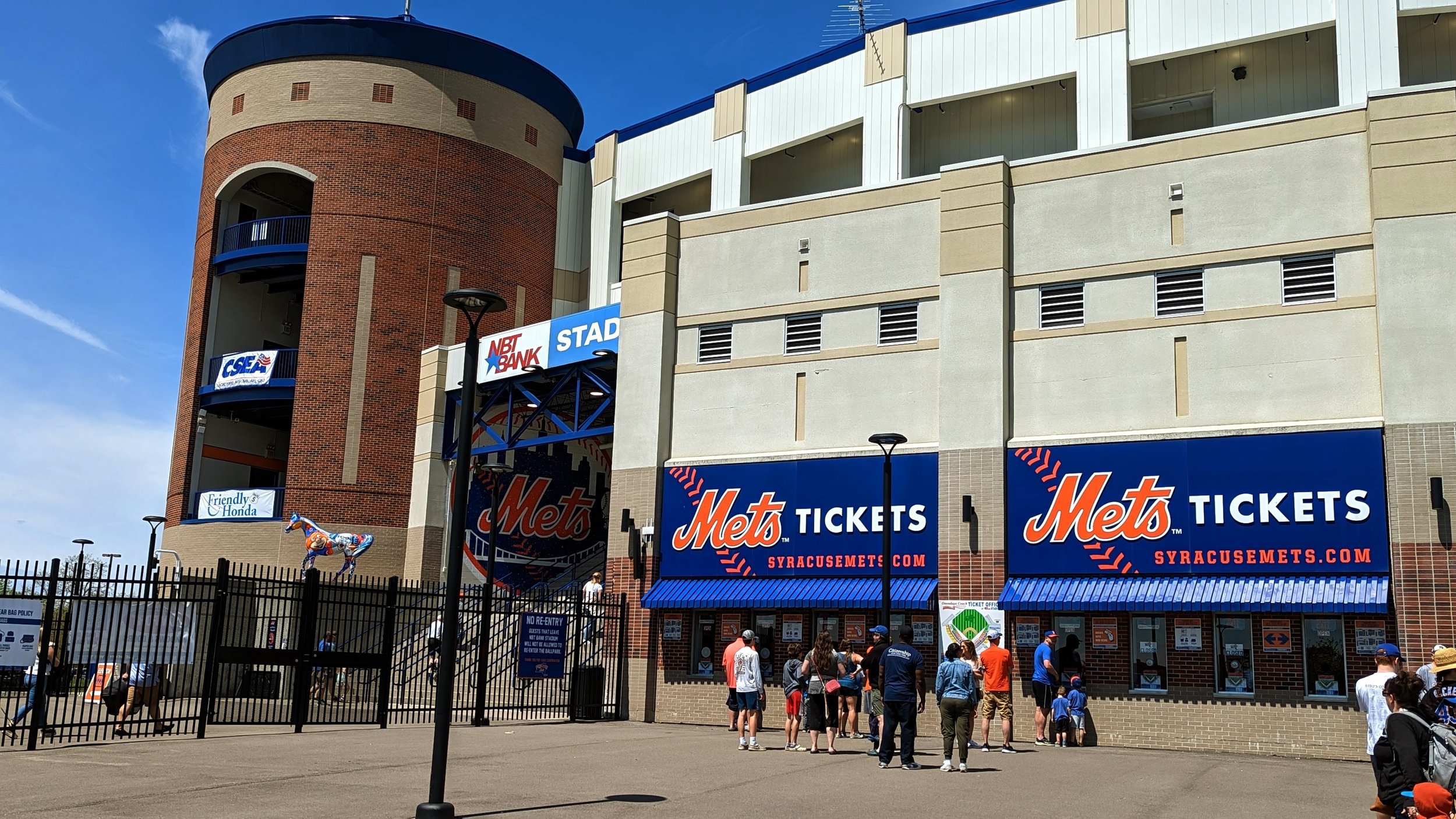
Today, NBT Bank Stadium recently underwent a $25 million renovation in 2020, as a way to keep the team, now the Syracuse Mets, in town for another 25 years. Now, towards the end of my 5th season as a weekend season ticket holder, I am off to the ballpark for Sunday brunch. While this walk is a bit outside the two-mile limit I had originally set out (roughly 2.4 miles), I think we should see how the decisions made nearly 30 years ago impact our ability to experience the City on a day out at the ballpark.

While you could take the Onondaga Creekwalk most of the way to the ballpark, I feel the more interesting, and more important, walk will take us north on N Salina St, cutting through Little Italy and the Northside. But, as always, we will begin from Downtown.

Downtown - Under I-81

PXL_20230820_151248700.jpg
PXL_20230820_151347703.jpg
PXL_20230820_151504584.jpg
PXL_20230820_151545367.jpg
PXL_20230820_151612998.jpg
PXL_20230820_151647785.jpg
PXL_20230820_151248700.jpg PXL_20230820_151347703.jpg PXL_20230820_151504584.jpg PXL_20230820_151545367.jpg PXL_20230820_151612998.jpg PXL_20230820_151647785.jpg

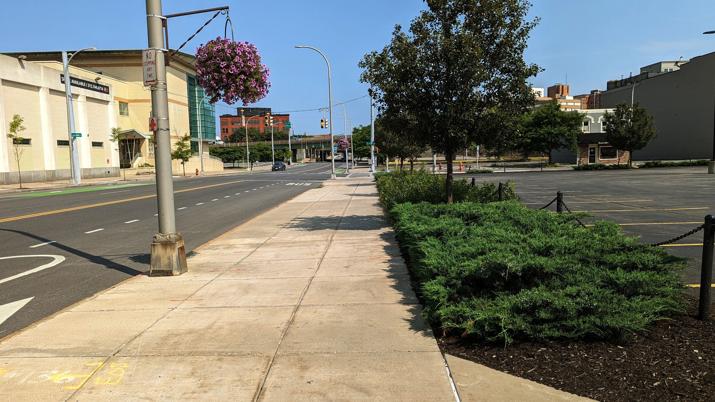
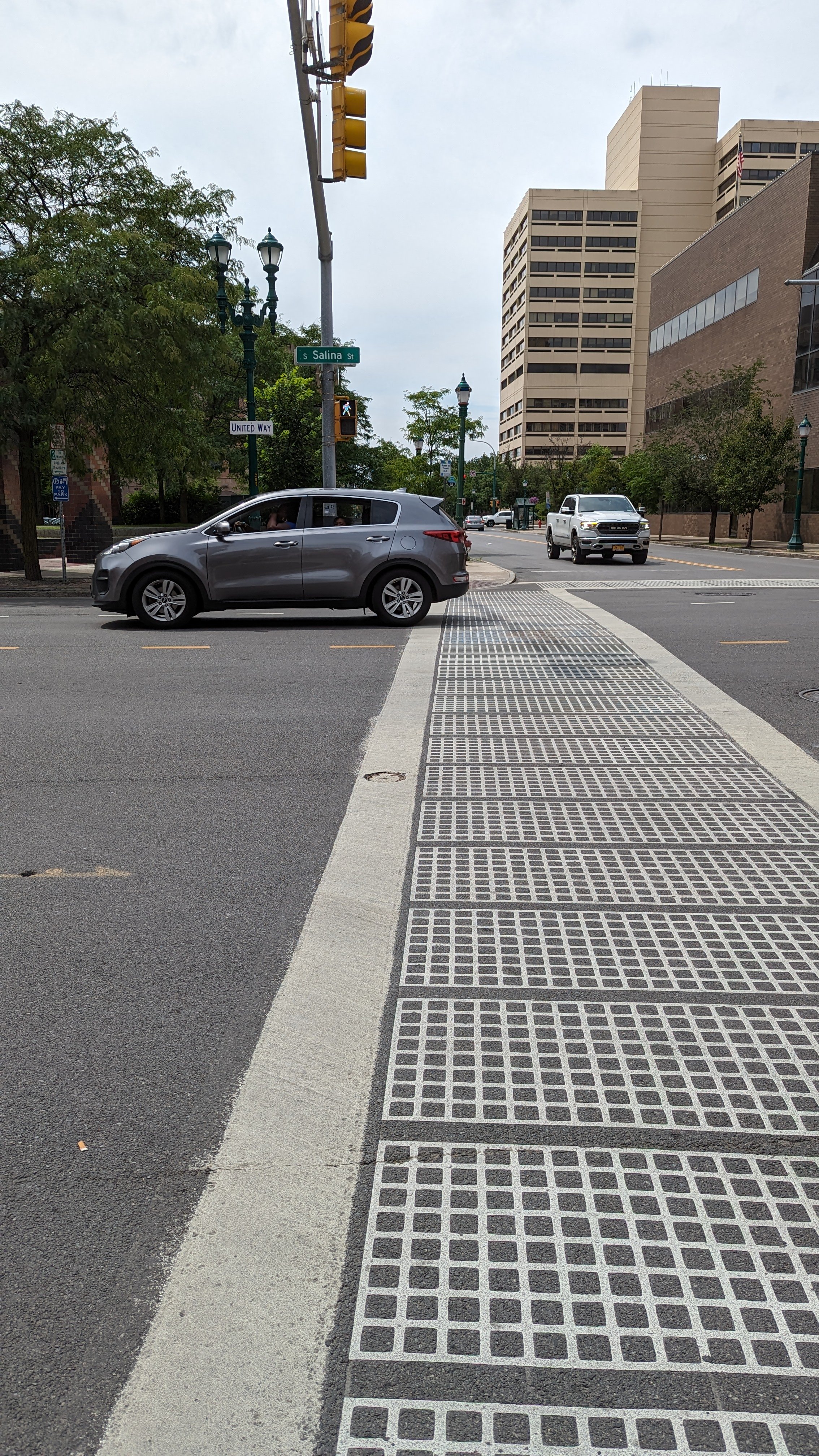
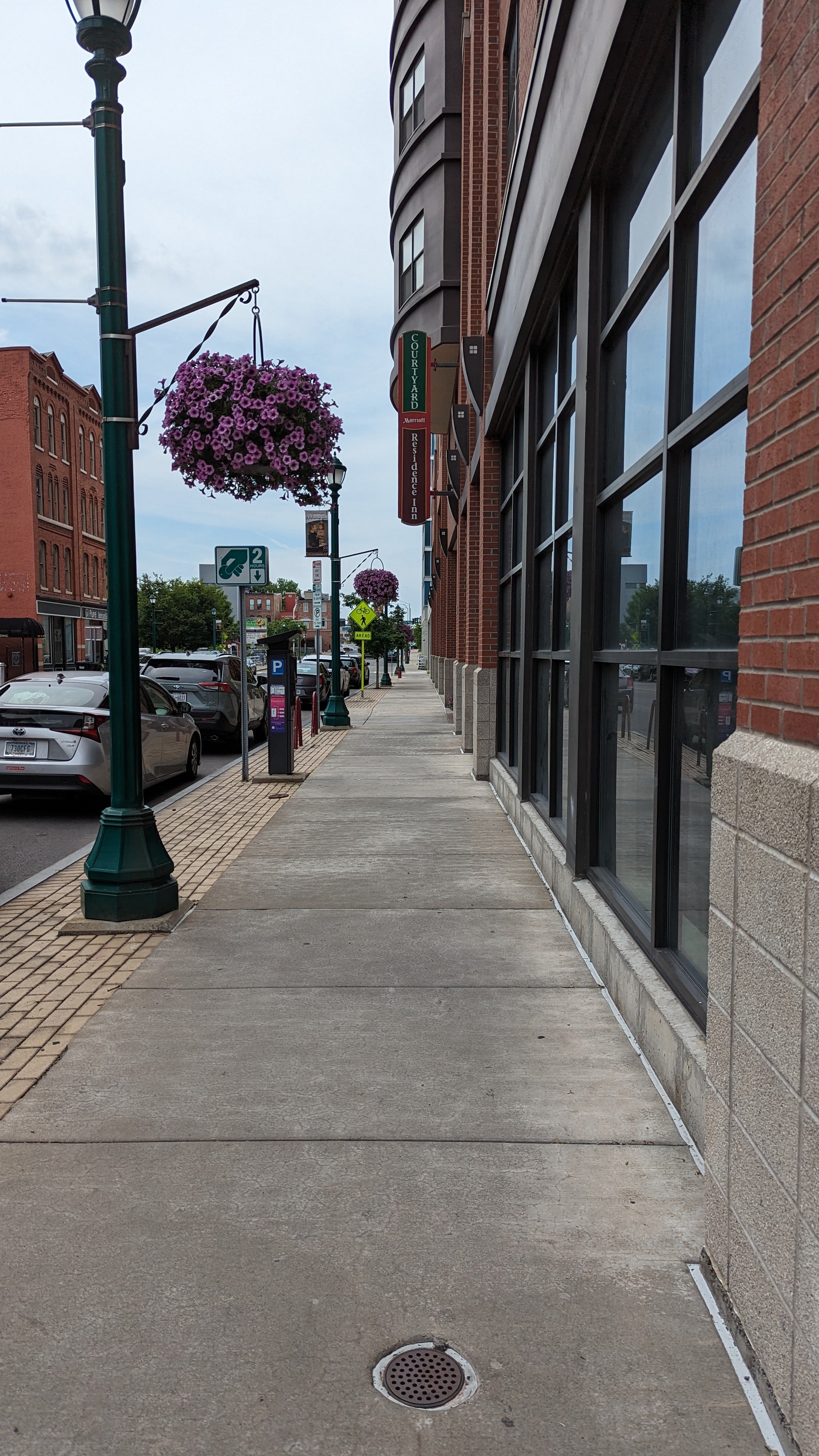
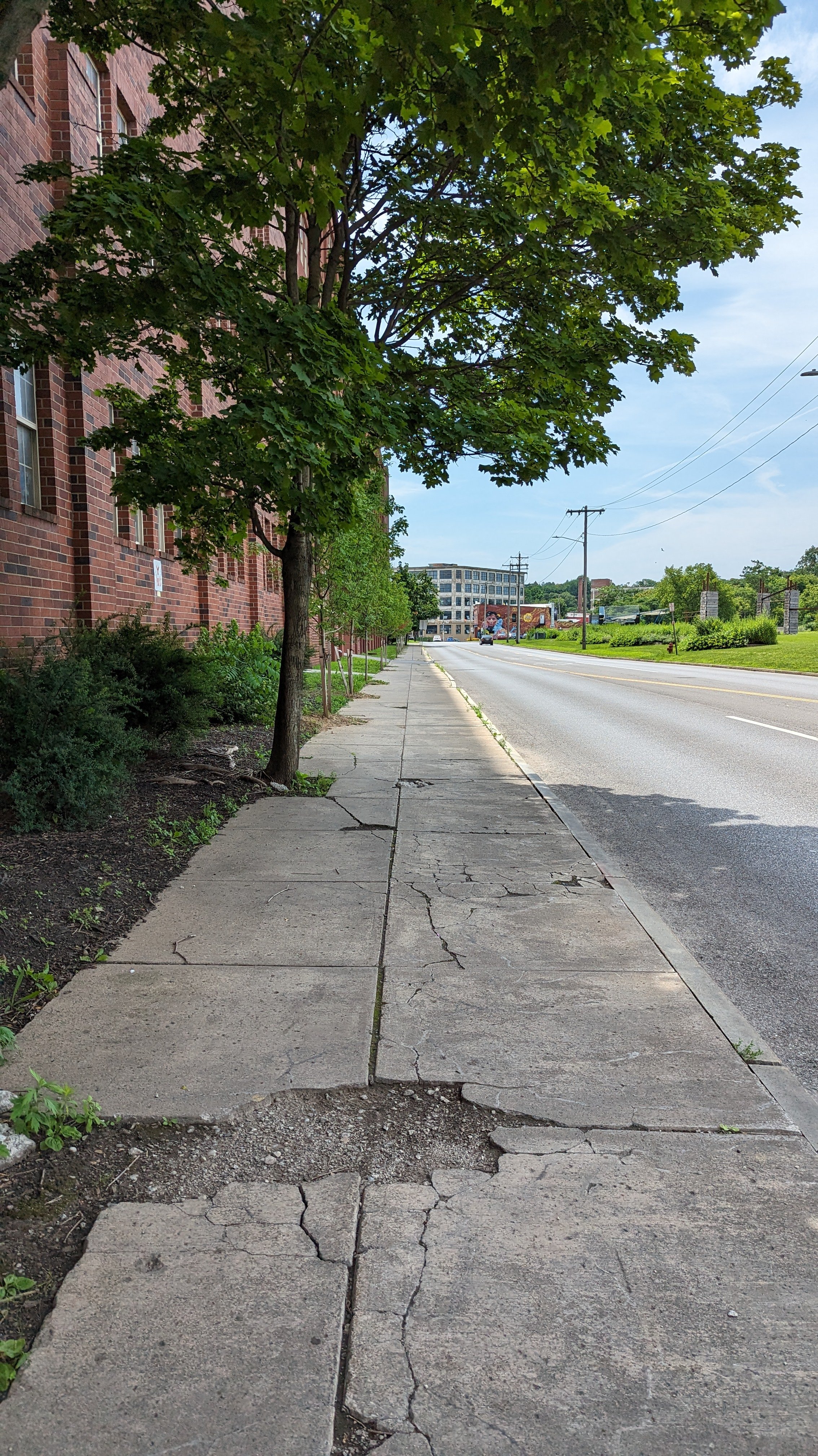
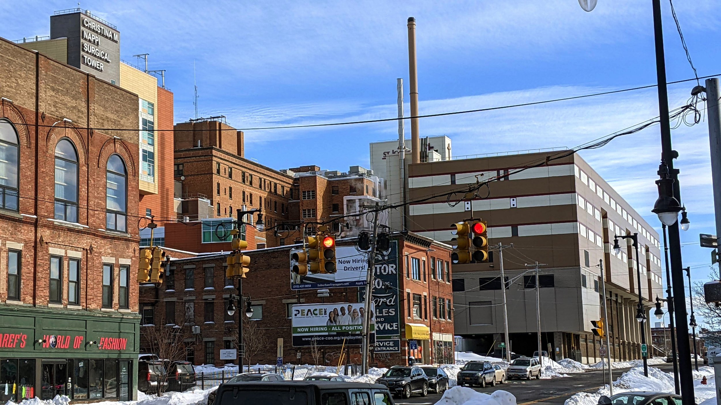
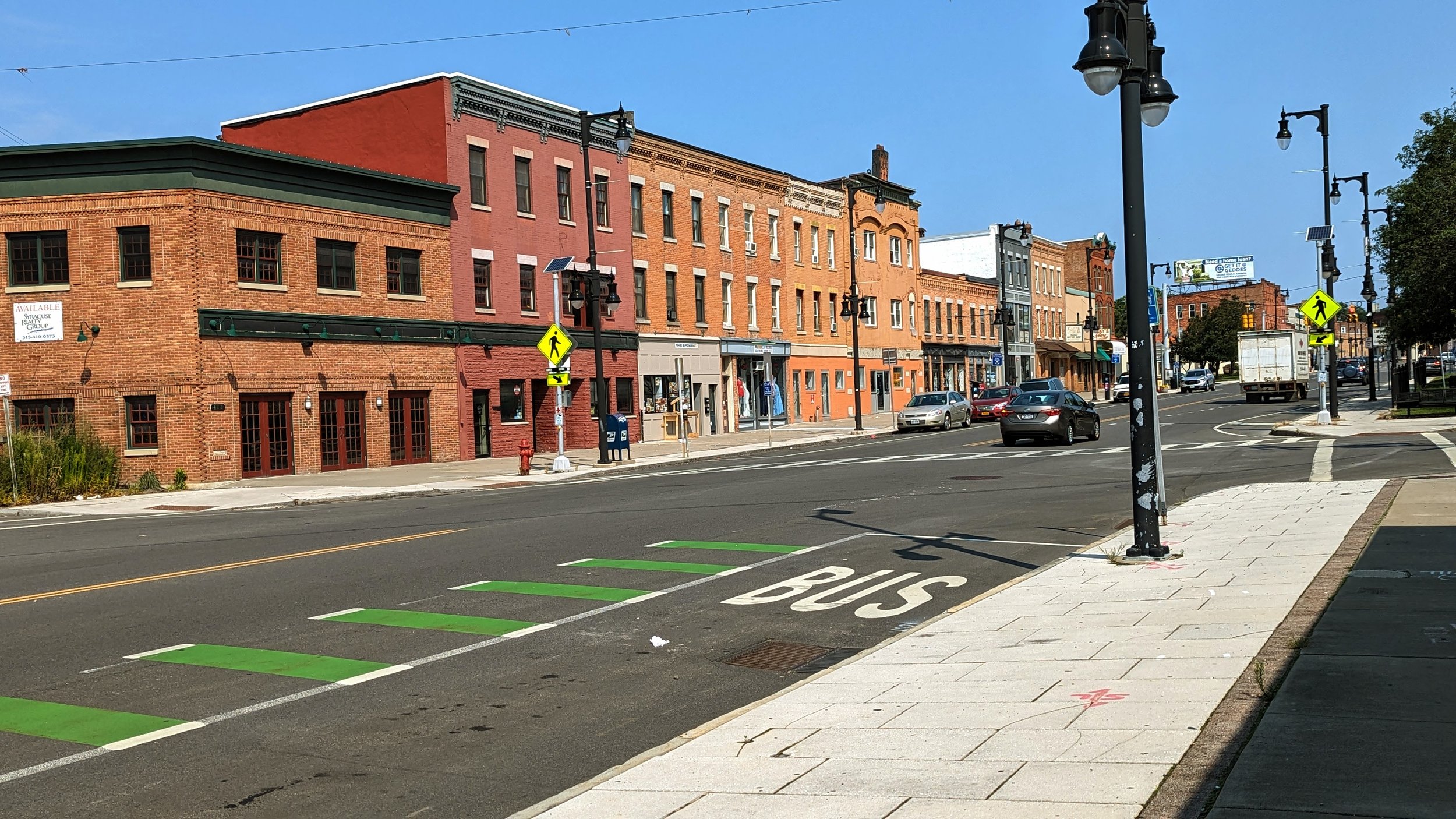
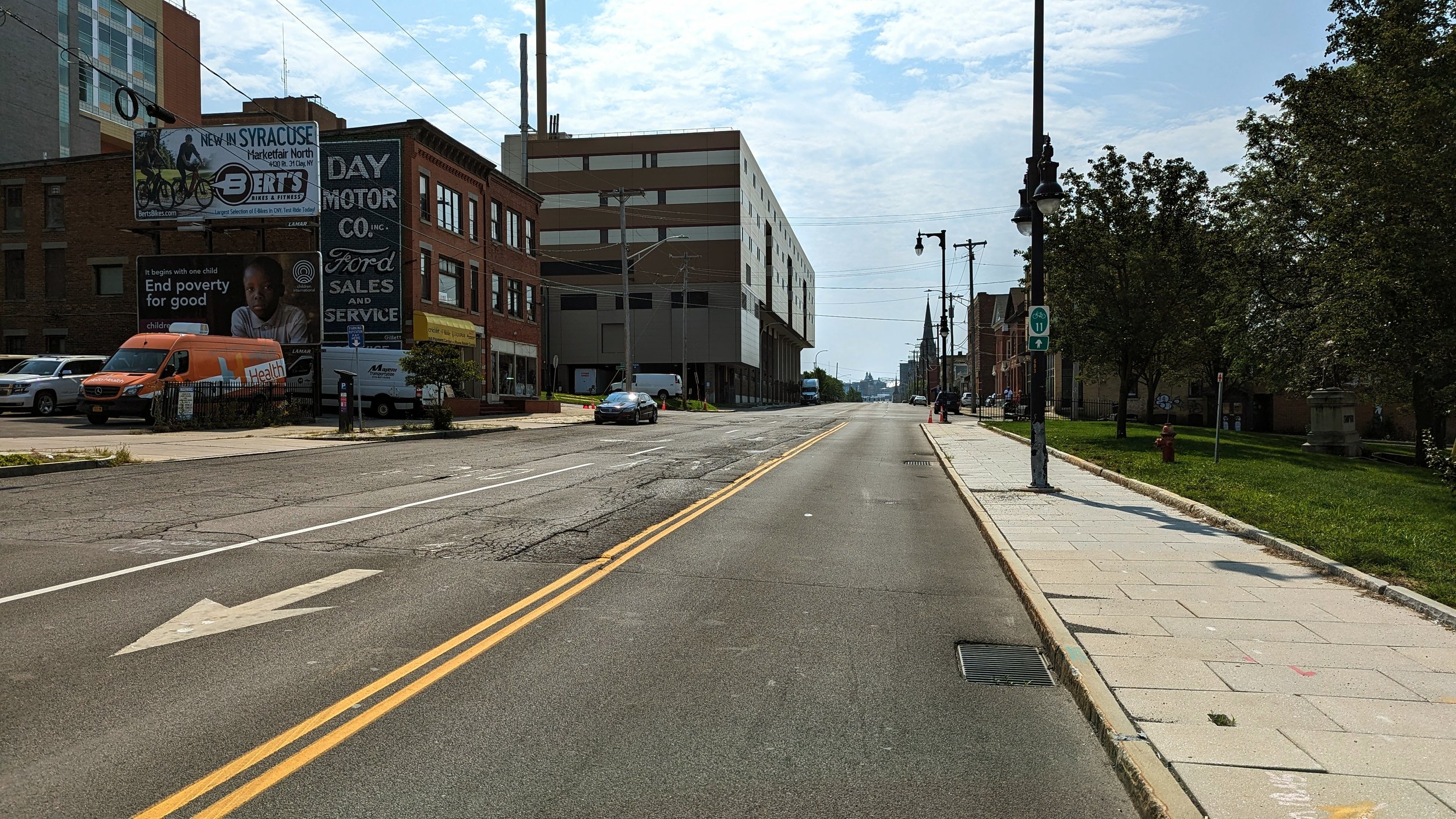
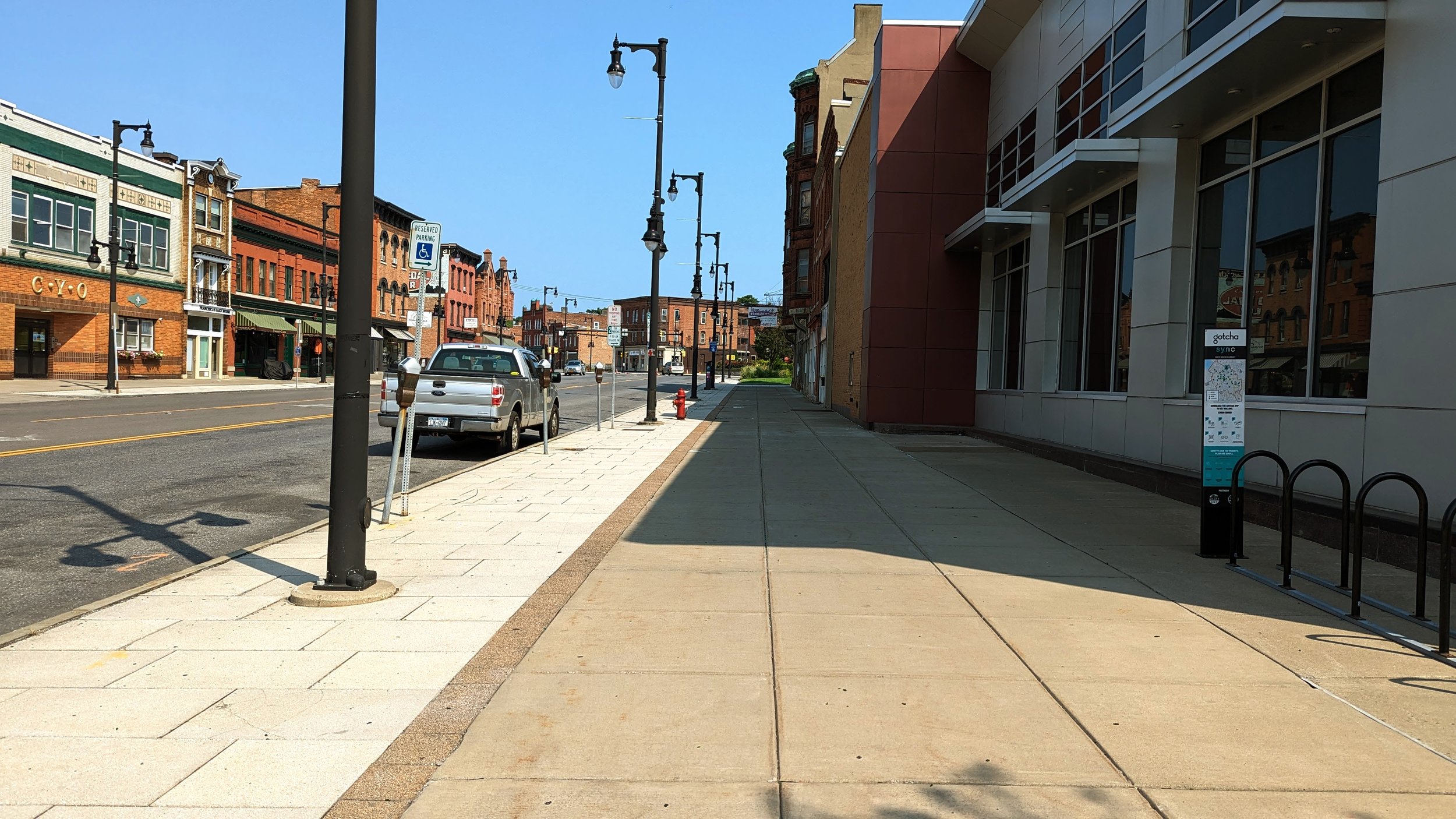
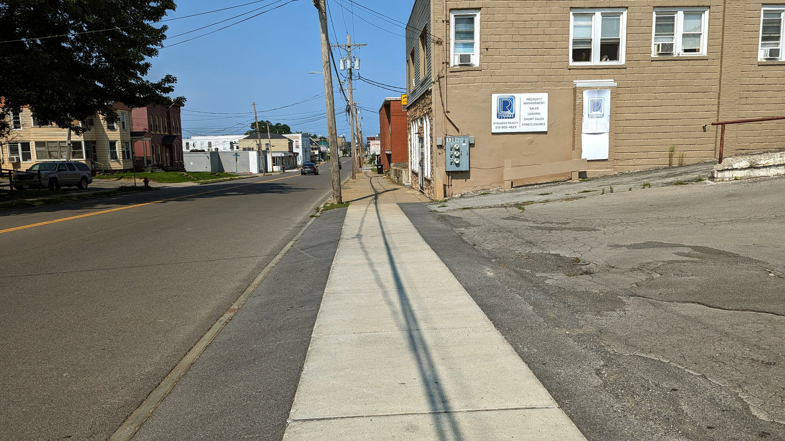
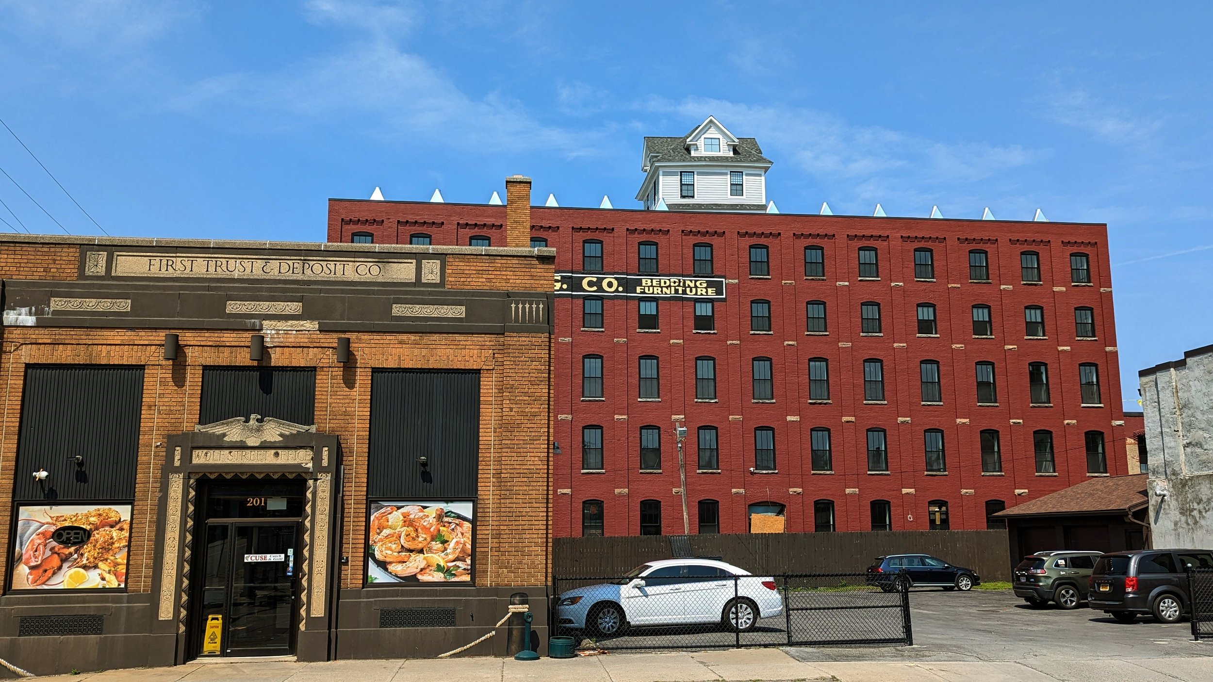
From Clinton Square you begin by heading north along N Salina St. The roadway deserves its place as Syracuse’s Main Street. Extra wide sidewalks line each side of the street with freshly painted buffered bike lanes along the curb. The bike lanes have allowed the City to reduce the roadway from four lanes to three, with a full bus shelter on the northwest corner of the N Salina / James St intersection.

The old Post Standard building, now known as the Post, recently went through a renovation that helps to clean up this corner, while the eastern side is fronted by an historic bank building, which has been around since the days of the Erie Canal.

This is generally where the positives end.

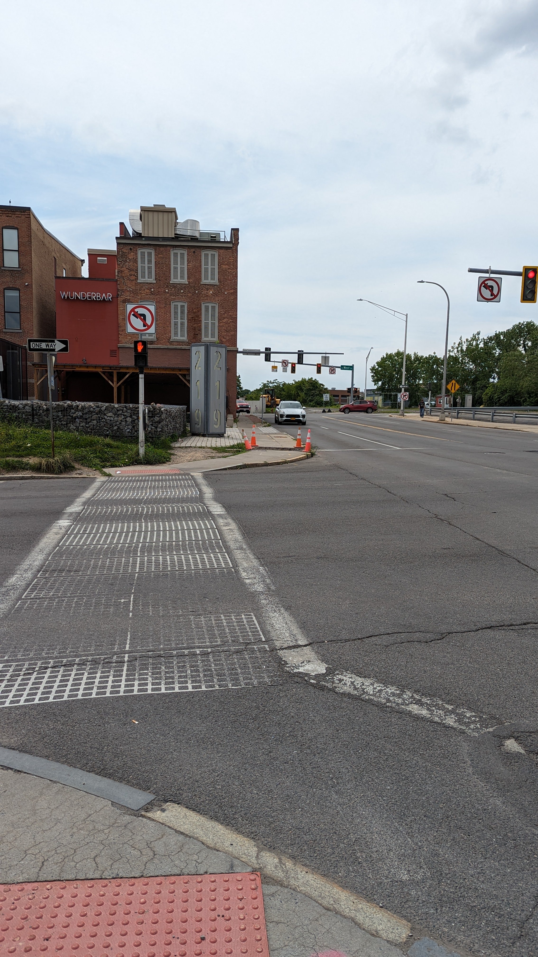
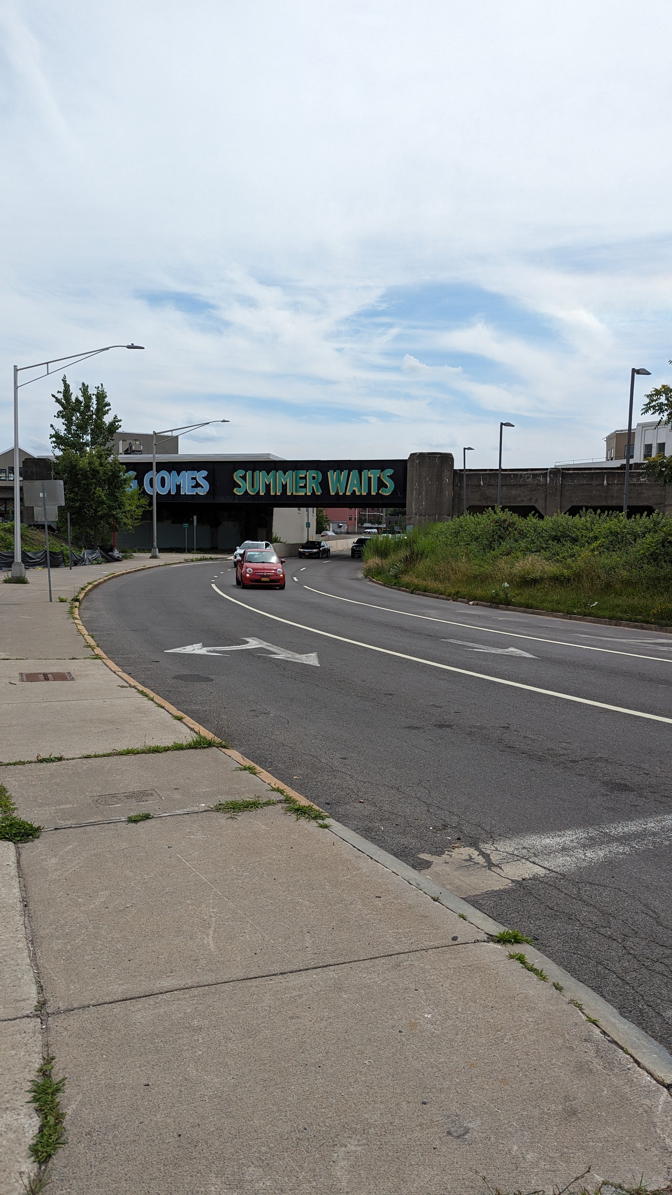
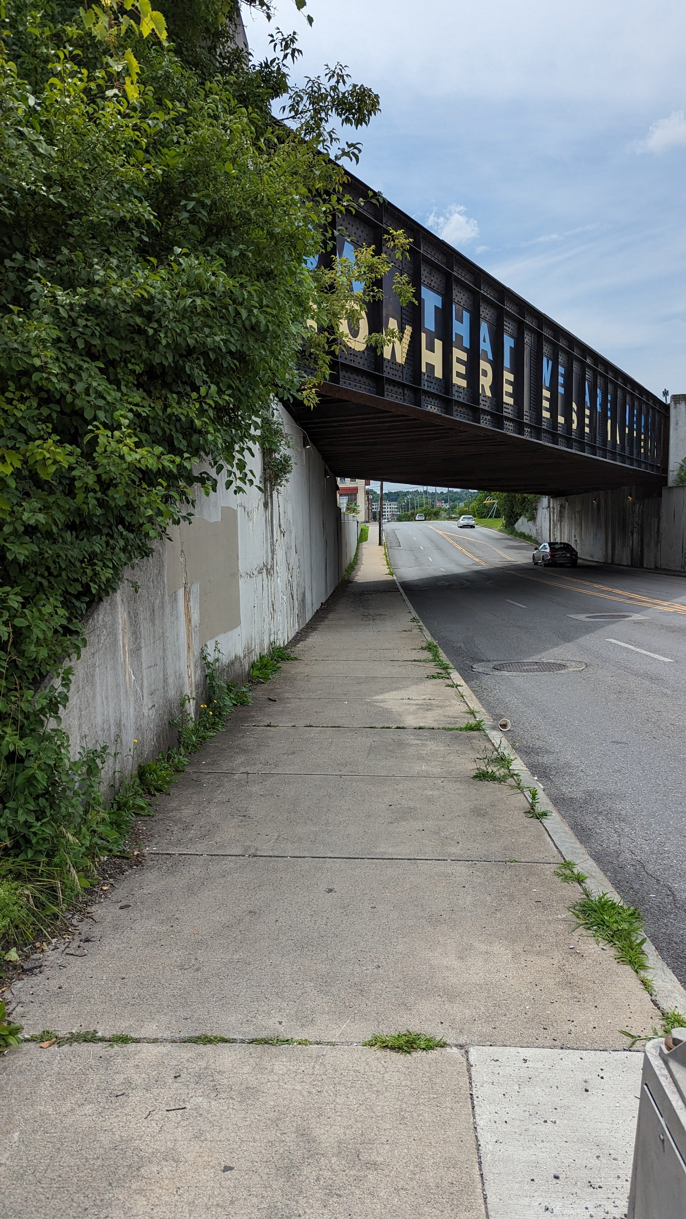
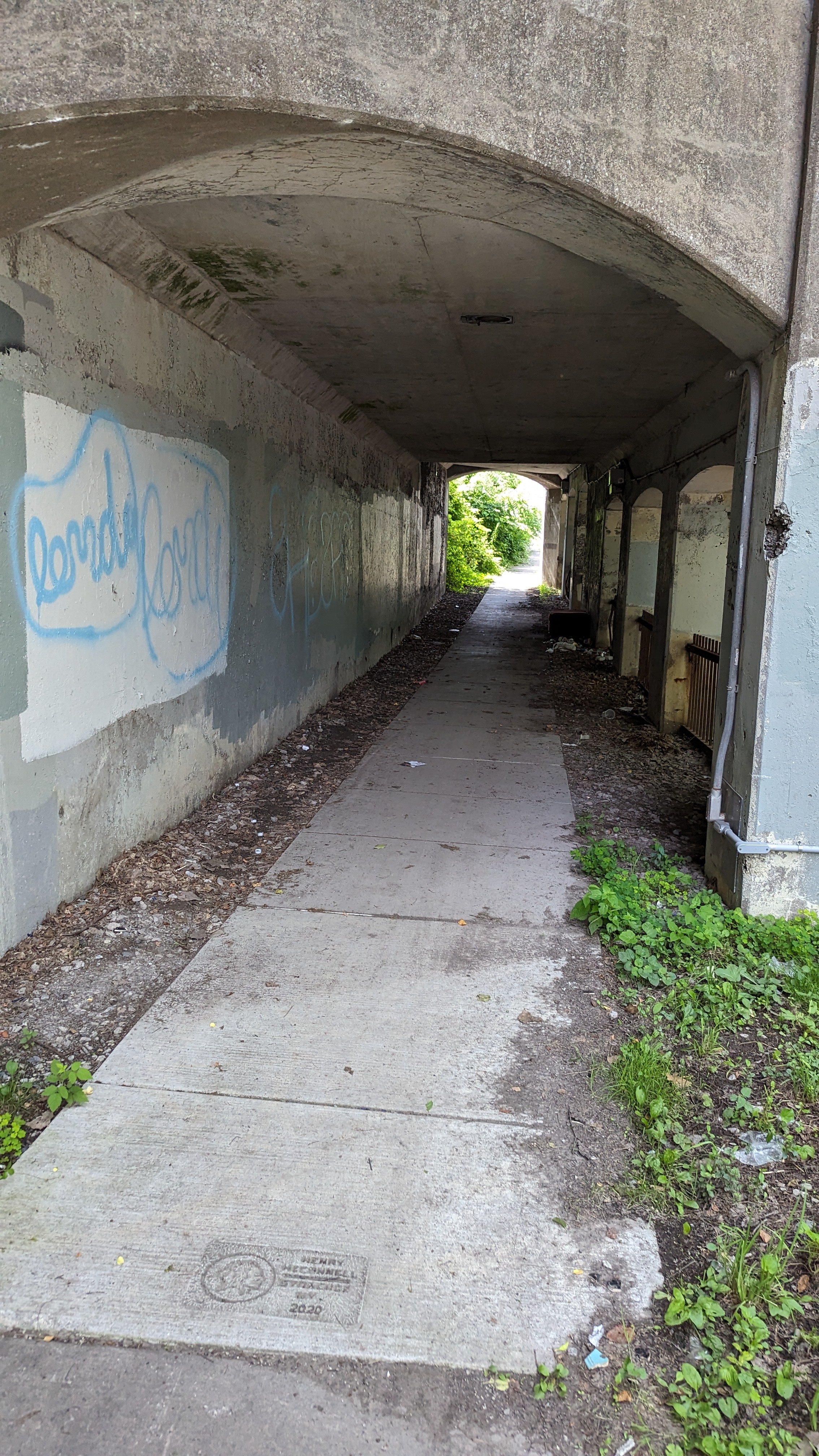
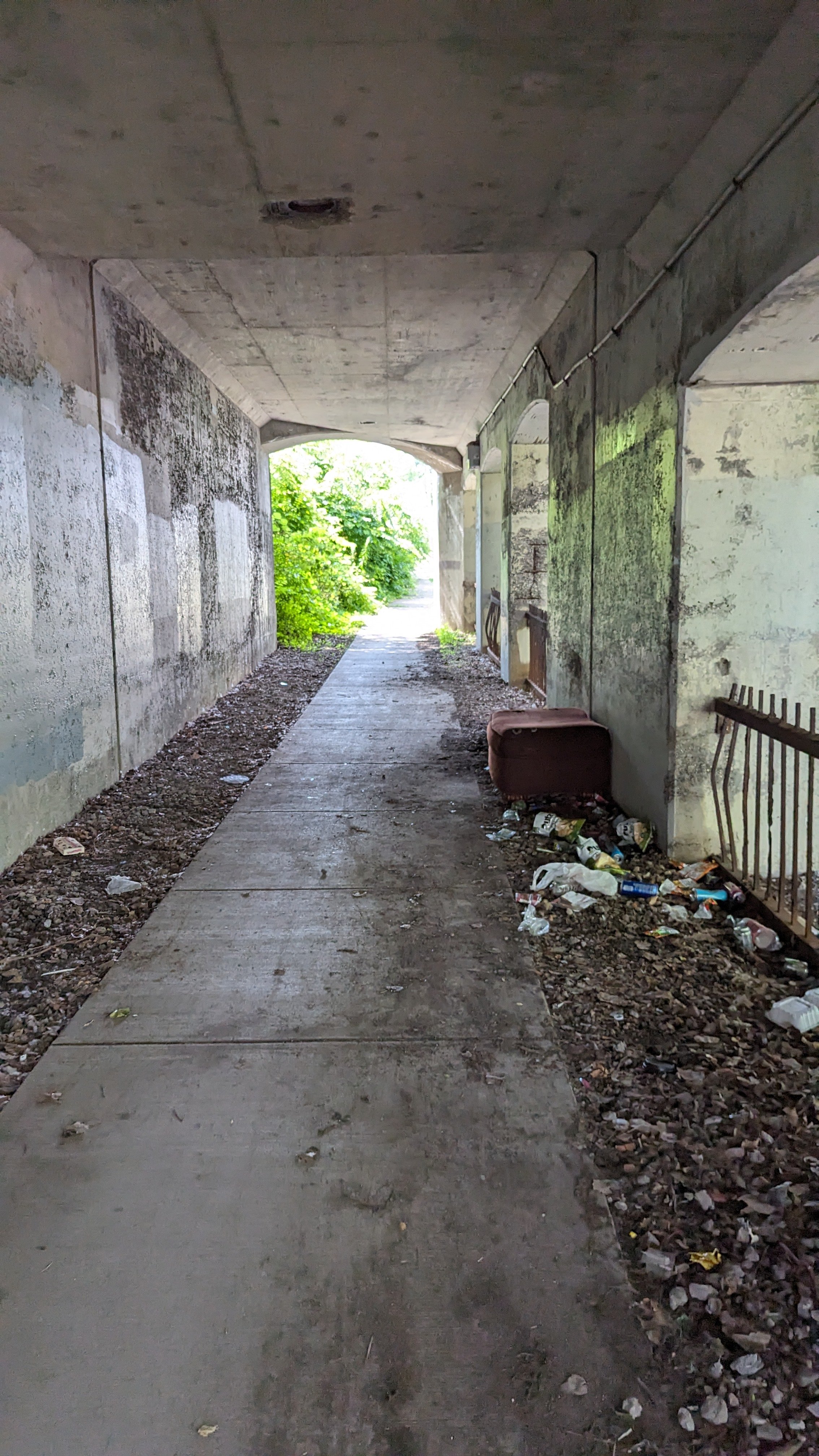
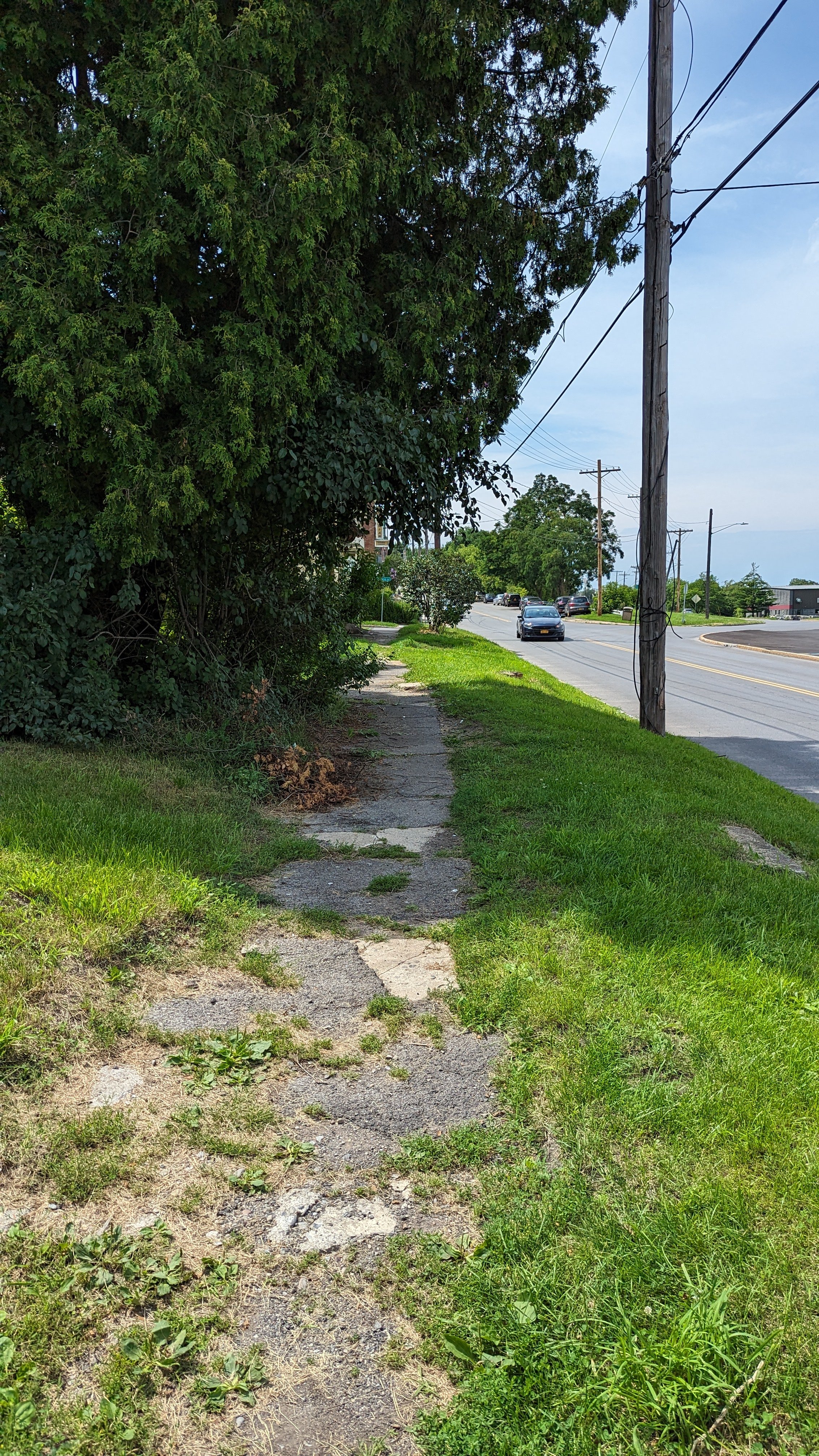
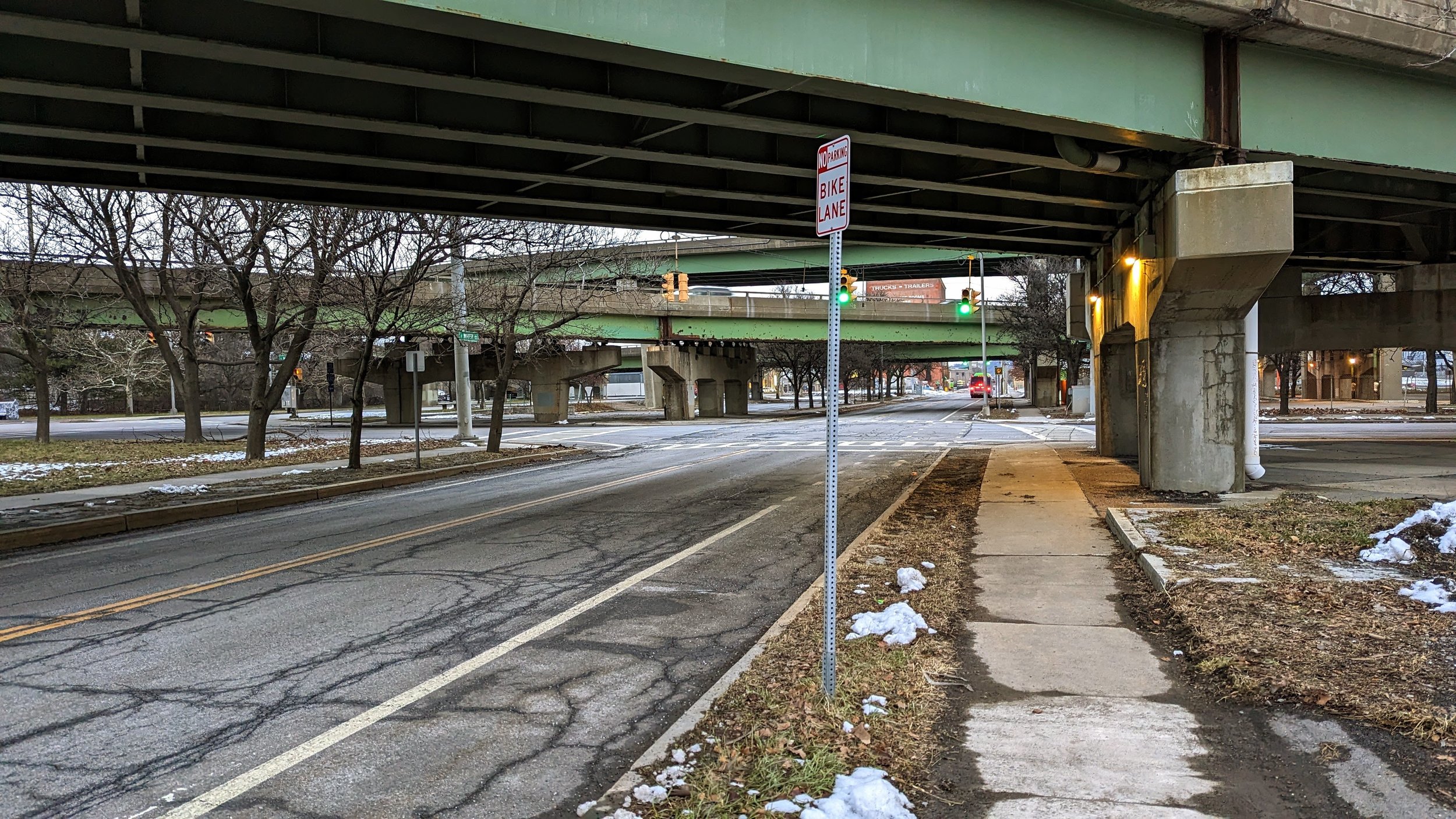
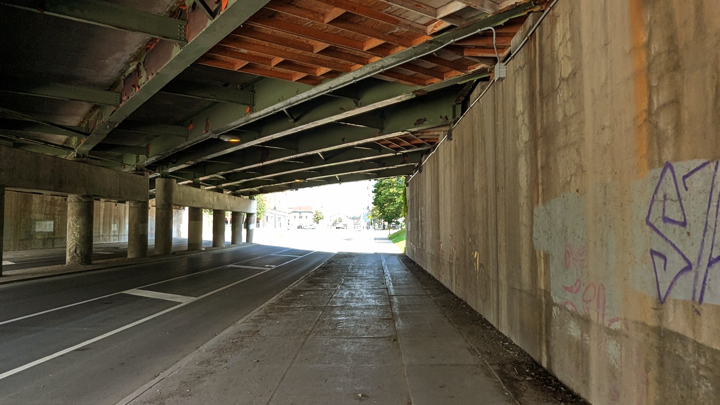
As I noted in a previous post, as you head north towards I-81, the buildings quickly fall away and you’re surrounded by parking lots and the hulking mass of the Post Standard’s former printing press and loading docks. While the parking lot on the eastern side is lined with trees and flowers, it does little to enliven the area.

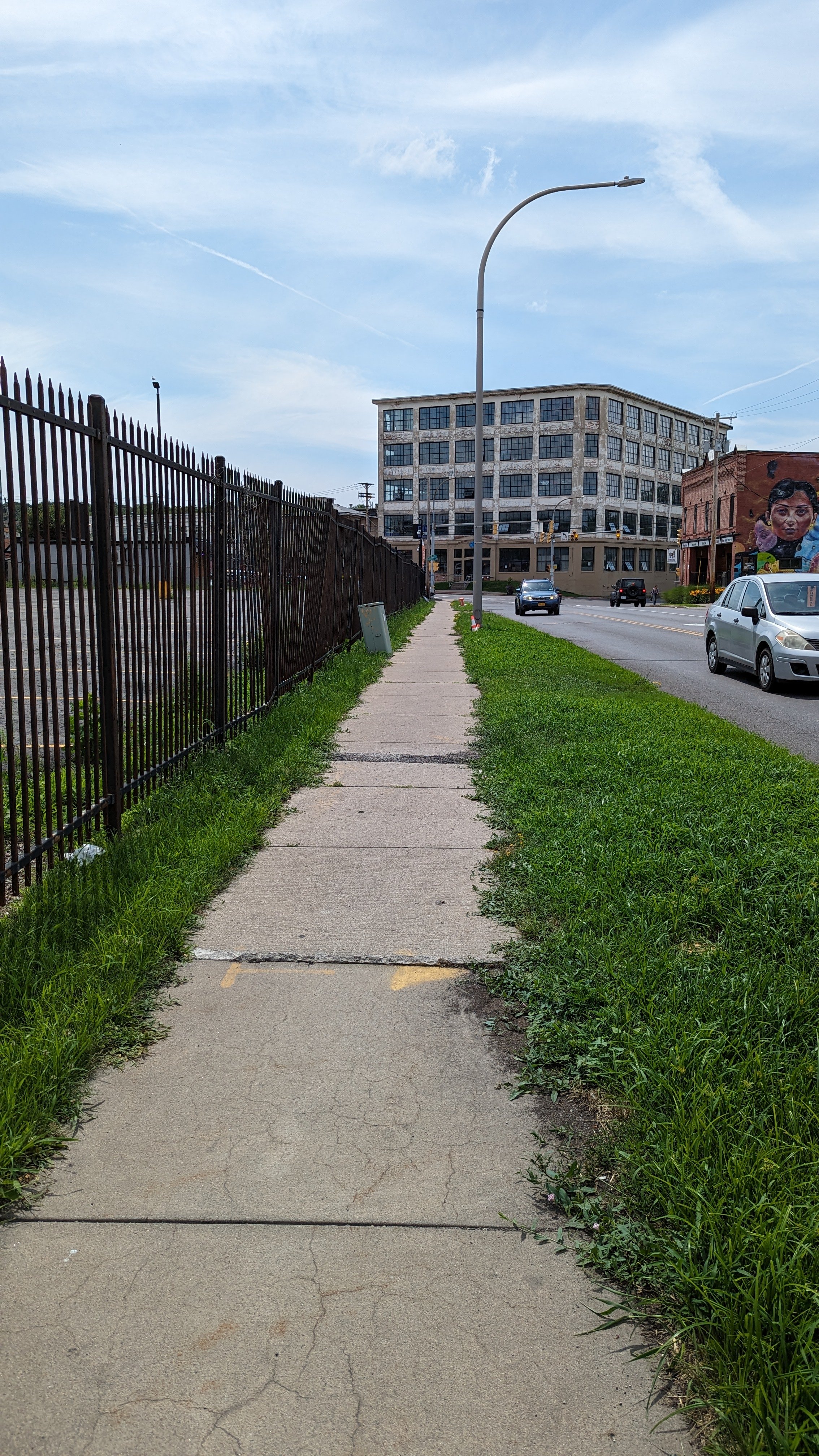
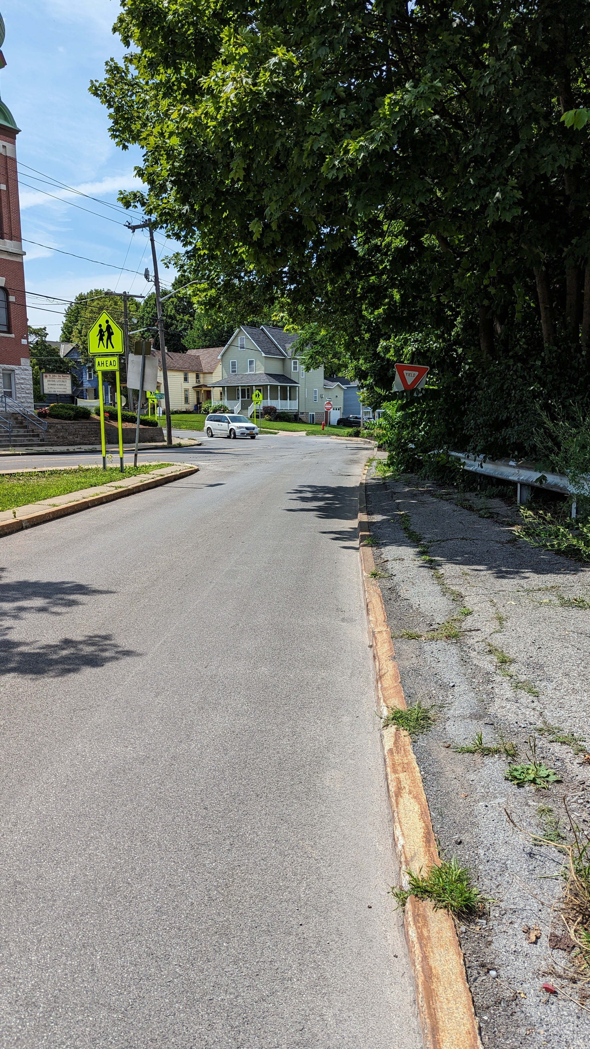
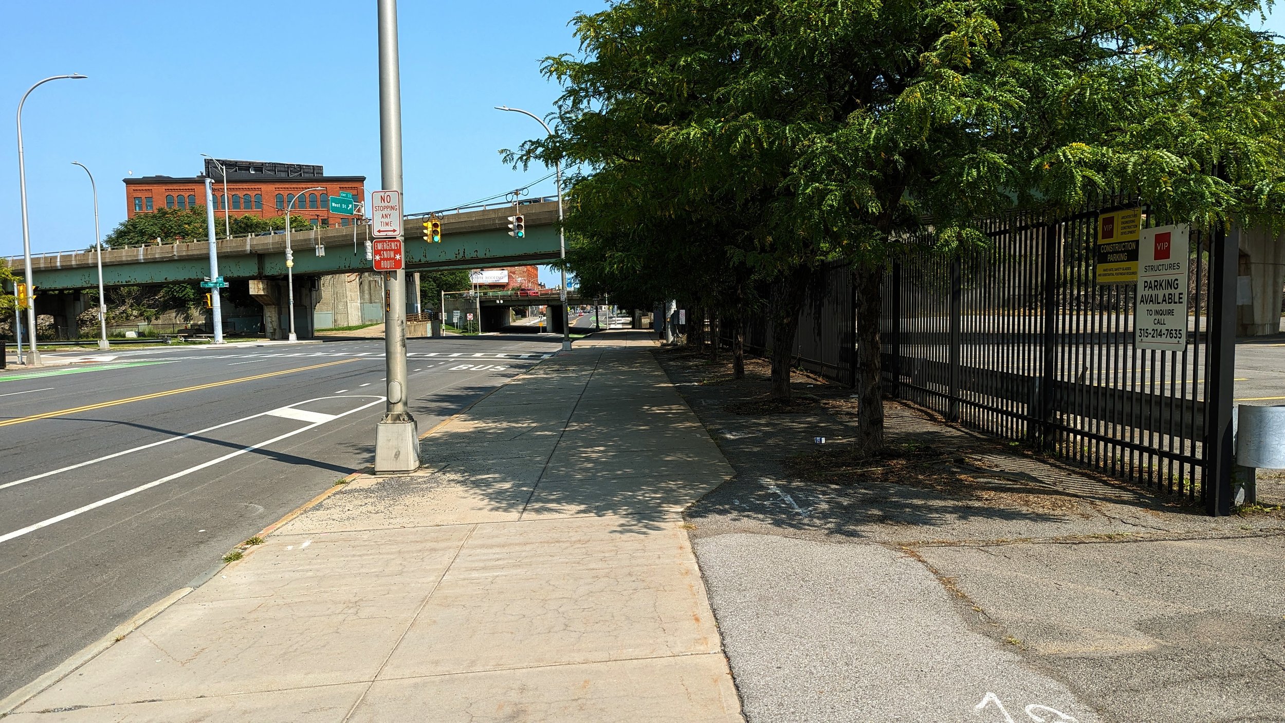
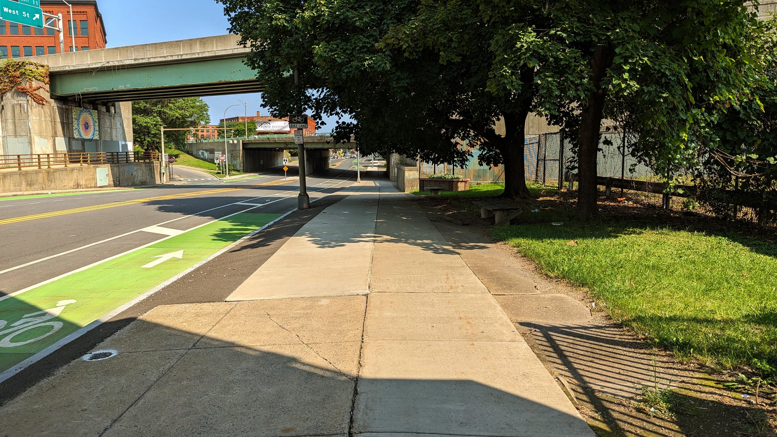
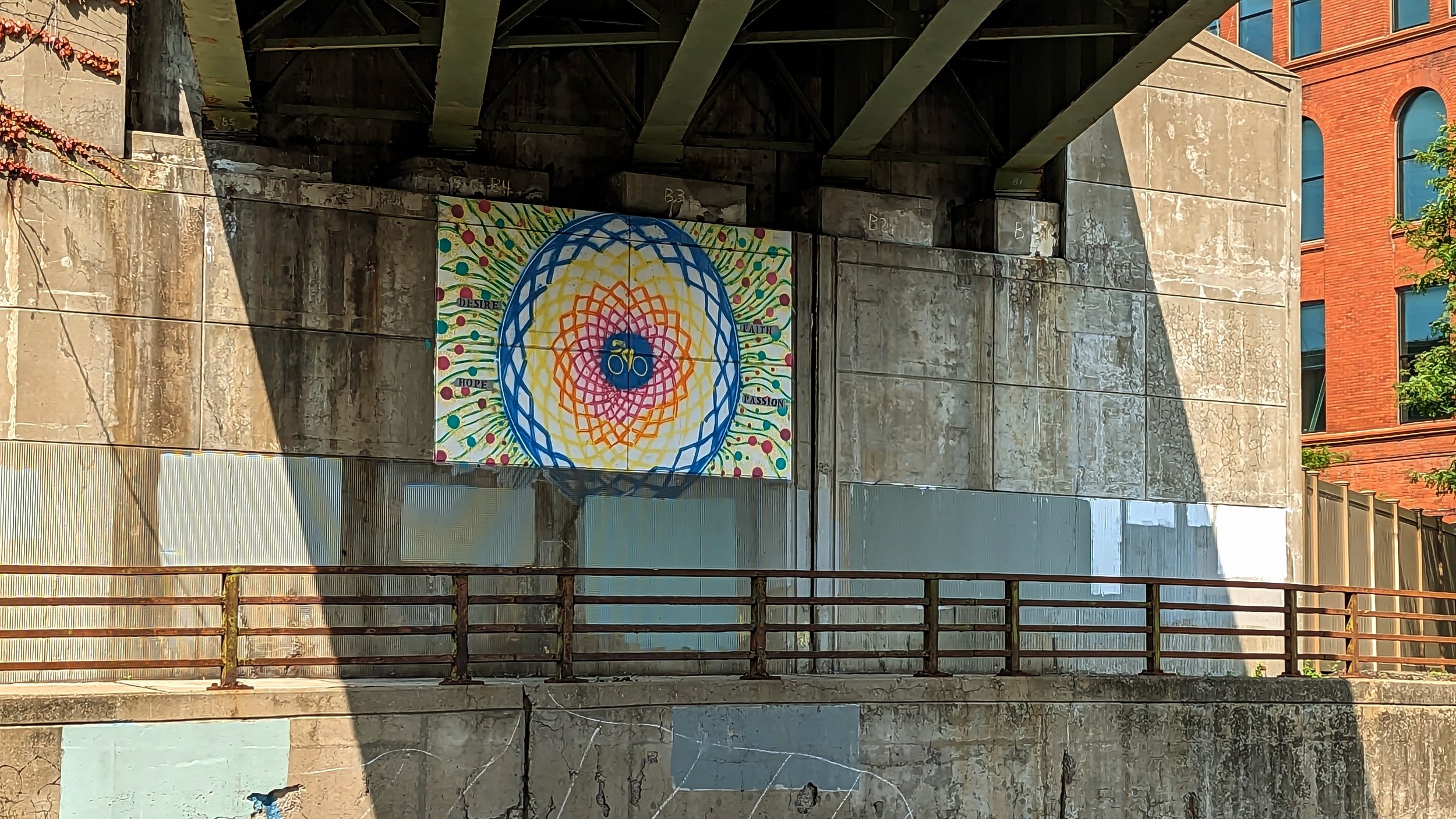
As you approach the I-81 bridge, only a small mural under the roadway brings color to the space. An old industrial building, currently under renovation to become apartments, sits between the I-81 and I-690 bridges. The removal of I-81 will help free this building and improve residential access to the nearby businesses. The highway removal will also improve pedestrian access on the western sidewalk, which currently forces people across an off-ramp with bad sight-lines, creating a dangerous crossing situation.

Little Italy (I-81 to Lodi St)

PXL_20230820_151855179.jpg
PXL_20230820_151901007.jpg
PXL_20230820_151942004.jpg
PXL_20230820_152013216.jpg
PXL_20230820_152016085.jpg
PXL_20230820_152032088.jpg
PXL_20230820_151855179.jpg PXL_20230820_151901007.jpg PXL_20230820_151942004.jpg PXL_20230820_152013216.jpg PXL_20230820_152016085.jpg PXL_20230820_152032088.jpg

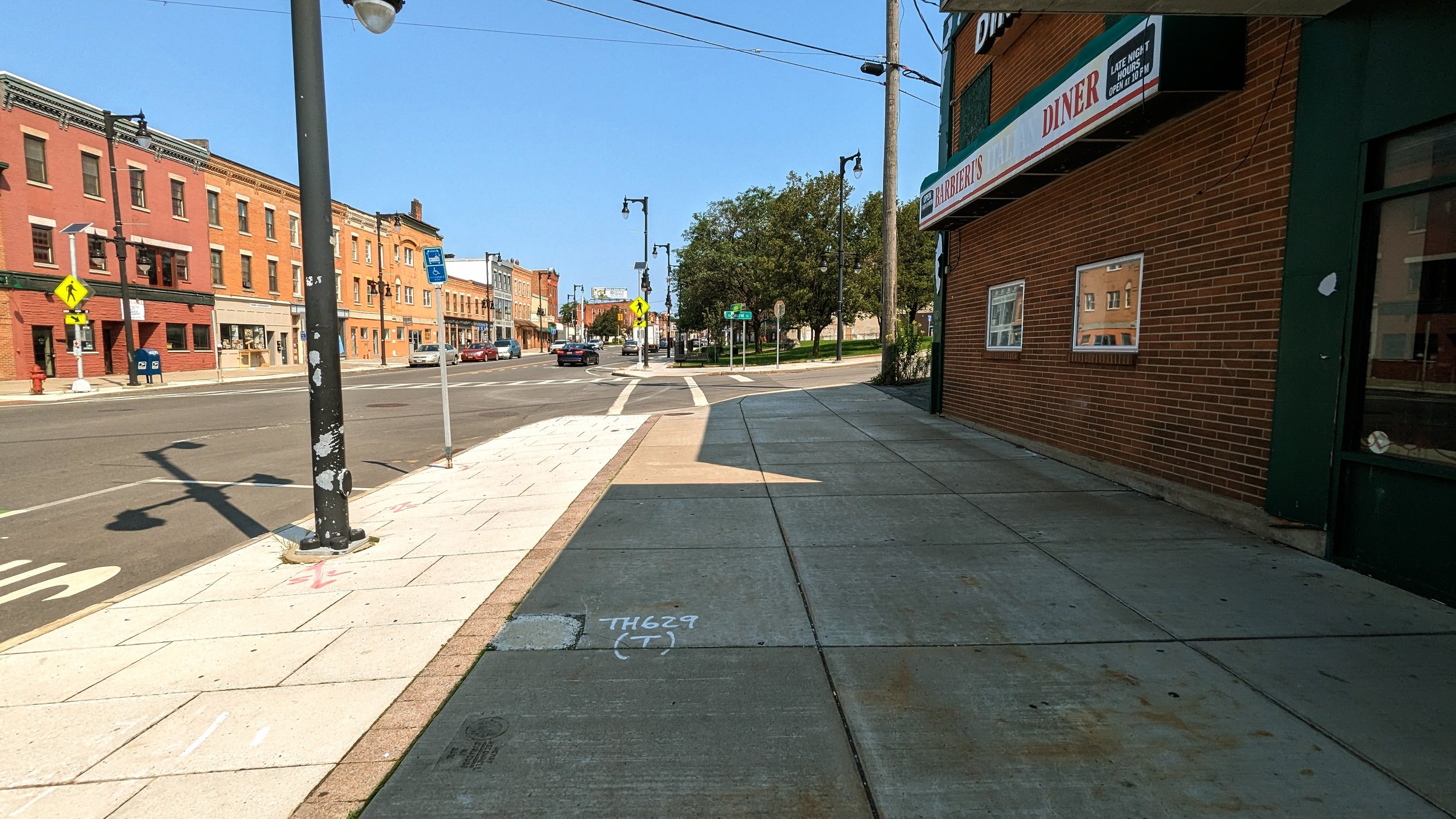
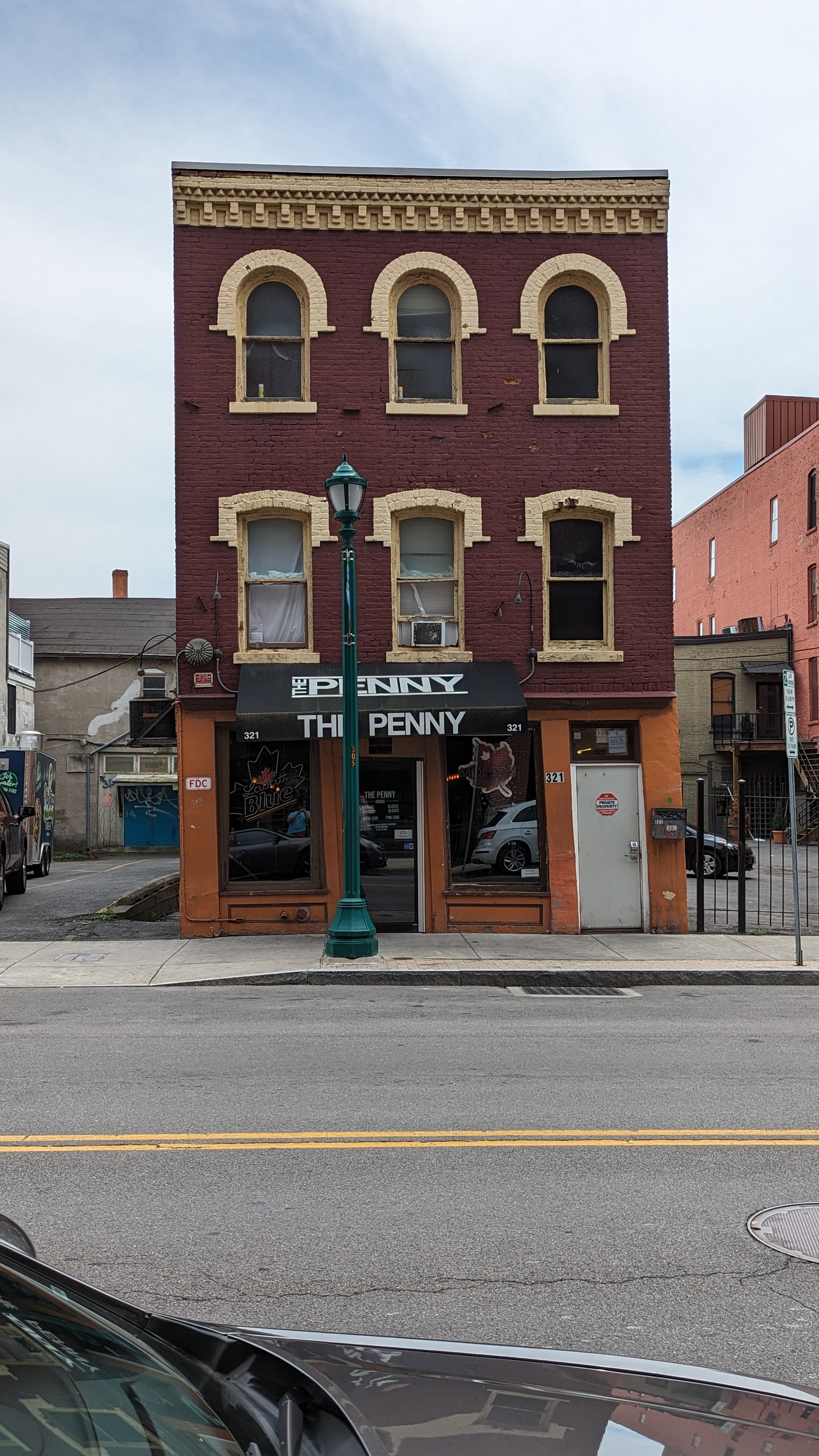
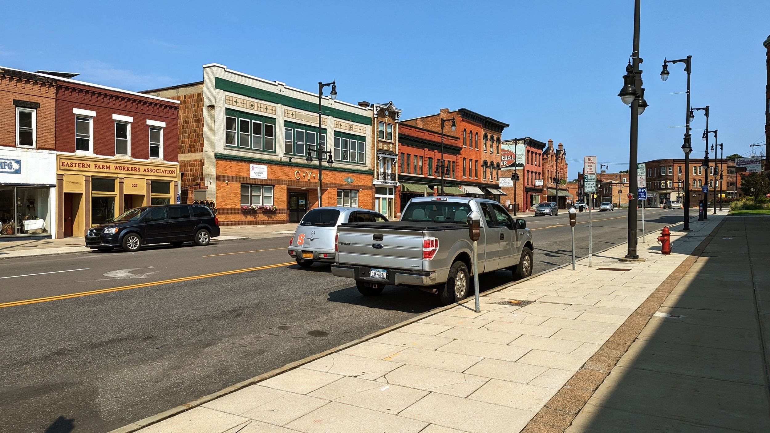
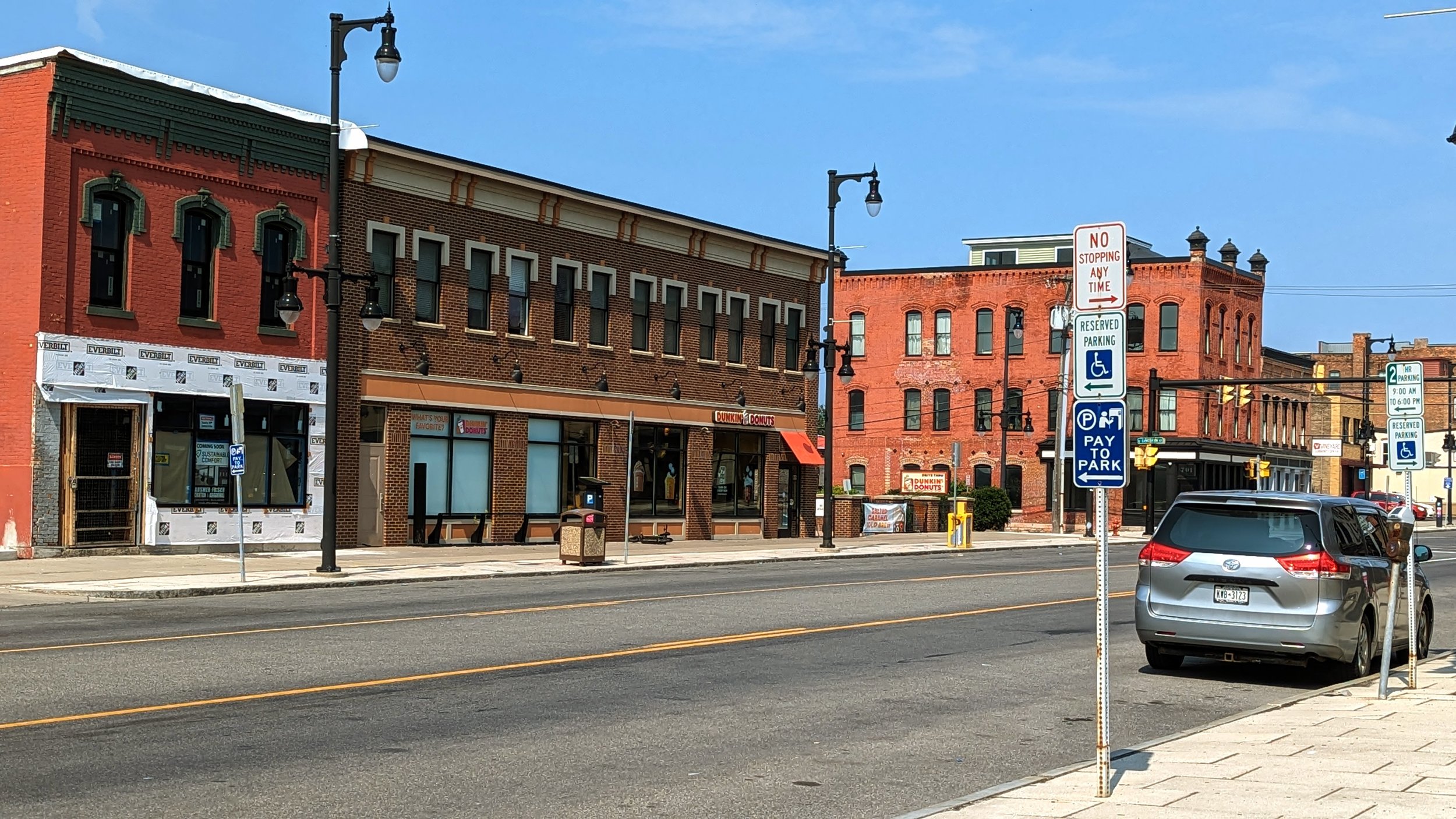
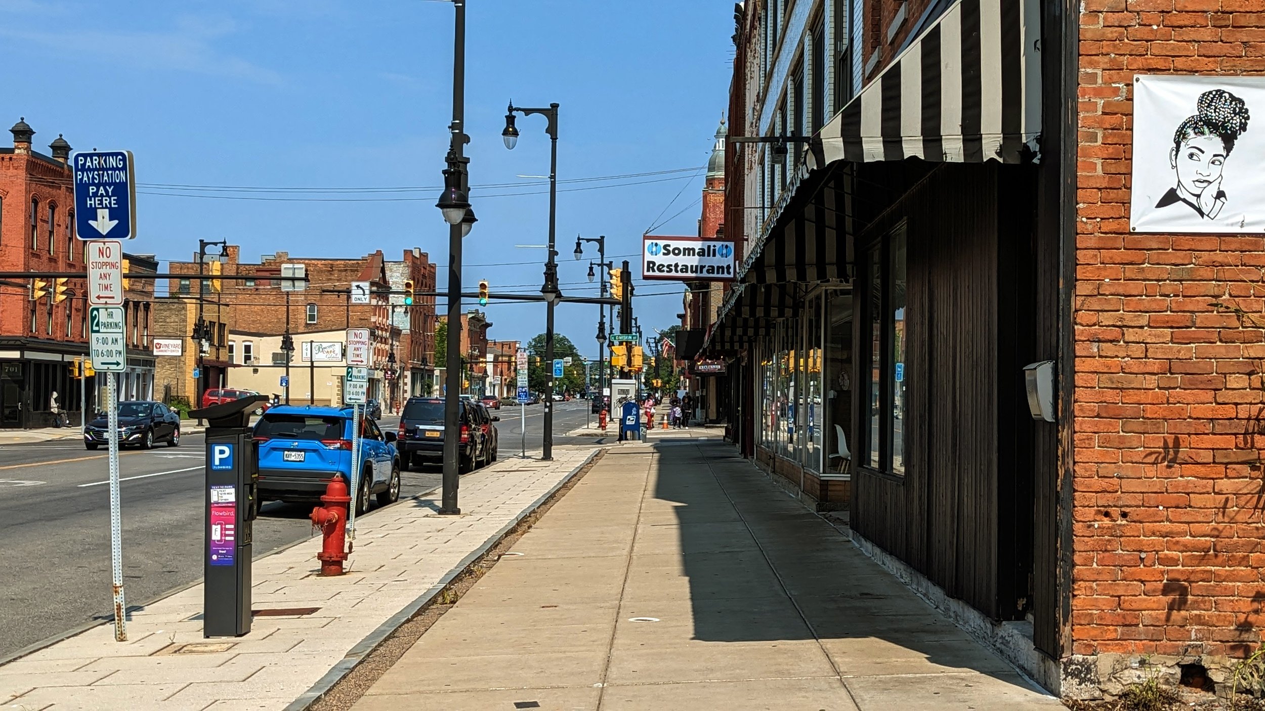
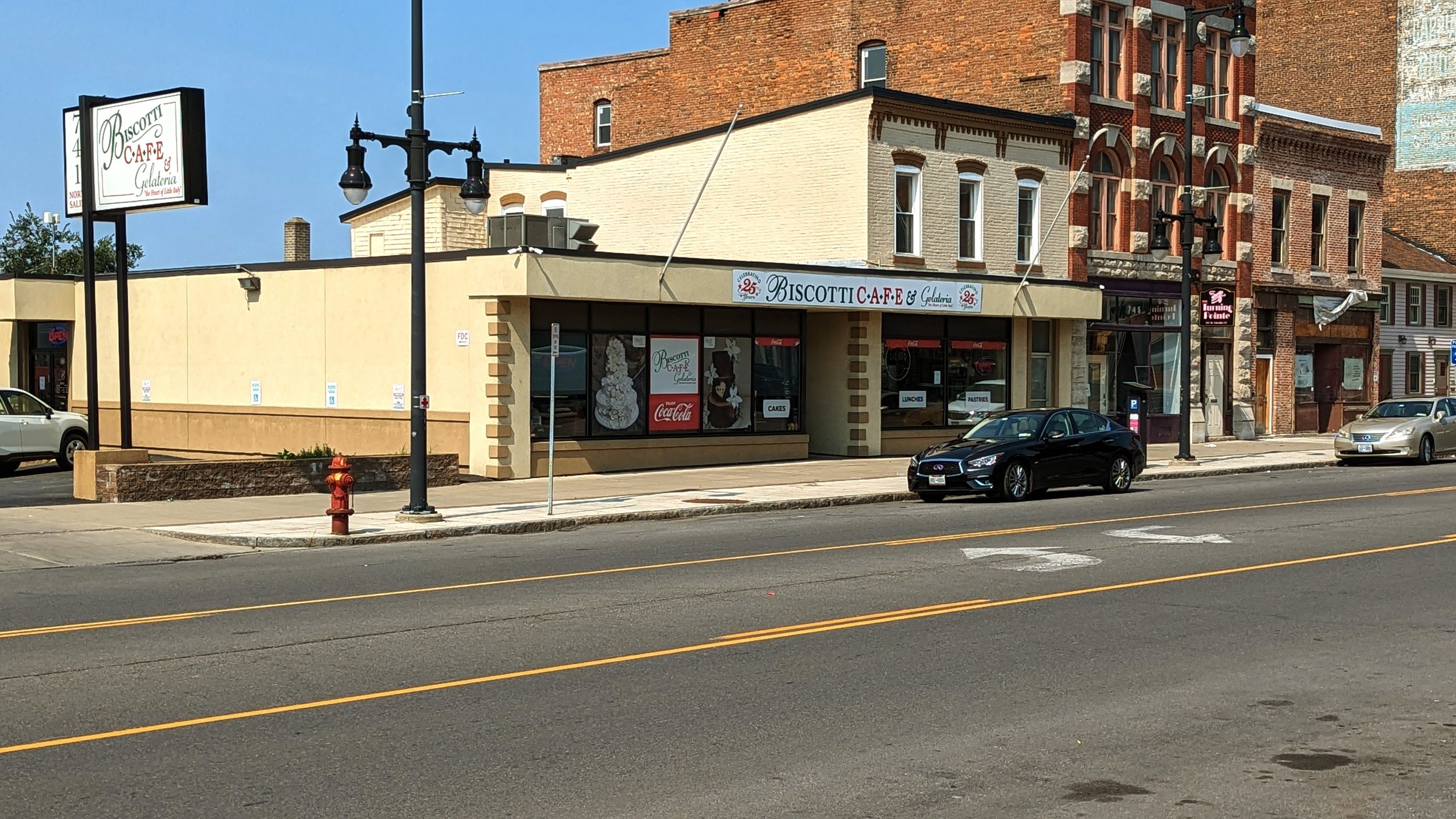
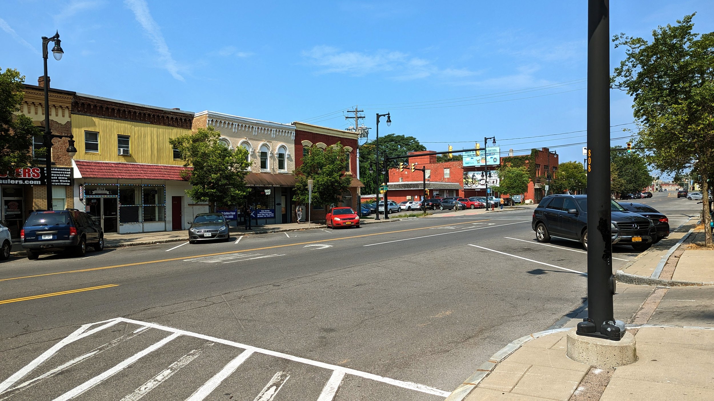
Once you’re out from beneath the highway, you’ve entered what has traditionally been known as Little Italy. While this moniker is still used today, the neighborhood has continued to diversify far beyond its Italian roots. The Northside is billed as “Home to generations from many nations,” and the current experience along N Salina St exemplifies that sentiment. Shops that cater to dozens of different cultures and backgrounds can be found throughout the neighborhood, including many with African and Middle Eastern roots. Some Italian, or Italian style, businesses still exist, including Francesca’s and Biscotti’s, but they are no longer surrounded by similar establishments as they once used to be.

If any neighborhood was ripe for growth, it is Little Italy. The older building stock, with many structures built in the late 19th and early 20th centuries, lends itself to apartment conversions and walkable stores and restaurants. Even some of the newer buildings, like the Dunkin’, mimic this classic style. But any redevelopment should take care to preserve the local businesses that currently call this street home. The incredible diversity of cultures found on the City’s Northside should find themselves welcome on this street, and visitors should come to appreciate what it has to offer. 

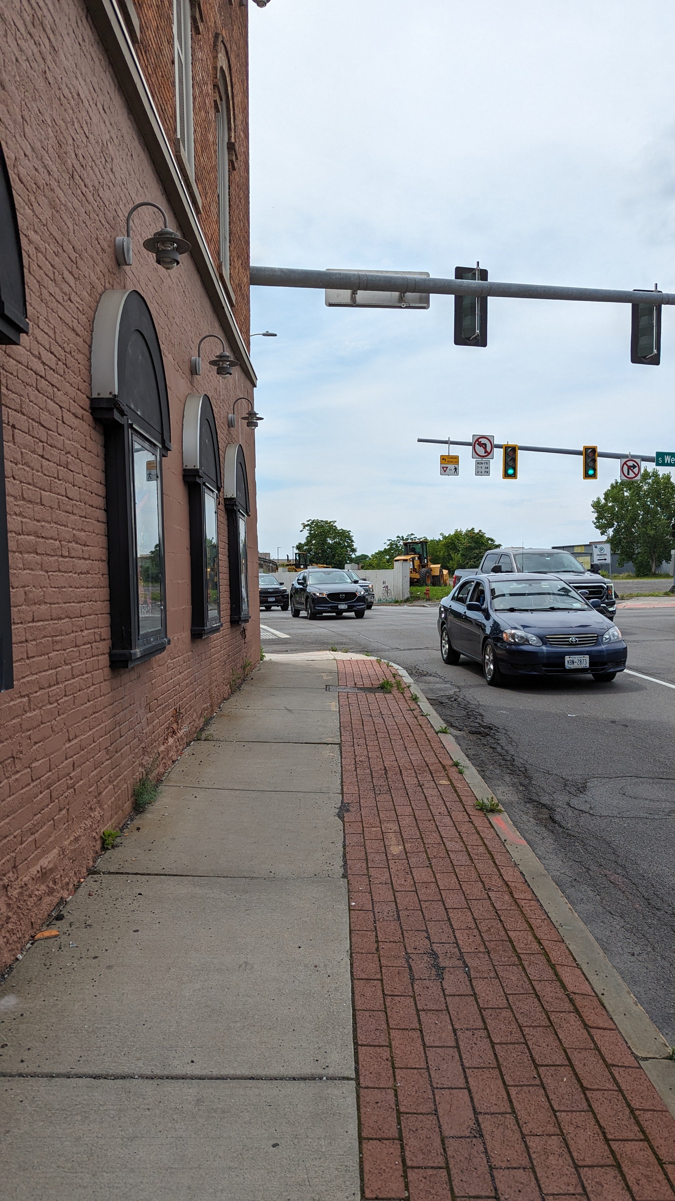
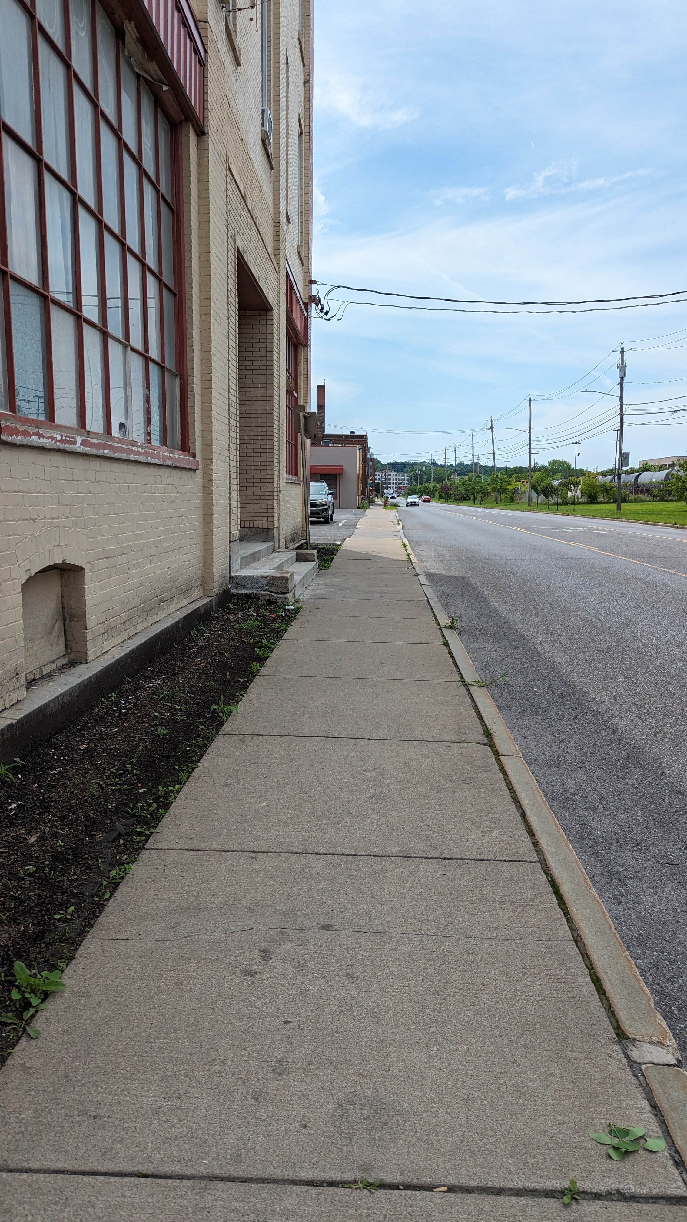
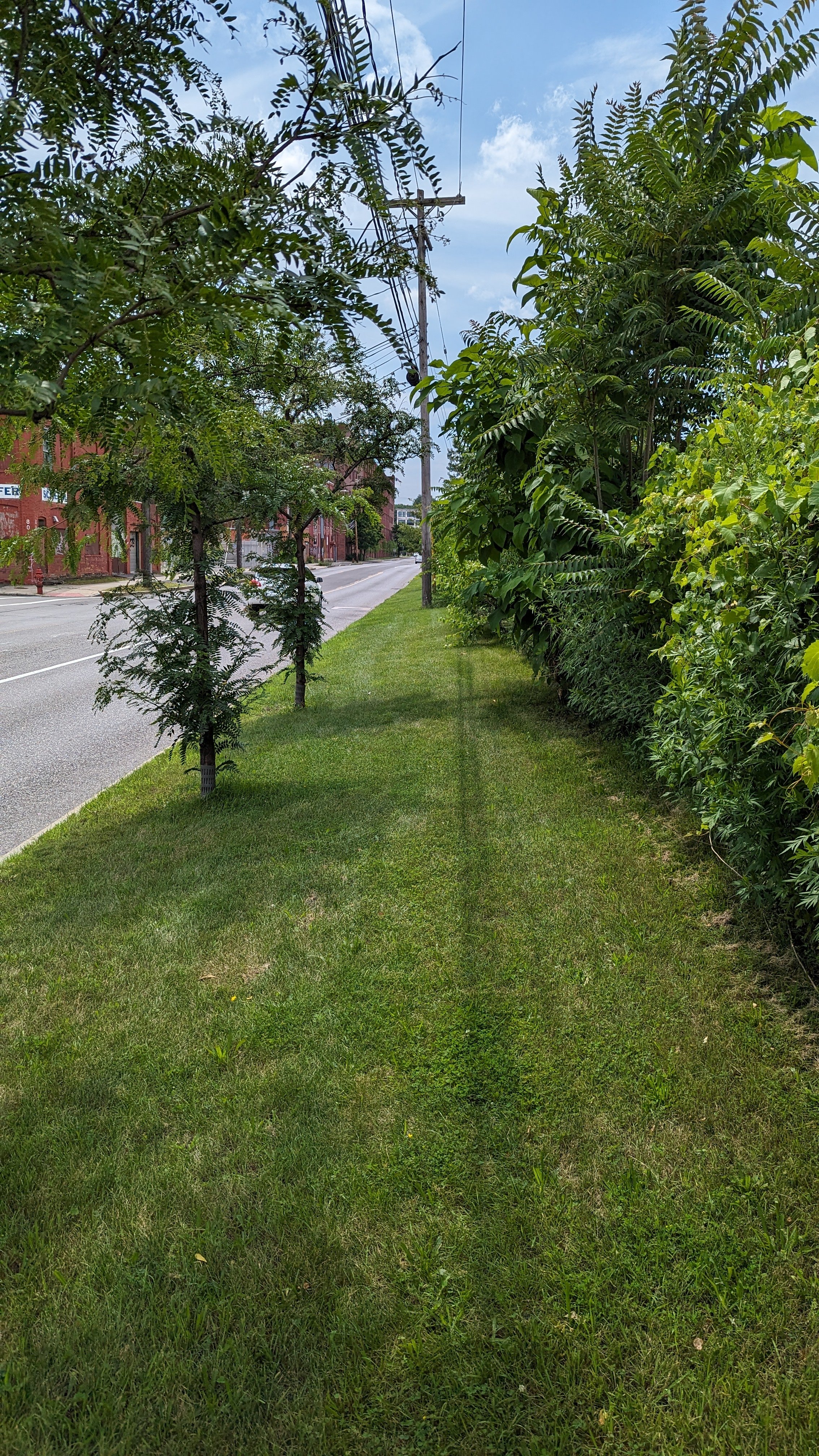
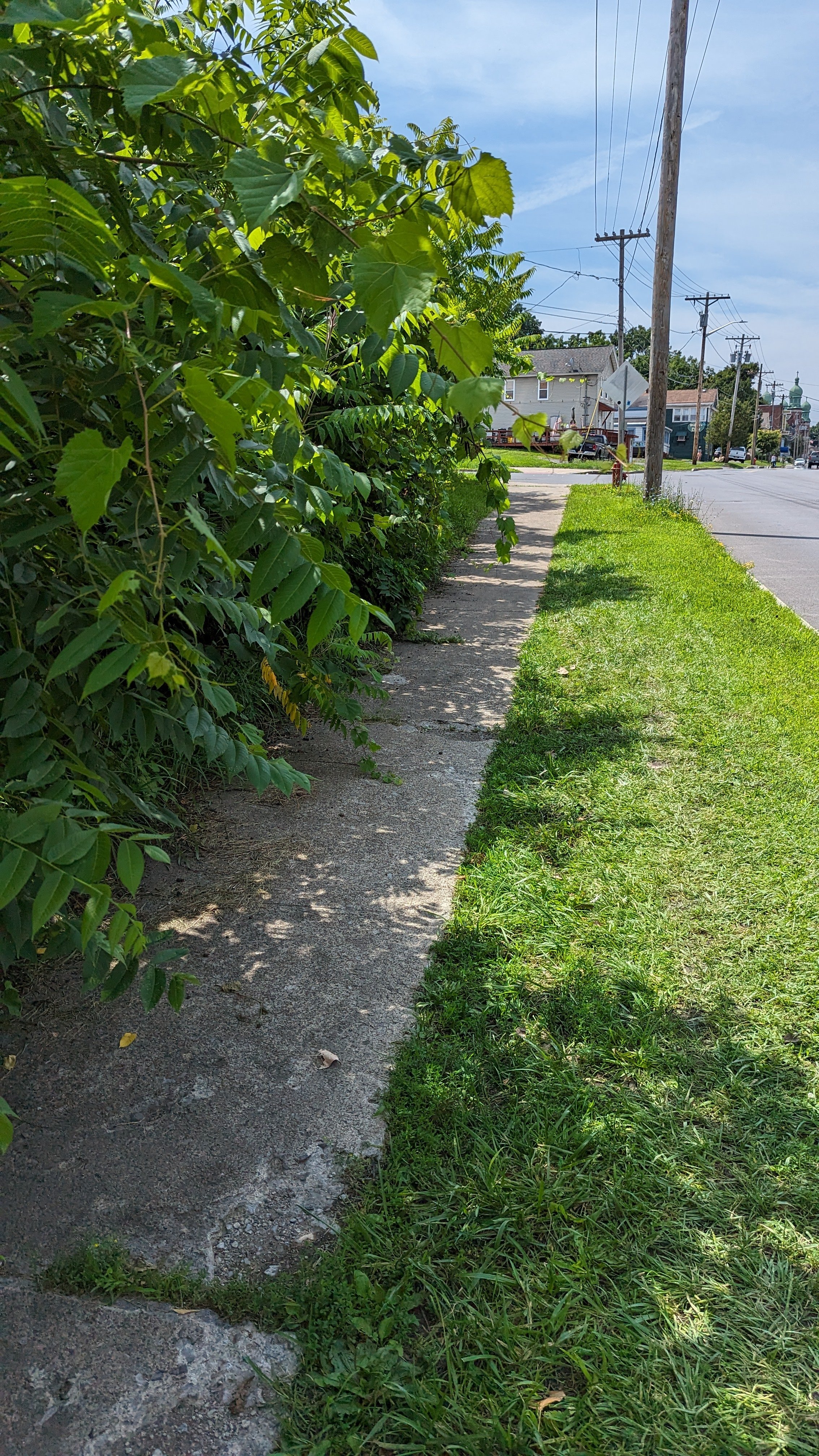
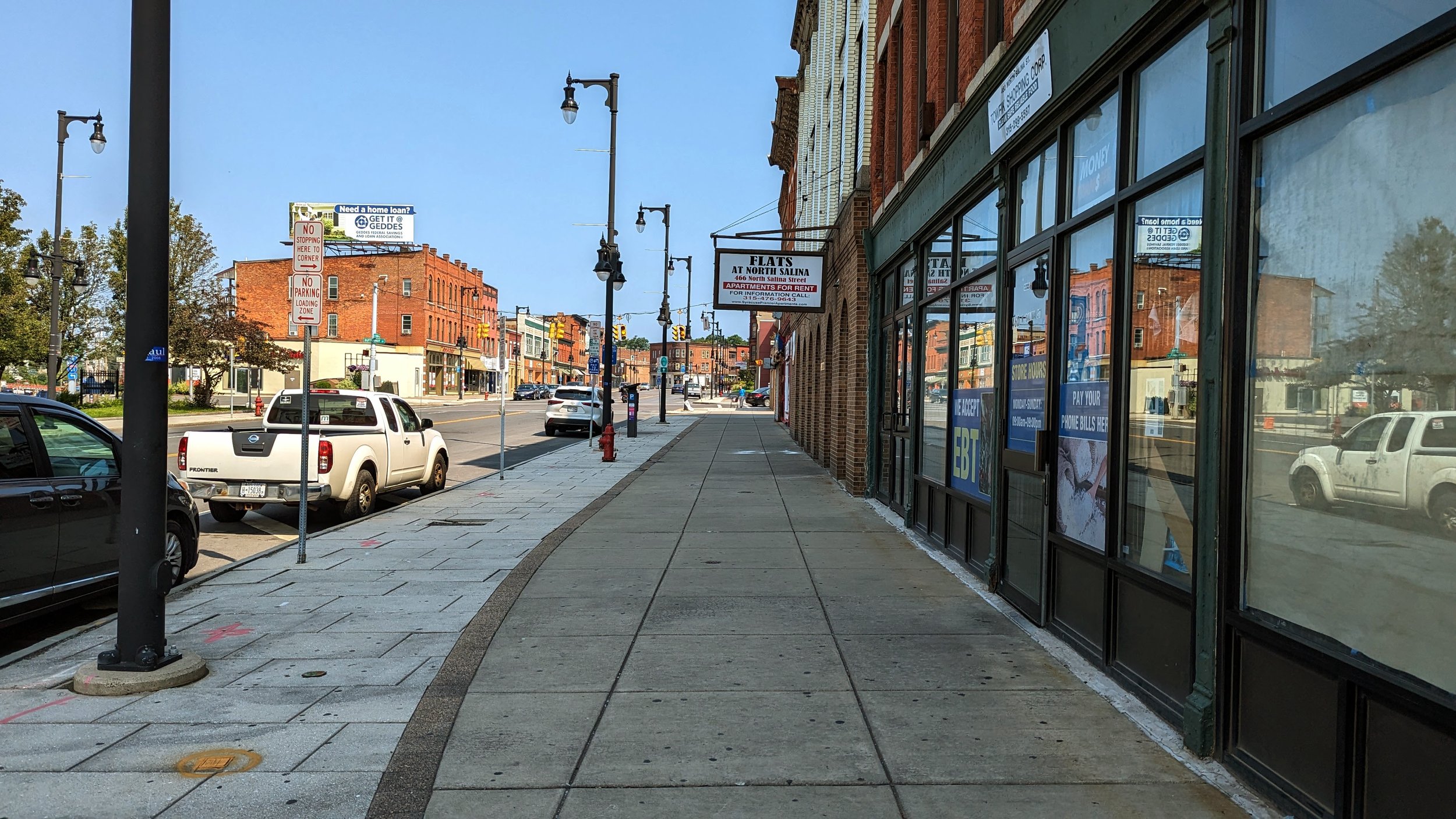
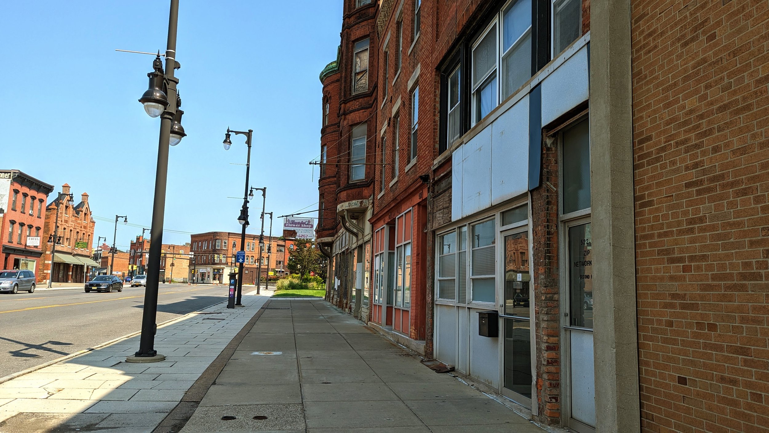
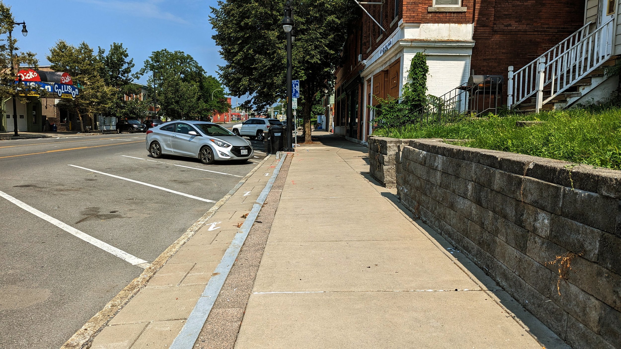
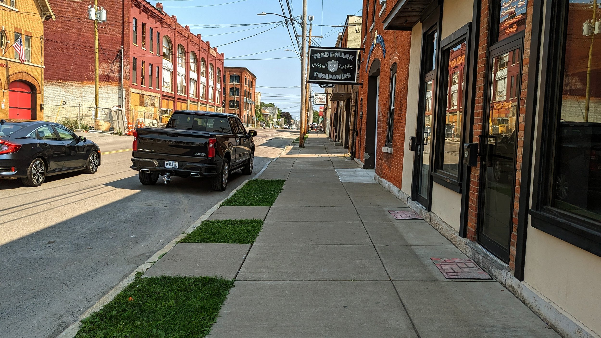
Throughout Little Italy the wide sidewalks found Downtown continue. Often these sidewalks are 25 ft wide, providing ample space for outdoor dining or sidewalk sales. The buildings that line the street are pedestrian oriented with commercial spaces on the ground floor and apartments above. While many are currently in use, several prominent buildings sit vacant or underutilized, including a vacant grocery store, which could serve both the Northside and Downtown residents. One thing this street is missing is a tree canopy. Beyond small pocket parks, the street is nearly devoid of street trees, which makes walking along the corridor on a hot day far less enjoyable than it could be.

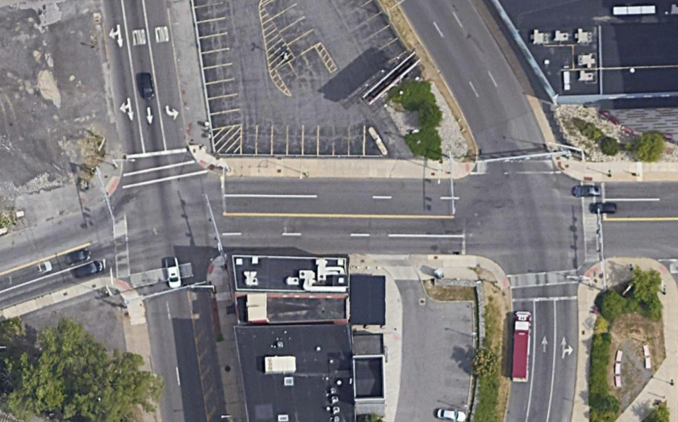
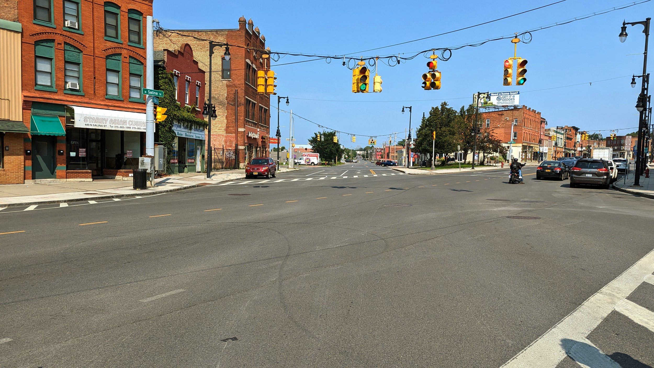
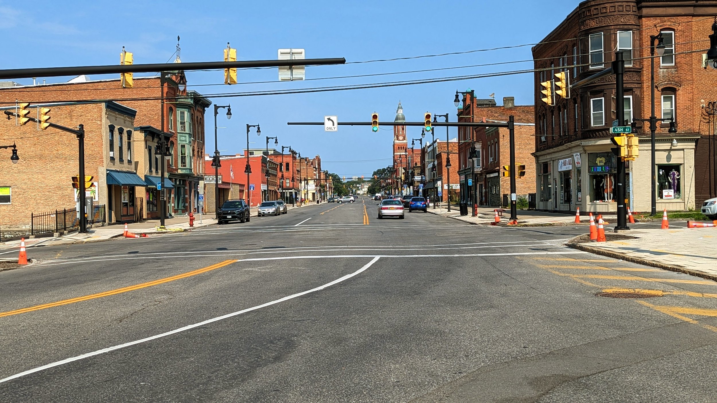
While the built environment lends itself to walking and experiencing it on foot, the Butternut St / State St / N Salina St intersection acts as a sharp divide.

Screenshot 2023-09-07 at 7.25.25 PM.png
Butternut new.png
Screenshot 2023-09-07 at 7.25.25 PM.png Butternut new.png

Forming the shape of a triangle, the intersection does little to help anyone get through easily. As a driver, lights often don’t line up, catching you in the middle of the multi-step intersection. As someone on foot, its tough to determine who is turning where, when. Add to that the thoroughly overbuilt State St, with four wide lanes that welcome speeding cars. 

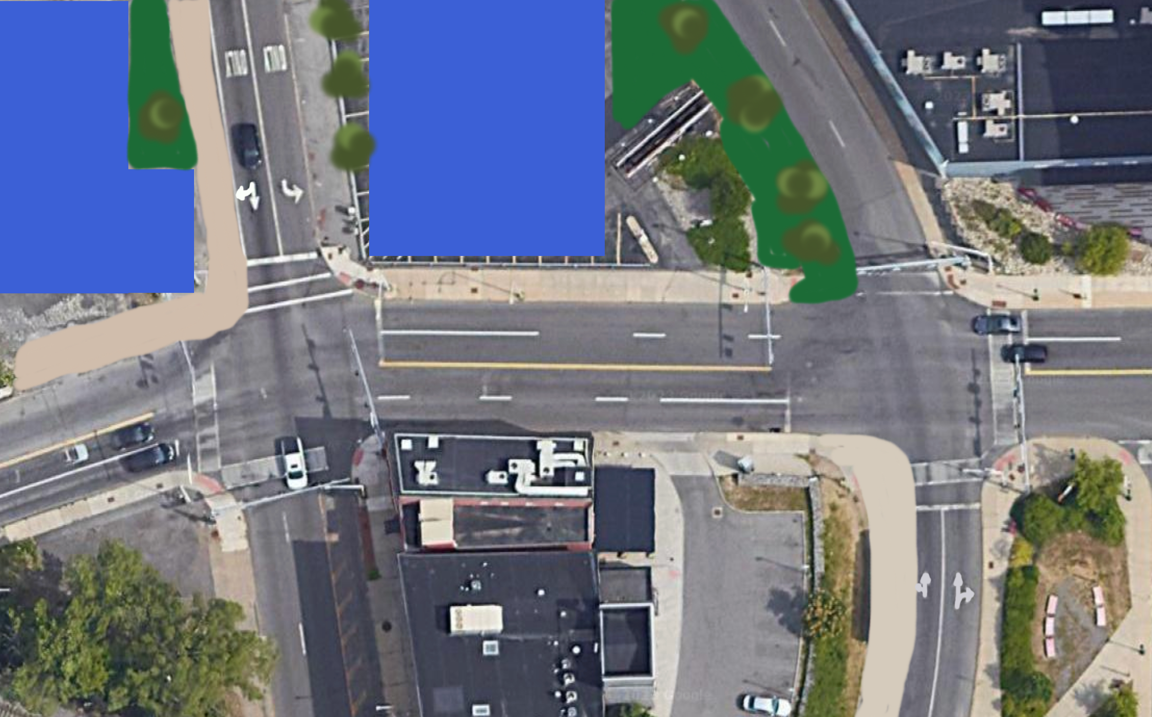
Minimal changes will occur to this intersection as a result of the I-81 project, namely a slight realignment of the Butternut St bridge and a removal of the on-ramp to the highway. But we should go further. In fact, we should remove and reshape large portions of this intersection to make it friendlier to people on foot.

Closing State St from Butternut to N Salina would allow for the expansion of the existing grassy median into a full fledged park. It would also slow drivers through forcing turns. On the remaining legs of State St, we should look to narrow the roadways and right-size our streets for the fairly low-level of traffic they actually receive. If done correctly, this intersection could become a place to be instead of a place to pass through,

PXL_20230820_152140741.jpg
PXL_20230820_152146792.jpg
PXL_20230820_152202325.jpg
PXL_20230820_152259964.jpg
PXL_20230820_152418701.jpg
PXL_20230820_152427643.jpg
PXL_20230820_152605962.jpg
PXL_20230820_152756489.jpg
PXL_20230820_152828614.jpg
PXL_20230820_152934806.jpg
PXL_20230820_152946933.jpg
PXL_20230820_152140741.jpg PXL_20230820_152146792.jpg PXL_20230820_152202325.jpg PXL_20230820_152259964.jpg PXL_20230820_152418701.jpg PXL_20230820_152427643.jpg PXL_20230820_152605962.jpg PXL_20230820_152756489.jpg PXL_20230820_152828614.jpg PXL_20230820_152934806.jpg PXL_20230820_152946933.jpg

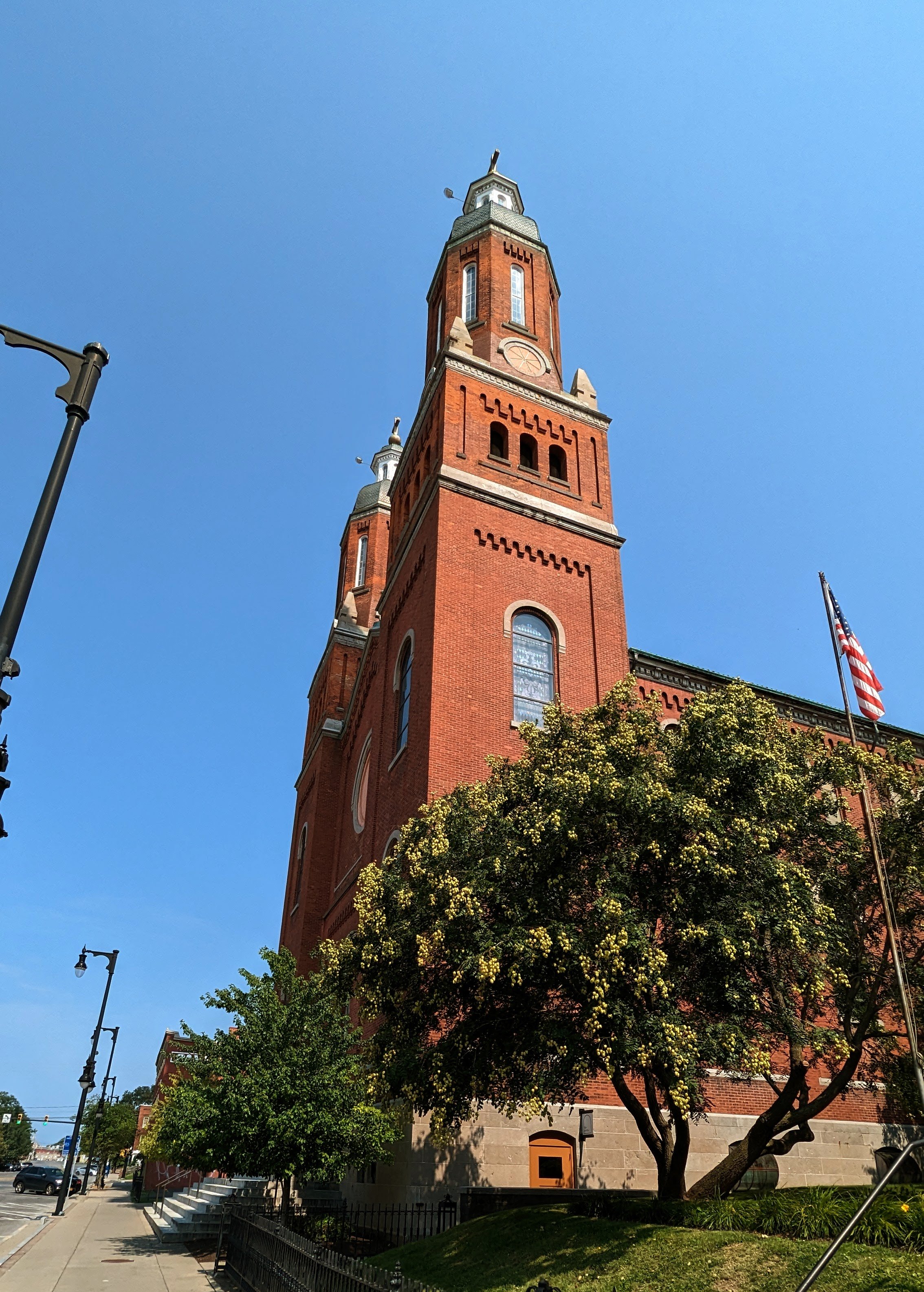
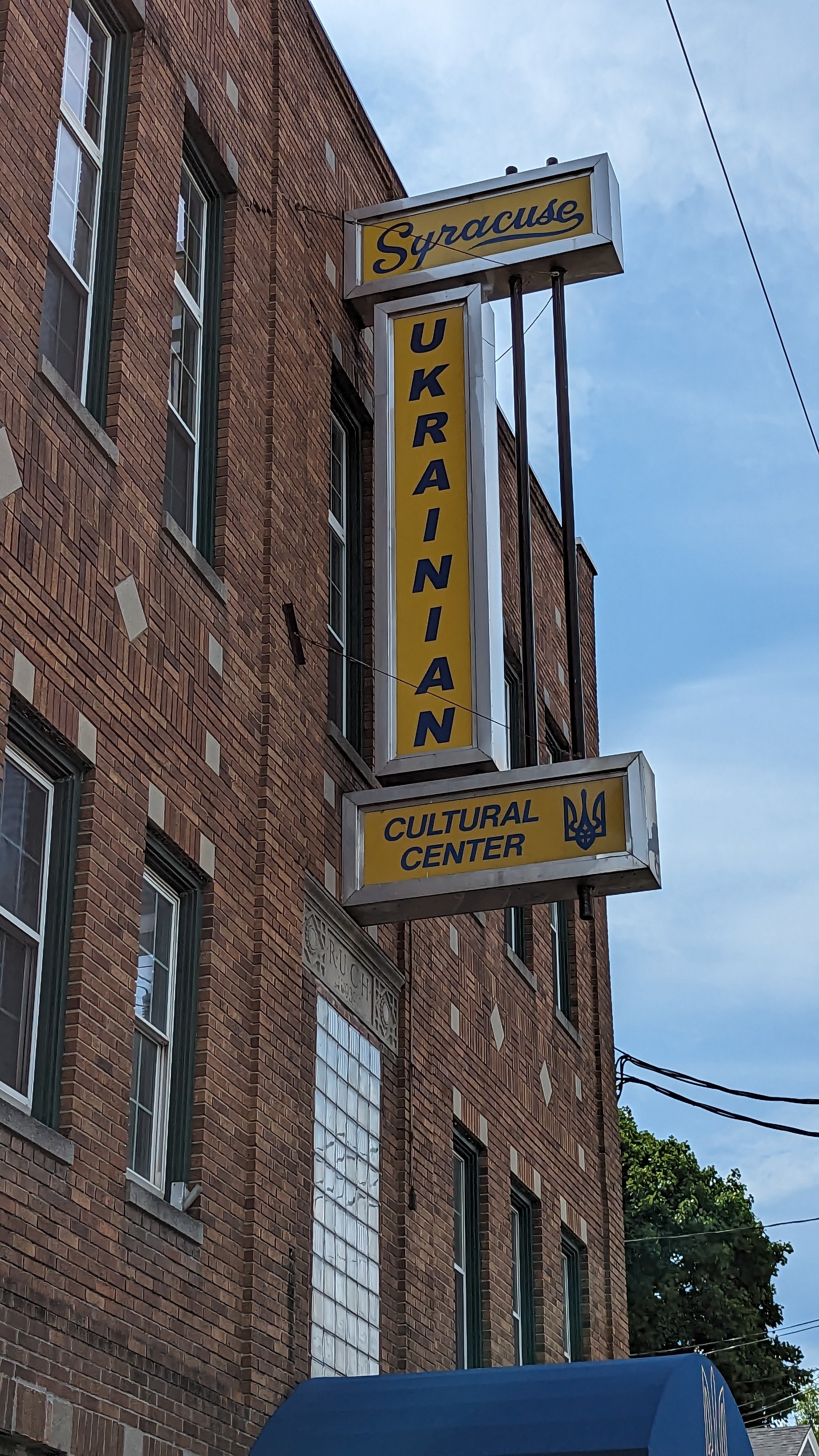
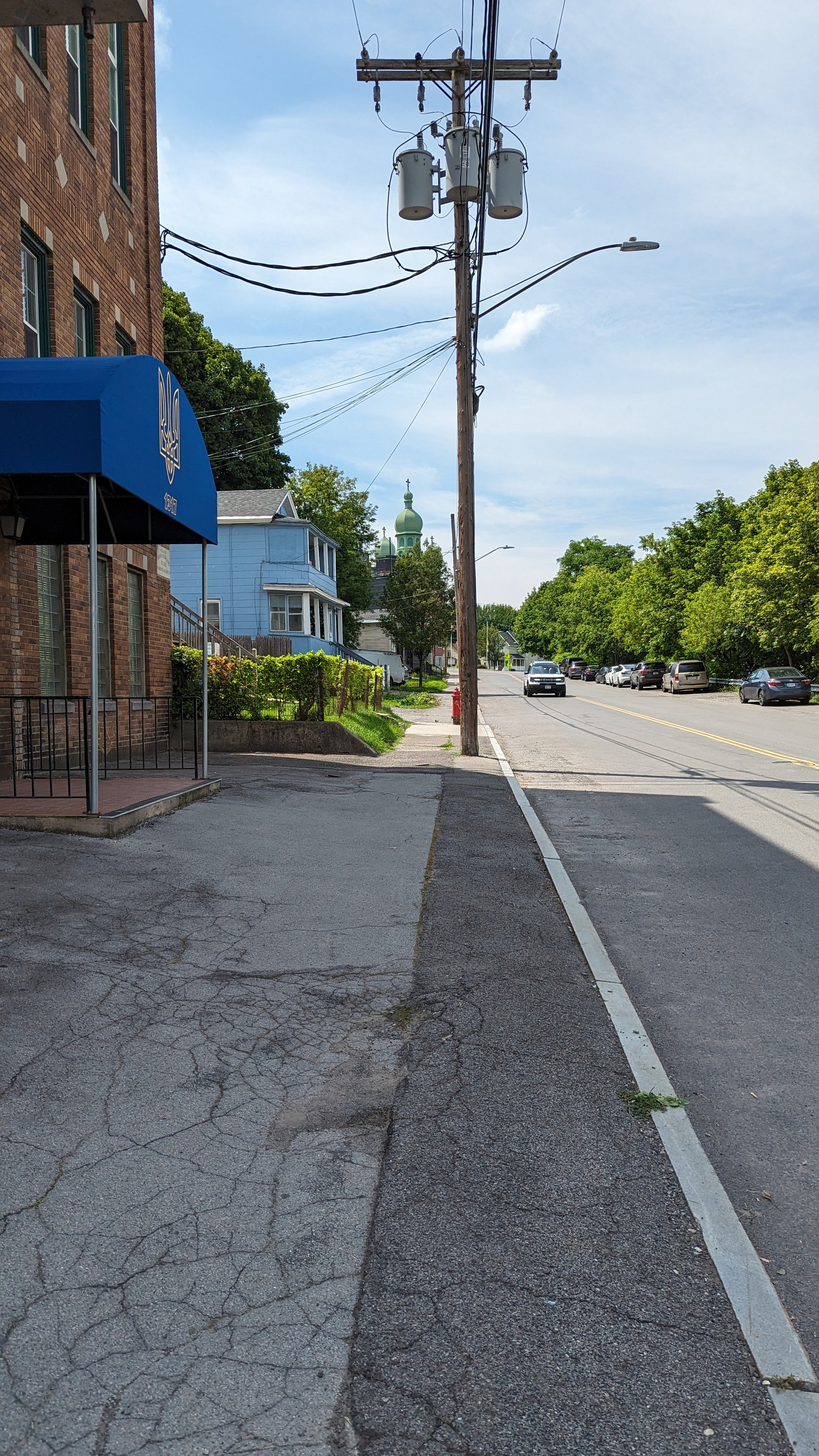
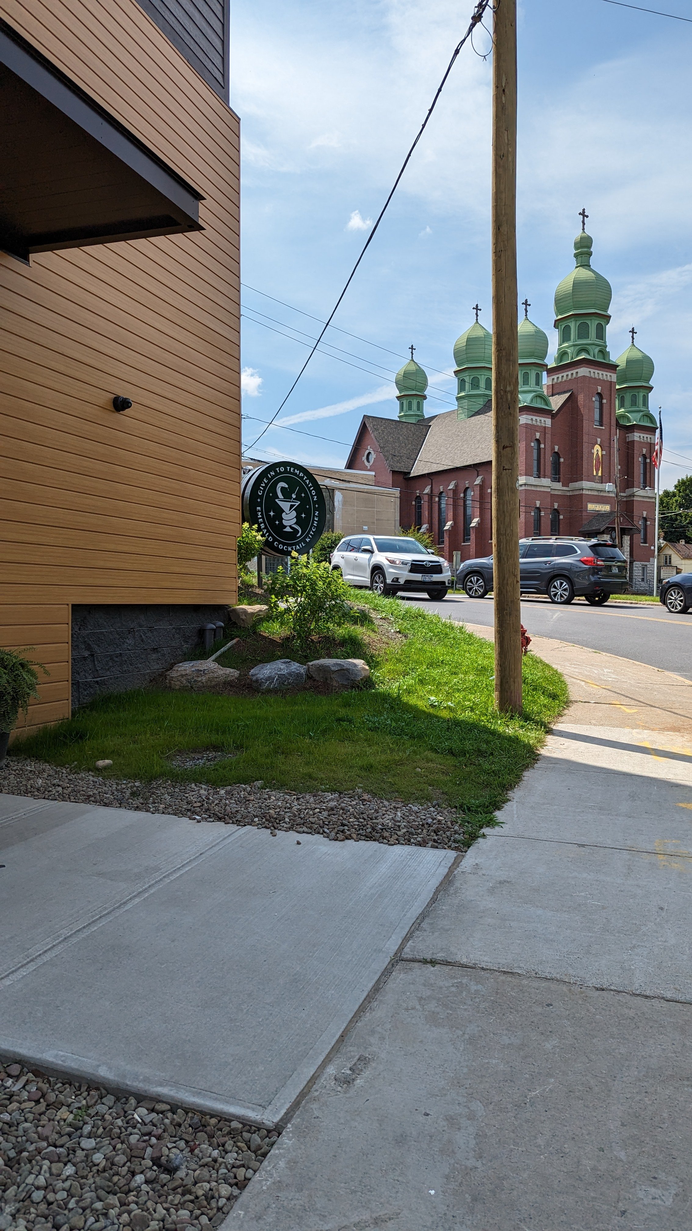
Past the Butternut intersection, the wide sidewalks continue alongside historic architecture until you reach the most prominent landmark of the neighborhood, Assumption Church.

The two bell towers define the Northside’s skyline and its campus of buildings anchor the area around Catawba St. The old school has been transformed into apartments over the last ten years, with its gym now serving as an indoor soccer pitch for youth leagues. The parish’s food pantry also serves as a vital community asset for those in need. As a result, walks near the church are often accompanied by people of all walks of life. Those volunteering at the pantry, those needing its services due to recent hardships, and those who have come to rely on it for near daily necessities. It is the most visible example of the church adhering to its stated mission, and yet, many find it uncomfortable to walk by.

As I noted in my walk to Tipperary Hill, these spaces reinforce the need for robust housing and relief programs that go far beyond walkability. But these are important issues to note and find ways to address. This may be through an abundant housing strategy, drug rehabilitation programs, job training, and readjustments to our social safety net programs. As noted before, I highly recommend a conversation on a recent episode of the Ezra Klein Show as a starting point on addressing these issues. There is also positive movement from the Syracuse Police Department in changing their approach to addressing the needs of individuals in these difficult positions.
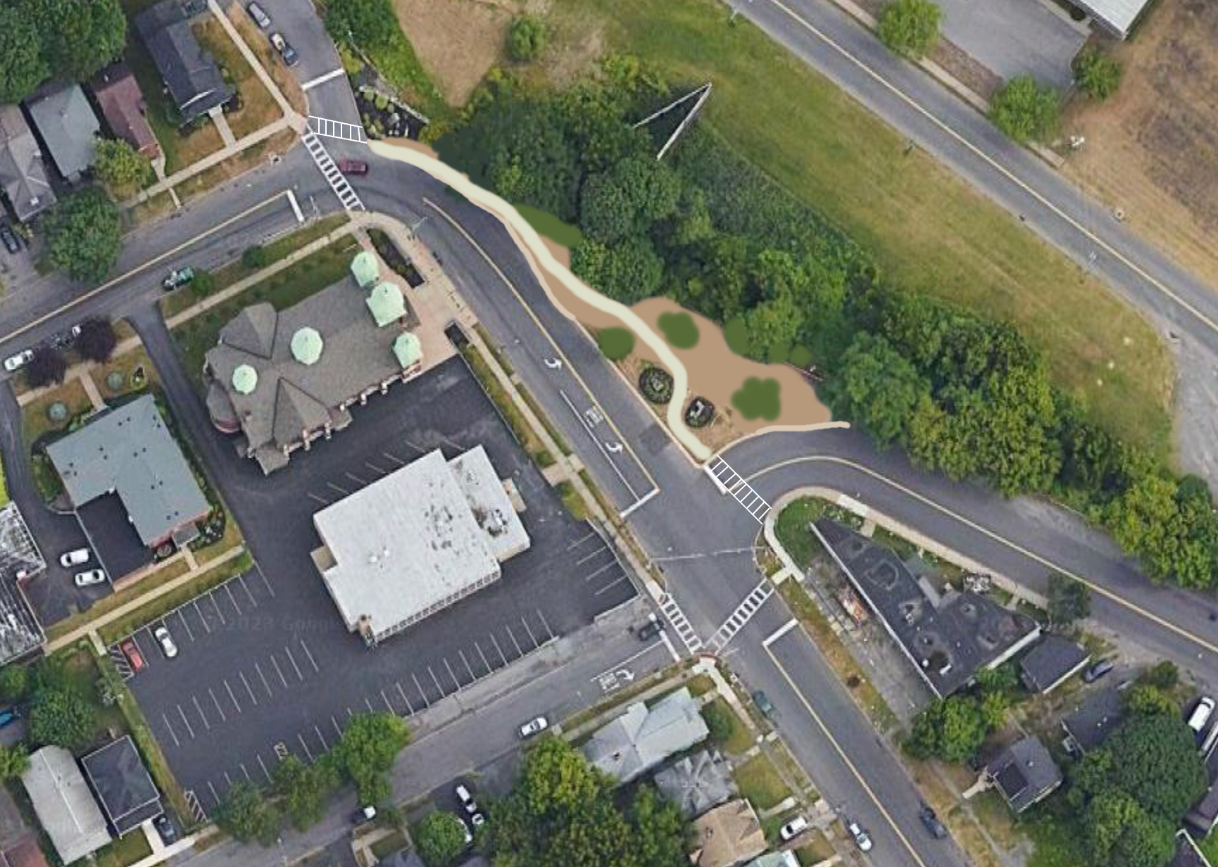
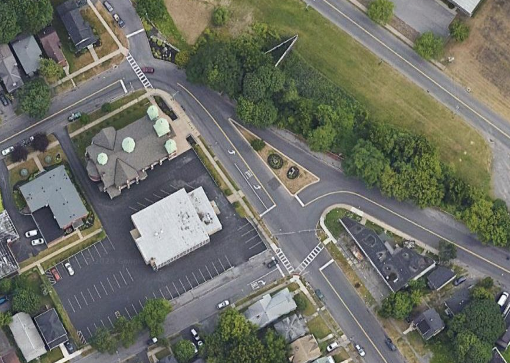
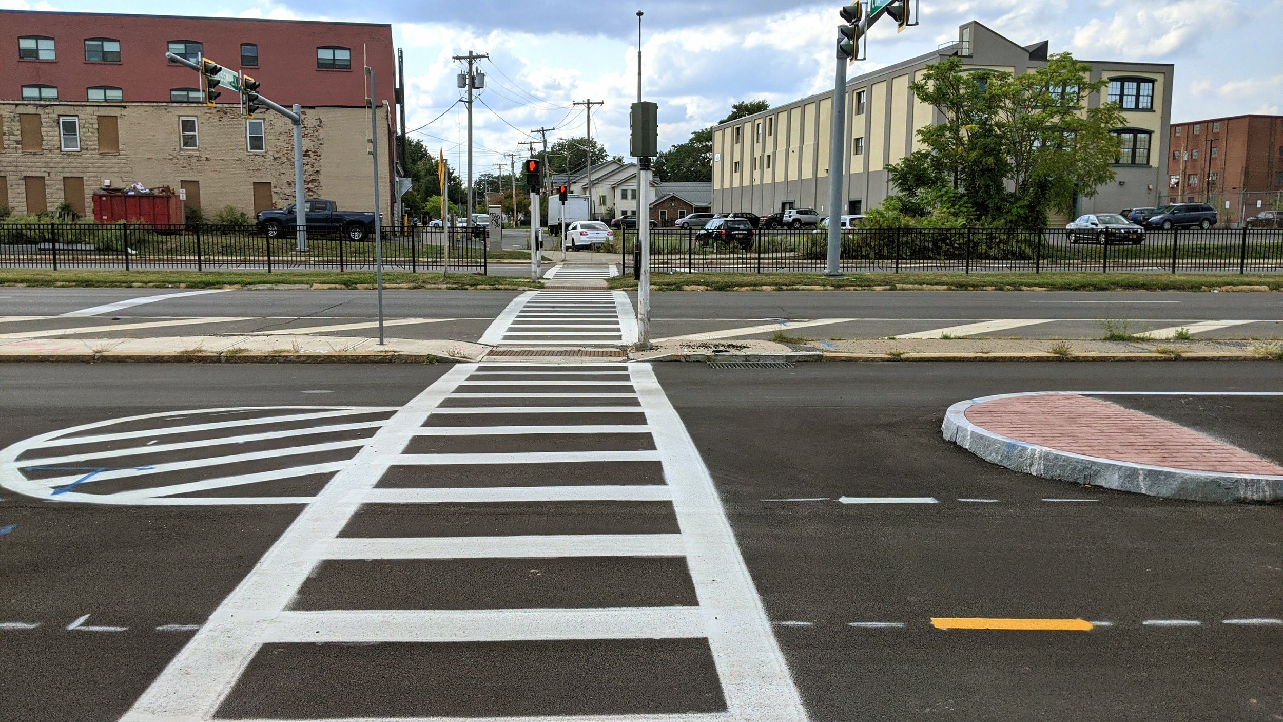
Lodi Intersection

Screenshot 2023-09-07 at 7.24.50 PM.png
Lodi new.png
Screenshot 2023-09-07 at 7.24.50 PM.png Lodi new.png

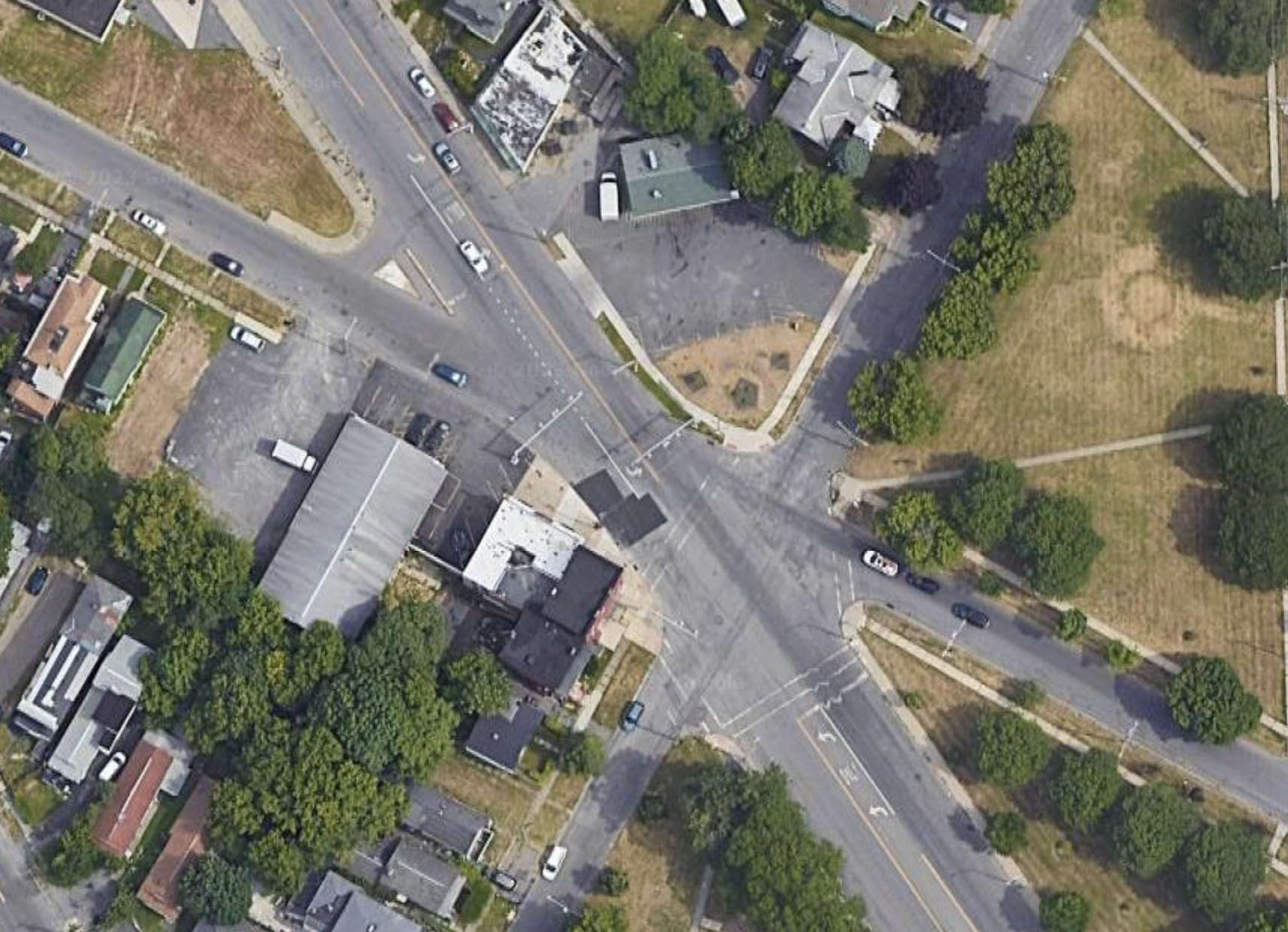
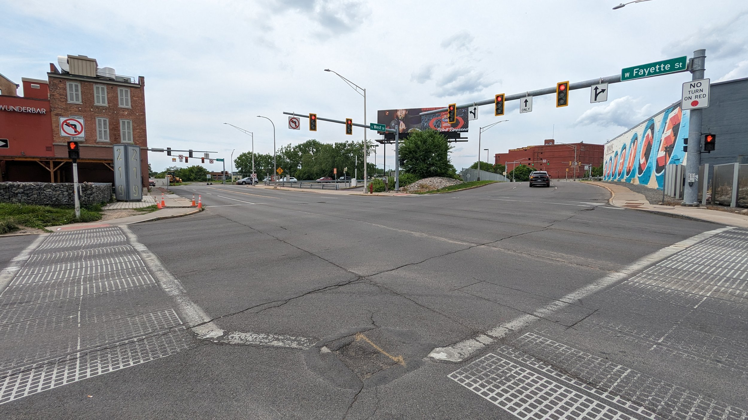
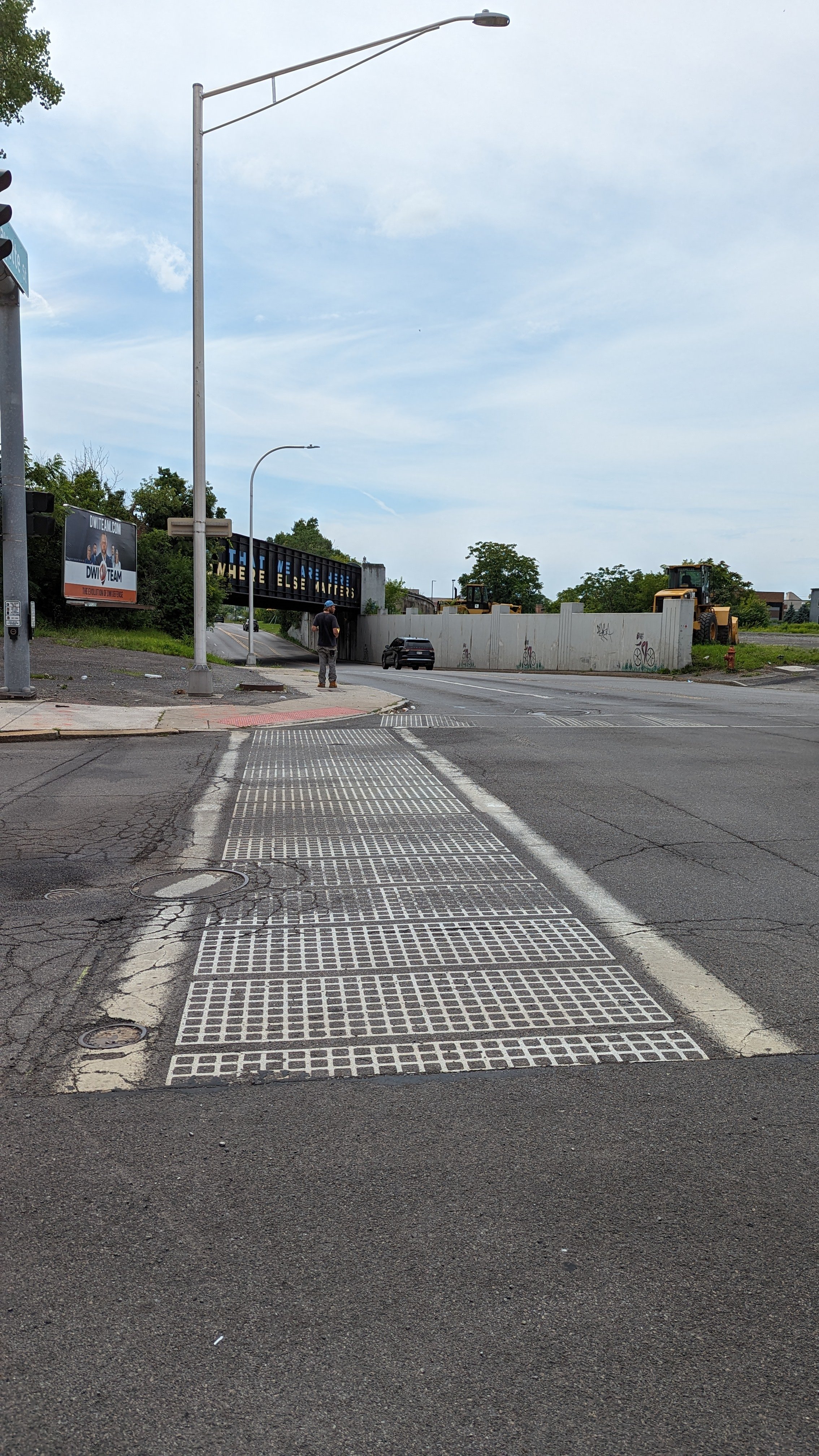
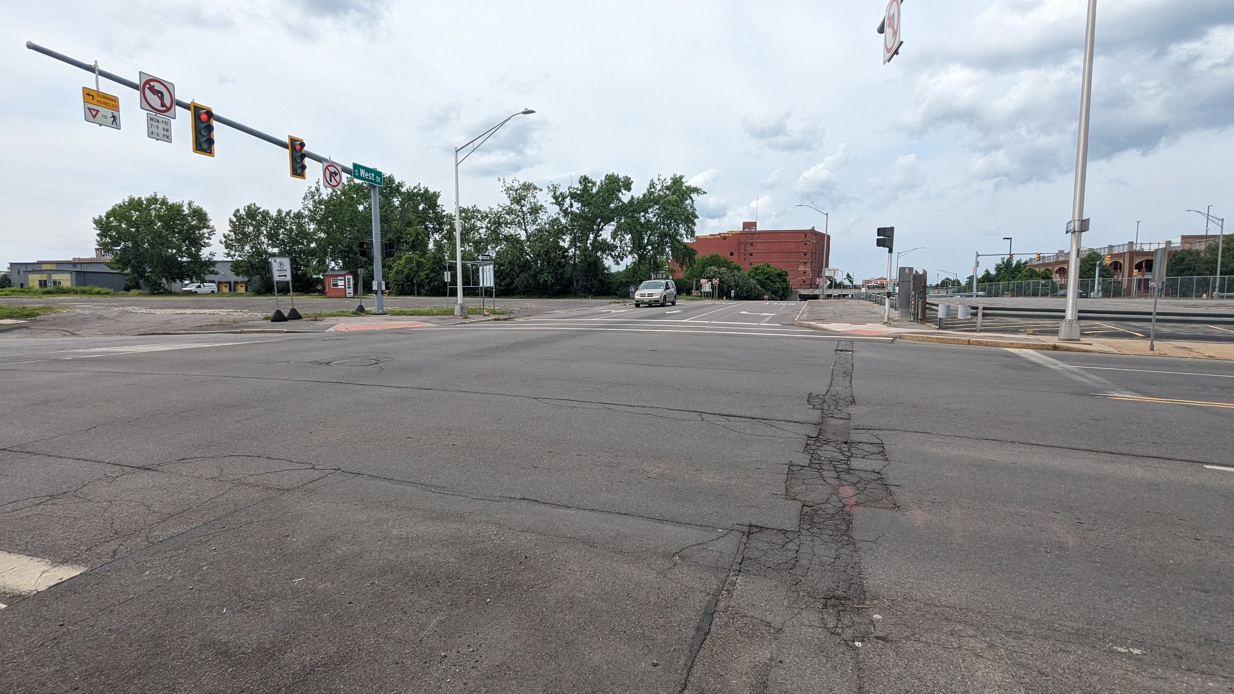
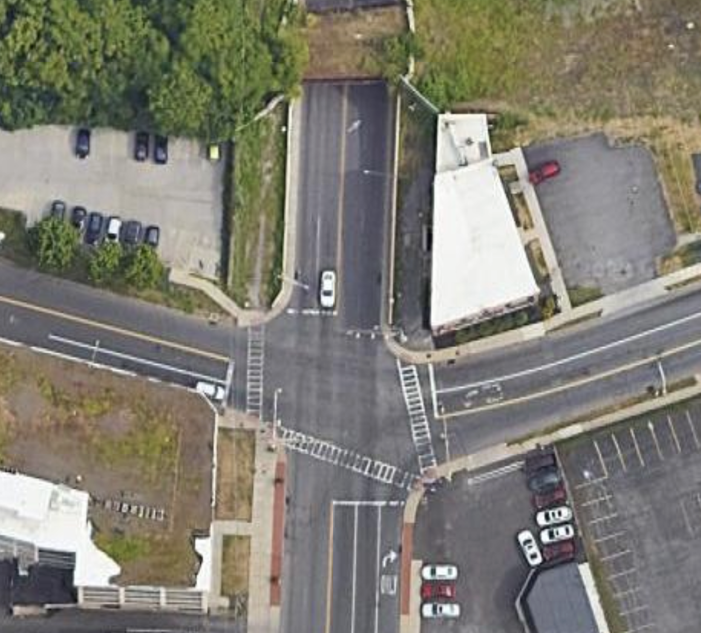
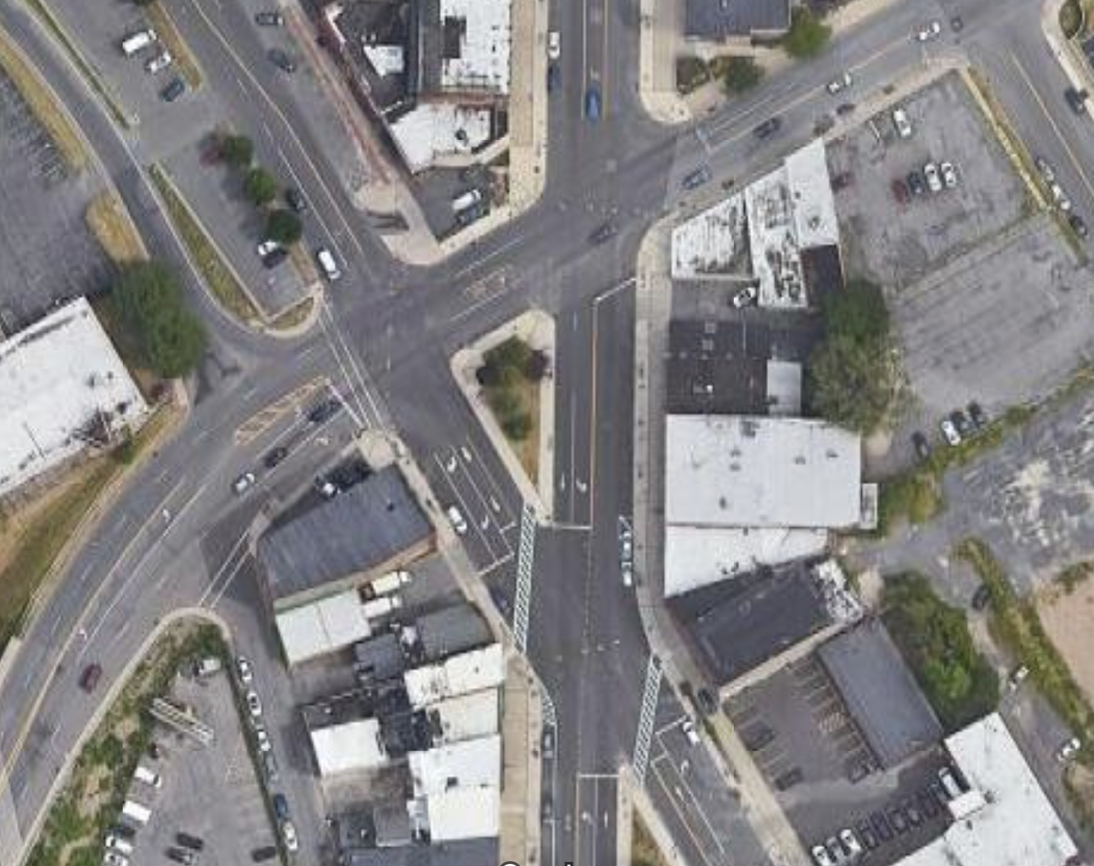
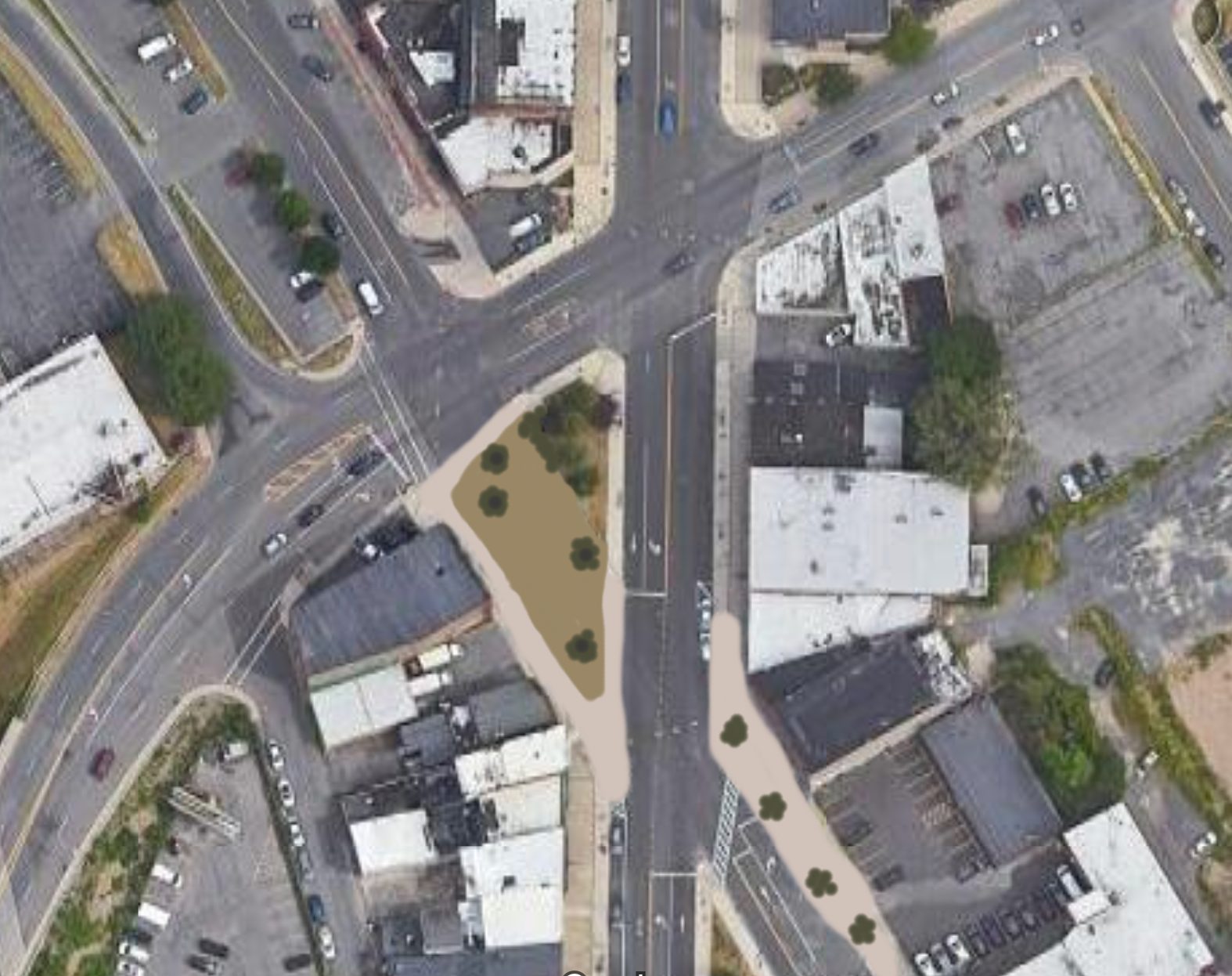
While the Butternut St / State St/ N Salina St intersection is complex, the intersection with Lodi St is far more complicated in terms of navigation. Similar to the previous intersection, six street legs converge at the same location, but this time there is no island helping to define the movements. 

The southbound approach of Lodi St reaches the intersection has vehicles stopping over 160 ft back from the center of the intersection and is bordered by a parking lot that pushes cars into the intersection as they exit.

Hills on the westbound approach of Kirkpatrick St and the northbound approach of Lodi St reduce visibility of people on foot, and also force them to walk up and down stairs if they are to use cross the streets legally.

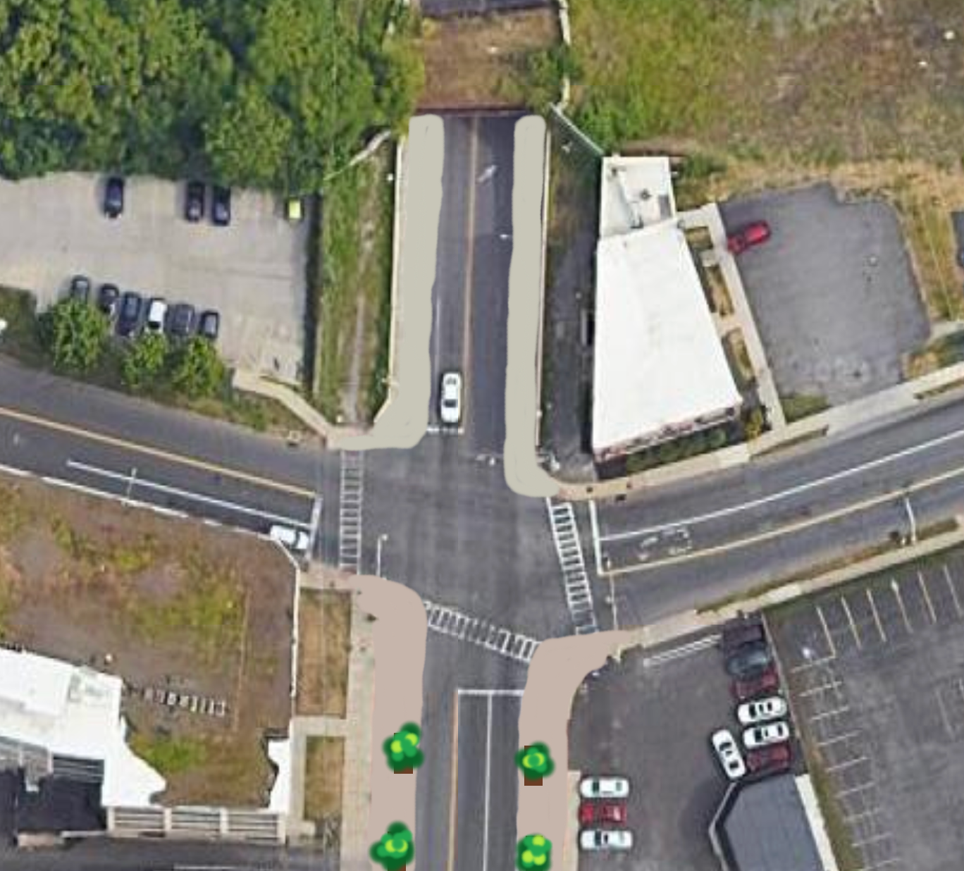
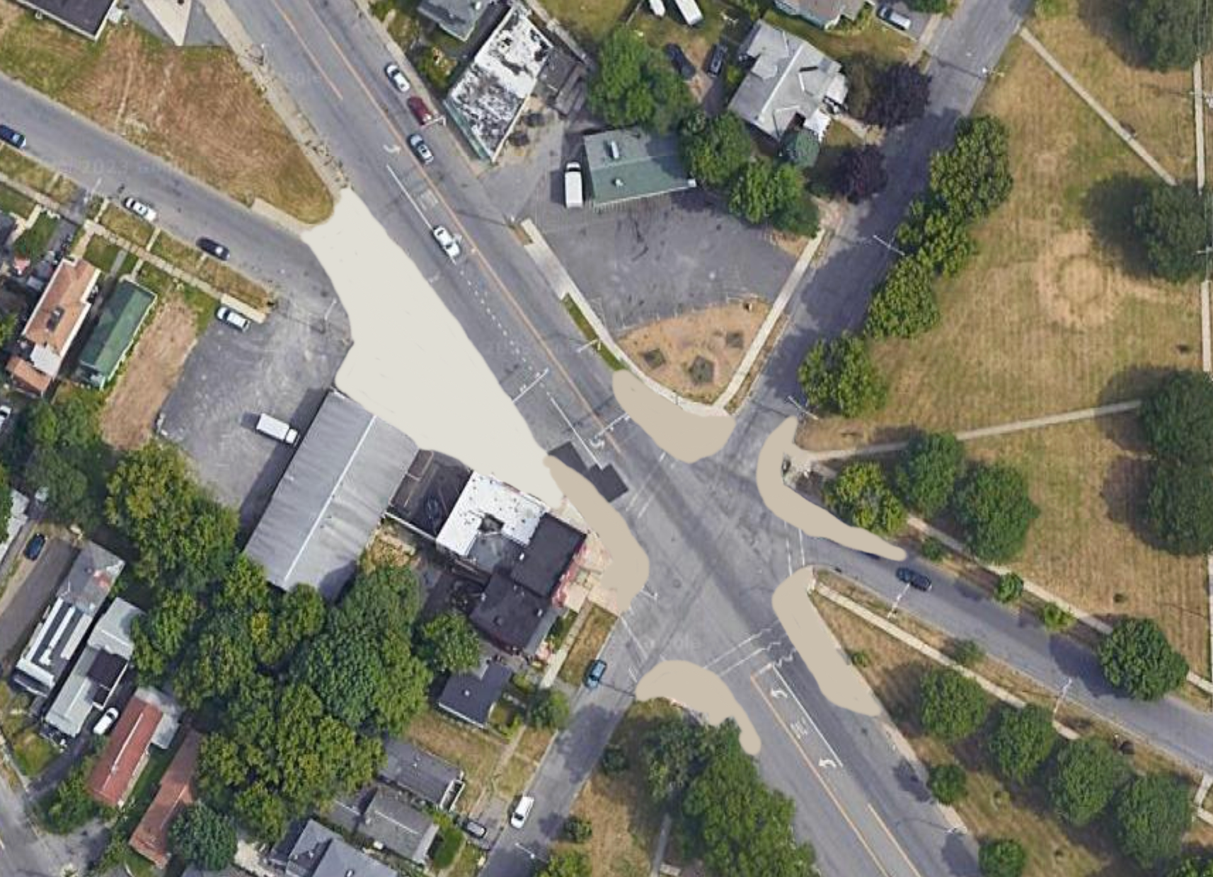
Again, this is an intersection in need of some trimming.

Southbound Lodi should see its movements blocked before the intersection, creating either a dead-end street or pushing drivers to turn on N Salina St before the traffic signal.

This should be paired with a narrowing of the other approaches. Currently, the northbound approach of N Salina St measures over 70 ft in width for only three lanes of traffic. The southbound approach isn’t much better at over 50 ft wide. These roadways have plenty of space to repurpose as curb extensions or bus lanes. Adding in painted bump outs would be an ideal approach as it would provide the flexibility to adjust for future transit improvements in the near future.

Lodi St to Wolf St

PXL_20230820_153407328.jpg
PXL_20230820_153454488.jpg
PXL_20230820_153611287.jpg
PXL_20230820_153630101.jpg
PXL_20230820_153720613.jpg
PXL_20230820_153801972.jpg
PXL_20230820_153825826.jpg
PXL_20230820_153951814.jpg
PXL_20230820_154022478.jpg
PXL_20230820_154134097.jpg
PXL_20230820_153407328.jpg PXL_20230820_153454488.jpg PXL_20230820_153611287.jpg PXL_20230820_153630101.jpg PXL_20230820_153720613.jpg PXL_20230820_153801972.jpg PXL_20230820_153825826.jpg PXL_20230820_153951814.jpg PXL_20230820_154022478.jpg PXL_20230820_154134097.jpg

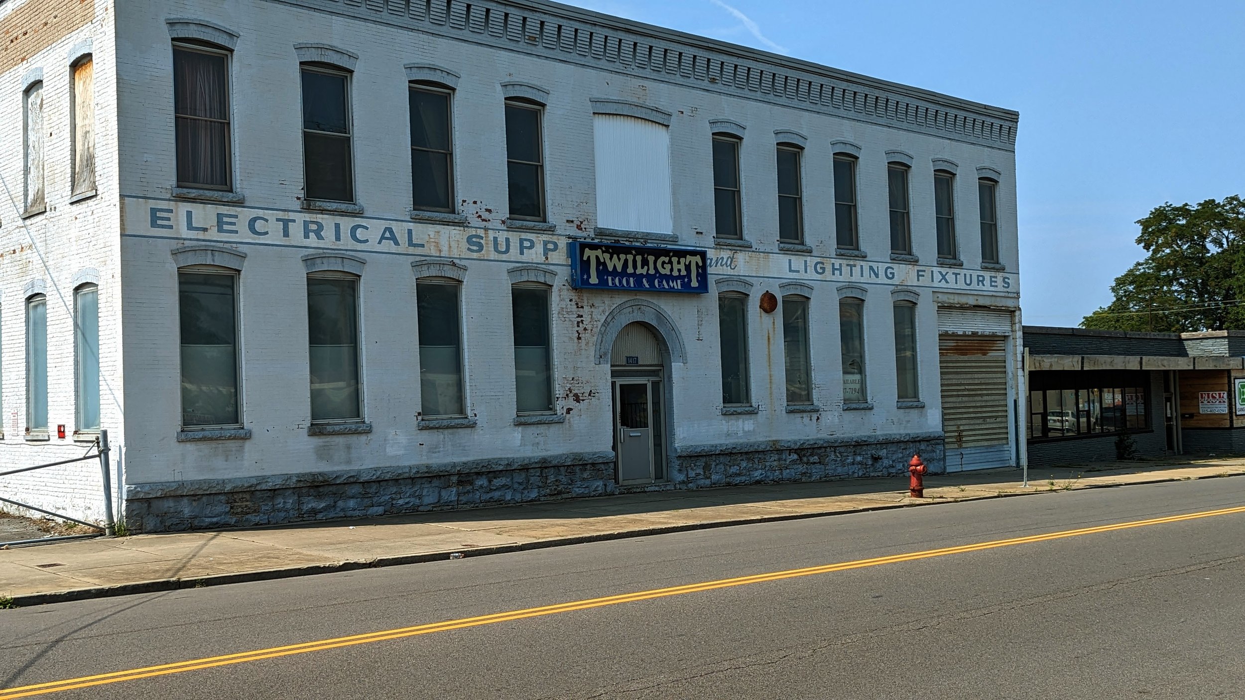
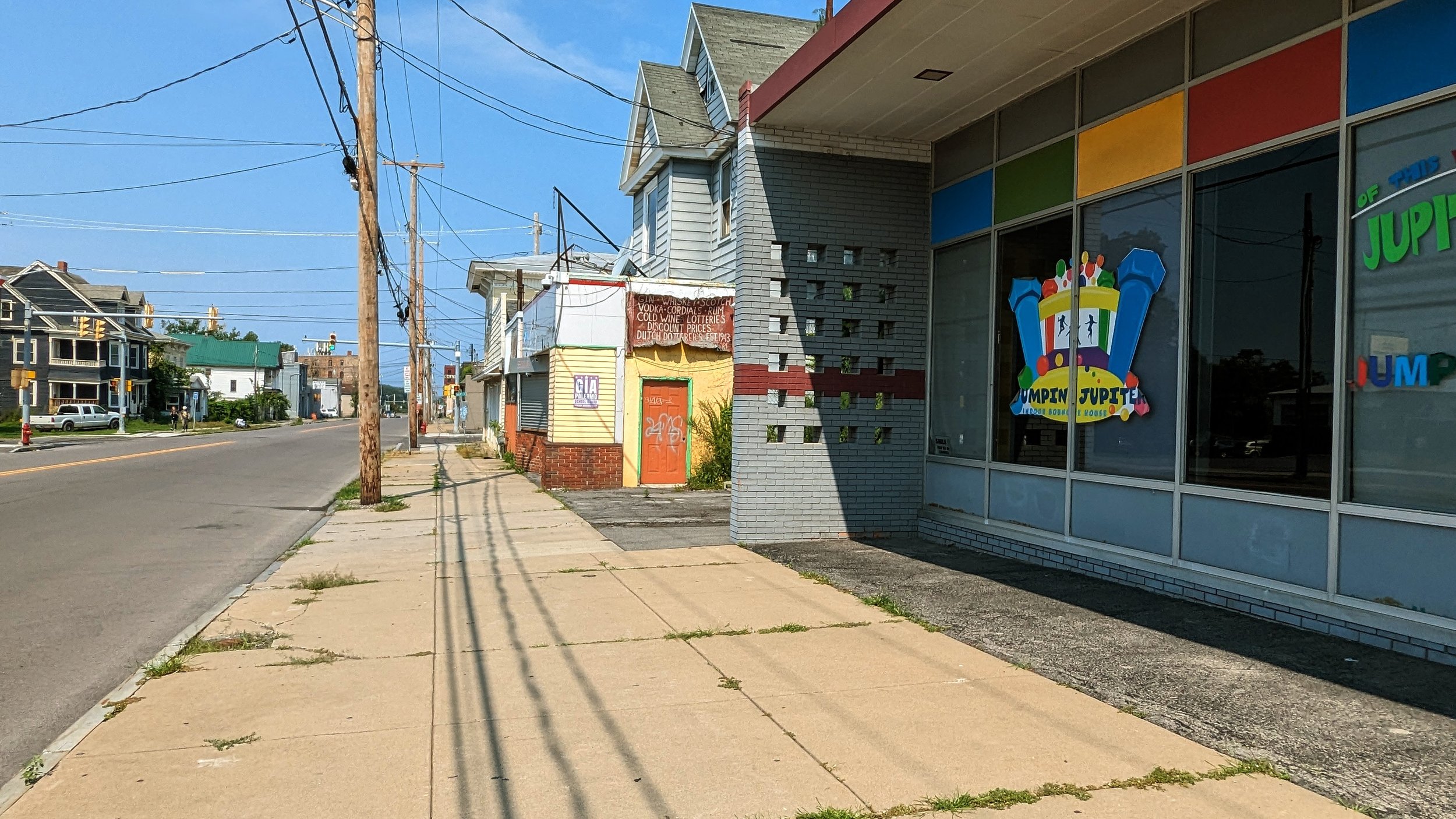
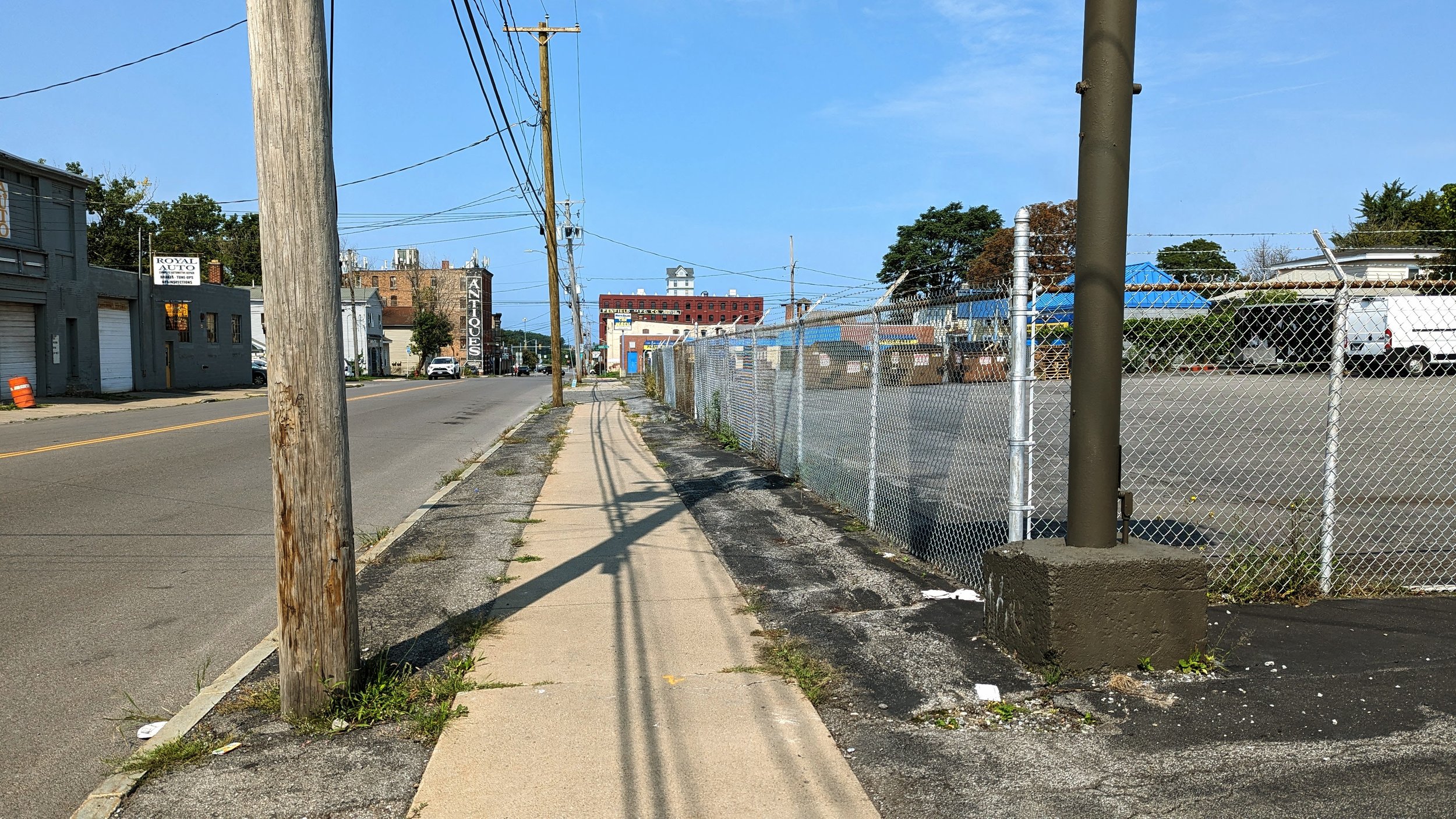
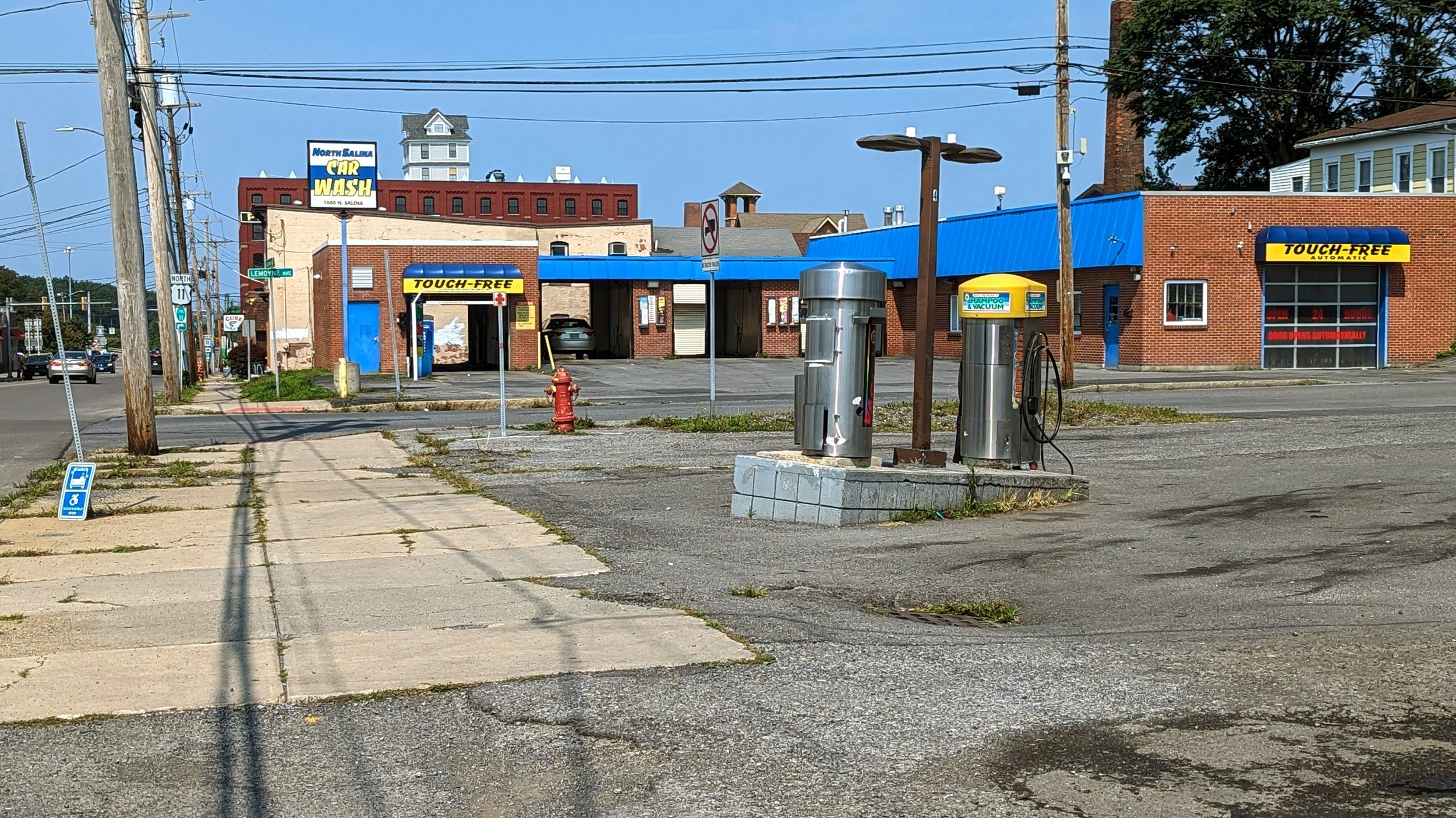
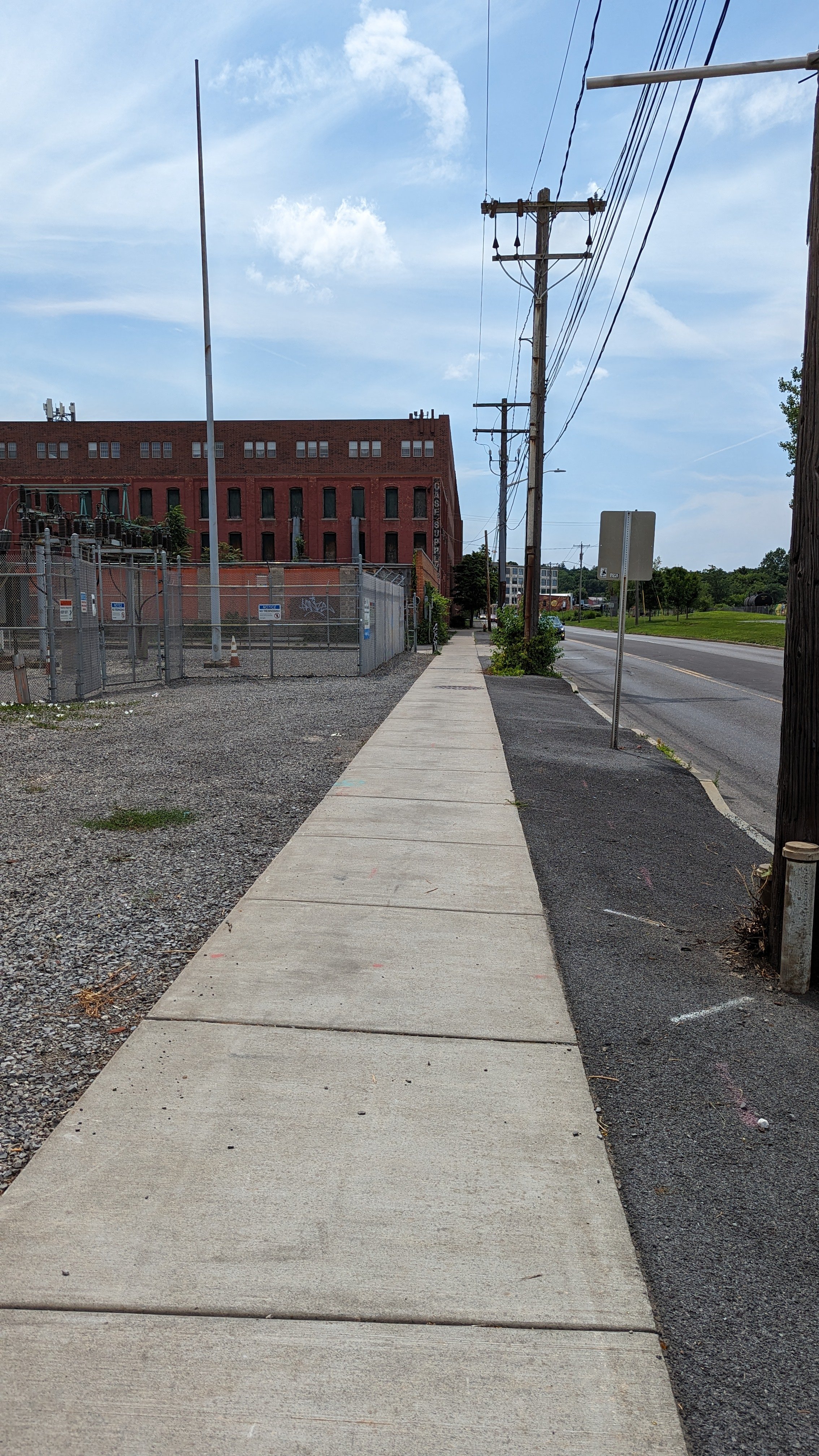
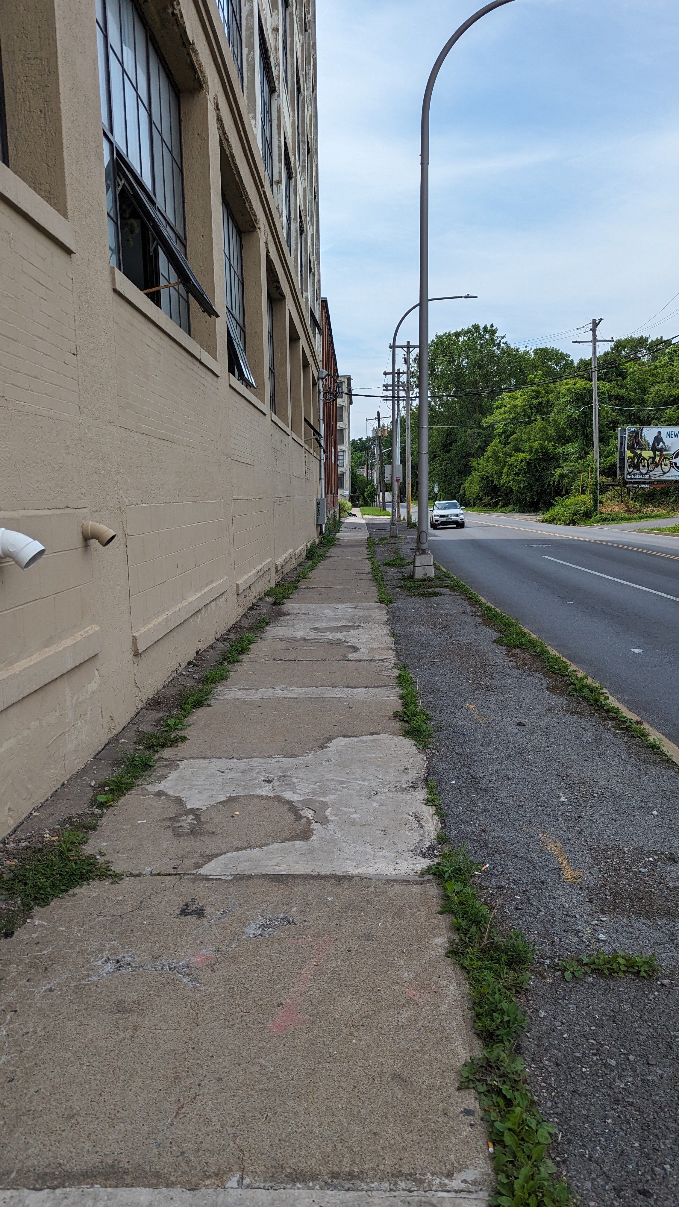
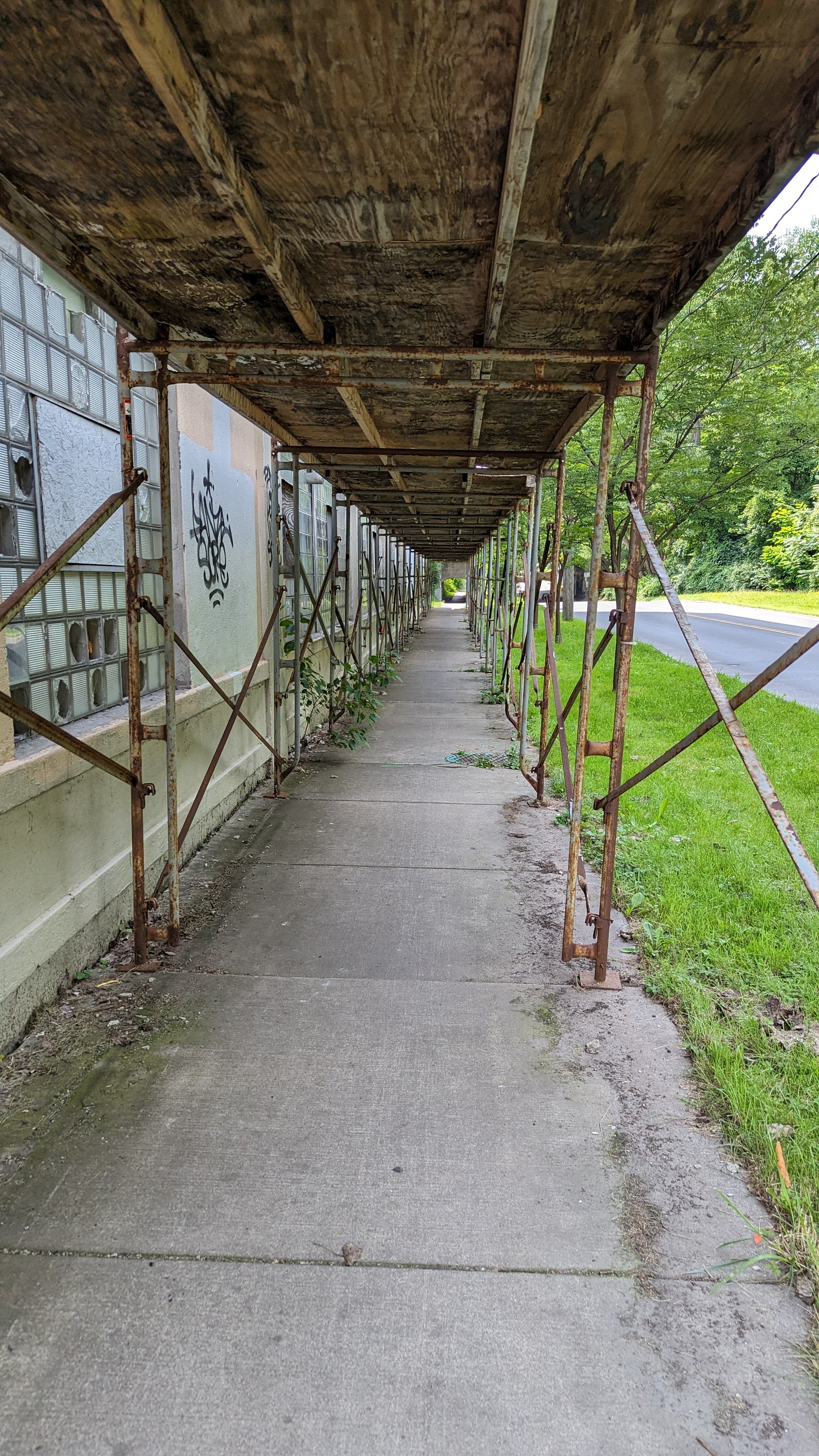
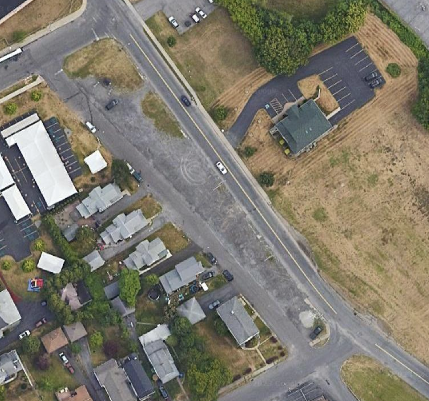
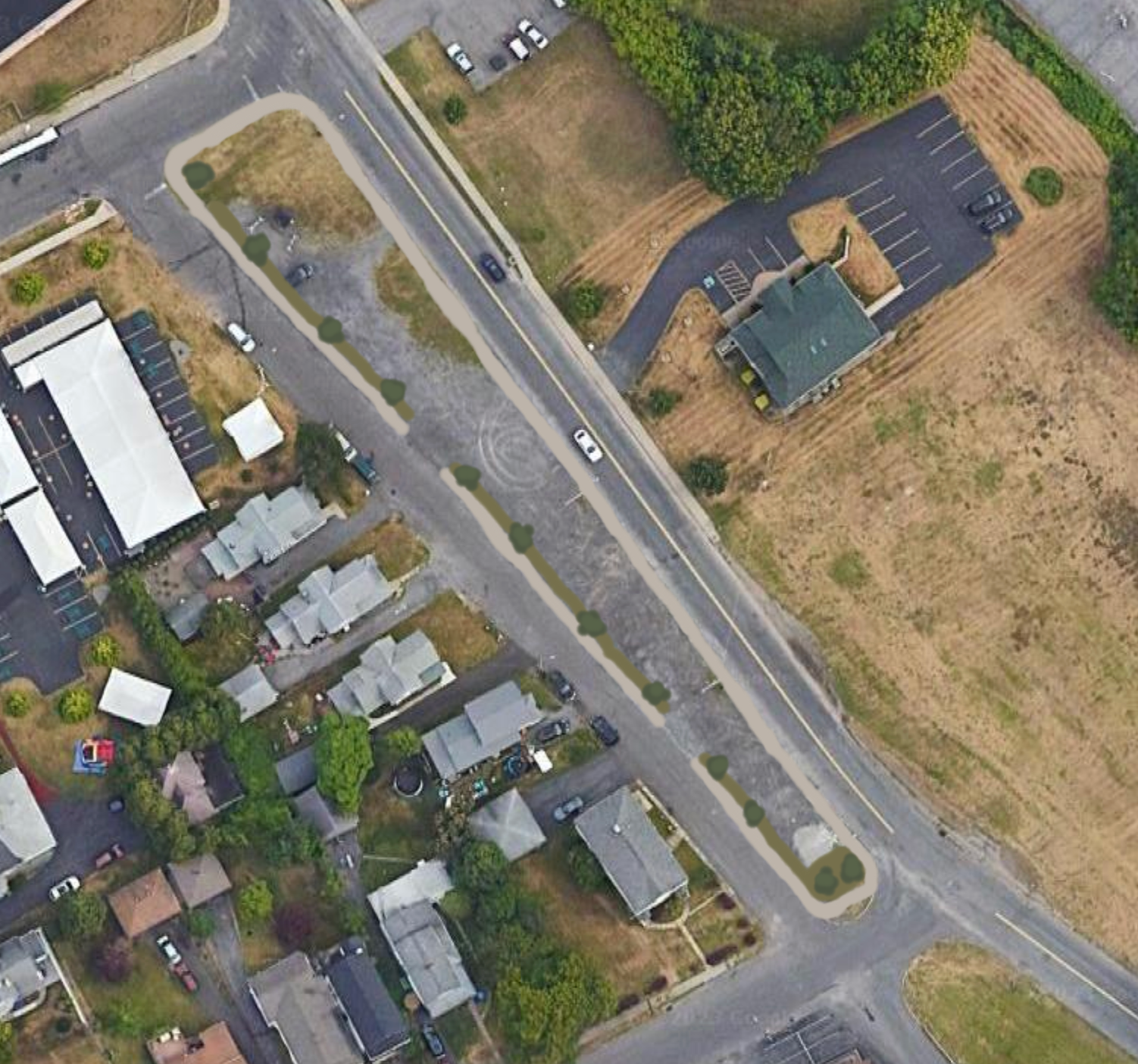
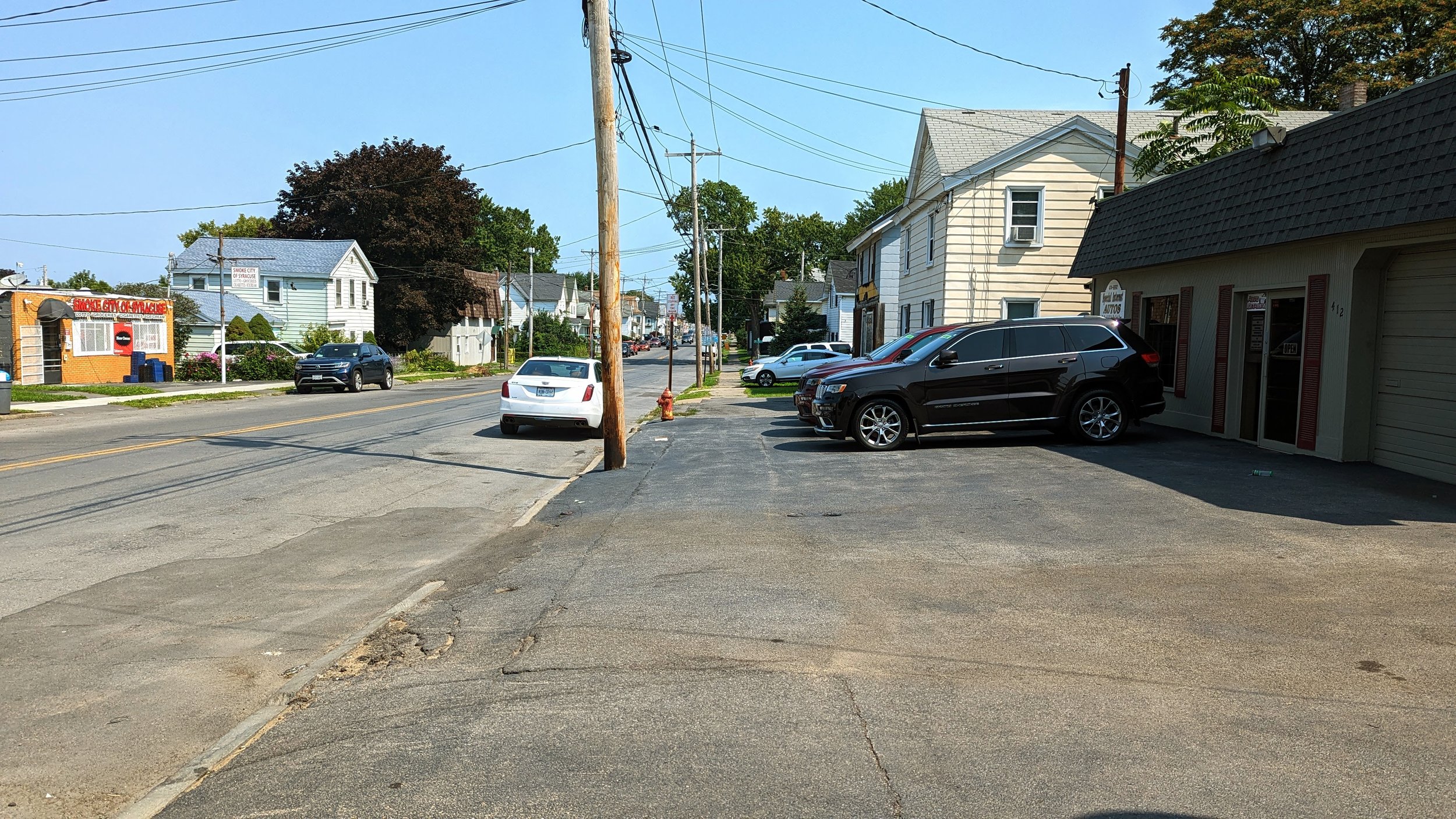
Once you are past Lodi, N Salina St loses much of its historic architecture in favor of auto oriented services, like car washes, convenience stores, and light industrial uses. 

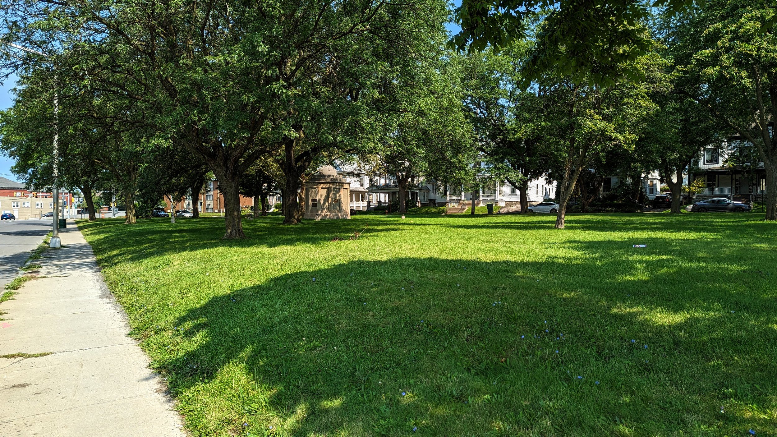
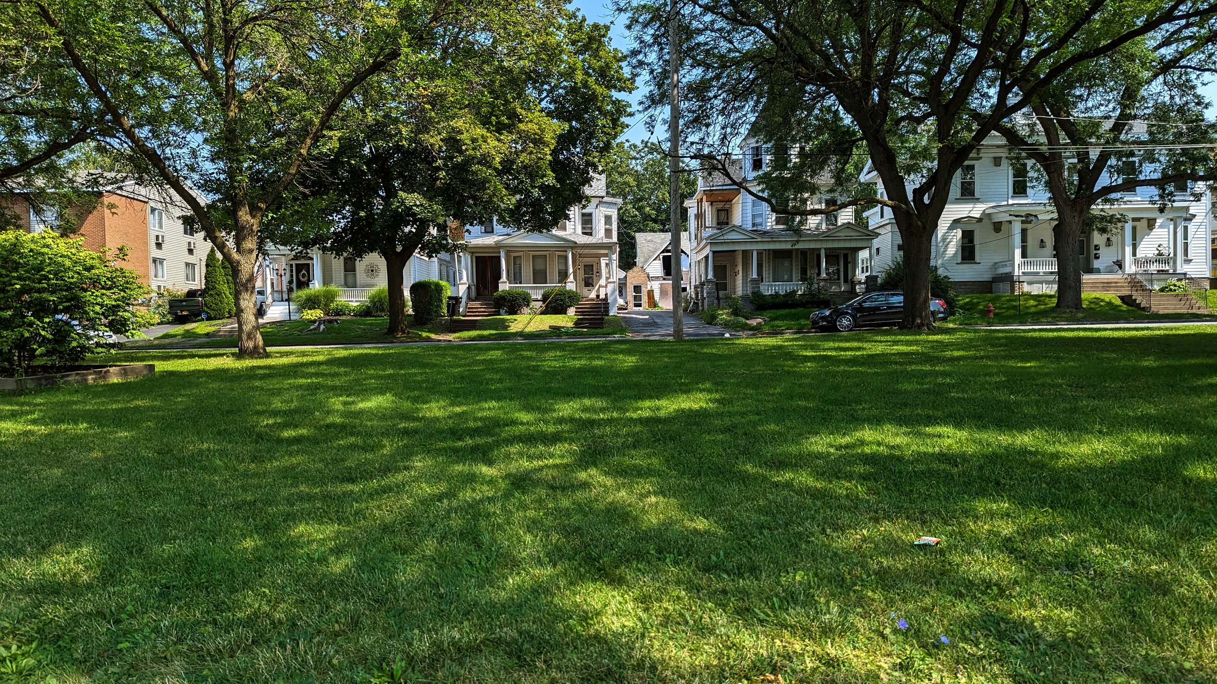
A small, well kept green space occupies the block between Danforth St and Court St and offers the only true shade and tree cover in the last half mile of N Salina St. Beyond this neighborhood park, the sidewalks are fairly barren.

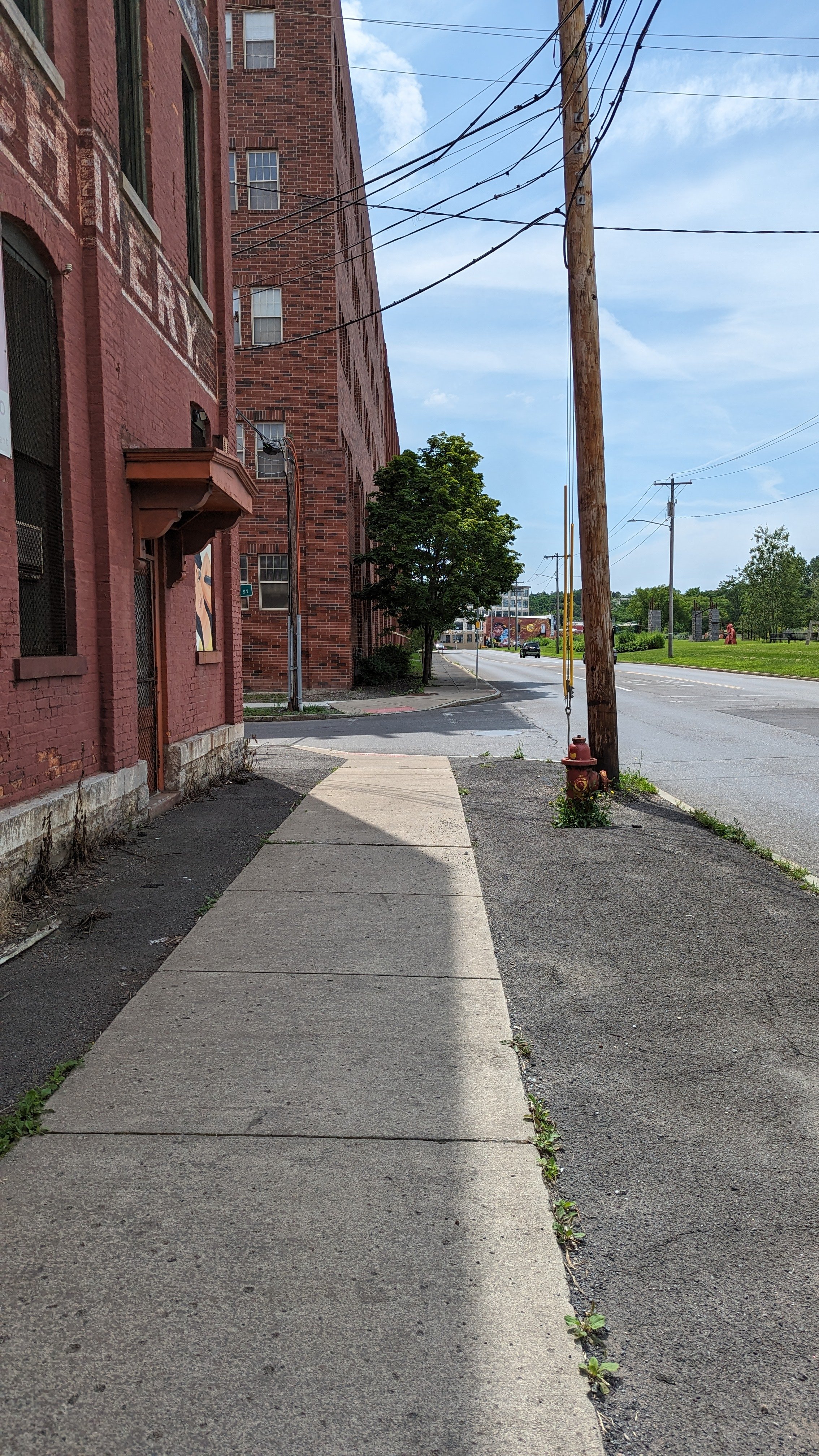
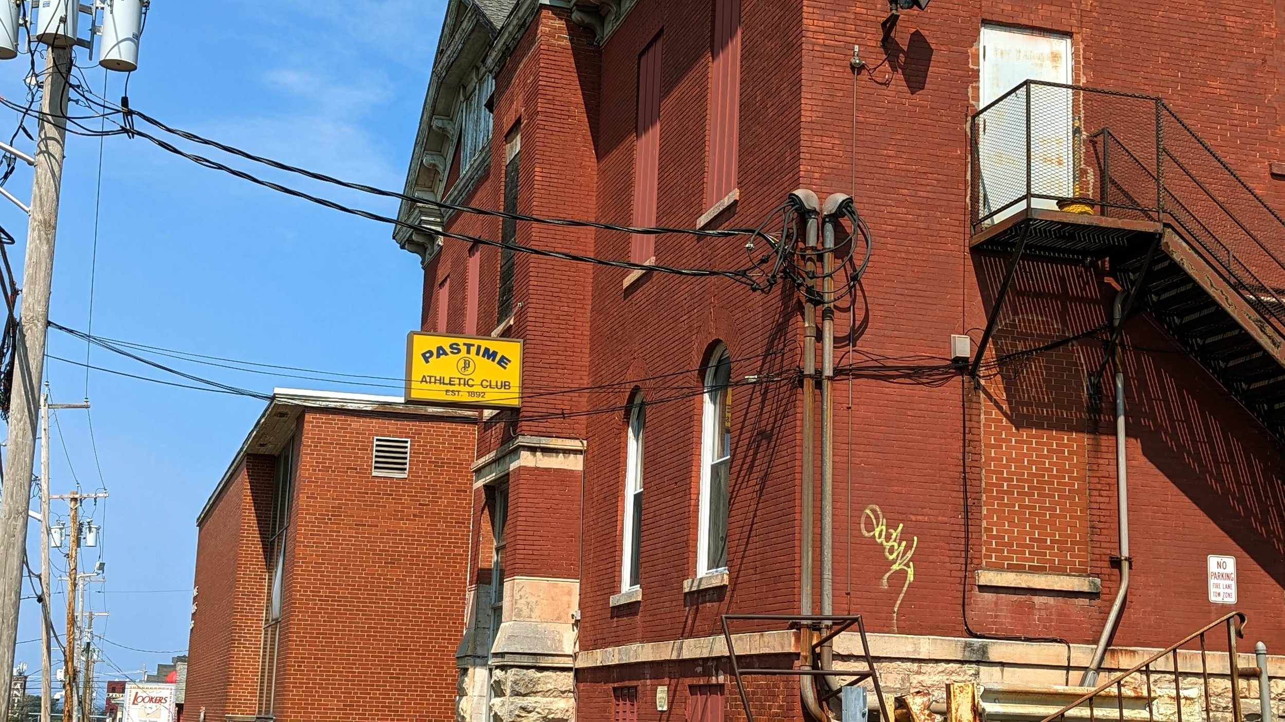
Across Court St, you continue past the Pastime Athletic Club, an athletic club that was founded in 1892, one of the longest running organizations in the City of Syracuse. While the organization has a long history, its impact on the streetscape is minimal. Its former front door is no longer in use, instead pushing members to its back parking lot to enter.

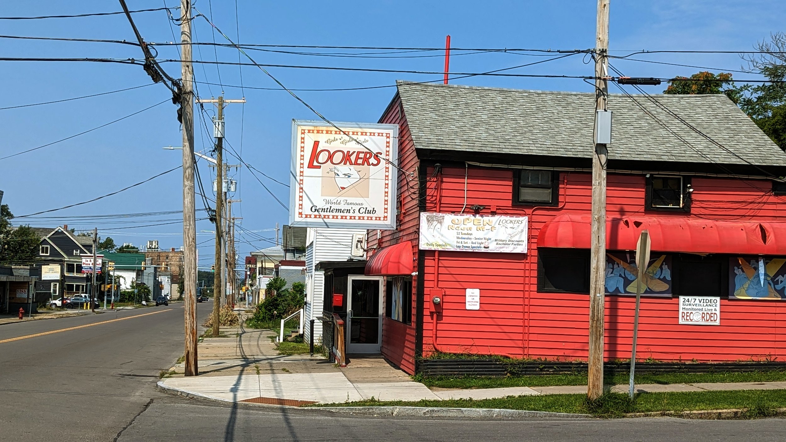
One short block away, you stumble upon the first of many, far too many, strip clubs in this part of the Northside, Lookers. While the business is less than desirable, it is an example of something found throughout Syracuse, and throughout the remainder of this walk - homes turned into commercial spaces. Further down N Salina St you come across an abandoned bookstore and music shop that were both housed on the ground floors of their respective homes. In some circles these types of businesses are referred to as “front yard businesses.” When the housing was dense and most people walked for their daily needs, these businesses thrived. Then, in the 1960s, we began making it harder for these types of businesses to develop, and we instead shifted our focus to national retailers in car oriented plazas on the edges of our urban area.

Wolf St (N Salina to Carbon St)

PXL_20230820_154226166.jpg
PXL_20230820_154235658.jpg
PXL_20230820_154249117.jpg
PXL_20230820_154348537.jpg
PXL_20230820_154431508.jpg
PXL_20230820_154226166.jpg PXL_20230820_154235658.jpg PXL_20230820_154249117.jpg PXL_20230820_154348537.jpg PXL_20230820_154431508.jpg

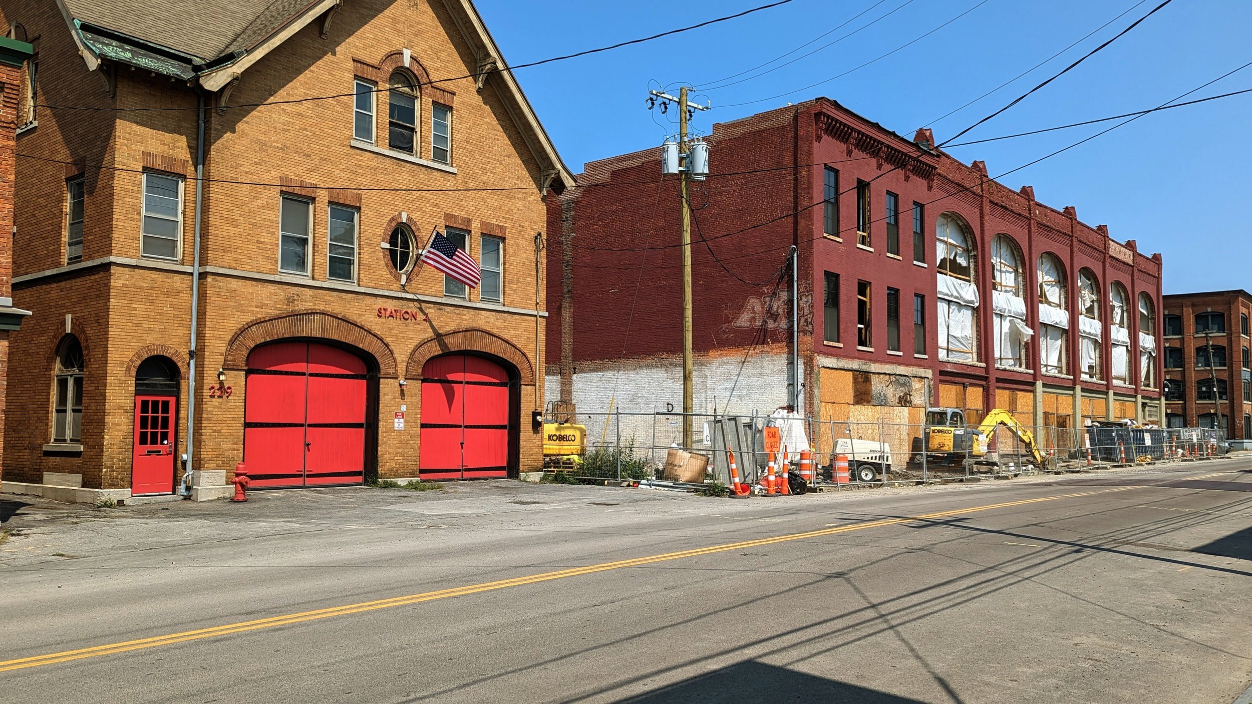
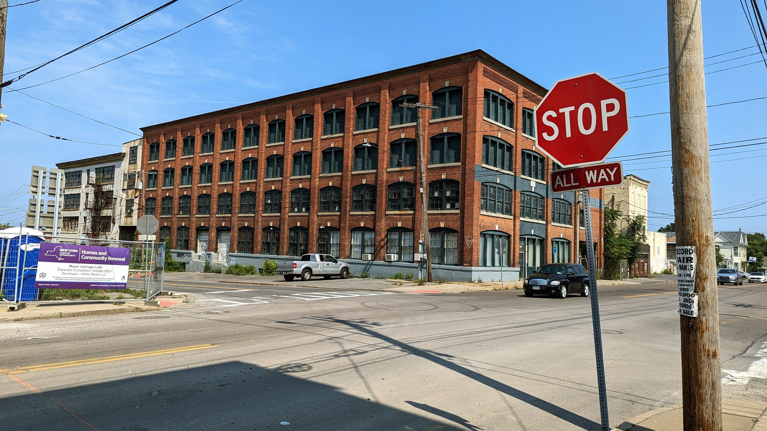
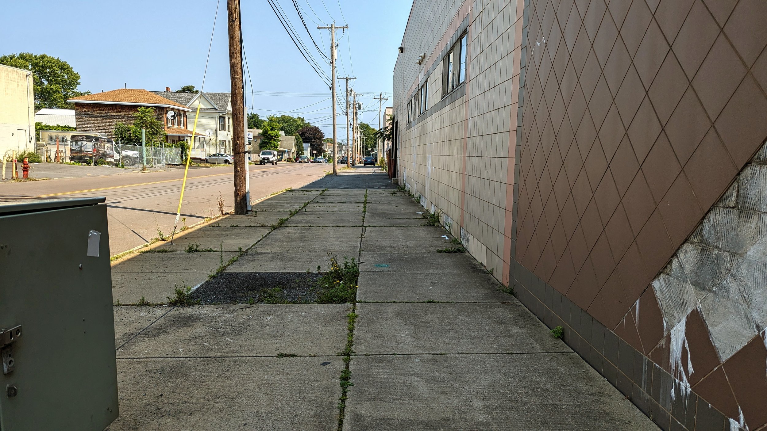
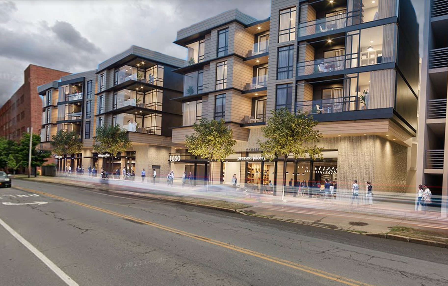
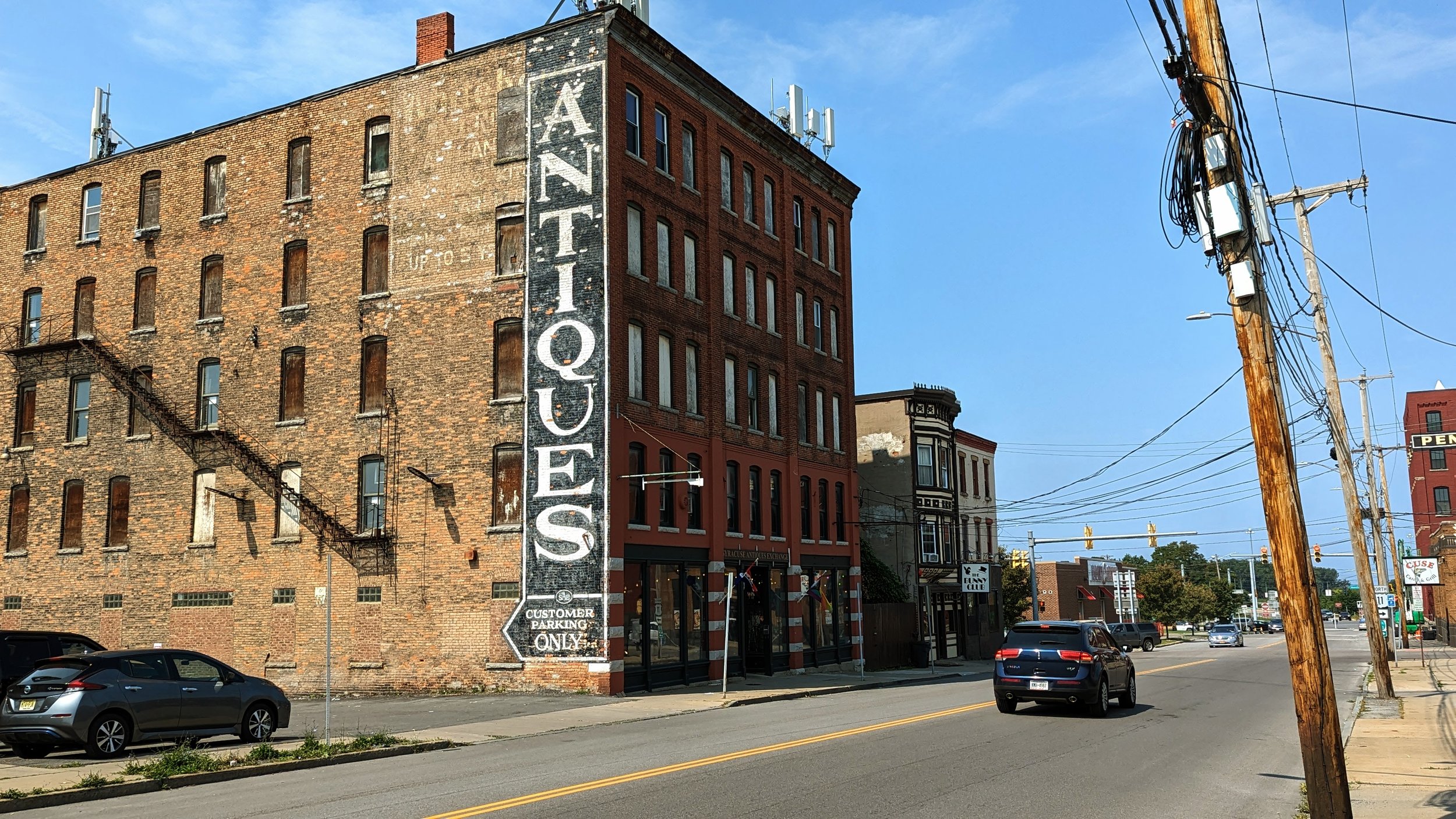
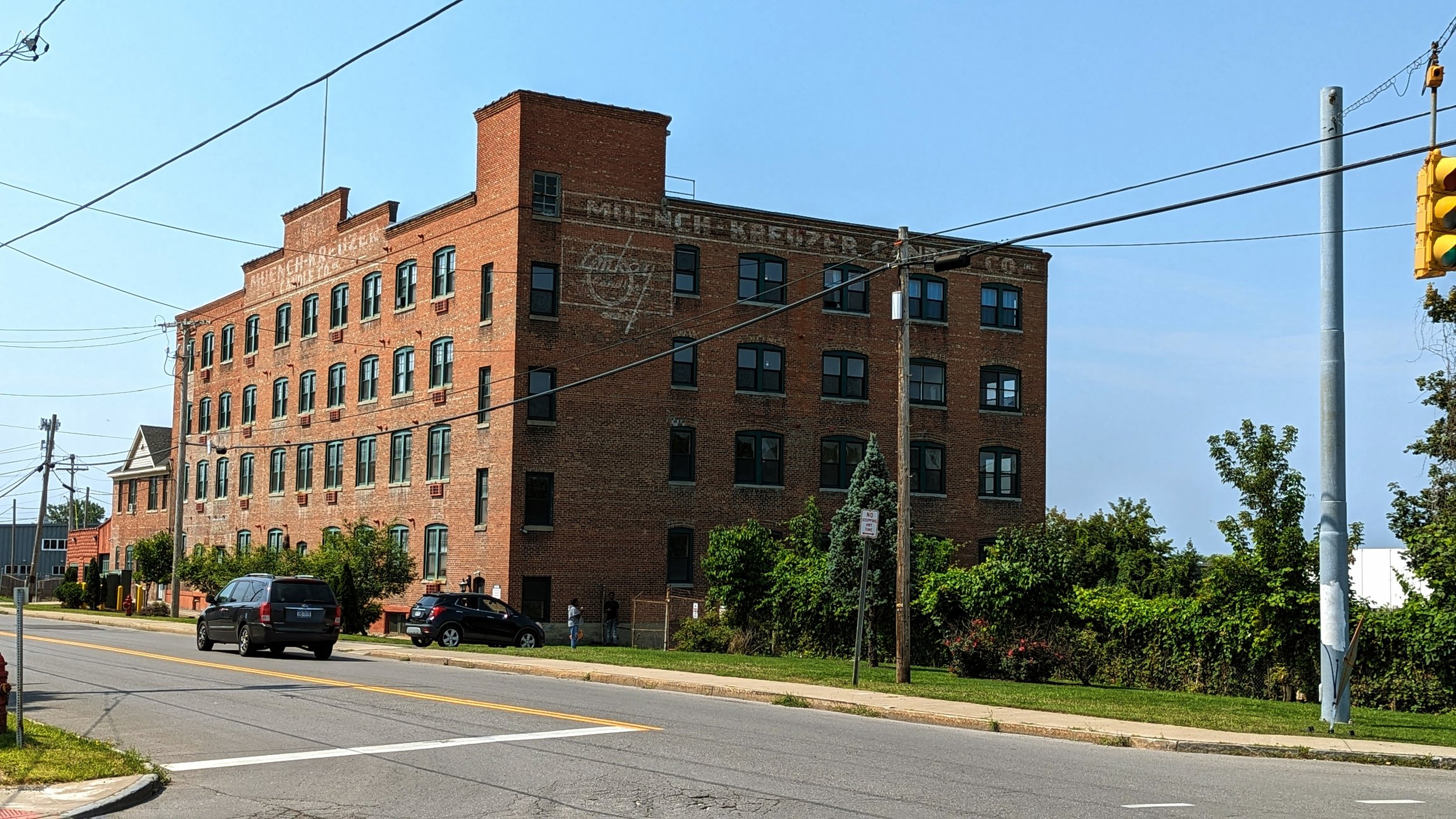
As we approach Wolf St, we re-enter a more historic architectural space, anchored by the Syracuse Antiques Exchange and the former H.A. Moyer carriage factory, which is in the process of being renovated into apartments. Due to the car oriented developments leading up to this intersection, the former warehouses and factories seem to spring out of nowhere. Today, the intersection is filling in, with Cuse Catch occupying a former bank and the gradual redevelopment occurring around it. At the same time, strip clubs and bars also fill the space. But Wolf St has the potential to be a true neighborhood center that other neighborhoods in the City could only dream of, and it is thanks to the historical industrial bones it is built on.

I have written previously about the potential of this area, including promoting the idea of the old industrial buildings being repurposed as a brewery center. Since then, new construction has begun, with several of the older buildings being converted into residential units, including units for individuals with disabilities and a broad range of affordability. Developers aim to fill the ground floor with commercial spaces, which can be an opportunity to not only serve the immediate community but also can become a destination if properly connected well to the nearby Regional Market, NBT Bank Stadium and Destiny USA. 

The wide sidewalks lend themselves to pedestrian activity, including sidewalk cafes and outdoor dining, yet some of the remaining industrial uses, namely Roma Tile & Marble, currently use the space to load in and out of their facilities. We should encourage this activity to continue, but it may be worth looking at restricting freight movements to morning hours, freeing up the sidewalks during the busier afternoon and evening hours.

Wolf St (Carbon St to Grant Blvd)

PXL_20230820_154615724.jpg
PXL_20230820_154712906.jpg
PXL_20230820_154939059.jpg
PXL_20230820_155100376.jpg
PXL_20230820_155615809.jpg
PXL_20230820_154615724.jpg PXL_20230820_154712906.jpg PXL_20230820_154939059.jpg PXL_20230820_155100376.jpg PXL_20230820_155615809.jpg

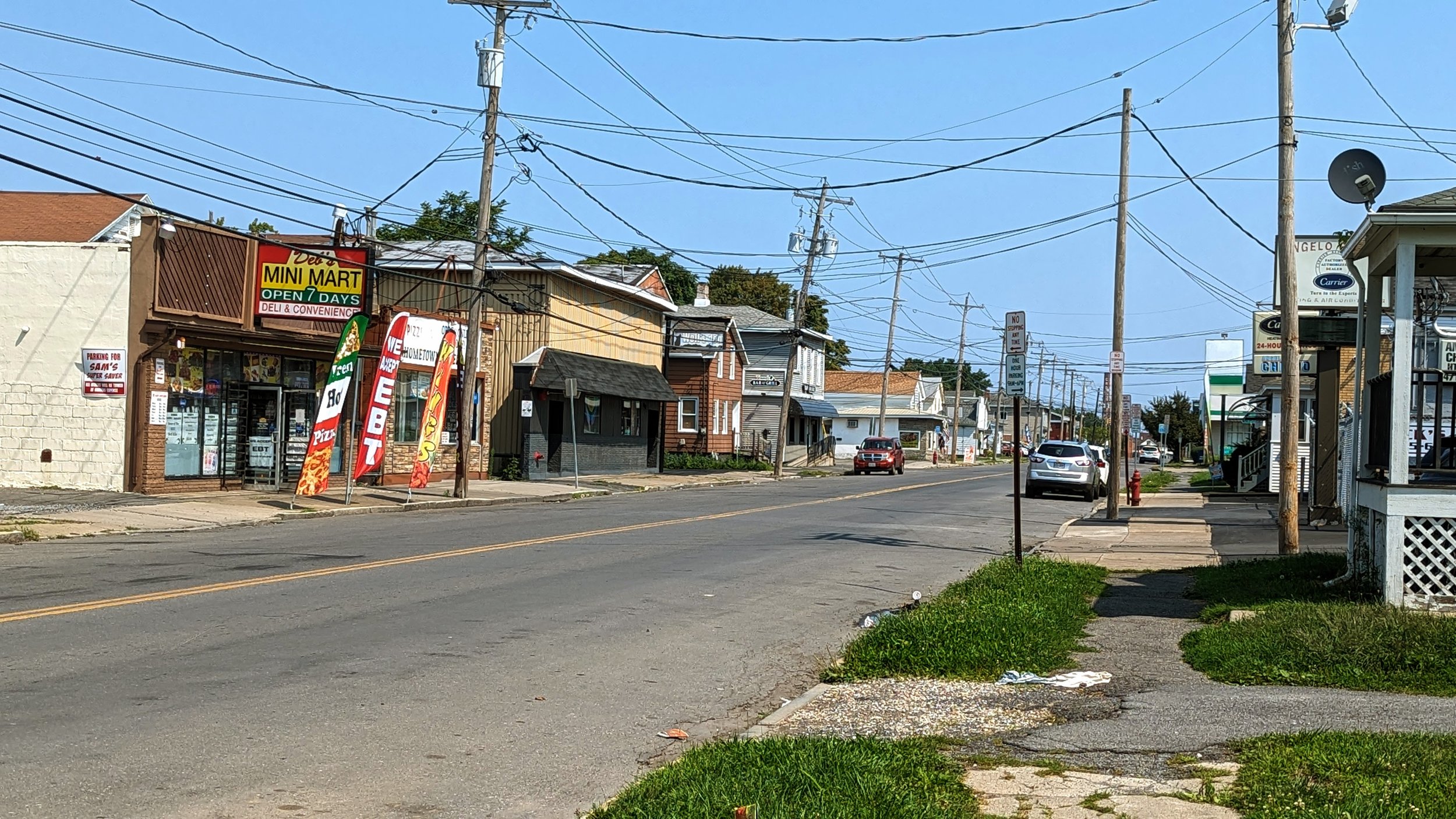
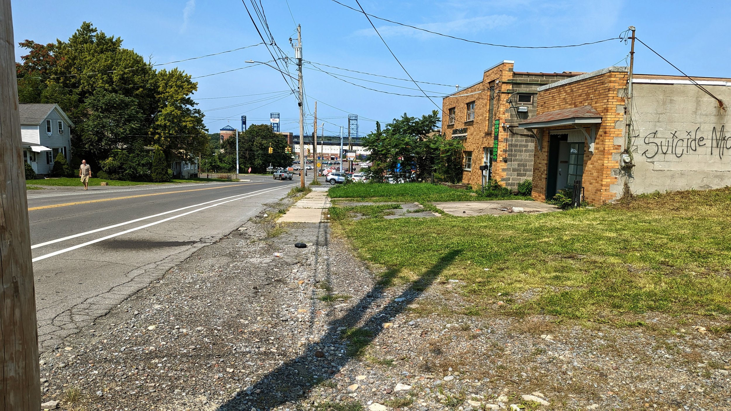
Beyond Carbon St, the sidewalk narrows with dense housing close to the street, setback only a few feet from the sidewalk. Mixed in with the housing is a variety of commercial spaces, primarily convenience stores that use the sidewalk, or really just the space where a sidewalk should go, as pull-in parking. While it is great that these commercial spaces exist, they are often being used in duplicative ways. While the area may not need a full on grocery store with Regional Market only a block away, a plethora of convenience stores make less desirable goods, like alcohol and cigarettes, much easier to access than the healthy food only available two times per week at the market. 

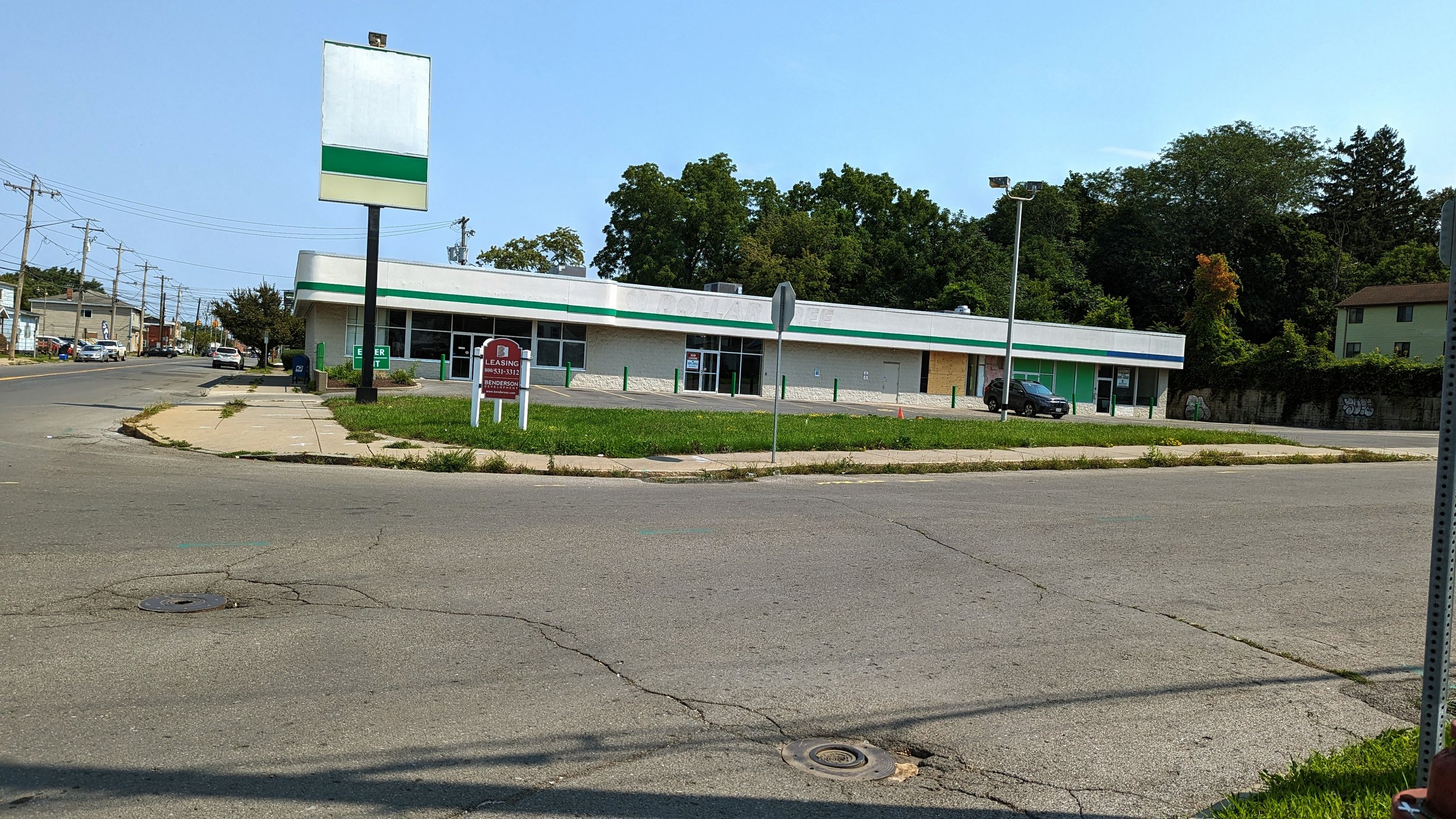
Further down Wolf St, a vacant storefront, previously a Dollar Tree, could be a prime location for a neighborhood grocery. But we should look to do more with this space, and all neighborhood grocery stores. We should look to add housing on top of these facilities, ensuring easy access to fresh food, and promoting the ability to get daily needs without a car. As noted in the SMTC’s RTC / Market Area Mobility Study, over 38 percent of households do not currently have access to a car and we should be focusing our efforts on bringing in development that promotes access to those on foot. 

While that study does not focus on Wolf St, many of the same observations hold true. The sidewalks are busy by Syracuse standards, with many others on bikes. This is not a car dependent neighborhood, yet we have not built spaces that are comfortable to walk on. Sidewalks are narrow, street trees are rare, and traffic is primarily passing through instead of heading to the neighborhood. 

PXL_20230820_155534417.jpg
Rockies.jpeg
PXL_20230820_155534417.jpg Rockies.jpeg

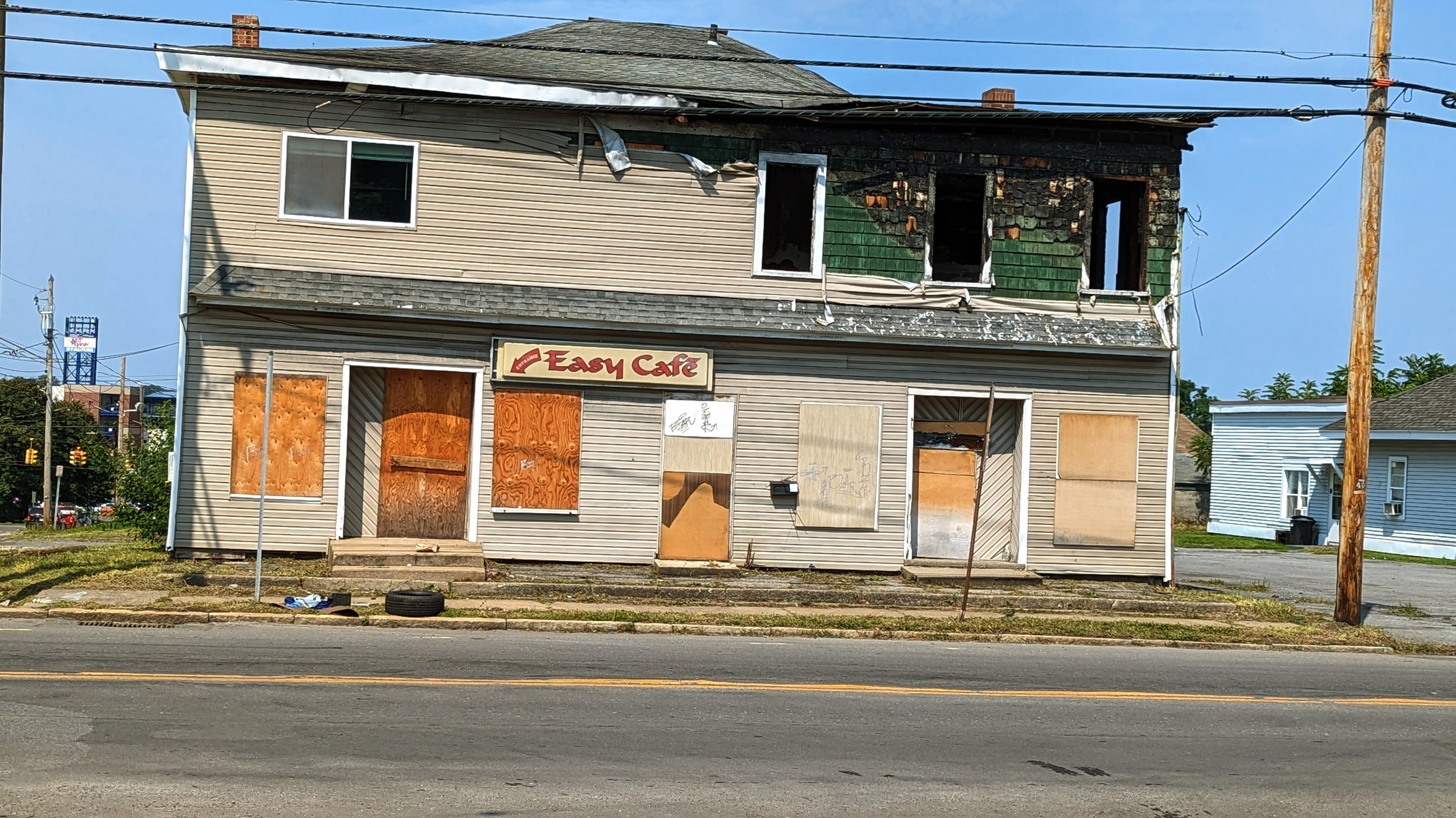
Further north, on the way to the ballpark, sits the former site of the Easy Cafe. Prior to the bar burning down, it was already a missed opportunity. As one of the only bars within easy walking distance of NBT Bank Stadium, it could have been, and should have been, a great place to grab a drink or bite to eat before a game. Instead, it did not open itself up as a welcoming space to many. Part of the reason may be its neighbors. Two small car dealerships and a gas station occupy the other corner locations. Such auto-oriented commercial spaces deaden the space and make it unpleasant to walk as you must navigate between cars parked up to the curb and watch for drivers pulling in and out. Due to these constraints, rebuilding the bar and making it a gameday destination will require an owner to go big. A dream of mine would be to see a wiffle ball bar open up near the ballpark, similar to Rookies in Wisconsin. By making the bar its own destination, it may be able to overcome its difficult neighbors and help bring baseball further into the neighborhood. As I have mentioned many times, baseball is an urban sport, and we should find ways to connect the team into the neighborhood as often as possible.

Into the Ballpark

PXL_20230820_155734557.jpg
PXL_20230820_155908465.jpg
PXL_20230507_170543774.jpg
PXL_20230804_235717318.jpg
PXL_20220714_225413994.jpg
PXL_20230820_155734557.jpg PXL_20230820_155908465.jpg PXL_20230507_170543774.jpg PXL_20230804_235717318.jpg PXL_20220714_225413994.jpg

Building these connections must also include Hiawatha Blvd. While for this trip I took the route down Wolf St, most often I find myself walking down Hiawatha on my way to a game. Hiawatha experiences many of the same issues as Wolf St: narrow sidewalks (where they exist), industrial and auto oriented uses that create conflicts, and a lack of tree coverage.

One highlight of Hiawatha Blvd is the Hiawatha Heights Apartments, which converted an old industrial building into apartments within the last decade. The building helps to bring life to a beautiful old building while offering views of the ballpark. It is an example of what should line this entire corridor, and ideally stretch towards the ballpark itself. In 2012, the Hiawatha - Lodi Brownfield Opportunity Area (BOA) Plan identified a need to develop Hiawatha into a mixture of industrial, commercial, and medium to high density residential to create an active neighborhood on a year-round basis. This includes improving pedestrian facilities and crossings, where currently none exist.

And this goes beyond Hiawatha and into the ballpark grounds.

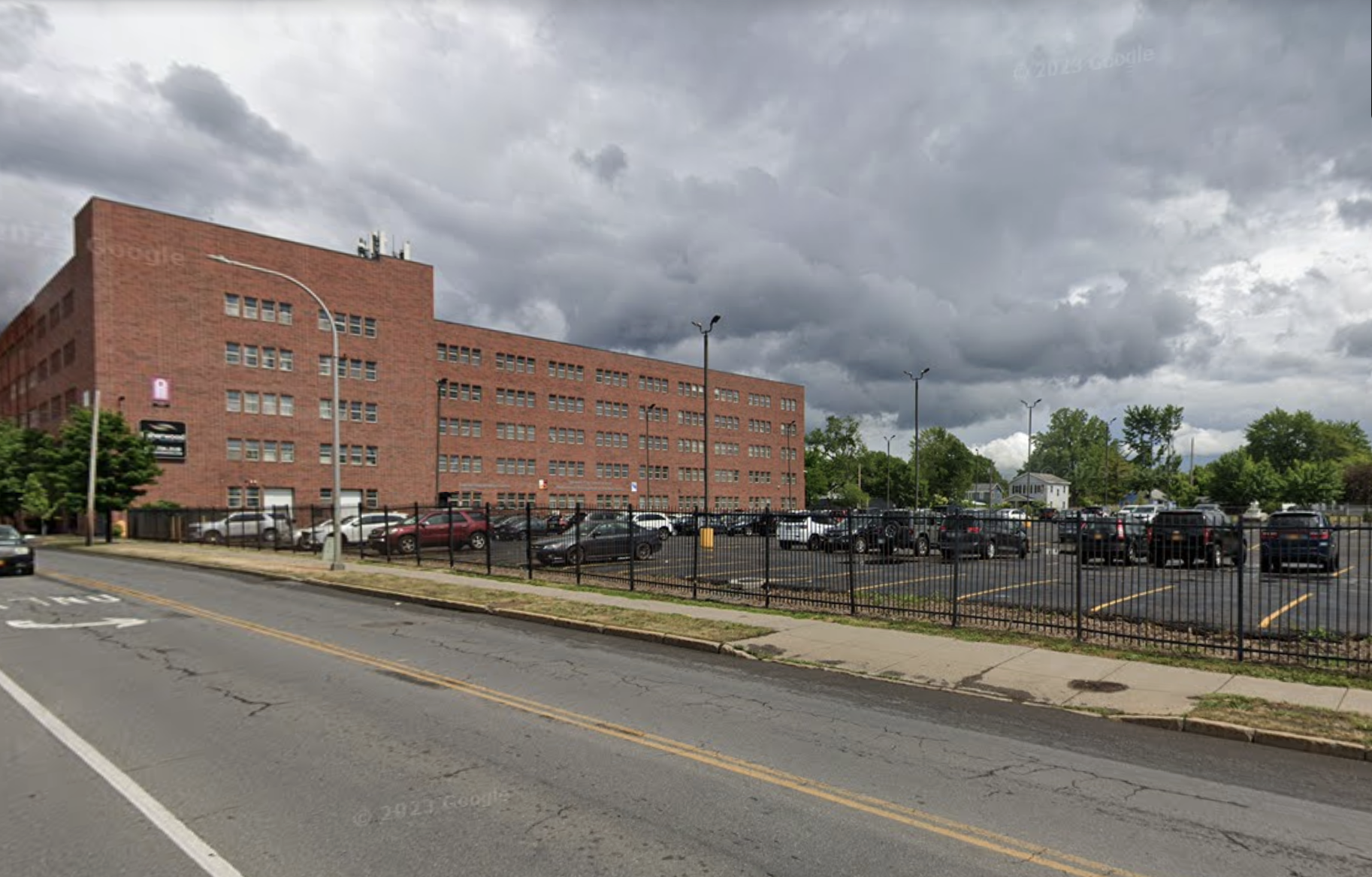
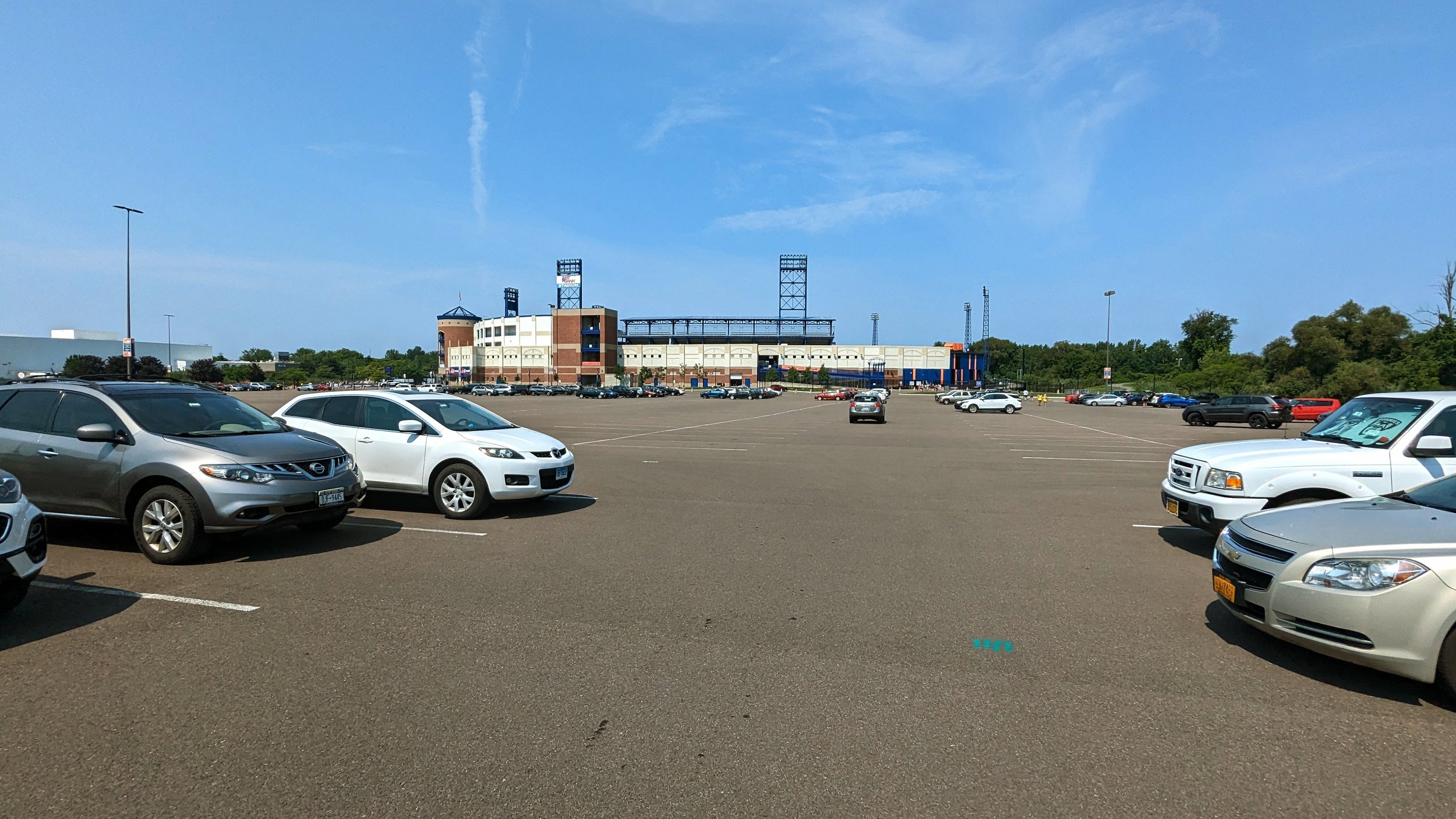
In 2020, Onondaga County renovated NBT Bank Stadium, including paving the large parking lot that separates the ballpark from its nearest neighbors. I have long advocated that the County should open up this land for redevelopment, which is now even less likely after this round of asphalt investment. While I will continue to advocate for these changes, a short-term improvement that can be made is the installation of pedestrian facilities through the parking lot. Currently, only one painted pedestrian path exists off the N 2nd St entrance. Building out a sidewalk network, mimicking city blocks, would be a step in defining future blocks for development while immediately improving walking access to the ballpark. 

While this series is focused on walking and improving access for those of us on foot, I do think it is important to call out the sheer lack of bicycle parking facilities. As a County park that is located in an urban neighborhood, there is no excuse for not providing bike corals and other secure bike parking facilities at multiple locations outside the ballpark. The City of Syracuse recently installed buffered bike lanes that lead directly into the ballpark from Grant Blvd, yet cyclists are left to chain their bikes up to lights in the parking lot or to gates surrounding the stadium. To better improve this accessibility, we need to offer people safe places to store their bikes, much as we provide excessive amounts of storage for cars.

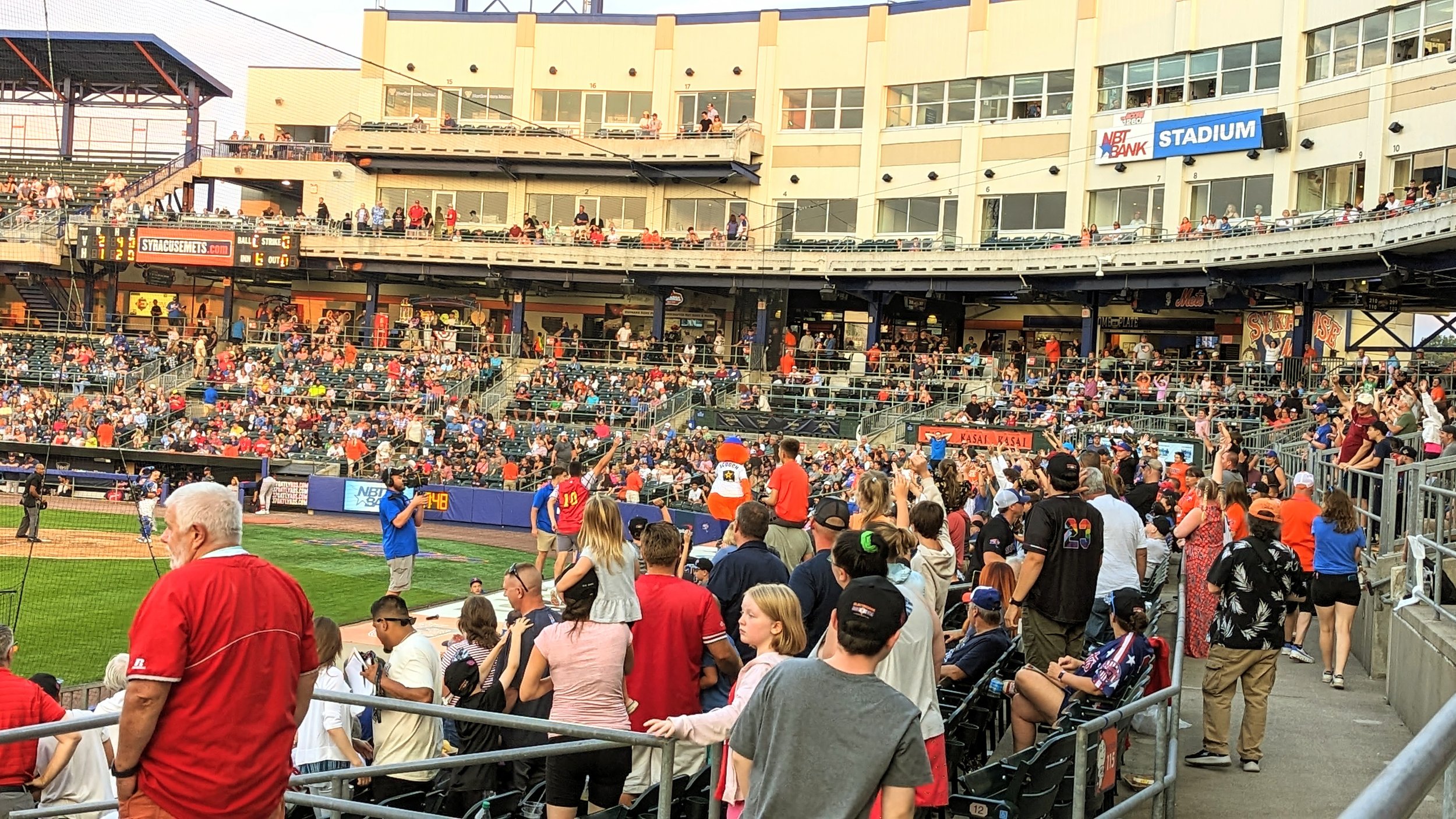
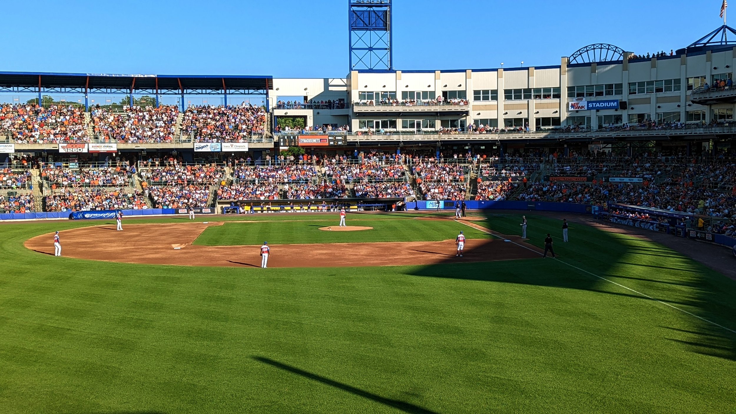
And as you make it across the final asphalt sea, you approach a true beautiful minor league ballpark. For all the faults of the location, and its lack of pedestrian access, the ballpark itself is a true gem for Syracuse. It is time for us to bring the ballpark into the City by bringing the City to it. Encourage fans to walk, bike, or take transit when possible. Give fans places to hang out before and after games that keep them in the neighborhood. And build up the neighborhood around the park and strengthen its connections to the team.

In Walkability, Urban Planning
Comment

The Walk: To Tipperary Hill

August 14, 2023

The Walk is a series of blog posts dedicated to documenting the current experience of walking between Downtown Syracuse and its surrounding neighborhoods. The purpose of these pieces is to highlight the importance of connections between neighborhoods. Small pockets of walkable spaces exist throughout the City, but there are large gaps between each. Building out safe, pleasant, and convenient routes between the City center and nearby neighborhoods is a great place to start.

Every July, St. Patrick’s Church holds its annual Irish Festival. Filled with music, food, and, of course, Irish beer, the festival is a great place to spend a few hours on a warm summer weekend. Who doesn’t love to hang out and have a few drinks with friends? And yet, many of us choose to drive to get there. During its busiest hours, cars line the neighborhood streets for blocks around the church. Should everyone who just spent a few hours drinking really get behind the wheel to head home? Ubers and Lyfts are options. The bus can be too, if you’re there during service hours. 

But why not walk? 

From Downtown Syracuse, the walk is just under two miles and nearly a straight line down W Fayette St. So, on a sunny Saturday afternoon, we took a walk.

The Downtown Walk

Fayette St through Downtown Syracuse is typically filled with activity. Bars and restaurants line the street from S Salina St west to West St. Wide sidewalks provide ample space to walk alongside outdoor dining setups. The Downtown Committee hangs flower pots from the pedestrian sized street lighting each summer, bringing color and nature to an urbanized space. 

When you walk down the street, the architecture that forms the street wall is built with pedestrian movements in mind. Large windows opening to first floor businesses, with three to four floors of residential or office spaces above, provide visual interest as you walk by. Generally speaking, Downtown streets are fairly narrow with pedestrian signals that line up with the traffic signals, ensuring safe crossings in the busiest pedestrian areas. At W Fayette St and Franklin St, people on foot are given a dedicated crossing time, stopping all cars to make crossing easier and safer. 

PXL_20230715_182656650.jpg
PXL_20230715_183018792.jpg
PXL_20230715_183226537.jpg
PXL_20230715_183229487.jpg
PXL_20230715_183240566.jpg
PXL_20230715_183309593.jpg
PXL_20230715_183423074.jpg
PXL_20230715_182656650.jpg PXL_20230715_183018792.jpg PXL_20230715_183226537.jpg PXL_20230715_183229487.jpg PXL_20230715_183240566.jpg PXL_20230715_183309593.jpg PXL_20230715_183423074.jpg

But the Downtown experience is limited. As I have mentioned in previous pieces, Downtown has been retrofitted for cars over the last several decades, with many parking lots surrounding the more walkable center. As you head westward, buildings fade away and car storage reigns supreme, before you encounter a mini highway that cuts straight through the heart of the City.

Crossing West Street

West St, which forms the western border of Downtown Syracuse, is a six lane roadway with on ramps to I-690 on its northern end. While the road is signed for 35 mph traffic, often cars travel upwards of 45 or 50 mph, speeding through at near highway level speeds. According to a 2015 article from the Post Standard, West St was originally built in the 1960s to form an “inner loop” highway, similar to the one recently filled in over in Rochester, NY. Over 100 buildings were demolished to make way for this overly wide roadway that was never ultimately completed as originally envisioned. So today, we are stuck with a high speed stretch of road that is unpleasant for all users.

In 2019, Wunderbar, one of the few queer bars in Syracuse, opened up in the former Redhouse Theater space. The bar is sandwiched between the north and southbound lanes of West St, placing it at an uncomfortable crossing point that has certainly prevented some bar hoppers from choosing to include it in their nights out.

So what makes this crossing so uncomfortable?

PXL_20230715_183508440.jpg
PXL_20230715_183514715.jpg
PXL_20230715_183529575.jpg
PXL_20230715_183619948.jpg
PXL_20230715_183634116.jpg
PXL_20230715_183714911.jpg
PXL_20230715_183752472.jpg
PXL_20230715_183508440.jpg PXL_20230715_183514715.jpg PXL_20230715_183529575.jpg PXL_20230715_183619948.jpg PXL_20230715_183634116.jpg PXL_20230715_183714911.jpg PXL_20230715_183752472.jpg

Car speeds are one of the biggest issues. From the south, cars come whipping around a corner under a railroad bridge. From the north, vehicles traveling at even higher speed coming off I-690 come racing up the depressed roadway from under Erie Blvd, trying to make the light, or rushing through shortly after it turns red. 

Some of these issues will be addressed in the upcoming I-81 viaduct project. West St will see its connection to I-690 adjusted, bringing cars to a stop at W Genesee St, two blocks north of W Fayette St, helping to slow down vehicles. This adjustment does little to address speedy vehicles from the south. Ultimately, reducing lanes, adding street trees, and narrowing the intersections would help reduce speeds further, but are currently not within the plans.

Screenshot 2023-08-08 at 4.26.15 PM.png
West Street suggestion'.png
Screenshot 2023-08-08 at 4.26.15 PM.png West Street suggestion'.png

Due to the existing features, and the lack of future improvements, few people choose to cross this intersection. Due to this lack of pedestrian activity, drivers are often not looking for people outside of vehicles, adding to the unsafe feeling for those who do look to cross. 

Once you’re across both legs of West St, vacant lots welcome you before you pass under a railroad bridge. Sidewalks are only available on the southern side of the street, but they are at least decently wide. Panhandlers do frequent this corner. There’s a larger conversation that must be had in terms of homelessness, panhandling, and drug use in our community. This piece is not the space to dig in at this time, but it is important to note that these complex issues impact all aspects of public life. As a primer for a broader conversation, I highly recommend a recent episode of the Ezra Klein Show podcast and a piece in the Atlantic by his guest, Jerusalem Demsas. For now, we continue our walk and consider the physical infrastructure we have in place.

W Fayette Street - West to Geddes

On the other side of the railroad bridge, the experience is a mixed bag. The Near Westside has an industrial legacy and, thanks to the Near Westside Initiative, many of the legacy warehouses and factories have been repurposed for the modern age. WCNY, the local PBS station, moved into the neighborhood over ten years ago. Artisan and light industrial businesses have also moved in. And some housing has been added. This neighborhood continues to experience concentrated poverty, and recently announced housing projects look to improve the quality of housing available, although it does not fully address the need for more mixed-income housing.

PXL_20230715_183923857.jpg
PXL_20230715_183937493.jpg
PXL_20230715_204513357.jpg
PXL_20230715_184003550.jpg
PXL_20230715_184400833.jpg
PXL_20230715_184507066.jpg
PXL_20230715_184604475.jpg
PXL_20230715_184612329.jpg
PXL_20230715_184629397.jpg
PXL_20230715_184844196.jpg
PXL_20230715_183923857.jpg PXL_20230715_183937493.jpg PXL_20230715_204513357.jpg PXL_20230715_184003550.jpg PXL_20230715_184400833.jpg PXL_20230715_184507066.jpg PXL_20230715_184604475.jpg PXL_20230715_184612329.jpg PXL_20230715_184629397.jpg PXL_20230715_184844196.jpg

When looking at the walking experience, the legacy architecture does help improve the interest level of the walk. Murals grace the face of several buildings, bringing a pop of color and visual interest as you walk. Even then, many of the buildings are currently underused. Some of this is due to a lack of demand, but that could be shifting as new investments come into the region. These older warehouses can easily become mixed-use centers, providing housing and maker spaces for hundreds of residents. The Gear Factory, further down W Fayette St, is a perfect example of this approach.There are also plenty of surface parking lots that we can redevelop into the mixed-use neighborhood scale buildings this neighborhood needs. 

While the buildings that line the southern side of the street do help with visual interest, the railyard and parking lot on the northern side of the street deaden the activity. Further west, the Lipe Art Park is an excellent start to bringing life and color to the space. What holds the art park back is a lack of connection to the neighborhood across the street. 

Screenshot 2023-08-08 at 4.21.54 PM.png
New Housing on Fayette.png
Screenshot 2023-08-08 at 4.21.54 PM.png New Housing on Fayette.png

Without any stop signs or traffic signals between West St and Geddes St, over 3,000 ft, cars often speed down the corridor, traveling far above the 30 mph posted speed limit. At the same time, the lack of sidewalks on the northern side signals that people are not welcome to cross, even if an artistic destination is located there. While some may be reluctant to slow vehicles down on a key commuting corridor, it is vital to creating a welcoming space for residents. If we see our legacy buildings as opportunities to provide housing for hundreds or thousands, then providing easy access to green spaces and artistic endeavors must be considered part of that. This may require adding traffic control devices in key locations, removing the center turn lane to reconfigure the space to include a shared use path or other infrastructure within the curb line, and slowing vehicles down to at least the posted speed limit, if not lower. 

We should also recognize that Erie Blvd W, which runs parallel to W Fayette St, could and should become more of a commuter corridor as the roadway is already overbuilt and underused. Moving commuting traffic to the north may allow W Fayette St to be humanized.

Crossing Geddes Street

Geddes St is the second concerning intersection along this trip. In 2021, the SMTC identified the intersection and corridor as a hotspot for fatal and serious injury crashes. When you make your way through the intersection, you begin to understand why.

As mentioned before, drivers on W Fayette St are often traveling far above the 30 mph speed limit, aiming to make the light before it turns red. Adding to this issue is the fact that most westbound traffic is turning left to head south down Geddes St. Left turns are the most dangerous movement in a vehicle, with many drivers looking for other cars but not looking for people on foot. Add to this the right turn lane for northbound traffic on Geddes St and the fairly wide crossing (roughly 70 ft), the end result is people on foot being exposed to drivers who are not looking for their presence.

Screenshot 2023-08-08 at 4.20.28 PM.png
Geddes Street narrowed.png
Screenshot 2023-08-08 at 4.20.28 PM.png Geddes Street narrowed.png

In 2020, the SMTC explored the option of reducing the number of travel lanes on Geddes St and repurposing space for a two-way shared-use path. This would help reduce the crossing distance and exposure to vehicles, while also improving access to cyclists. One thing this analysis does not fully take into account is the fact that drivers will find the path of least resistance or opt for new modes of travel. If you make the turns and connections to W Fayette St less ideal, many drivers will opt for new paths, including continuing northward onto Erie Blvd W. Reducing the amount of turns at this intersection would help people on foot by reducing the amount of conflicts they have with cars.

Luckily for us, walking on a Saturday meant lower than average car volumes and only two or three cars waiting to turn as we crossed. 

W Fayette Street - Under the Railroad

Once you’ve made it to the other side, you’re greeted by the Gear Factory, a true highlight in how to reuse older, legacy industrial buildings. While the building is seeing new life, the public space outside of it is in need of repair. While the City’s sidewalk program will likely improve the sidewalks in the coming years, the street lighting should be reconfigured to emphasize more human scale movements. Currently, the cobra style streetlights are closer to what you see on a highway instead of on a neighborhood commercial strip. Adding accessory lighting fixtures could help address this concern.

Soon, just to the west of the Gear Factory, the Syracuse Police Department (SPD) is eyeing another underused warehouse for a potential upcoming move. This move would not only help shore up a quickly deteriorating building, but also add activity and people to a block in need of them. Bringing public investment into this neighborhood could be the catalyst for other forms of development. Currently, the building the SPD is considering has a less than trustworthy sidewalk shed protecting people as they walk next to it. Unlike the sidewalk sheds in New York City, the ones used in Syracuse are short, narrow, and dark. They add a feeling of being constrained even while you’re out in public.

PXL_20230715_185008338.jpg
PXL_20230715_185056379.jpg
PXL_20230715_185159718.jpg
PXL_20230715_185306745.jpg
PXL_20230715_185314950.jpg
PXL_20230715_185344720.jpg
PXL_20230715_185008338.jpg PXL_20230715_185056379.jpg PXL_20230715_185159718.jpg PXL_20230715_185306745.jpg PXL_20230715_185314950.jpg PXL_20230715_185344720.jpg

These sidewalk sheds act almost as an extension of the dark, constrained feelings you experience when walking under the unused railroad bridges at their western end. While the previous SMTC study recommended adding lighting and signage beneath the bridge, the path is littered with trash and drug paraphernalia, which is likely to continue until the area is more well trafficked on foot. Another option is to remove the bridge entirely, opening up the space. While I would love to see the bridge repurposed for riding bikes and walking, it might make more financial sense to remove it and improve the street and sidewalks in its place.

This section of W Fayette St should be seen as the entrance to Tipperary Hill and Skunk City. Just a couple blocks away, as massive new development is taking shape. The former Syracuse Developmental Center is being redeveloped into roughly 500 housing units and a light industrial complex. We must be thinking of ways to improve these connections and encourage residents to walk and bike down this corridor. Adding light, widening sidewalks, and bringing public safety investments to the area are all good ways to start.

W Fayette St - Up to Tipp Hill

Once you’re under the railroad bridge, you’ve mostly made it to Tipperary Hill, just a few more blocks to get to most of the bars. And those blocks mostly lack quality sidewalks. Where sidewalks do exist, they’re broken up and overgrown. Again, many of these issues will be addressed through the City’s new municipal sidewalk program, but will not be addressed is how we treat these spaces. Often cars block the spaces where people are meant to walk, either in driveways or outside of bars. The presence of a new sidewalk could dissuade some of these drivers from storing their cars here, but that won’t last for long. Part of the issue is that we still promote people driving to bars in the first place, often by providing free car storage. 

PXL_20230715_185458217.jpg
PXL_20230715_185534784.jpg
PXL_20230715_185654779.jpg
PXL_20230715_185657760.jpg
PXL_20230715_185814865.jpg
PXL_20230715_185853136.jpg
PXL_20230715_185912017.jpg
PXL_20230715_185935096.jpg
PXL_20230715_185956429.jpg
PXL_20230715_185458217.jpg PXL_20230715_185534784.jpg PXL_20230715_185654779.jpg PXL_20230715_185657760.jpg PXL_20230715_185814865.jpg PXL_20230715_185853136.jpg PXL_20230715_185912017.jpg PXL_20230715_185935096.jpg PXL_20230715_185956429.jpg

As you make your way up the hill, you arrive at the newest Tip Hill bar, Emerald Cocktail, which is the first rooftop bar in the City. This bar is built in a much more urban style, with no car storage and large windows that open up onto the street. Its a welcome addition to the area and helps fill a gap along the route, providing one more interesting stop to encourage you to walk between. 

While the building and business are a welcome addition, the intersection it sits at is not ideal. The main issue here is a slip lane for westbound traffic to continue up Tompkins St. What is odd about this slip lane, and the way this intersection is set up, is that a small garden and seating area are positioned on the far side, across from the Ukrainian church, where no sidewalk exists. So we have pedestrian amenities placed where people are not encouraged to go. I would propose some changes to this area to make it more people friendly. The first major change is closing off the slip lane. Make cars slow down and perform a full turn at the light. This helps make their movements more predictable and easier for people to cross. Second, fill in that closed off slip lane by extending the garden. Make this a place people actually want to congregate. Encourage people to cross over to the church’s garden, where the Celtic cross stands. Give people a chance to sit outside in the shade as they walk through their neighborhood. 

Tompkins edited.png
Screenshot 2023-08-08 at 4.19.06 PM.png
Tompkins edited.png Screenshot 2023-08-08 at 4.19.06 PM.png

This intersection redesign would also help move people down towards Nibsy’s, but there’s need for improvements on that final block. Currently, N Wilbur Ave, between Tompkins St and Ulster St, is a one-way street heading south. While the street is narrow (around 23 ft), it can be narrowed further. If you remove on-street parking, with most homes having off-street space or the ability to store their car in the open lot down the block, you gain more than enough space to fit a full sidewalk down the block.

Speaking of that open lot, the space needs definition and shade. You would be forgiven if you were unsure where the street begins and the empty lot ends. No sidewalks help distinguish this expanse of asphalt from the street, and no formalized entrance points. While I personally would like to see this space developed into housing, along with the wide open field across W Fayette St, we should first start by defining the space. Add sidewalks and line it with shade trees. Then, in the future as housing demand increases, the space is primed for redevelopment into a higher use. But until that time, providing a shaded path across this open space will help to improve walkability for all.

Screenshot 2023-08-13 at 7.37.44 PM.png
Gravel lot improved.png
Screenshot 2023-08-13 at 7.37.44 PM.png Gravel lot improved.png

And, at the end of this lot, we finally reach St. Patrick’s Church. 

This trip, right around 2 miles in length, and about 40 minutes, takes you through very different built environments with varying levels of success in terms of accessibility on foot. There’s a lot to work with, in terms of repurposing our legacy buildings, slowing traffic, and adding shade, but there are good bones to work from. One of the keys is realizing that we must design spaces for the uses we desire, not for what is there currently. A prime connective corridor like W Fayette St should be oriented towards people on foot, while Erie Blvd W, where the Erie Canal used to run, was never meant for people. Finding ways to shift car trips to that corridor, and reimagining a neighborhood corridor is a good place to start.

In Walkability, Syracuse
1 Comment

The Arts and Crafts Festival in Downtown Syracuse gives the streets over to people on foot and provides a purpose to our walks.

The Walk

July 31, 2023

Walkability is one of those terms that continually comes up in planning and development circles. Real estate websites champion the Walk Scores of different apartments and houses. Comprehensive plans highlight the desire of younger generations to live in walkable neighborhoods. But what does walkability mean?

In one of my earlier pieces on the holiday season, I highlighted the work of Jeff Speck, author of Walkable City: How Downtown Can Save America, One Step at a Time, who identifies four keys to making a city walkable:

  1. Provide a proper reason to walk

  2. Make the walk feel safe

  3. Make the walk comfortable

  4. Create an interesting walk

When we look across the City of Syracuse, we find islands of walkability; James St in Eastwood, Grant Blvd and N Salina St on the Northside, Westcott St on the Eastside. The prime example of this is Downtown Syracuse. As the central hub of the region, the neighborhood has a Walk Score of 93, achieving the title of “Walker’s Paradise.” While this is evident to anyone who spends time downtown, walking to and from Downtown to nearby neighborhoods is a different story.

Railroad bridges, highway overpasses, and overbuilt stroads (a term coined by Strong Towns to describe a thoroughfare that attempts to serve the purpose of a road and street while failing to do both) surround Downtown, cutting it off from close in neighborhoods. Poor sidewalk quality, underused lots, car storage, and wide intersections continue to break up what should be an easy walk. 

I-81 overpass on Water St.jpeg
Railroad Bridge on W Fayette.jpeg
Under I-81.jpeg
I-81 overpass on Water St.jpeg Railroad Bridge on W Fayette.jpeg Under I-81.jpeg

Most people, if given the right conditions, would be happy to go for a two-mile walk, roughly30 to 45 minutes. In larger cities, due to their interesting environments, frequent shops and restaurants, and quality pedestrian infrastructure, a two-mile walk goes by without thinking. When you walk under highways and next to parking lots, two-miles can seem like a never ending distance. Walking has also been continually associated with good health, mindfulness, and connection with your surroundings, as noted in a recent New York Times opinion piece. Nick Offerman, of Parks and Recreation, has even highlighted its personal values to him in a recent podcast episode and in his latest book.

For Downtown Syracuse to continue to grow and for the central, nearby neighborhoods to begin to thrive, improving these connections is vital. To demonstrate this, we’ll take a look at walks to key destinations within two-miles of Clinton Square in Downtown Syracuse. We will look at what the City is doing right, where improvements can be made, and envision some potential futures these corridors may have in store. As Syracuse looks to add density and improve our housing stock, these central neighborhoods will become increasingly important.

If we can improve connections within two-miles of our City’s center, we can rethink how these inner neighborhoods function and how they connect to one another. Gone will be the need for car storage, as people will easily be able to walk or bike to most of their daily needs. Most trips in America, especially beyond our commutes to work, are already under 3 miles. If we can make those miles attractive and pleasant to walk, people of all ages gain the freedom to explore their communities and understand neighboring ones in ways they don’t quite get to from a windshield perspective.

Inner Harbor.jpeg
N Salina St.jpeg
Near Westside.jpeg
Inner Harbor.jpeg N Salina St.jpeg Near Westside.jpeg

This will be an ongoing project to document these walks. And we begin with the walk:

  • To Tipperary Hill

  • To the Ballpark

  • To Middle Ages (coming soon)

  • To Syracuse Stage (coming soon)

In Walkability Tags The Walk
Comment

Lessons from the North

June 21, 2023

One of the most common phrases I hear about why we can’t make Syracuse a more pedestrian and bike friendly city is the concern about winter. “It's too cold for people to be outside on a bike or to walk.” “What about the snow?” “Plows will struggle if you do that.” “People are only outside for 3 months out of the year.”

I’d like to report that all of these concerns are overblown, if not just a straight up lie. Yes, cold weather and snow pose challenges to all infrastructure, but we have far fewer bad days than people like to admit. It doesn’t snow every single day for six months straight. Very few days are so cold you hide away inside all day. I’ve written about different ideas for how we can embrace winter in the past (here, here, here, and here). But Syracuse is not the only northern city in the US, and there is much we can learn from some. 

In May, I was finally able to take a trip to Minneapolis, a city that has become increasingly prevalent in urban planning circles, especially in terms of bike infrastructure. Even on a brief trip, there was a lot to learn just from walking the streets.

Space for Bikes

“People won’t bike when it's cold,” Well, someone should tell the residents of Minneapolis that fact. The city gets far colder than Syracuse during the winter, yet has 8 times the share of people riding bikes to work (4% vs 0.5% in 2019). If you factor in other types of trips (daily errands, visiting friends, recreational), bike riding numbers would go even higher. It's not the cold that keeps people from biking, it's the lack of safe infrastructure that is maintained throughout the year.

In 2018, Minneapolis was ranked as the 4th best bike city in America by Bicycle Magazine. While the article criticizes the city for its past focus on recreational trails while forgetting about the day-to-day needs of cyclists in its urban spaces, it notes that in 2016 the city implemented a new complete streets policy. All road reconstruction projects now must prioritize walking, cycling, transit, and cars, in that order. This is the same approach several European countries take, which has resulted in far higher rates of bike ridership and transit usage than what is found in the US.

View fullsize Raised bike lane
Raised bike lane
View fullsize Raised bike lane
Raised bike lane
View fullsize Pocket turn
Pocket turn
View fullsize Shared use path
Shared use path

As of 2023, Minneapolis has over 100 miles of off-road trails and bikeways, 98 miles of bike lanes, and 16 miles of protected on-street lanes. These facilities aren’t just available during the summer months, but are kept care of throughout the year. In fact, many residents have noticed the protected lanes and trails being cleared before the roads. One of the reasons for this - no parked cars getting in the way.

As you walk around the city, you find the desire to provide truly separate facilities for bikes. Raised bike lanes can be found throughout Downtown Minneapolis, and off-street trails and shared use paths spread out across the city. This is by design. Off-road shared-use paths are the preferred infrastructure throughout the city, while raised lanes are opted for wherever there is not room for a shared-use path, or it is deemed undesirable. When bikes and cars do mix at intersections, clear markings help guide people on bikes in designated spaces, including pocket turn lanes. These turn lanes help riders wait to turn in a safe, protected space away from traffic.

The Martin Olav Sabo Bridge

Even further separation occurs when you look to cross busier roadways. The Martin Olav Sabo Bridge was the first cable-stayed bridge in Minnesota and it is dedicated solely to people on bikes and on foot. While it might be the most impressive shared-use bridge I saw, it was not the only one. Bridges cross roadways and waterways throughout the city, allowing you to travel with limited interaction with cars often. 

While Syracuse is making progress on some of these fronts, its network is still inconsistent and very few facilities truly separate riders from traffic. The closest experience to these paths and trails in the Syracuse area are the Creekwalk and the Loop the Lake trail. While we are working to improve connections to these trails to make them easier to use for commuting instead of just recreational purposes, key connection points often remain stubbornly blocked during the summer months due to festivals and concerts. Until we prioritize these connections, like Minneapolis has, commuting by bike will remain a less desirable and less safe alternative.

View fullsize Bike locker at light rail station
Bike locker at light rail station
View fullsize Bike parking outside Target Field
Bike parking outside Target Field

One thing Syracuse has not made a lot of progress on is providing secure bike parking facilities. In Minneapolis, bike parking in the commercial centers is seemingly everywhere. Just look outside Target Field, where the Minnesota Twins play, and you’ll find dozens and dozens of bikes locked up by fans during the game. Meanwhile, NBT Bank Stadium, home of the Syracuse Mets, currently suffers from a lack of bike racks, or really any easy connections for individuals outside a car. Not only does Minneapolis have a plethora of  traditional staple racks, but bike lockers can be found in many key locations. These lockers are found throughout Downtown Minneapolis and at most light rail stations in the region. For less than $50 a year, residents can use the lockers as they need, creating a seamless and safe transition between riding a bike and transit. Bike parking is often overlooked in our transportation systems, while we obsess over storage for our cars. To get people on their bikes, they need to feel safe about where they leave them at the end of their rides.

Building for Transit

Beyond riding bikes and walking, transit access in Minneapolis can teach us quite a bit. While Minneapolis is denser than Syracuse at this time (7,962 people/square mile vs 5,930 people/square mile), much of our street networks were built out around the same time when both cities had higher populations and higher densities. One difference between the cities is that Minneapolis refocused itself around transit access long before Syracuse has started to do the same.

View fullsize Nicollet Mall
Nicollet Mall
View fullsize Bus shelter on the Nicollet Mall
Bus shelter on the Nicollet Mall

In the 1960s, Minneapolis opened the country’s first transitway, Nicollet Mall, which closed the street to private vehicles while opening it to high quality transit and pedestrian space. The mall was most recently renovated in 2017 to provide more space for people and added greenery and updated lighting, making it a more pleasant experience. Along the transitway, and at many bus facilities across the city, large shelters are provided with detailed digital countdown boards, so it's easy to tell when to expect the bus you need.

Syracuse is getting its first bus rapid transit (BRT) lines in the coming years, and would do well to learn from the Nicollet Mall. Prioritize people and buses. Exclude cars when necessary. Provide up to date information to people as they wait. Provide ample space for people to wait to better ensure comfort.

Being a larger city than Syracuse, Minneapolis has also made key investments in light rail, which first came into service in 2001. What makes the Minneapolis light rail, known as the Metro Blue and Green lines, different from other rail transit networks I have ridden on across the US, is its focus on connecting population centers. Unlike Denver’s rail lines, which were pushed to the edges of communities and are surrounded by parking lots, Minneapolis has instituted transit oriented development (TOD) and transit improvement zones within a half mile of all stations. These policies promote denser development patterns with less space for car storage. The city has also secured grants in recent years to study potential improvements surrounding stations and identify funding opportunities for developers to help promote denser development patterns.

Metro Blue Line running through Downtown Minneapolis.

Syracuse is looking to implement some forms of transit oriented development through ReZone Syracuse, but many of those policies are tied to the implementation of BRT. Developers need to know where BRT stations will be as the immediate blocks will be the focus of TOD style projects. Concentrating development on top of high quality transit lines, along with reducing and adequately pricing car storage, will help promote this more sustainable growth pattern.

On a brief side note about dense development and access, the stadiums for Minneapolis’ major league teams are all integrated into the fabric of the city. Each one is accessible via transit (rail and bus), the bike network, and pedestrian infrastructure (both sidewalks and skyways). Most of the stadiums are surrounded by their neighborhoods, with bars and restaurants, apartments and offices all within a short walking distance. This may not be the most important piece of infrastructure in a city, but emphasizing these connections instead of sitting in a sea of car storage helps integrate the team and its fans into the community. I’ve continually advocated for Syracuse to do the same.

Target Field

Public Spaces in All Seasons

While density, along with proper transportation infrastructure, is key to a thriving city, providing excellent public spaces helps the residents get out of their homes and connect with one another. This is not just about being outside in summer months, but providing spaces for year round use.

One way that Minneapolis has addressed this need is through their extensive network of skyways. In fact it is the world’s largest network of interconnected pedestrian bridges. First opening in 1962, the skyways have over 80 blocks through Downtown Minneapolis, allowing people to walk through dozens of buildings and past interior shopping and dining options without stepping foot outside. During the Minnesota winters, having a heated pathway through the city can be vital.

View fullsize Skyway bridges
Skyway bridges
View fullsize Skyway map
Skyway map

But I bring up the skyways not as a, “we should 100% build this in Syracuse,” type of idea. While the skyways help shield people from harsh weather, they also dampen street life, which is something the city has been concerned about since the very beginning. Instead, I see this as an idea that can be improved upon. Being able to experience the heart of the city without needing to bundle up every time you need to go somewhere is an enjoyable experience, but it needs to be grounded back to the street. The existing skyways in Minneapolis do not always have obvious entrances and exits. Often you feel like you are intruding on someone else’s space, which in some ways you are. And the bridges can be closed at the will of the building owners, potentially blocking key routes when you need them most. 

Syracuse’s only two skyways currently connect offices to parking garages. This is an extremely limited use and does nothing to truly benefit the city. If northern cities want to embrace skyways as a way to improve mobility during the winter months, they must be publicly controlled and clearly marked. Dedicated entrances that open onto the sidewalk, and ideally lead directly to destinations throughout the downtown core. 

Another option, which I’ve discussed in a previous piece, is utilizing STOA, or covered walkways. These are most famously found in older Italian and Spanish cities to help shade residents from the sun, but could easily be repurposed to cover us from rain and snow. While there’s no heating in these structures, blocking some of the elements that make walking uncomfortable while keeping us on street level might be enough to convince some to venture out during poor weather.

Rooftop bar at the Brit (photo by Tyler Henderson)

A more tried and true place to gather is the local pub. While Syracuse has finally opened its first rooftop bar, Minneapolis has many. People often shoot down the idea of a rooftop bar because of the colder winter months, yet most of the year we experience pleasant weather, even during the winter. One rooftop bar in Minneapolis, at the Brit, features an entire bowling green, acting as a second story lawn for playing games. We might not need something quite as large as this space, but recognizing that we deserve rooftop access in our downtown core is not up for debate.

Public Art

The final piece I will touch on in this piece is the importance of public art. Syracuse has been making strides towards improving the quality and number of public art pieces across the city, but we have a ways to go before we begin to match Minneapolis. Just outside Downtown Minneapolis sits a world famous sculpture garden that was busy even on a dreary day. The sculptures are larger than life, and a few were even interactive.

View fullsize IMG_20230515_211723.jpg
View fullsize PXL_20230513_004255374.jpg
View fullsize PXL_20230513_155633003.jpg
View fullsize PXL_20230514_164659871.jpg

Even on the walk to the garden, and throughout the city, you stumble upon large scale murals highlighting famous residents or landscapes. These pieces are seen as preserving the history of the city and highlighting what they are proud of. Syracuse has begun down this path more vigorously in recent years, with new murals going up in each neighborhood. We should continue this process and encourage even more.

The big takeaway from this experience is that many of the things Minneapolis has achieved in terms of public infrastructure are not that far out of reach for cities like Syracuse. If anything, they are a model for what we can achieve in colder climates. We may not have the financial strength or cache of a larger city, yet, but we can prioritize investments that make some of these goals more achievable.

View fullsize PXL_20230513_024932244.jpg
View fullsize PXL_20230513_130440966.jpg
In Transportation, Urban Planning, Walkability
Comment

We Need a Housing Compact

May 10, 2023

New York State, along with states around the country, is suffering from a housing crisis. When most people hear this, they immediately think of the high housing costs in New York City and the surrounding areas, where rents are well over $3,000 per month, home ownership is out of reach for many, and recent reports indicate roughly half of residents can not comfortably afford their current living arrangements. But this should not overshadow the very real housing crises experienced across Upstate New York as well. Highly restrictive zoning policies have segregated our communities, both racially and economically. High levels of abandoned properties and disinvestment have left large portions of our housing stock in poor conditions, increasing the demand and costs for the quality housing that remains. These are issues that must be addressed and we must admit that our current land use and zoning structures have failed to do so. This is why I support Governor Hochul’s Housing Compact, which was regrettably removed from the State’s 2023-2024 budget.

Before we jump into why I believe the Compact is needed, and what we might do to improve upon it, I think its important to first run through what it is.

The aim of the Housing Compact is to build at least 800,000 housing units over the next ten years. This is in response to the State creating over 1.2 million jobs this past decade, but only building 400,000 units of housing. As we all learn in high school economics classes, when demand rises but the supply does not meet that demand, prices go up. Simply put, all localities would be required to build a certain amount of housing every three years - 1 percent growth Upstate and 3 percent growth Downstate. So if you’re in a small village with only 300 units of housing currently, you would need to allow for at least 3 housing units to be built. For the City of Syracuse, the target would be roughly 680 units.

View fullsize Darlington Rd.jpeg
View fullsize Solvay homes.jpeg

If a municipality does not meet their targets, they can get credit for updating their zoning to allow denser housing development. If a municipality continues to miss their targets, or does not put in effort to make it easier to build, the State would be allowed to override the local zoning and approve projects.

Additionally, the State would emphasize transit oriented development (TOD) near all train stations operated by the Metropolitan Transportation Authority (MTA). TOD would allow for more residents to live car free with easy access to high quality transit in our State’s primary economic center. While this doesn’t apply Upstate, cities and regions should be taking similar approaches around stations with frequent service.

As you can imagine, and as you have probably heard, many people are not happy with the idea of the State overriding their local zoning laws. They’ll bring up discussions of “community character,” “local control,” or “concerns of overcrowded schools.” What it truly boils down to is concerns over home values and who lives in their community. 

Elected leaders in the State legislature proposed utilizing incentives to encourage housing construction instead of penalizing localities. On its face, this seems like a fair compromise, but it would only lead to further segregation. Wealthy communities do not need financial incentives and will decide against adding housing, while cash strapped municipalities, primarily cities and older inner ring suburbs, will forge ahead with housing plans. While the financial incentives will help those communities, the wealthy communities will continue to shrug off their responsibilities to their regions. 

Overall, the Compact would go a long way towards addressing the housing crises impacting our communities. Creating more housing where it is desperately needed. Providing housing opportunities in all communities to allow for greater access to resources. Improving our rapidly deteriorating housing stock Upstate. But I believe there are a few things we can do to improve upon it.

Starting Downstate, and really anywhere that touches MTA infrastructure. Currently large parking lots and garages surround many of the suburban MetroNorth and Long Island Rail Road (LIRR) stations. This is land that is owned by the State and its time for the State to get back into the business of building housing in a big way. Each of these lots is a prime opportunity for affordable housing and related public services. Providing subsidized parking to commuters should not come at the expense of pushing housing further away from quality transit.

View fullsize Screenshot 2023-05-09 at 6.25.10 AM.png
View fullsize Screenshot 2023-05-09 at 6.26.13 AM.png
View fullsize Screenshot 2023-05-09 at 6.27.00 AM.png
View fullsize Screenshot 2023-05-09 at 6.28.13 AM.png

These policies can and should be emulated across the State as other transit agencies introduce bus rapid transit (BRT) or have rail infrastructure of their own. Publicly owned lots and garages should be targeted for housing construction whenever possible.

Moving to statewide policies, we should follow the lead of California and band single family zoning statewide. California’s Senate Bill 9 allows for up to four units of housing to be built on every residential lot across the state. While I believe we should follow this same policy, even allowing two-family homes on every lot would mark a dramatic improvement. This goes far beyond just allowing for auxiliary dwelling units (ADUs), essentially a granny flat, on properties. While building ADUs should be allowed, building multi-family housing is far less expensive per unit and more flexible than a single family homes with an ADU. This can be simplified in even further by following creating a set of housing designs that are universally approved across the State, allowing for builders to streamline their approval processes. Spokane, Washington has moved forward with a similar set of policies hoping to encourage faster adoption of denser housing models and cut down on bureaucratic costs, both in time and money.

Additionally, the State should look for ways to promote flexibility in zoning. Storefronts in residential neighborhoods, corner shops, neighborhood bars and restaurants, all used to be common features of residential neighborhoods - even those primarily made up of single family homes. Creating a statewide policy that allows certain commercial or office uses to develop in these neighborhoods would help provide local amenities, reduce car trips, and reduce the barrier of entry for entrepreneurs.

View fullsize E Genesee St.jpeg
View fullsize Multi Family Grant Blvd.jpeg

Related to each of these points, the State must promote infill development over further expansion. There is a fear that pushing municipalities to provide more housing will push encourage the redevelopment of rural land into subdivisions, or see the removal of our precious forested lands. These are areas we must preserve. One option is dictating that large portions of the development in metropolitan regions must occur in urbanized areas, as defined by the US Census Bureau, until certain density thresholds are met. By emphasizing infill development and increasing density, transit, walkability and safe cycling infrastructure can be invested in. Once a density threshold is met, new boundaries can be discussed based on the next three year housing target. This would function similarly to Portland, Oregon’s urban growth boundary, but with defined triggers to when the boundary is allowed to grow. I’ve already explored where housing in the Syracuse area should be targeted in my Growth in CNY series. 

These policy ideas will not address all of the issues facing us, but they can go a long way towards increasing our housing stock, improving the living conditions across the State, reducing our greenhouse gas emissions through denser development, and promoting more integrated communities through removing local barriers. I know communities do not like losing power, but these same communities have chosen to build barriers over the last 70 years instead of bridges. New York State is struggling to stay competitive and its single biggest obstacle is providing affordable, quality housing. Its time we make this a priority and ensure every community is doing its part.

In Housing, Urban Planning
Comment
← Newer Posts Older Posts →

Recent posts

Featured
PXL_20241010_211844719.jpg
Jan 30, 2026
Let's Do Good
Jan 30, 2026
Read More →
Jan 30, 2026
PXL_20250830_182821521.jpg
Sep 15, 2025
Urbanism Lessons from the Great White North
Sep 15, 2025
Read More →
Sep 15, 2025
Carousel.jpg
May 27, 2025
Destiny USA and the City
May 27, 2025
Read More →
May 27, 2025
PXL_20240805_141743149.jpg
Jan 1, 2025
All Cities Are Beautiful
Jan 1, 2025
Read More →
Jan 1, 2025
PXL_20241005_135224129.jpg
Nov 6, 2024
A Healthy Future for the Regional Market
Nov 6, 2024
Read More →
Nov 6, 2024
PXL_20240728_191254239.jpg
Jul 31, 2024
Renters Matter, Too
Jul 31, 2024
Read More →
Jul 31, 2024
Vista view.jpeg
Mar 21, 2024
The Valley of the Sun - A Land of (Sub)Urban Extremes
Mar 21, 2024
Read More →
Mar 21, 2024
Manlius Cinema.jpeg
Jan 31, 2024
The Movie Theater at the Urban Core
Jan 31, 2024
Read More →
Jan 31, 2024
Clinton Square Christmas Tree at night.jpeg
Nov 30, 2023
The Case for a Holiday Village
Nov 30, 2023
Read More →
Nov 30, 2023
PXL_20230817_220739294.jpg
Oct 31, 2023
The Walk: To Middle Ages
Oct 31, 2023
Read More →
Oct 31, 2023
Ballpark.jpeg
Sep 7, 2023
The Walk: To the Ballpark
Sep 7, 2023
Read More →
Sep 7, 2023
PXL_20230813_213112525.jpg
Aug 14, 2023
The Walk: To Tipperary Hill
Aug 14, 2023
Read More →
Aug 14, 2023

Powered by Squarespace