• Blog
  • Blog Index
  • Video Work
  • About
Menu

Thomas Bardenett

Urban Planning - Writer - Filmmaker
  • Blog
  • Blog Index
  • Video Work
  • About

Bus Rapid Transit: A Response

April 13, 2023

Public transit is at a precarious moment in time with ridership still significantly below pre-pandemic levels, a significant driver shortage, and the approaching depletion of federal funds meant to shore up operating budgets. While some newspapers are looking for answers to how transit agencies might approach solving these issues (funding more frequent service, reducing fares, reforming construction procedures), others, including my hometown paper, have chosen to openly question one of the first significant investments in transit in my lifetime.

On April 6, 2023, the largest news outlet in Syracuse published an article titled, “Centro has millions of dollars and a new idea. Will anyone ride it?” The article aims to inform readers of the upcoming implementation of bus rapid transit (BRT) but instead frames the investment as a boondoggle that is unlikely to attract riders and does not provide service to the areas that truly need it. Well, as you can imagine, it sparked a lot of conversation amongst advocates and planners who see BRT for what it truly is: a major step in the right direction. So let us look at some of the issues raised in the report, what they got wrong, what they oversimplified, and how we should be looking at this investment.

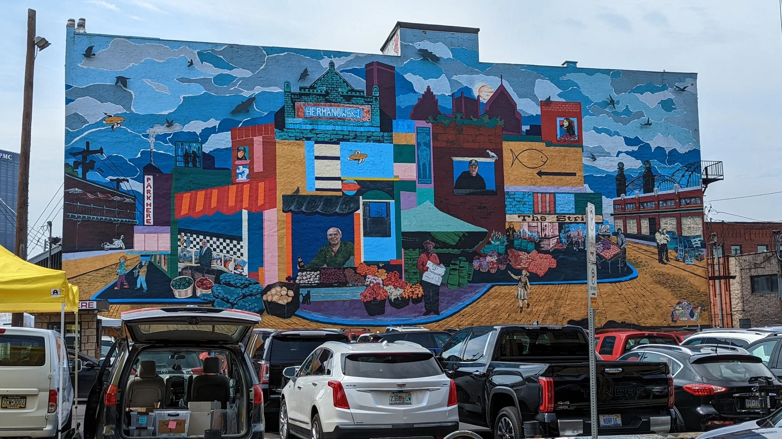
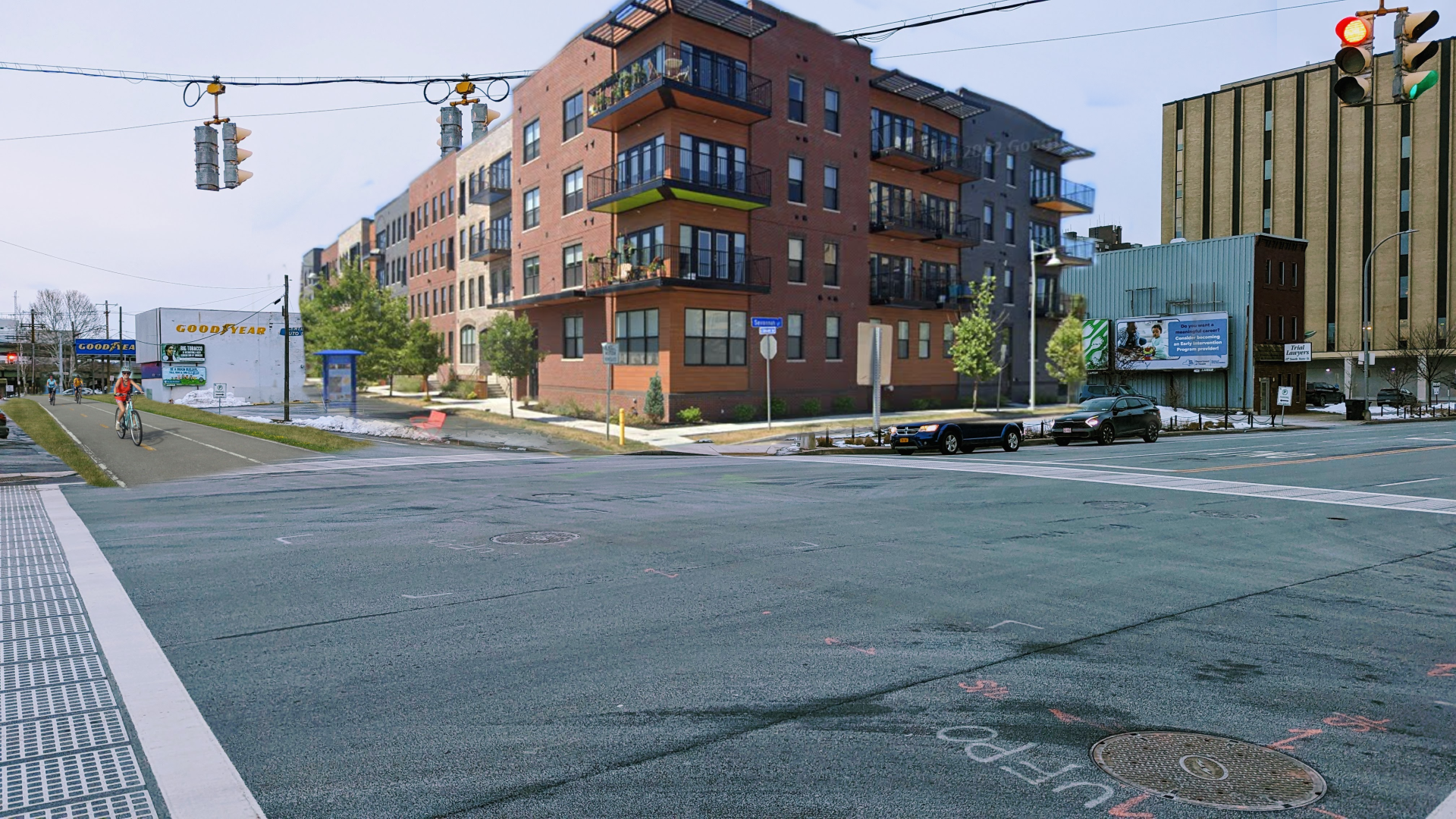
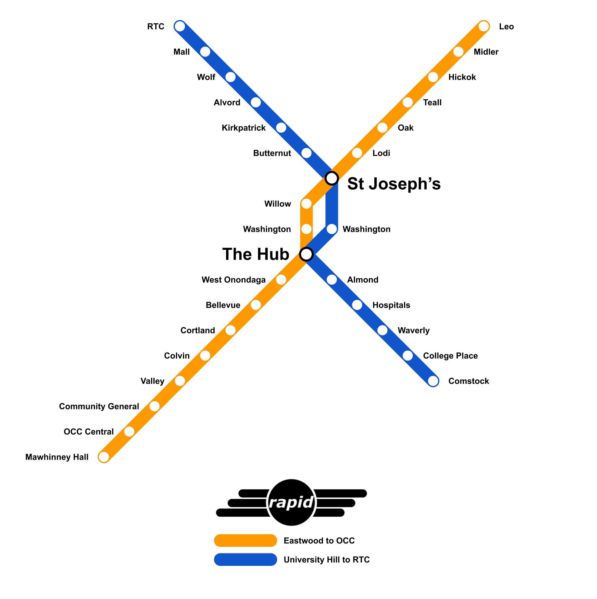
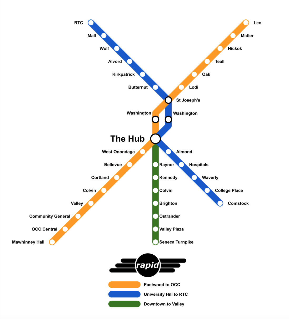
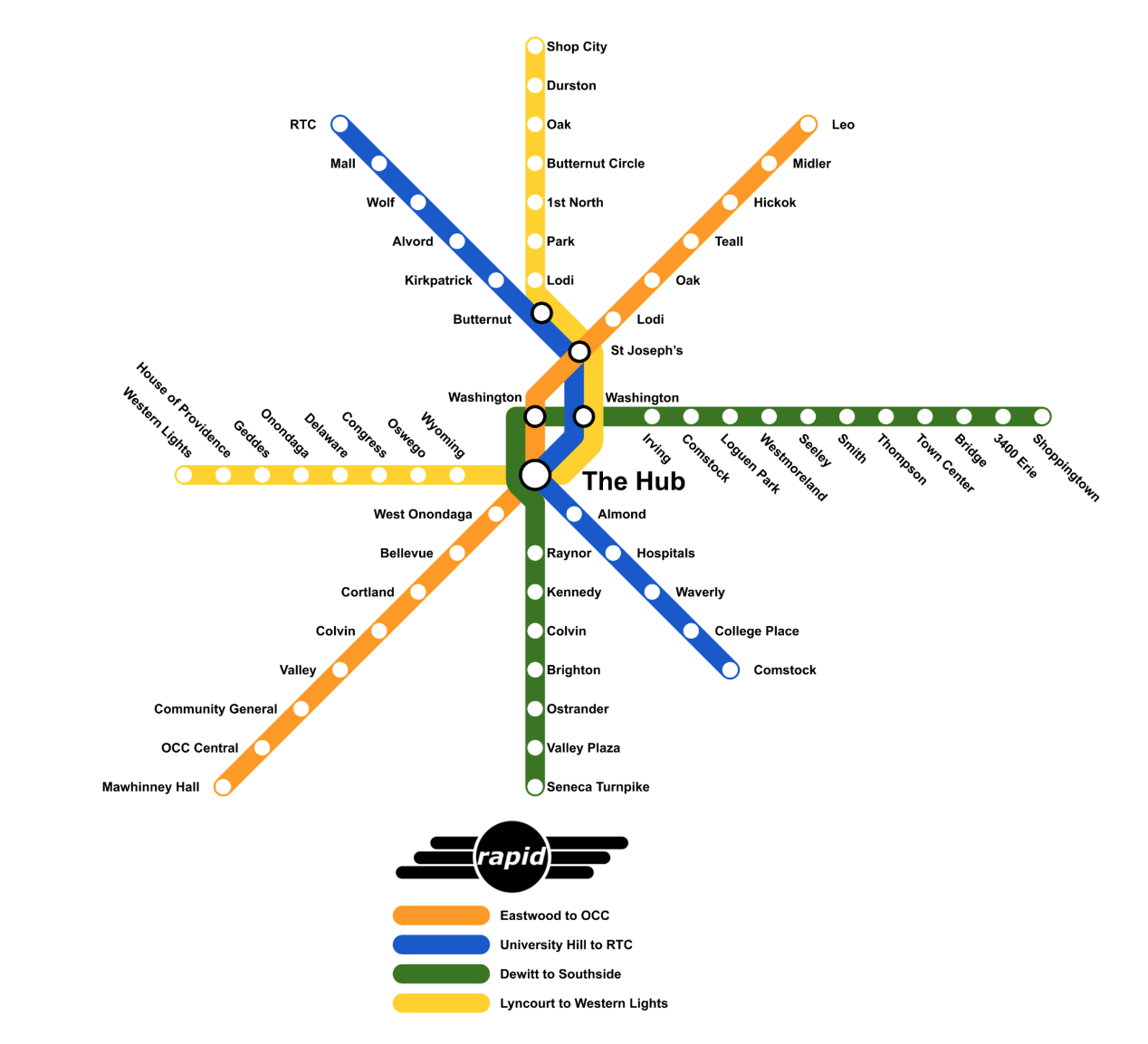
First, let’s begin with a key fact that the report chose to omit - the BRT plan currently moving forward is based on an extensive study completed by the SMTC in 2018 (SMART 1). This is not a new scheme, but instead a thoroughly researched plan based on best practices seen in cities across the world, including in nearby cities such as Albany and Cleveland. The plan identified the two routes, which form an X across the city due to the high demand of ridership already seen along those corridors. They connect the three largest employment centers within the region (Downtown Syracuse, Destiny USA, and University Hill), some of the densest neighborhoods in the city, along with four large college campuses (Syracuse University, SUNY ESF, SUNY Upstate, SUNY OCC) and a fifth satellite campus (SUNY Oswego’s metro campus in Downtown Syracuse). As the vast majority of City residents commute within the City, not just for work but for their daily needs, improving access to these key destinations is vital. BRT will become the backbone of the transit system.

View fullsize  Many bus stops in Syracuse currently lack shelters, sidewalks, or even a flat piece of ground to wait.
View fullsize  Walking conditions along bus routes vary, with some in unpleasant areas beneath highway overpasses. BRT stations must be located in key, centralized areas to promote easy acces.

Now the article does bring up the valid concern of individuals who must reach far flung suburban jobs or medical appointments. Over the past 70 years, Onondaga County has promoted suburban sprawl through zoning and land use policies that have resulted in a decentralization of services and jobs. Shopping centers, office parks, and medical campuses now sit on the fringes of our county, making themselves difficult to reach for anyone who does not own a car. This form of development also makes transit difficult as every mile added to a route means the frequency of that service will decline. This is why many routes in our region are lucky if they have a bus more than once an hour. Spreading service thin to serve a handful of individuals or workplaces is not a sustainable model for mass transit. This has led to difficult decisions in the past. In 2017, the Town of DeWitt built a new public library, moving away from its long time location in Shoppingtown Mall as that property was slowly abandoned all together. The library’s new location is roughly a mile away from an existing bus route. Instead of the Town working with Centro to identify a location along existing routes, the library was built and then service was demanded. Centro, understanding that this additional mile would throw off the rest of that route’s service, made the difficult decision not to serve the library. This same story could be written for many employers who choose to be located in suburban communities but rely on workers from the City who in turn rely on Centro. 

Riders are right to voice their frustration with old routes that no longer make sense, or routes that result in longer trips than needed. Central Current, a start-up news outlet, wrote a tremendous series on rider experiences that reflect these issues, but also showcase what the service means to them. There are models of service that can help fill these gaps experienced by a more suburban oriented growth pattern. The individuals quoted in the article who provide van and shuttle services to specific employment centers are following more realistic models for how to serve these locations. Sending a 40 or 60 ft bus to carry one or two people just does not work. This is why Centro is also exploring the use of vans for on-call services in more suburban locations, something mentioned in passing in the article but given no explanation. LA Metro, RTS in Rochester, and CDTA in Albany have all begun experimenting with similar services to supplement their fixed route systems. Riders can either travel door to door within specific zones, or from a fixed route stop to their final destination, calling a van with an app similar to Uber. These are not replacements for fixed route services, but instead help boost flexibility in areas that are not conducive to mass transit services.

View fullsize CDTA Flex.png
View fullsize Metro Micro.png

So what should we be looking for in a BRT system?

As noted in the SMART 1 report, BRT in Syracuse will run mostly in mixed traffic, as Syracuse does not experience much congestion. This may need to be reevaluated in the future if development spurred by the Micron development leads to the job growth anticipated, but it holds true today. Stops will be spaced out further, closer to 1/3 or 1/2 mile apart, allowing buses to move faster between each instead of stopping nearly every block. Buses arriving every 15 minutes makes traveling predictable and easy to use. This is one of the reasons people prefer subways and streetcars as they feel more predictable, and often arrive far more frequently than buses do.

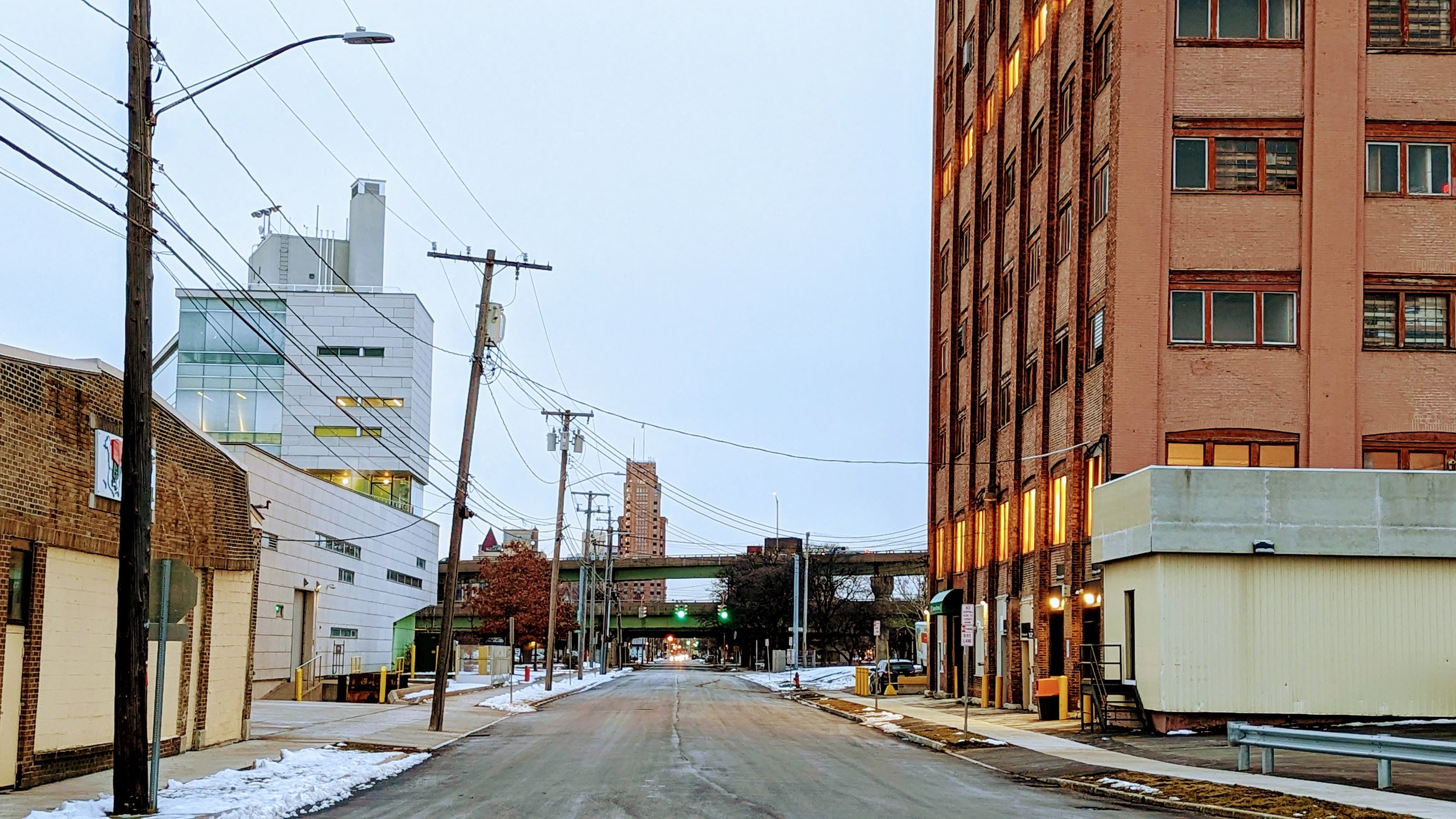
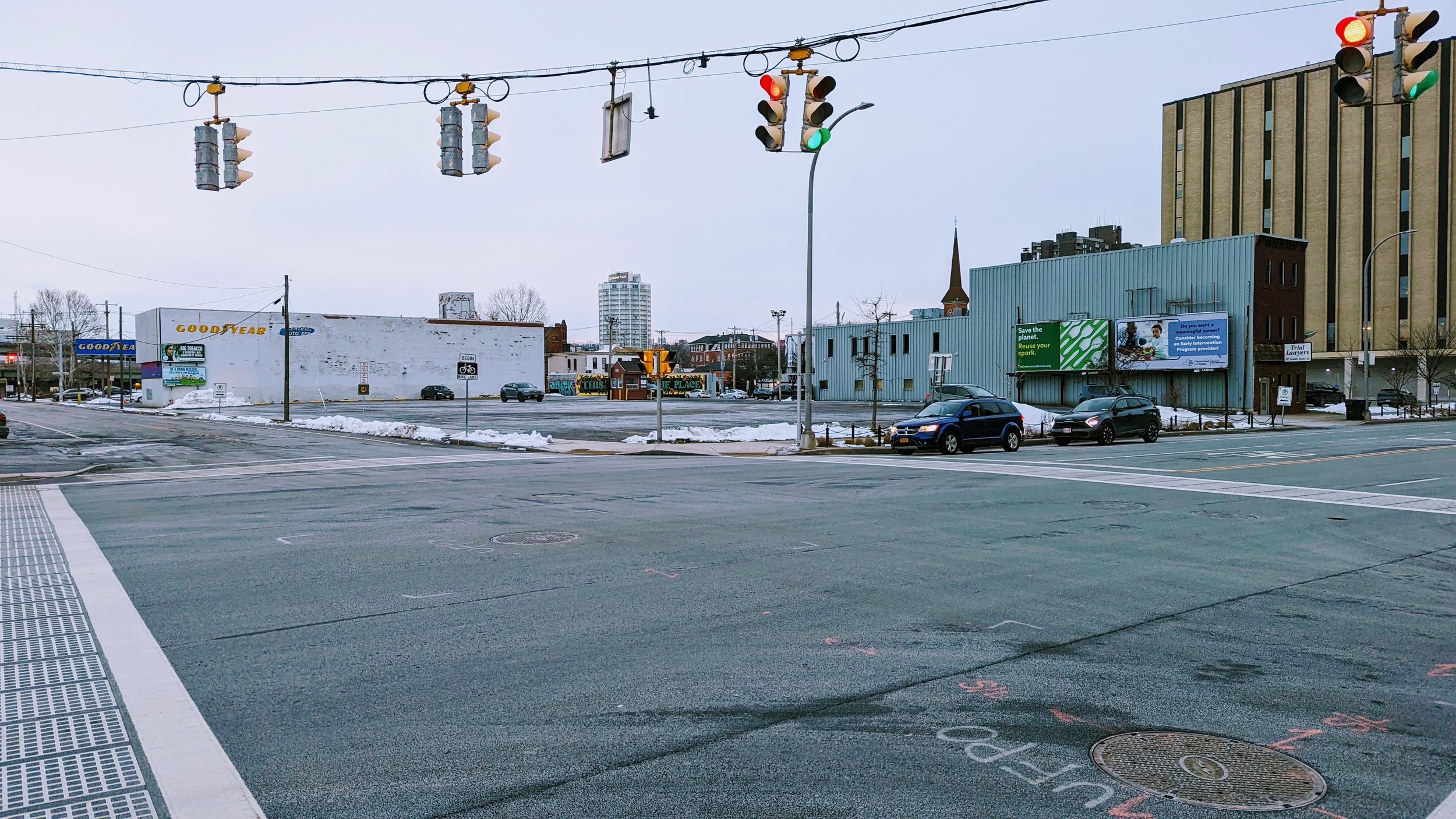
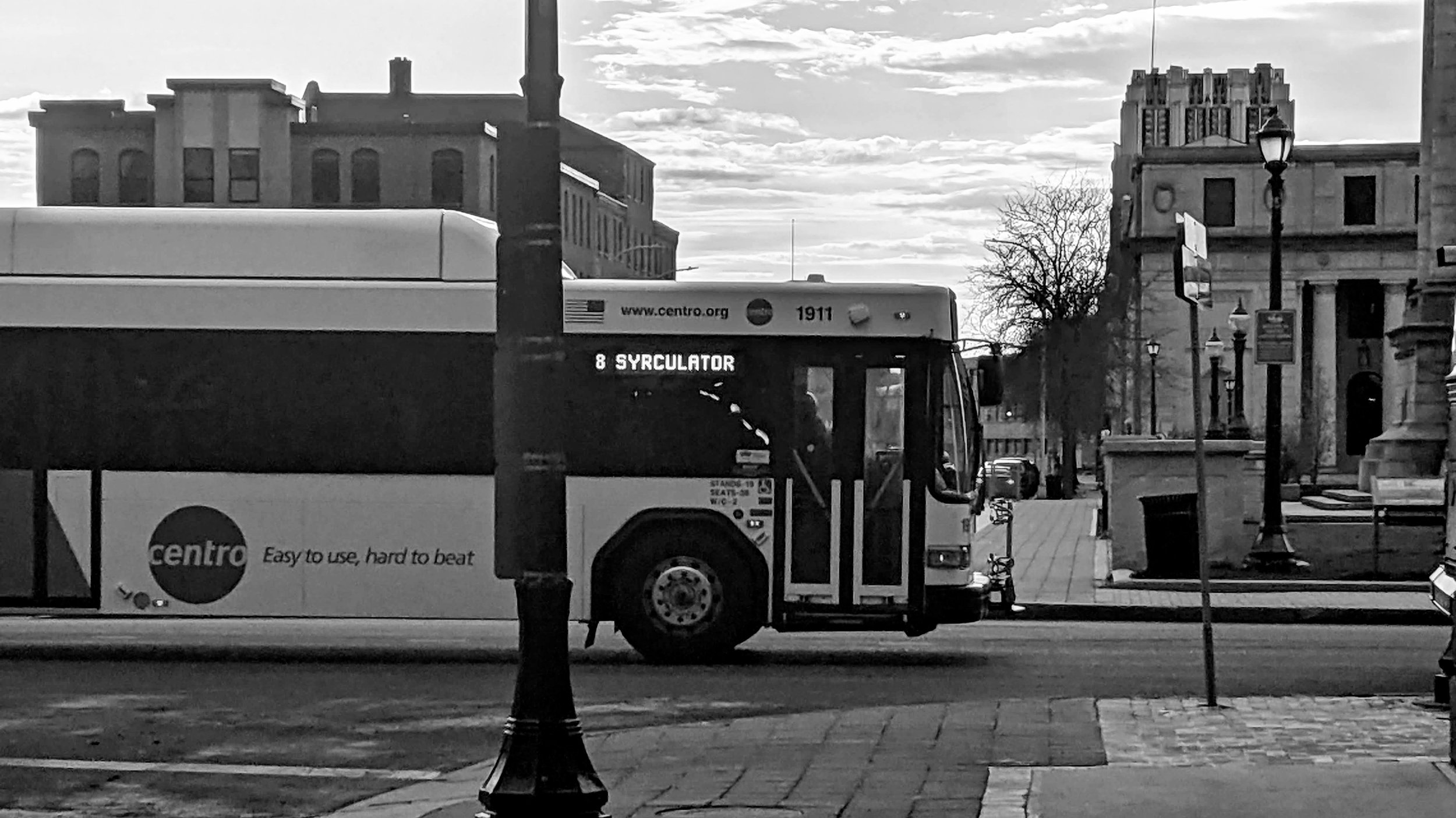
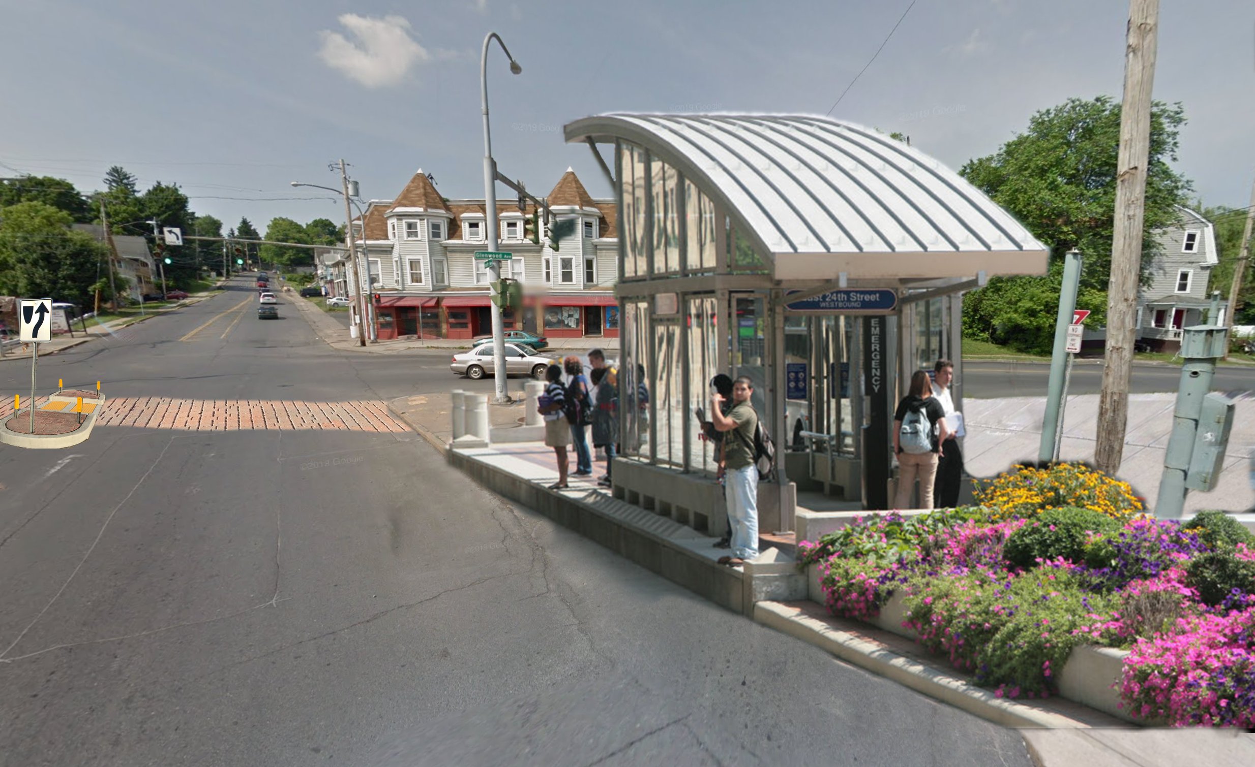
The article notes, “The new bus rapid transit lines won’t have … raised station platforms …,” and later continues, “Centro could used the $35 million to build infrastructure for the bus lines, including new curb cuts and bigger bus shelters that may be equipped with kiosks of customers to pay their fares in advance.” There’s a lot in those two sentences, but this is where we do need Centro to step up - the stations. While BRT will result in shorter wait times overall, providing comfortable spaces for riders to wait is still important. It shouldn’t just be a slightly larger bus shelter. Raised platforms would speed up boardings by reducing the number of times buses must “kneel” to allow individuals with reduced mobility to board. Instead, those same individuals can easily walk or roll across the platform and onto the bus. Stations should also have kiosks for fare payment along with real-time countdown clocks to inform riders of when the next bus is expected. These simple amenities both help speed up boarding and provide peace of mind to those waiting.

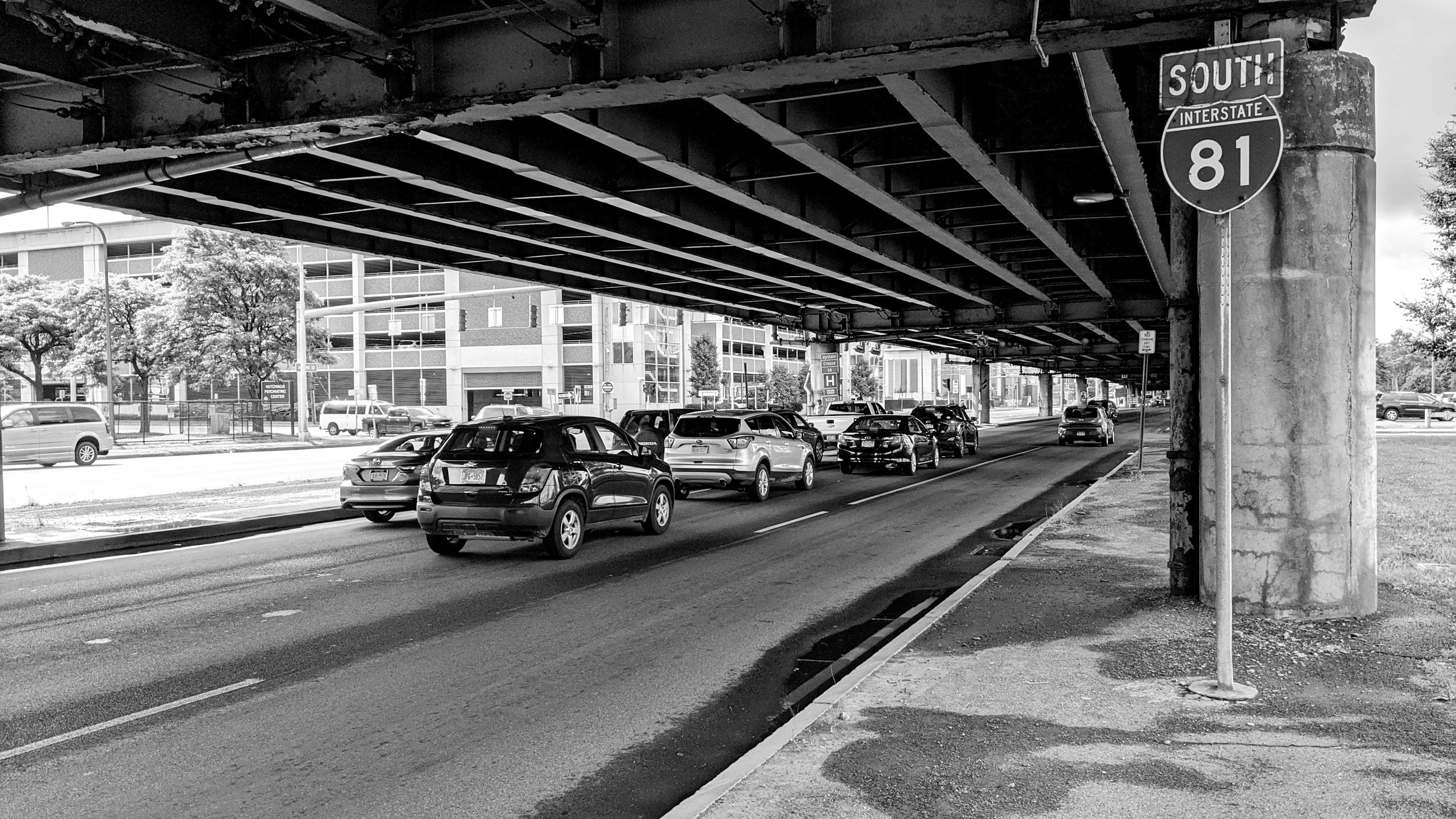
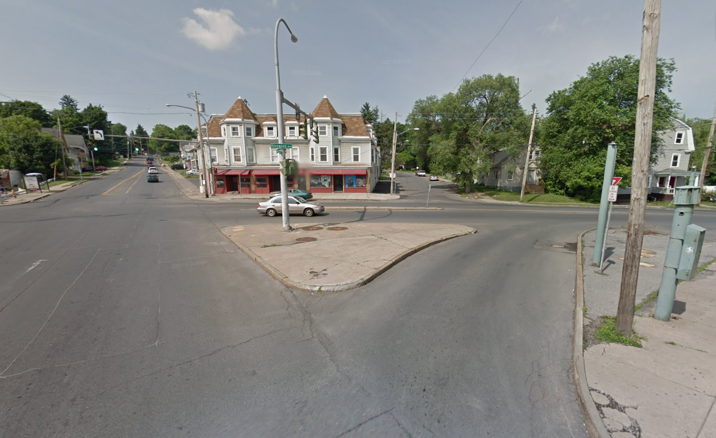
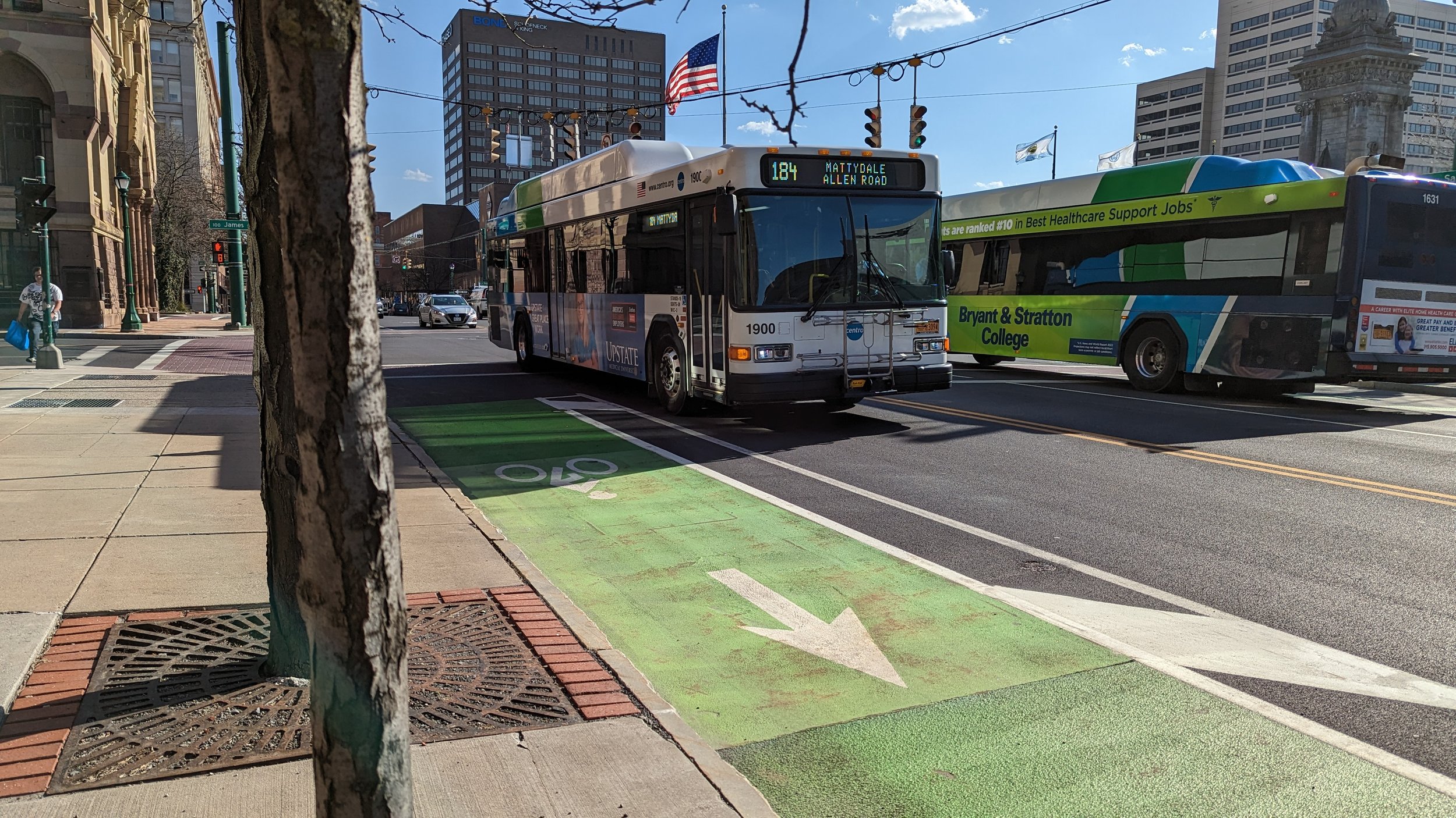
A standard bus shelter in Downtown Syracuse. BRT stations must be more robust and contain more amenities as a way to improve its service quality.

One note on the pre-pay kiosks and payments in general, we should also be encouraging the faster deployment of tap systems throughout our transit services. Utilizing a tap system (either through using a credit card, phone, or prepaid transit card) helps simplify the process of using transit. No longer must you have exact change or a pre-purchased transit pass. It will allow casual riders to take a trip when they see a bus coming without having to plan ahead, especially as more and more of life goes cashless.

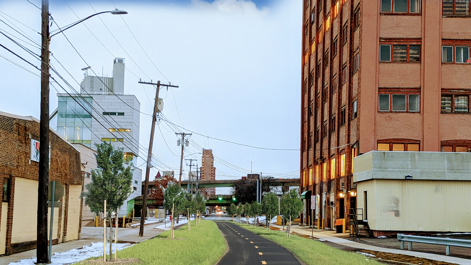
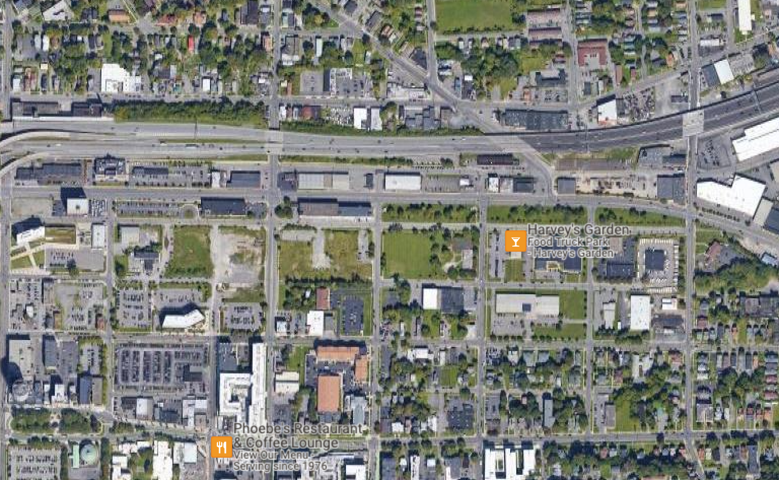
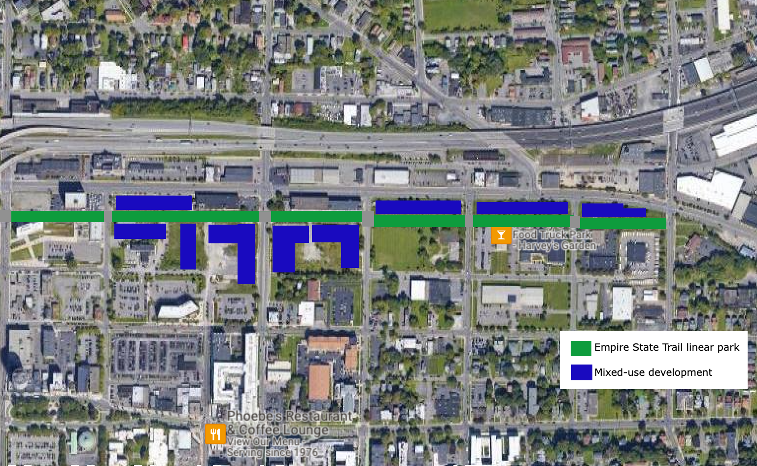
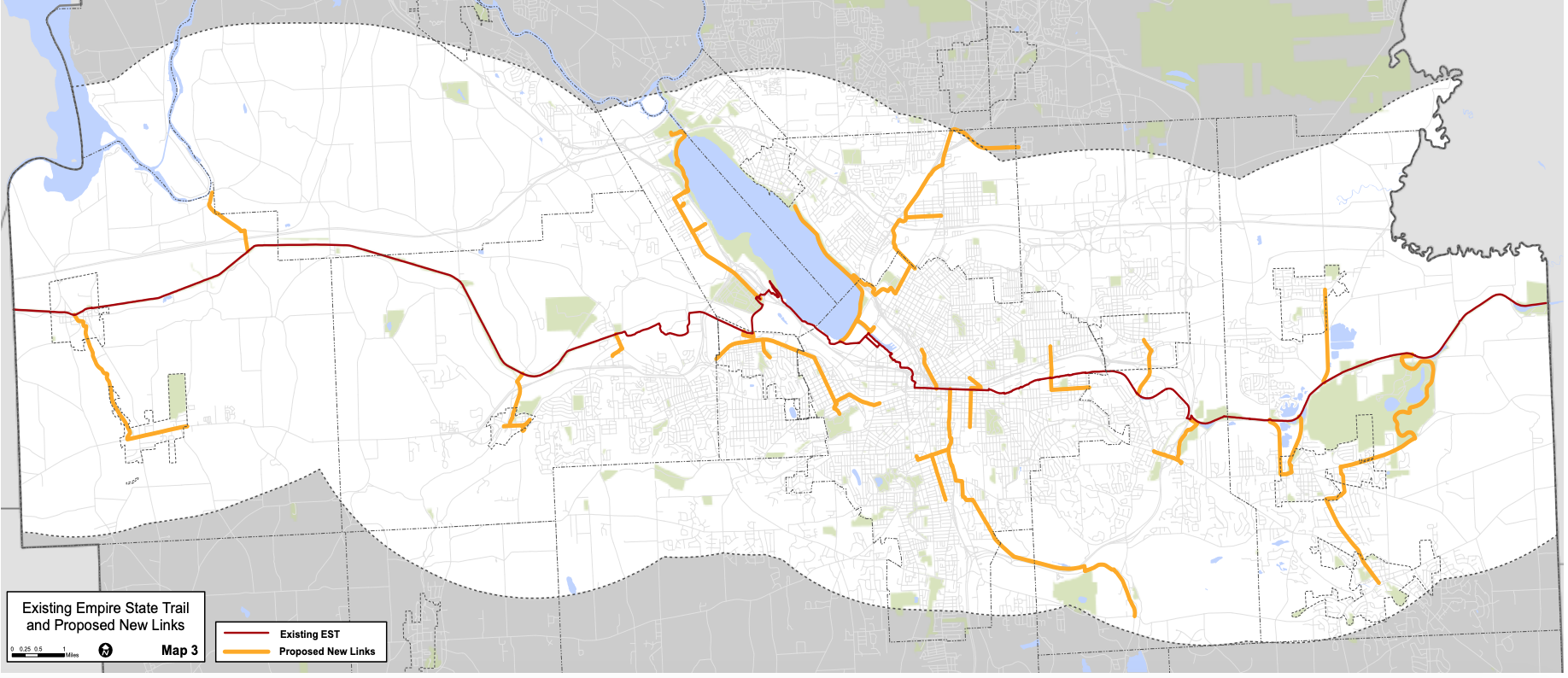
The last piece of the equation I must mention, and that I have covered more thoroughly in my Growth in CNY series, is the need to develop around the stations. Encouraging dense development, both residential and commercial, will help promote the use of the system. The BRT planned for Syracuse already has ridership levels to sustain it, but to see growth we must build for growth. This goes for future extensions as well. In the Salt City has already written about what future BRT expansions may look like, with some pretty excellent maps to go along with it. But this goes for developments along all major transit corridors in our region. Building more sprawl will only make it more difficult to serve our region successfully with transit. Dense nodes of activity (town centers, villages, urban cores) lend themselves to transit in a way our current development pattern does not. We must look at BRT as the backbone of the system, and it will only get stronger as we build denser along it. 

To end this piece before I go on for too long, I just want to summarize my thoughts in this way: BRT in Syracuse will improve the lives of thousands of people and may even encourage others to take advantage of its services, even if it does not solve all of our transit issues. We should not let perfection be the enemy of good, scratch that, great.

In Transportation, Urban Planning, Syracuse
Comment

Fixing Car Storage

March 30, 2023

One of the most common complaints people have when heading into their local downtown or any popular neighborhood is finding a place to store their car. They circle the block looking for an open spot, causing congestion in return. It’s not that open spots don’t exist, it’s that they either cost money or are more than a block or two away from their destination. Through film and television, we have been sold the fantasy that we should expect easy car storage at our destinations, always pulling up right out front. Over the last 70 plus years we have been building suburbia and retrofitting cities to continue this illusion by putting a sea of asphalt in front of our buildings. While this gives people the feeling that their car is nearby, it may actually be further away than if you used the garage three blocks away from a downtown restaurant. Now I don’t believe I can fix all of the car storage problems, but there are plenty of ways we can chip away at them while encouraging people to use other modes of transportation.

To start, I think it’s important for us to use the phrase “car storage” over “parking.” This may seem trivial, but when you hear the phrase “car storage” you start to understand that we have been subsidizing the storage of private property in our public spaces for decades. And that space is not free to build. Curb space could be used for other modes of transportation (bikes and buses) or for loading zones for local business, instead of forcing many delivery drivers to stop in the travel lane, blocking traffic. We have attempted to privatize some of this by requiring a minimum number of spaces at private developments, but that has only exacerbated the issue by spreading businesses and residents out further and encouraging more and more people to drive where they could previously walk or take transit. So with that in mind, let’s take a look at a few different approaches to fixing this storage issue and how they might all work together to improve how our cities function. And remember, these strategies can be used in our cities, villages, and towns.

Ending Minimums

To start this conversation off, we return to a topic I’ve mentioned time and time again throughout my blog - ending parking minimums. 

As cars began to dominate our roadways, space to store them was scarce. To accommodate this increase in cars, cities turned to a new tool, zoning, to require new developments to provide off-street storage for cars. Much like many other aspects of zoning codes, these minimums come with the appearance of being based on scientific reasoning and study. In reality, they’re not based on much at all. If you scroll through municipal zoning codes online, you start to see very similar requirements for places that are very different from one another. You might even be surprised to learn that much of New York City is governed by parking minimums as well - even in a city where more than half of households do not own a car.

View fullsize PXL_20220903_161125679.jpg
View fullsize PXL_20221021_221528801.jpg

But let’s look at what parking minimums do. If you’re looking to build a small restaurant or bar, you might be required to build one parking space for every three seats. Well, three seats might only take up about 50 square feet, but the space to store that car takes up around 200 square feet. That space begins to add up to the point where the restaurant is now surrounded by a deep moat of asphalt for car storage. And it doesn’t come cheap - with the average cost to build a lot coming it around $5,000 to $10,000 per space. But let’s say you’re not building this restaurant from scratch. You’re looking to repurpose an older building in your neighborhood that would make a great spot for neighbors to walk to for dinner. Many older buildings don’t come with lots next door. You might need to look at tearing down a building to provide the required number of spaces for your customers, or hope to have a variance approved so you can provide fewer spaces or none at all. Both of these options add expense to a project and may impact whether a project is feasible or not. To get a sense of just how much parking is required, below is a table giving a snapshot of some of the requirements found around Onondaga County.

This does not mean car storage won’t exist, it just allows developers to build the amount they believe they need to be successful. We don’t have to look far for an example. Buffalo eliminated minimums in 2017. In the years since, nearly every development has built some car storage, with many building close to the number they would have been required to before this change. The upside is, if those developments choose to expand, they can now opt to build upon their lots without needing to provide additional spaces.

Beyond the costs and logistics of providing these spaces, it also reduces access to businesses for anyone outside of a car. Large lots push businesses and residences further and further apart, reducing the usefulness of transit and making it difficult to walk or bike. If you’ve ever walked through a parking lot on a hot summer day or on a freezing winter day with a harsh wind, you know just how unpleasant these spaces become. When looking at the images below, its easy to see which place is more pleasant to be in, yet our arbitrary rules prevent more of these places from existing.

View fullsize PXL_20230412_101320195.jpg
View fullsize PXL_20230706_125838523.jpg

With all of this in mind, it’s time for those of us who champion removing these minimums to emphasize what we gain instead of what is lost. We gain flexibility for businesses large and small. We gain affordability by reducing the costs of construction. We gain the ability to create more accessible places. In many ways, we gain freedom.

Dynamic Metered Spaces

Now that we have addressed off-street car storage requirements, we must look to our streets, beginning in our business districts. 

Metered spaces across downtowns and in neighborhood business districts have prices that do not reflect their true value. Some spaces, near major destinations, popular restaurants and bars, are priced at the same level as spaces on the outskirts of their neighborhoods. For Syracuse, this is $2 per hour. While this is a deal in Hanover Square or Armory Square, what sense does this make near the highway viaducts several blocks away from any destination? Most people would understand that these spaces do not hold equal value and should be priced differently - and no, they should not be free.

Donald Shoup, the person who has truly brought car storage policy to the forefront in urban planning settings, has long advocated for a smarter approach to pricing our curbs. In 2014, he worked with San Francisco on a pilot program, SFPark, aimed at pricing the city’s streets to reflect the demand for space. Using cameras and sensors, the city tracked how much space one each block was being used to store cars at any one time. Pricing at the meters would change to reflect this usage, trying to find the price at which every block had one to two spots open at all times. Its important to note that San Francisco aimed to keep this program cost neutral, meaning they did not want drivers to spend more per hour than under the original pricing scheme. In more desirable places the price could be over $6 per hour while further out they could be as low as $0.50 per hour. At the end of the pilot, they measured less congestion on the study streets due to reduced circling for spots, and noted the average price per hour for each driver went down while the overall revenue went up, meaning there was an increase in turnover.

Other cities have instituted similar programs, including Seattle, WA and Calgary, Canada. These cities set their target occupancy rates a little differently and adjust their prices on different timelines, and even have different prices based on the time of day. One thing Syracuse should learn from some of these other cities is that we turn off our meters too early, at 6pm (although most of us know its before that) right when they begin to hit another demand peak for dinner at local restaurants. Keeping meters on until 8pm would help manage the demand better and encourage higher turnover in the most coveted locations.

Our curbs are too valuable to give away for nearly free, but we must recognize that not all curb space is valued the same. Programs like this prove that you can use the same amount of space to provide access to more and more people if it is managed well. Dynamic metered pricing can also be tied into benefit districts, which I will discuss later in this post.

Centralized Car Storage and Improved Garages

While it is important to manage our curbs well, there is still demand for longer term car storage for workers and residents in our business districts. At the same time, we cannot have surface lot after surface lot creating dead zones throughout. Instead, we need to look for opportunities to provide shared lots and structures in a more centralized way. 

I will be the first to say that parking garages are less than ideal.They are far more difficult to redevelop in the future than surface lots, they cost far more per space ($24,000 - $34,000 per space), and are often less appealing to drivers due to the decreased visibility causing safety concerns. But, for now, they are a necessary evil that we must contend with and work to improve. Garages help to centralize car storage, freeing up other land for development. Not all garages are created equal. Below are multiple examples of garage throughout Downtown Syracuse, some doing a much better job of preserving the streetscape than others, including providing ground floor retail or office space. 

View fullsize PXL_20230309_190442025.jpg
View fullsize PXL_20230328_203911121.jpg
View fullsize PXL_20230128_220221309.jpg
View fullsize PXL_20230328_202955073.jpg

Beyond the traditional garage, vertical car storage, often seen around New York City, provide a less expensive and less permanent option. According to a 2014 New York Times article, vertical car storage devices cost less than half (roughly $16,000 per space) than a conventional garage. While still more expensive than a surface lot, the value is created through freeing up additional land for development.

Employer Incentives

A final piece to car storage in our downtowns and business districts involves our employers. While more suburban office parks and commercial centers offer free car storage for all, many employers in downtowns and business districts provide permits for their employees to use designated lots. These are often purchased from the building, lot, or garage owner and are considered pre-tax benefits for employees. But what about employees who walk, bike, or take transit to work? In effect, those employees are losing out on a portion of their pay all because they choose not to drive to work, or perhaps they cannot afford to drive to work.

Instead, we should require employers to provide alternative transportation benefits to their employees. In practice, whatever funds were used to pay for car storage could instead be given to employees in the form of transit passes or a cash payout. New York City requires all employers with more than 20 full time employees to offer these types of passes, but similar programs exist in smaller cities as well, such as Hartford, Connecticut. 

By allowing employees to choose which commuting option works best for them, without financially penalizing them (and yes this is a form of financial penalization), we begin to emphasize that all modes of transportation are equal instead of prioritizing the car.

Residential Permit Systems and Benefit Districts

Now moving to our residential neighborhoods. Car storage isn’t just a downtown issue. Urban neighborhoods, village centers, and anyone living near popular destinations often compete for spaces to store their vehicles in front of their homes. While no one should be guaranteed a piece of public land to store private property, helping improve access to people’s homes is a reasonable policy choice, within some restrictions.

Many cities have implemented residential permits with a wide range of rules, but often the prices are too low and management of the system is hit or miss. So here are a few things we should consider about permit programs to make sure we gain the most benefit from them:

  • Track curb usage on a regular basis - every couple of years

    • Only institute permit programs in neighborhoods that truly have a storage issue. Set the goal (maybe 70% of curb space used) and track it over multiple days to ensure the need is there.

  • Limit the number of permits provided per household

    • Providing more than two or three permits per household would quickly overrun whatever space is available

  • Institute an increased price for each additional permit beyond the first

    • The more space a household consumes, the more it should pay

    • This goes for larger vehicles as well - vehicles larger than a sedan or a compact SUV (think Chevy Trailblazer) should pay a higher price for a permit due to the additional space they consume

  • Utilize license plate readers instead of hang tags

    • Helps to cut down duplicated tags and improves efficiency in enforcement

  • Put the funds gained from the permit system back into the neighborhood

The last point is crucial. Using the funds collected from the neighborhood, either from permits or dynamic metered spaces, to reinvest in those specific neighborhoods help to build good will for the program as well as provided a consistent funding source for needed improvements. Sidewalks, bike lanes and bike racks, pedestrian lighting, street trees, all can be funded through what is known as a parking benefits district. Cities across the country have raised millions of dollars for neighborhood improvements through similar programs. Pittsburgh has used funds to improve public safety infrastructure in nightlife communities while Washington D.C. improved trash collection services. Neighborhoods should have a say in how their funds are used to improve their communities. 

On a related note, and much to the anger of many college students, I believe permits to store student cars on university campuses are necessary. In my time in college, and in seeing many posts on social media since, students are often angry at having to pay an additional fee to store their car on campus after paying tens of thousands of dollars to attend classes there. This mentality ignores the thousands of students who do not have cars and should not be forced to subsidize those who do. College is one of the few times in life where cars really are optional in most American cities. Campuses are built to promote walkability and often run bus and shuttle services to off campus locations for free or very reduced prices. But that is all I will say on that topic as working with universities is a complex issue that deserves its own examination.

Moving Forward

Car storage is a tricky issue and we must be open to different solutions and act creatively. None of the ideas covered here will solve the problem alone, and they must be combined with other changes to our transportation network. We cannot think of these issues in a vacuum. Land use decisions, public transit networks, biking and walking facilities all factor in to how our public realm is used. The more we promote modes of transportation beyond private cars, the more space we can take back from car storage.

Comment

Water Street to Linear Park

February 24, 2023

The street grid through Downtown Syracuse continues to be built around a canal that was removed nearly 100 years ago. At that time, Water St acted as a vital access road for the many businesses that lined the Erie Canal. Many of the remaining buildings from that time still front Water St with more utilitarian doors and windows facing Erie Blvd. Today, outside of the blocks around Hanover Square, Water St is a minimally used street surrounded by parking lots, underused and vacant parcels, and open green space. At the same time, it is a key portion of the Empire State Trail (EST), a premiere 750 mile bicycle trail that connects the entire state. It is time to rethink Water St and the area around it.

View fullsize Business fronts on Water St
Business fronts on Water St
View fullsize Business backs on Erie Blvd
Business backs on Erie Blvd

First let’s look at the street’s current use. According to NYSDOT’s Traffic Data Viewer, an average of 700 to 2,000 vehicles use the street on a daily basis, which is a fairly light volume. Most of these vehicles are utilizing the parking lots that front the corridor. To accommodate the EST, standard painted bike lanes function for the majority of the corridor, with sharrows occupying the three blocks between State St and S Salina St, with the block off of S Salina St utilizing a protected contra-flow bike lane as well. For people on foot, there’s even less infrastructure. The sidewalk network is in pieces, with parts overgrown as you move further away from Downtown Syracuse. The street may attempt to serve all users but it struggles to serve any of them well.

So what if we decided to focus on just the active modes of transportation?

By removing cars from Water St, the corridor opens up to possibilities. A shared use path, typically 10 to 12 feet wide, could be shifted to the center of the corridor while the rest of the right-of-way is filled with greenery, similar to the characteristics of the EST further east down Erie Blvd. This change creates the opportunity for a truly urban linear park, similar to portions of the Onondaga Creekwalk, but more ambitious in some ways.

PXL_20230128_221459363.jpg
EST near Uhaul.png
PXL_20230128_221459363.jpg EST near Uhaul.png

The Onondaga Creekwalk through Downtown Syracuse leaves a bit to be desired. It forces cyclists off of their bikes as they must share sidewalks instead of having a dedicated off-road path. Its circuitous route, a necessity due to the space constraints associated with trying to follow the path of the creek, is less desirable than the straight shot that Water St offers. Instead, we will look more towards the second phase of the Creekwalk which runs through primarily park-like conditions and minimizes street crossings. While a Water St linear park will require far more street crossings, we can alter the function of those intersections through the use of raised intersections, which help to slow drivers as they pass, as well as switching many of them from signalized intersections to stop signs. As Jeff Speck notes in Walkable City, stop signs are preferable to traffic signals from a safety perspective, for all mobility methods.

With a linear park in place, the conversation turns to development along its path. Looking at ReZone Syracuse, most of the land fronting Erie Blvd will be zoned as MX-3, which encourages mixed-use development. Large portions of the land fronting Water St on the southside of the street is zoned as MX-4, again mixed-use but at a higher level of density. Three blocks, between University Ave and S Beech St are zoned for open space. While this open space preservation makes sense with the current configuration of the street network, by shifting Water St into open space, the narrow lots currently zoned for it should be converted for mixed-use development.

The development along Water St will be unique in that they can be built truly for car-free households, opening up to the linear park and providing ample access to transit along Erie Blvd. To ensure this opportunity is seized, secure bike parking should be thoughtfully included in every development along the route, both for residents and visitors to the commercial spaces. As the major entryway into Downtown Syracuse along the EST, providing ample accommodations for cyclists is vital to attracting cycling tourists into the City. It is also a way to make it easier for city residents to embrace a car free or car light lifestyle, saving each thousands of dollars per year.

Google Maps Overview.png
Google Maps Overview Future.png
Google Maps Overview.png Google Maps Overview Future.png

Some parking lots and car centric businesses currently line the corridor, including the Syracuse Center for Excellence. While the Center for Excellence is an experiment in sustainable building practices, as well as energy and water use, it does not fully embrace more sustainable transportation methods, with the building utilizing a large parking lot and only providing a handful of bike racks. Some businesses, including the U-Haul rental and storage office, may need to be completely rethought to encourage more desirable uses near our city’s center. The building currently used by U-Haul is structurally deficient on many floors, which might make demolition a requirement for redevelopment. 

View fullsize PXL_20230128_220750498.jpg
View fullsize PXL_20230128_221021587.jpg
View fullsize PXL_20230128_221025050.jpg
View fullsize PXL_20230128_221033506.jpg

The area currently covered by I-81 will also be open for development once the viaduct is removed. Auto-oriented businesses must be avoided in this area. Drive-thrus, automotive repair shops, and car sales should be excluded in favor of street fronting businesses, which may still include chain restaurants and businesses, but utilizing more urban oriented designs. College Town in Rochester, NY is a good example of this style, but the development still relies heavily on an inner parking lot. Some parking will need to be built to make this corridor function, but it should be minimized.

PXL_20230128_220545800.jpg
Water St and State NEW.png
PXL_20230128_220545800.jpg Water St and State NEW.png

A Water St linear park is a chance for Syracuse to embrace a unique development style and encourage car free / car light living. It's time to rethink our streets and there’s no better place to start than a street whose purpose has been reduced over the last 100 years.

In Walkability, Transportation, Syracuse
3 Comments

Growth in CNY: Culture & Amenities

December 31, 2022

I had planned to end 2022 with a blog post looking ahead to the future and ways that CNY, and more specifically Syracuse, can encourage growth in sustainable way, I have had conversations over the years saying that Syracuse would be a great city of 250,000 people, with just small tweaks and changes to our built environment. Now, at the beginning of October 2022, these conversations take on a new urgency, with the announcement of Micron investing up to $100 billion just north of the City and bringing 9,000 high paying jobs, with up to 40,000 additional jobs in related industries. So to finish up my 2022 blog series, I plan to address this growth in three parts: Housing, Mobility, and Culture & Amenities.


Syracuse and the surrounding region are blessed with beautiful parks, great traditional public spaces, and beloved cultural amenities. Many of these assets were founded and preserved during the first half of the 20th Century, when American cities were investing heavily in the public realm. Ever since, budgets have been cut, priorities have shifted, and the legacy institutions, parks, and amenities we still enjoy today were lucky to find continued funding and support. Growth in Central New York, if done in a sustainable fashion, should bring additional funding sources that can be used to help us grow these amenities to suit the needs of our community. While housing and our transportation network require a great deal of planning, the thoughtful growth that will hopefully occur will allow us to expand our public spaces and strengthen our cultural amenities. At the same time we must work towards improving access for all members of our community, and that includes finding new opportunities to bring us all together in common causes. 

Unlike the last two posts, this will not primarily focus on planning principals, but instead will be more aspirational for where we should put our public and private funding. Supporting public spaces, cultural amenities, and encouraging our neighbors to mingle together are vital to a well functioning society.

Parks and Open Spaces

Public parks first appeared in American cities in the middle of the 19th Century, at a time when our urban spaces were growing rapidly and access to green space was slipping away. In Syracuse, many of the parks we cherish were founded in the early 1900s, with the formation of the City Parks Department in 1917. With over 170 parks and 1,000+ acres of land, the City of Syracuse has an extensive park network common among legacy industrial cities. According to the Trust for Public Land (TPL), 77 percent  of Syracuse residents live within a 10 minute walk to a public park. 10 minutes is considered a reasonable distance for most individuals to walk to a destination, including park space, which is the basis for TPL’s 10-Minute Walk program. 10-Minute Walk encourages cities to expand park space to ensure every resident can reach a public open space within 10 minutes of their home, providing access to fresh air, greenery, and places to gather. Syracuse’s rate of 77 percent is far higher than the 55 percent national average, but that still leaves nearly a quarter of residents without easy access to greenery.

One way to help improve this access is the continued expansion of urban trails and greenways. The Onondaga Creekwalk is projected to expand to the southern city line by the end of the decade, which will immediately connect neighbors across the city and expand their access to greenery and our waterfront. The City and County should be looking for additional opportunities to provide linear park spaces that allow residents to explore their communities without needing to interact with cars. This includes bringing back a Covid era policy of banning vehicles from streets within parks to promote walking and biking in our greenest areas. 

View fullsize Creekwalk underpass.jpeg
View fullsize Meachem Park.jpeg

Outside of the City of Syracuse, access to park space decreases as many residents emphasize using their private backyards over public parks. This is a continued trend of the privatization of space that began with suburbanization. Heather McGhee’s The Sum of Us: What Racism Costs Everyone and How We Can Prosper Together, both the book and its companion podcast, tells this story through the slow disappearance of public pools across the country once desegregation took hold. Specific corners of American society seemed to deem investments in public amenities like pools and parks as less desirable once all members of society were finally allowed to enjoy them. Soon private clubs, personal pools, and other private open spaces began to take over as public funding for similar spaces eroded. You see this trend continued in youth sports (which has many other negative consequences that are better explored at length in Linda Flanagan’s Take Back the Game: How Money and Mania Are Ruining Kids’ Sports - and Why it Matters) as private travel leagues take over spaces that used to be open to public leagues and pick up games.

As the County densifies, public open spaces and parks will become increasingly important and we should increase funding to reflect that fact. This includes funding youth programming, athletic leagues, and expanded park space where it is most needed.

Public Spaces

While you might think public spaces are the same as parks and open spaces, I want to separate this out as these are spaces that can be commercialized and encourage different types of activities. A prime example of existing public spaces within Syracuse is Hanover Square, a small public plaza that has shifted from a former roadway into a shared space that emphasizes pedestrian access and outdoor dining. Hanover Thursdays, this past summer, brought live music into the square and helped promote the local bars and restaurants that open out onto the plaza. 

View fullsize Hanover Thursdays
Hanover Thursdays
View fullsize Weekends on Walton
Weekends on Walton

A similar public space was temporarily instituted within Armory Square with the Weekends on Walton program during 2020 and 2021. As new businesses return to Armory Square, this program should be made permanent, with Walton received a similar treatment to Hanover Square. In 2019, the Syracuse Metropolitan Transportation Council (SMTC) published the Armory Square Mobility Plan that laid out potential treatments to make this street into a more pedestrian friendly, if not pedestrian only, public space.

Similar programs should be explored in commercial areas around the City and County. All neighborhoods deserve public spaces that allow residents to gather away from cars and support local bars and restaurants. Programs can start as temporary block closures, creating small events to promote the concept. As the closures (or street openings if you’re like me an view streets without cars as truly open) gain support, municipalities should create guides for how to shift towards more permanent public spaces depending on the needs of each individual neighborhood. 

Museums and Learning Opportunities

Syracuse has been a cultural center for Central New York for nearly 200 years and our museums help tell that story: The Everson, the Museum of Science and Technology (MoST), the Onondaga Historical Association (OHA), and the Erie Canal Museum help tell the story of our past, present and future through art, science, and artifacts. Micron has promised to fund programming at the MoST for years to come to help promote science and engineering education, but we shouldn’t stop there.

The OHA has continually expanded its reach through lending historical photos and artifacts to businesses across the region, including the CNY “Brewseum” that preserves the history of brewing in our region. As I-81 comes down, and the stories of the old 15th Ward are front and center, we should ensure that history, and the story of the current residents of Pioneer Homes, are preserved within that neighborhood. While the OHA is only minutes away from the neighborhood, a new historical outpost should be developed as part of the Blueprint15 project.

View fullsize The Erie Canal Museum
The Erie Canal Museum
View fullsize The Everson
The Everson

The Everson houses one of the finest ceramic collections in the world, and yet I sometimes believe we take this gem for granted. One reason may be its location. While it is located in Downtown Syracuse, it is surrounded by government offices, the county jail, and a sea of parking lots. While the museum is a work of art, its surroundings do not inspire visitors to linger and offer no other experiences. The City should promote the redevelopment of the nearby parking lots and garages as a way to create a Downtown arts district and tie the museum into the community. 

Beyond museums, the Rosamond Gifford Zoo (Zoo) and the proposed Inner Harbor aquarium are some of the most important cultural attractions our region will be able to offer. These are spaces where families can gather and kids can learn through experiences. While the Zoo has seen tremendous improvements around the elephant exhibit and medical facilities, some of the other facilities around the park are in great need of improvement, including the expansion of exhibits and enhancements to viewing areas. This may require the acquisition of additional land, including clawing back some land from the recent Syracuse Developmental Center deal. Many families choose to visit the Wild Animal Park in Chittenango instead of the Rosamond Gifford Zoo due to the quality of exhibits, even if the Wild is not an accredited zoo. If the Zoo wants to recapture those guests and promote the mission of the accredited zoos, they need to compete with the quality of experiences private wildlife parks are providing. The Inner Harbor aquarium needs to be part of this effort, including providing lower cost entry fees for low-income families so education remains accessible to as many people as possible. 

Live Experiences

Beyond our public spaces and institutions, we also need to focus on the events that bring us together; live sports, music, and theater. Our culture is built around shared experiences. 

In April I discussed the desire to be considered a “major league city” and how that influences the conversation surrounding public financing for stadiums. Professional and high level college athletics bring together communities through competition. There is a shared public pride when teams do well, and a shared commiseration when teams disappoint. Regardless of the feeling, the City and region experience them together, creating a common thread between most neighbors. Syracuse is experiencing a rebirth in the facilities associated with our teams, with a major renovation of the JMA Wireless Dome (the Dome), home of the Syracuse Orange, and a recent $25 million renovation of NBT Bank Stadium, home of the Syracuse Mets. As I have mentioned before, and will continue to, the area surrounding NBT Bank Stadium is calling out for investment and should see its parking lot transformed into a neighborhood. 

The Upstate Medical Arena at the Oncenter War Memorial (War Memorial), home of the Syracuse Crunch, has received some updates in recent years, but remains one of the smallest and oldest arenas in the AHL. It is also the only sports arena in Downtown Syracuse, creating a unique experience for fans. While the arena currently fits the needs of fans, a growth of the region will hopefully result in the growth of the fanbase for each of our teams. While NBT Bank Stadium has room for fan growth, the War Memorial already comes close to selling out many times a season, especially when the team is good. If the demand increases, it may be time to explore a new home for the Syracuse Crunch. 

View fullsize JMA Wireless Dome
JMA Wireless Dome
View fullsize War Memorial
War Memorial

This is where sports and music collide. Currently, Syracuse is home to a beautiful amphitheater on Onondaga Lake, which hosts high profile touring acts throughout the summer months. The Dome has also seen its use as a concert venue increase in recent years after the installation of air conditioning, hosting Paul McCartney and Elton John in 2022. But during the winter, many acts cannot find a concert venue of the right size in Syracuse. The Dome is too big for most acts and the Amphitheater cannot be used. The War Memorial, Oncenter, and Landmark Theatre are too small for many touring acts, forcing residents to travel to Buffalo or Albany to see shows. 

Should the War Memorial ever become too small to house the Syracuse Crunch, a larger facility in Downtown Syracuse, potentially in one of the parking lots surrounding the Everson, should be built so that it can attract larger concerts all year round. Hosting such concerts draws attention to the City and provides a true amenity for residents, as the Amphitheater has proven. 

The last piece of live entertainment is theater, something Syracuse has excelled at attracting in recent years. Not only does Syracuse enjoy the touring Broadway shows, but Syracuse Stage and the Red House continually produce excellent professional theatre. With the Red House now located a block away from the Landmark Theatre, S Salina St is slowly returning to its place as a theater district. Syracuse should embrace this trend and promote the use of underused spaces along the corridor for small scale theatrical productions, including avant garde shows and puppetry. Open Hand Theater, a puppet theater, has been without a permanent home since Shoppingtown Mall closed. Bringing the company to S Salina St could emphasize the corridor's place as the heart of live theater in Syracuse while diversifying its offerings to crowds. 

As Syracuse looks towards growth, we cannot overlook our cultural institutions and amenities. Sustainable growth, including limiting suburban sprawl and promoting density, will increase the efficiency of our public infrastructure investments, freeing up additional funds and resources for our public institutions. We need to invest in our public realm if we want to see this growth positively impact all residents.

In Civic Pride
Comment

Growth in CNY: Mobility

November 30, 2022

I had planned to end 2022 with a blog post looking ahead to the future and ways that CNY, and more specifically Syracuse, can encourage growth in sustainable way, I have had conversations over the years saying that Syracuse would be a great city of 250,000 people, with just small tweaks and changes to our built environment. Now, at the beginning of October 2022, these conversations take on a new urgency, with the announcement of Micron investing up to $100 billion just north of the City and bringing 9,000 high paying jobs, with up to 40,000 additional jobs in related industries. So to finish up my 2022 blog series, I plan to address this growth in three parts: Housing, Mobility, and Culture & Amenities.


I had initially intended to name this post “Growth in CNY: Transportation,” but after some thinking, I realized that the word “transportation” often is synonymous with cars. In contrast, I think we should really be thinking in terms of mobility in our communities. How can people get to where they need to go? Do they have options? Are you forced to use one mode over any other because of the built environment? This is how we must frame these conversations related to the Micron development and the growth of our region, or else we will continually be bogged down in conversations over cars and gridlock (which may or may not exist).

Mobility and housing must be intertwined if we ever hope to grow in a sustainable way. As I mentioned in the previous post, we should concentrate new housing developments in key locations that lend themselves to improved transit and active transportation options. Everything within this post builds off of where we build our housing and should work together to create a seamless network for all users. 

The Community Grid

To state this clearly and succinctly: Syracuse, and CNY, need the community grid to replace the I-81 viaduct. We have spent well over a decade studying alternatives for a highway that should never have run along its current path to begin with. Micron selected the Syracuse area with the knowledge that portions of the highway network would be removed. Wider viaducts, tunnels, “sky bridges,” depressed highways have all been looked at in various capacities, but they fail to address the fundamental issue of highways and traffic - induced demand. As you make it easier to drive by adding more lanes, more people will choose to drive. This is one of the major drivers of suburban sprawl and leads to increased congestion as a result. The community grid can help solve this, even if I believe it doesn’t go far enough.

While the current plan does well at improving non-vehicle mobility within the Downtown core, the plan still maintains barriers north and south of Downtown. Unlike the unfortunate lawsuit currently holding up progress on the project, the answer is not to continue having a highway cutting through the city, but in fact requires the elimination of more of the highway. Over the past year, the plan has shortened the community grid portion of the project by several blocks, moving a planned roundabout north to avoid bringing all traffic to grade level next to an elementary school. While the issues raised about the placement of the roundabout are valid, plenty of roundabouts exist near schools throughout the world. But, while we’re looking to move the roundabout, I would argue instead to add more of them further south. Bring the highway down to street level and speeds 3,000 ft south of Dr. King elementary to Colvin St, adding in a roundabout, allowing vehicles to disperse along the street grid prior to reaching the school. At the same time maintain a roundabout near Dr. King and at the new proposed location at Van Buren St (see graphics below). This will continue to enforce slower speeds through the city while maintaining efficient through-put, something many of our suburban neighbors are concerned about. Single lane roundabouts have been proven to handle over 30,000 vehicles per day.

Roundabout Current.png
Roundabout Past.png
Roundabout Proposed.png
Roundabout Current.png Roundabout Past.png Roundabout Proposed.png

North of Downtown Syracuse will not only see the highway maintained, but in fact expanded by a lane in each direction. While many suburban leaders will say these lanes are needed, especially in light of the Micron development north of the city, a better option would be repurposing the lanes to prioritize public transit and other high occupancy vehicles. I will discuss these options in greater detail later in this article, but it should be noted these changes can be made without expanding the highway through the Northside. 

One of the greatest benefits of this project is the land freed up within the city once the viaduct comes down. The increased residential development potential, which was discussed in the previous post, can bring more residents into our region’s urban center, allowing for a car-light or car-free lifestyle close to employment opportunities, active transportation options, and public transit hubs. Importantly, this neighborhood will be well served by the proposed bus rapid transit (BRT) network.

Bus Rapid Transit (BRT)

As I have mentioned many times before on this blog, in 2018 the SMTC released the SMART1 report identifying the preferred route for two bus rapid transit (BRT) lines that cross Syracuse in an X shape. The first line connects Eastwood’s James St corridor down to the Onondaga Community College (OCC) campus in the Town of Onondaga. The second line connects Destiny USA along the city’s waterfront south to the Syracuse University (SU) campus. These lines follow existing transit lines that already have enough ridership demand to warrant BRT treatment. These lines already are, and will continue to be, the backbone of the bus network within Syracuse.

SMART 1.png
Screen Shot 2022-11-30 at 6.55.14 PM.png
Screen Shot 2022-11-30 at 6.55.52 PM.png
SMART 1.png Screen Shot 2022-11-30 at 6.55.14 PM.png Screen Shot 2022-11-30 at 6.55.52 PM.png

Fellow Syracuse blog, In The Salt City, has written countless pieces on BRT within the city, including identifying a more expansive network that I also believe should be further developed once the initial lines are up and running. Each of the maps above come directly from their blog and showcase how the network can expand moving forward. This urban network design is not, and should not be, affected by the Micron development.

While I recommend reading more about the lines and their destinations, let’s focus on how to make BRT work well within Syracuse, and that includes the location of stations, amenities at said stations, payment methods, and service.

It should be noted that the BRT system recommended within SMART1 is not full BRT, but instead improved service in mixed traffic. This means that buses will not have their own lane and will not be separated from traffic for most of their routes. This is similar to Albany, NY’s Bus Plus BRT system, which has recently expanded to three lines. While this makes sense for the city at the moment, we should look to set the stage for a more robust BRT network including bus only lanes. Again, we can learn from Albany.

While service may initially operate in mixed traffic, we must ensure stations are located in prime locations and given priority access to right-of-way. This includes siting stations as close to key destinations as possible, including grocery stores, pharmacies, entertainment venues, etc. Riders must see this as the most convenient option.

Similar to the SMART1 plan, CDTA, Albany’s public transit agency, utilizes targeted bus lanes around stations to prioritize boarding and alighting. Additionally, their stations employ the use of real time informational signage and free wi-fi.These amenities allow for riders to confidently know when their bus is arriving and be able to enjoy their personal devices as they wait. This has been shown to reduce how long riders feel they are waiting when compared to traditional bus stops. These are basic amenities that need to be included at all BRT stations to help promote the use of the service and improve rider experiences.

View fullsize Albany, NY
View fullsize Belo Horizonte, Brazil
View fullsize Cleveland, OH
View fullsize Rio de Janeiro, Brazil

Another simple, but important, aspect of the station is that they’re all covered to protect riders from the elements. While the CDTA stations have larger coverings than traditional stops, they are not on the same level as true BRT stations found elsewhere around the world. Above are examples of stations in cities across the world. Many have raised platforms allowing riders to board the bus directly at an even level  without the use of steps or waiting for the bus to “kneel,” or dip, to allow riders with mobility issues to board. These types of stations are also common with light rail and subway stations as they provide the most accessibility for all users. Stations of this quality should be the aim of the Syracuse BRT network. An example can be seen below.

South at Glenwood Before.png
South at Glenwood After.jpg
South at Glenwood Before.png South at Glenwood After.jpg

Now looking at how we pay to ride, we need to embrace technology. Centro has been looking at using a tap payment system for riders, similar to OMNY in NYC, where riders can tap their phone as they enter the bus. While cash payments and physical cards must still be available for unbanked riders, adding a digital payment system will help increase casual ridership and simplify rides for long term customers. On the BRT system, this tap system should be installed prior to entering the station, allowing for immediate boarding without needing to wait for payments to be made on the bus.

Beyond the BRT system, creating easy to use weekly and monthly unlimited ride passes should be a priority. This includes creating a fare capping system so riders who cannot afford the upfront costs of unlimited passes can be ensured that they will not pay more than those passes cost over the same period of time.

Other Bus Connections

Moving away from BRT, other key bus connections must be implemented, including direct connections to the Micron development in Clay. As mentioned before, a bus only lane on I-81 as it runs north of Downtown would allow for an express bus service to serve the Micron development along with ancillary businesses that will undoubtedly pop up near the main plant. This service may start as a rush hour service, but it should be expanded to help better connect residents to the shops and services at either end of the line.

Looking at the development areas discussed in the previous post, a full build out at these sites may allow for high quality bus service to exist. Route 11 offers up one of the most promising bus routes. An increasingly dense and urbanized Mattydale will provide a key anchor point between the City and the northern suburbs, potentially allowing for a major transfer facility to be developed in one of the currently underutilized shopping plazas. As your travel north on Route 11, you pass through North Syracuse and the potential development sites SMTC reviewed in 2019, hitting dense population centers that can be focused around a high frequency bus service. At the Route 11 / Route 31 intersection, the service can head west to end at the Micron development.

View fullsize Route 11
Route 11
View fullsize Route 31
Route 31

At the other end of Route 31, a high frequency bus service could serve the Village of Baldwinsville and a redeveloped Great Northern Mall. Again, serving dense population centers and encouraging more walkable, bikeable communities connecting to the well developed bus stations and allowing for car free commutes to the Micron development from the suburbs.

The Bike Network

While public transportation has been the main focus up until this point, we cannot forget our bike network. Not only does a well designed bike network allow for increased mobility on its own, but it also allows for easy connections to public transportation, providing additional mobility methods without needing a personal vehicle. In 2012, the City of Syracuse released a bike plan which, if implemented fully, would provide a decent level of connectivity across the city. While the plan is a good place to start, many of the routes should be re-evaluated with modern standards in mind, emphasizing protected lanes wherever possible.

County wide map from the LEOP showcasing the different backbone routes.

At the end of 2020, the Empire State Trail (EST) was officially completed, providing a continuous bike route from Buffalo to Albany and NYC to the Canadian border. In 2022, Onondaga County, SMTC, and the CNY RPDB released the Empire State Trail Local Economic Opportunity Plan (LEOP) which looked to identify key routes to connect the EST into communities around Onondaga County. While these routes were limited to areas within four miles of the EST, they emphasize connections to population and commercial centers. They offer up a backbone for local communities to build off of, acting as collectors and arterials for bike riders.

Once a regional network is established, we need to make sure as many people as possible have access to a bike or other micro mobility option, like a scooter. One way to do this is by expanding the bike/scooter share network already in use in Syracuse into the suburbs. I have already written about some of my issues with the current system, including a desire for a membership option. I must acknowledge that the Veo Ride system is a dockless system, which my previous post did not note. At that, I believe we need to move away from a dockless system or at least prioritize the use of permanent hubs. By moving towards more of a hub oriented system, we can look to pair bike share with public transit, similar to a method Pittsburgh has been running with over the past few years, Move PGH.

Move PGH is Pittsburgh’s response to mobility as a service (MaaS). MaaS is the concept that all mobility methods should be integrated with one another, through apps and placement. Move PGH utilizes 50 mobility hubs which locate scooter and bike share docks at frequent transit stops. Additionally, car share only spaces are located nearby to offer additional mobility options. Move PGH has worked towards creating an app where users can book their entire trip at once, paying for their transit use, reserving a scooter/bike or even a car as needed. A similar system in Syracuse would require our scooter/bike share system to emphasize the use of docks to ensure transit riders have access upon their arrival. 

View fullsize Move PGH hub
Move PGH hub
View fullsize Move PGH hub
Move PGH hub
View fullsize Oonee pod concept
Oonee pod concept
View fullsize Veo Ride scooters at corral
Veo Ride scooters at corral

But we shouldn’t forget individuals who own their own bikes and scooters. Something most cities in the United States struggle to do is provide secure bike parking. One company trying to change this is Oonee, out of NYC*. Over the past year they have rolled out secure bike parking pods across Jersey City and parts of NYC, using advertising sold on the pod exteriors to keep the use of the pods free. Syracuse and Onondaga County should be looking for similar solutions to roll out near transit stops and destinations to encourage the use of bikes and scooters around the region.

Bikes are some of the cheapest and most accessible forms of travel out there, with models built for different ages and abilities. The fast growing market of e-bikes is something that is welcome news for a hilly city like Syracuse. Many riders struggle up the hills that many of our neighborhoods sit on, making biking a less attractive option to get to and from work. Who wants to show up to work covered in sweat? One of the issues with e-bikes is the upfront cost of many of the higher quality bikes. While there are some low-cost models, they tend to have less safe batteries and limited weight/distances. One way to change this dynamic is by implementing a rebate system, similar to ones existing for electric vehicles. Denver has been a pioneer in this, offering up to $1,700 back for e-bikes, including cargo bikes. New York State should be looking to do the same, but offer that rebate to the bike seller, so the customer can immediately get that discount, making the upfront cost more affordable. This would be a game changer in terms of access for all users.

OnTrack 2.0?

As many people know, I loved riding OnTrack as a kid and have even advocated for its return to service, albeit in a much more functional capacity. While I still believe the Syracuse region could benefit from using trains for transit purposes, I think our main efforts should be towards improving our bus network. Should BRT and an improved bus network yield results, we should not be afraid to revisit OnTrack’s original vision of connecting the airport - baseball park - Destiny USA - Downtown - SU, and eventually expanding out towards the Micron development. 

Parking Maximums

With all of the mobility opportunities presented so far, one of the most important policies we need to implement to encourage both the expansion of these options and the housing density needed to make them work well is eliminating parking minimums and implementing parking maximums. 

For those that do not know, our current zoning laws, which vary by municipality, require all property owners to provide a minimum amount of parking space for their property. Each type of use requires a different amount of parking. While this might make sense on its face, the truth is those requirements are not based on anything. They are made up numbers, best guesses, whatever felt right to the authors of that specific zoning code. 

By eliminating parking minimums, you allow businesses to decide how much parking works for their business. This lowers the cost of entry for many businesses who can’t afford the large swaths of land parking requires. It also makes each building more adaptable since a different business type can take over without needing to expand their parking facilities. And this isn’t a new idea. In fact, it has picked up steam in recent years, with even Anchorage, Alaska abolishing parking minimums in November. 

Parking maximums, on the other hand, help prevent excessively large parking lots from developing. This allows for denser development to occur at lower costs, increasing walkability and rollability while also encouraging the use of nearby transit options.

Mobility requires each of these pieces to work together. While many people will still use their personal vehicles to get around, we cannot grow in a sustainable way if nearly every trip requires one. Creating an environment where a family can get by with one car, or even no car, should be our goal as our region finally experiences growth. 

*Full disclosure, I have (minimally) invested in Oonee as I believe it is a company addressing a key issue in our urban mobility network.

In Transportation, Urban Planning, Walkability
Comment
← Newer Posts Older Posts →

Recent posts

Featured
PXL_20241010_211844719.jpg
Jan 30, 2026
Let's Do Good
Jan 30, 2026
Read More →
Jan 30, 2026
PXL_20250830_182821521.jpg
Sep 15, 2025
Urbanism Lessons from the Great White North
Sep 15, 2025
Read More →
Sep 15, 2025
Carousel.jpg
May 27, 2025
Destiny USA and the City
May 27, 2025
Read More →
May 27, 2025
PXL_20240805_141743149.jpg
Jan 1, 2025
All Cities Are Beautiful
Jan 1, 2025
Read More →
Jan 1, 2025
PXL_20241005_135224129.jpg
Nov 6, 2024
A Healthy Future for the Regional Market
Nov 6, 2024
Read More →
Nov 6, 2024
PXL_20240728_191254239.jpg
Jul 31, 2024
Renters Matter, Too
Jul 31, 2024
Read More →
Jul 31, 2024
Vista view.jpeg
Mar 21, 2024
The Valley of the Sun - A Land of (Sub)Urban Extremes
Mar 21, 2024
Read More →
Mar 21, 2024
Manlius Cinema.jpeg
Jan 31, 2024
The Movie Theater at the Urban Core
Jan 31, 2024
Read More →
Jan 31, 2024
Clinton Square Christmas Tree at night.jpeg
Nov 30, 2023
The Case for a Holiday Village
Nov 30, 2023
Read More →
Nov 30, 2023
PXL_20230817_220739294.jpg
Oct 31, 2023
The Walk: To Middle Ages
Oct 31, 2023
Read More →
Oct 31, 2023
Ballpark.jpeg
Sep 7, 2023
The Walk: To the Ballpark
Sep 7, 2023
Read More →
Sep 7, 2023
PXL_20230813_213112525.jpg
Aug 14, 2023
The Walk: To Tipperary Hill
Aug 14, 2023
Read More →
Aug 14, 2023

Powered by Squarespace