• Blog
  • Blog Index
  • Video Work
  • About
Menu

Thomas Bardenett

Urban Planning - Writer - Filmmaker
  • Blog
  • Blog Index
  • Video Work
  • About

Growth in CNY: Housing

October 30, 2022

I had planned to end 2022 with a blog post looking ahead to the future and ways that CNY, and more specifically Syracuse, can encourage growth in sustainable way. I have had conversations over the years saying that Syracuse would be a great city of 250,000 people, with just small tweaks and changes to our built environment. Now, at the beginning of October 2022, these conversations take on a new urgency, with the announcement of Micron investing up to $100 billion just north of the City and bringing 9,000 high paying jobs, with up to 40,000 additional jobs in related industries. So to finish up my 2022 blog series, I plan to address this growth in three parts: Housing, Mobility, and Culture & Amenities.


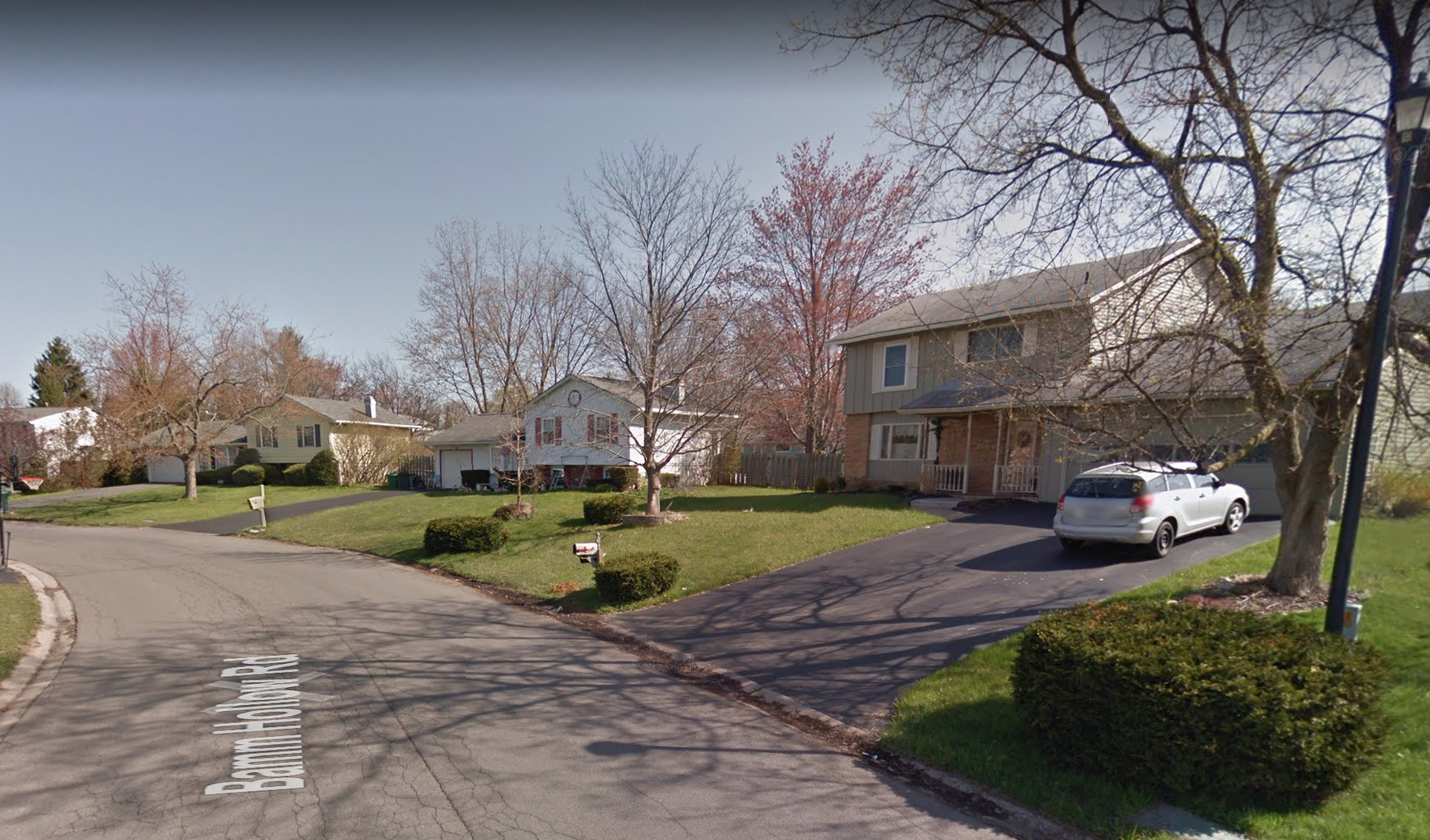
Syracuse, Onondaga County, and Central New York have not experienced any significant growth in 50 years, meaning we have not seriously considered how we should grow and in what places. Onondaga County’s built out footprint has steadily increased over this time while its population has stagnated. This is unsustainable in the long term, and detrimental to our environmental, fiscal, and individual health. As one developer noted in a recent Post Standard article, many of the suburban zoning codes require that any new development take place on one acre lots, leading to significantly larger and more expensive housing than is needed. That same developer is asking for zoning changes to allow up to three homes per acre, but even that is still far too large and spread out for sustainable growth. 

To give an example, in 2020, the average household size for owner occupied homes (primarily single family homes) was 2.46 people, for renters that drops to 1.97. At three homes per acre, that’s roughly 4,600 people per sq mile. That’s better than most suburban towns in Onondaga County presently, but even if you look just south of the White Pines Commerce Park, where Micron will soon be located, many of those developments have blocks with densities of four homes per acre, and over 6,000 people per sq mile. 

Darlington Rd - Syracuse
Wadsworth St - Syracuse
Bamm Hollow Rd - Clay
Darlington Rd - Syracuse Wadsworth St - Syracuse Bamm Hollow Rd - Clay

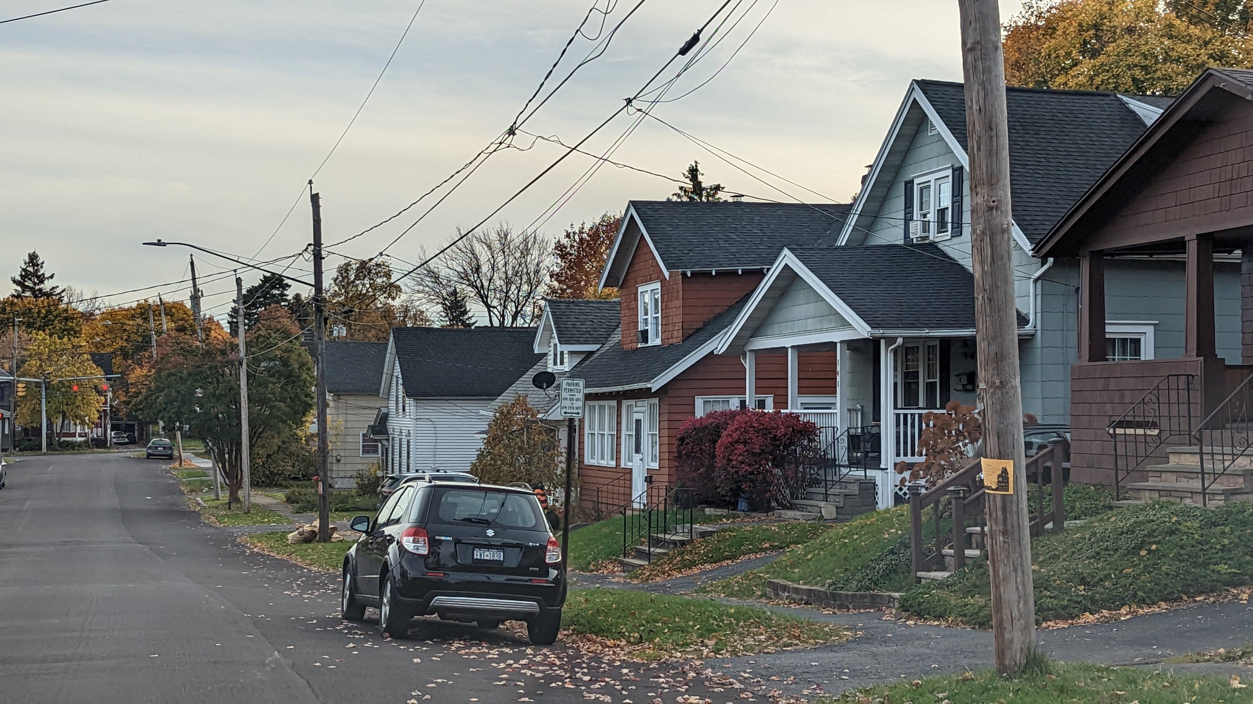
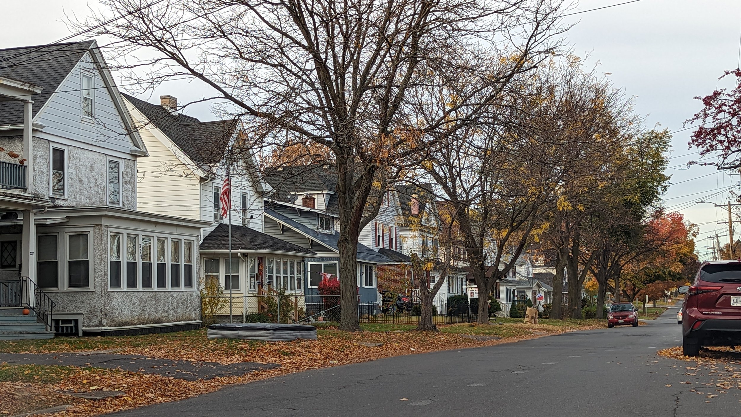
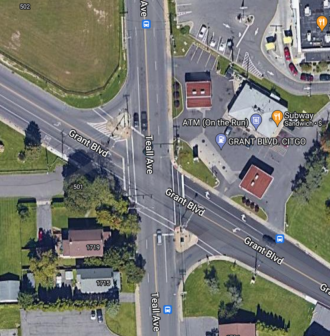
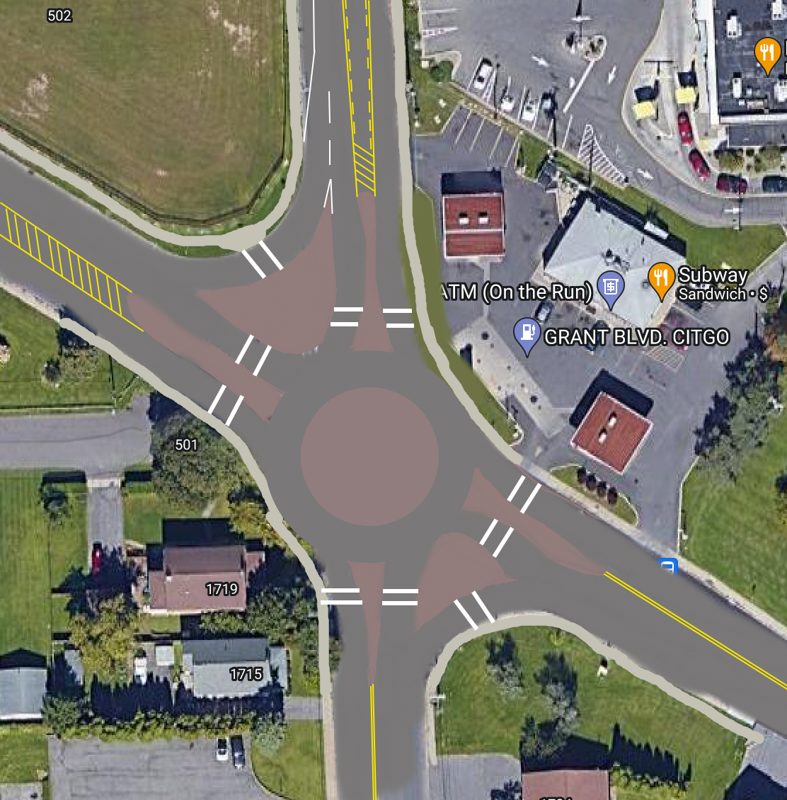
Currently, Syracuse has a population density fo around 5,700 people per sq mile, for a total population around 148,000. For Syracuse to reach a population of 250,000, the City as a whole will need an average population density of roughly 10,000 people per sq mile (actual residential blocks being a bit denser than that to account for park land, cemeteries, commercial areas, etc.). That may sound like a lot, but let’s look at a few examples of neighborhoods that reach that same level of density on the City’s Northside. The block bordered by Darlington Rd, Grant Blvd, Mayer St, and Listman Ave has roughly eight homes per acre, with a population density of 11,000 people per sq mile. Or if you move a few blocks west, the block bordered by Wadsworth St, Grant Blvd, Woodruff Ave, and Listman Ave houses a few more two-family homes, and has a density of over 13,700 people per sq mile. Compared to many larger cities in the country, these two blocks are nearly suburban in nature, yet provide a level of density that helps support nearby neighborhood businesses on Grant Blvd and promotes a fair bit of walkability. These smaller homes are also more affordable for most people and easier to maintain. With the current suburban zoning regulations, neighborhoods of this size are impossible to build. 

So let’s take a look at places within the City of Syracuse and the surrounding towns that are ripe for development to help promote both this gentle density and higher density developments, helping to prevent the continued sprawl that threatens the region.

City of Syracuse

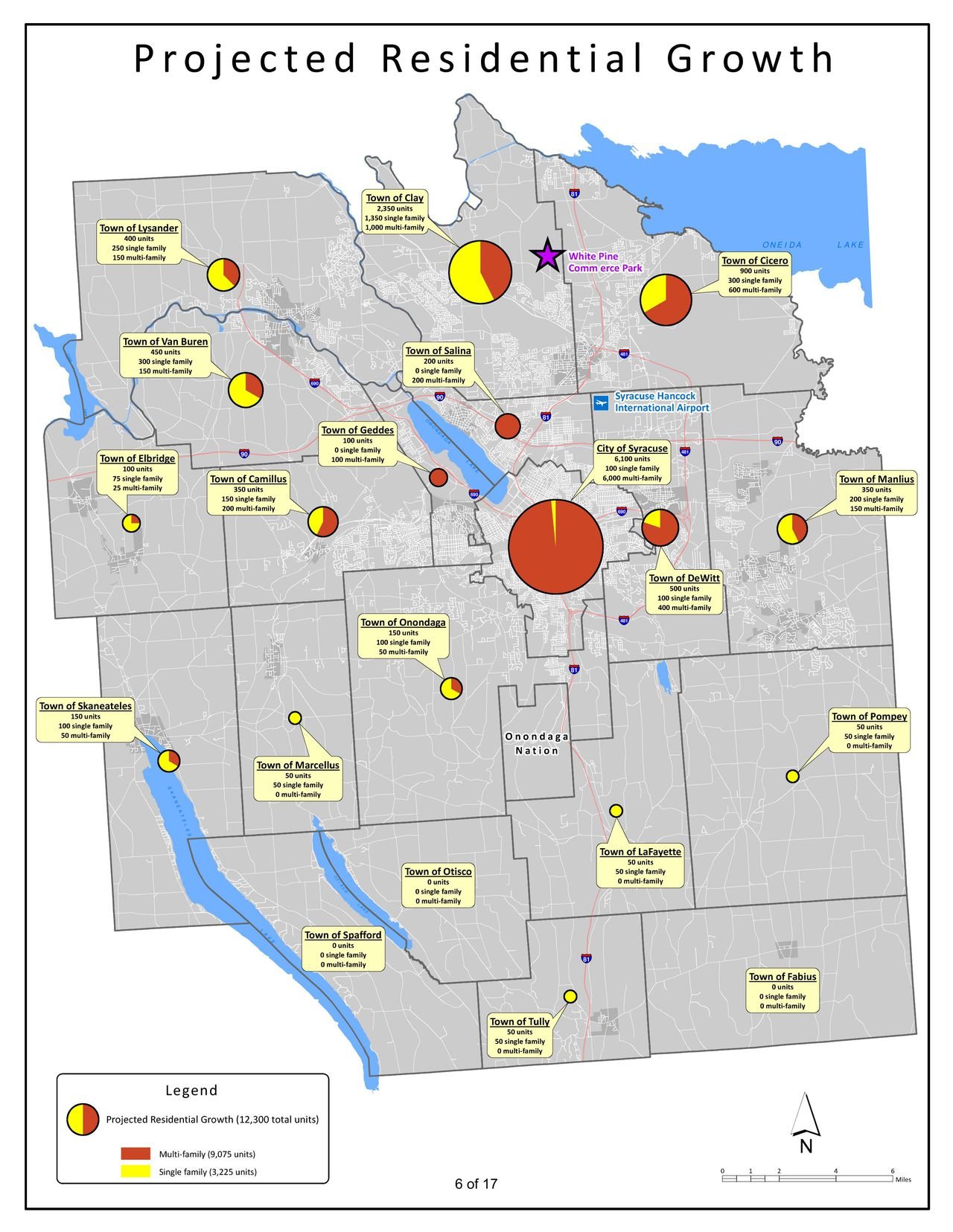
Let’s start with the City itself. In meetings with Micron, Onondaga County laid out plans to build over 9,000 new homes in the next 20 years (above), with over 6,000 of those homes coming to the City of Syracuse. It's natural for the City to absorb a large share of the new housing, and it's encouraging that the County overall views multi-family housing as the primary driver of this new expansion. But let’s look at a few different neighborhoods that can play a big role in adding density without displacing others.
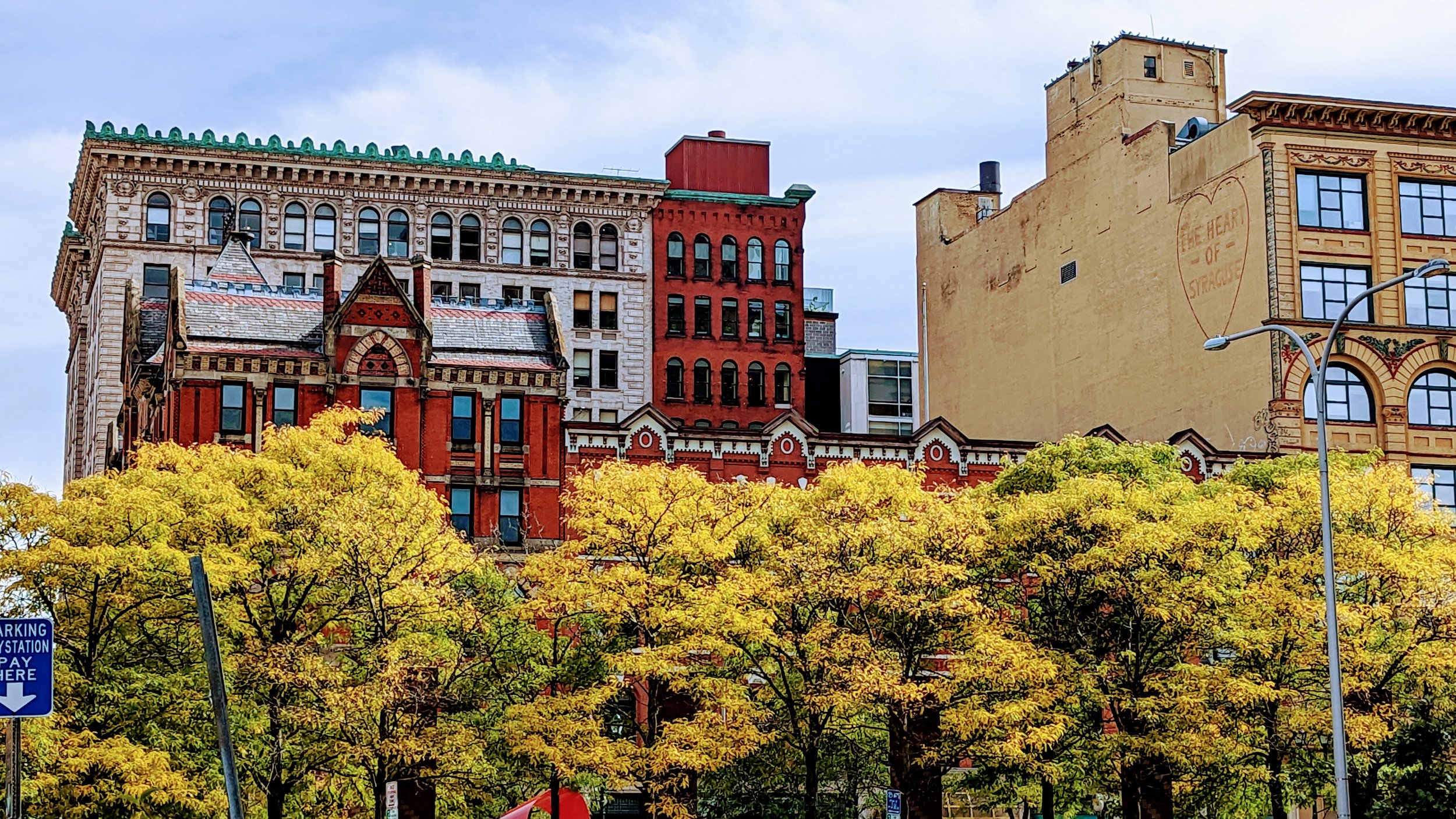
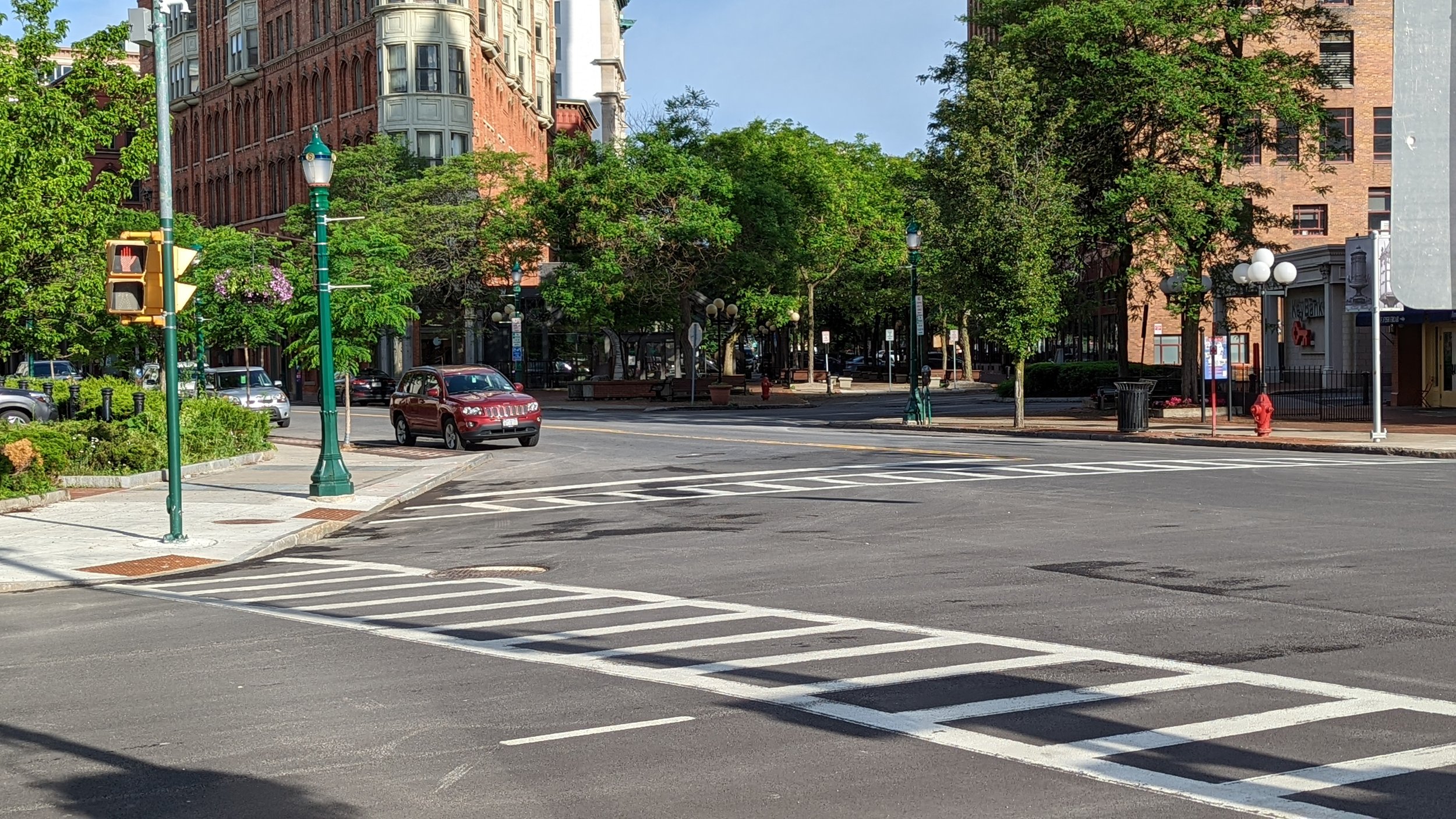
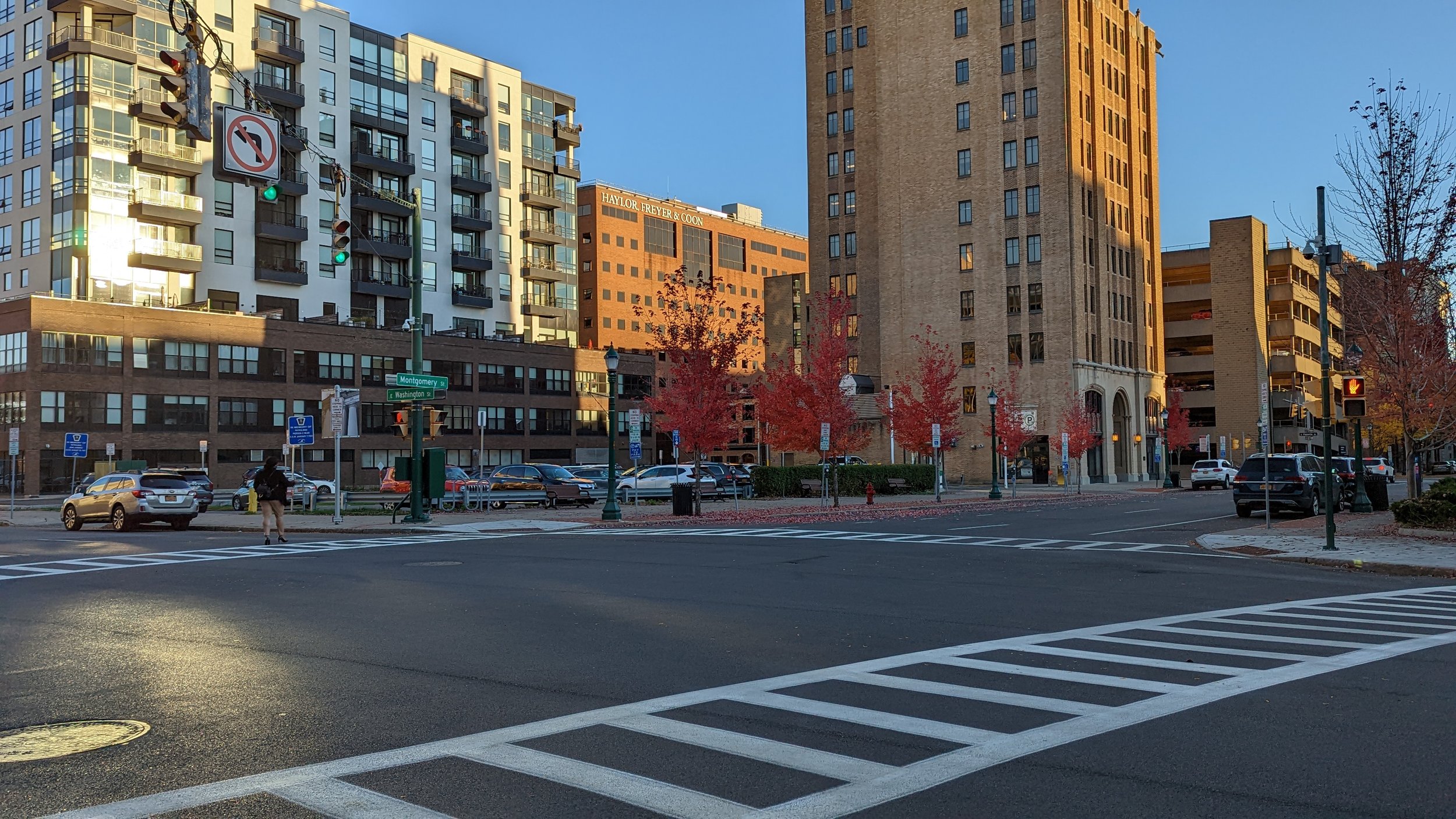
Downtown

Downtown Syracuse has grown into a full blown residential neighborhood over the past two decades, and the trend is not slowing down. With I-81 coming down, more land between Downtown and University Hill will be freed up for development, which should be primarily mixed-use in nature. But there is already plenty of land to build on Downtown, it just happens to be covered with parking lots.

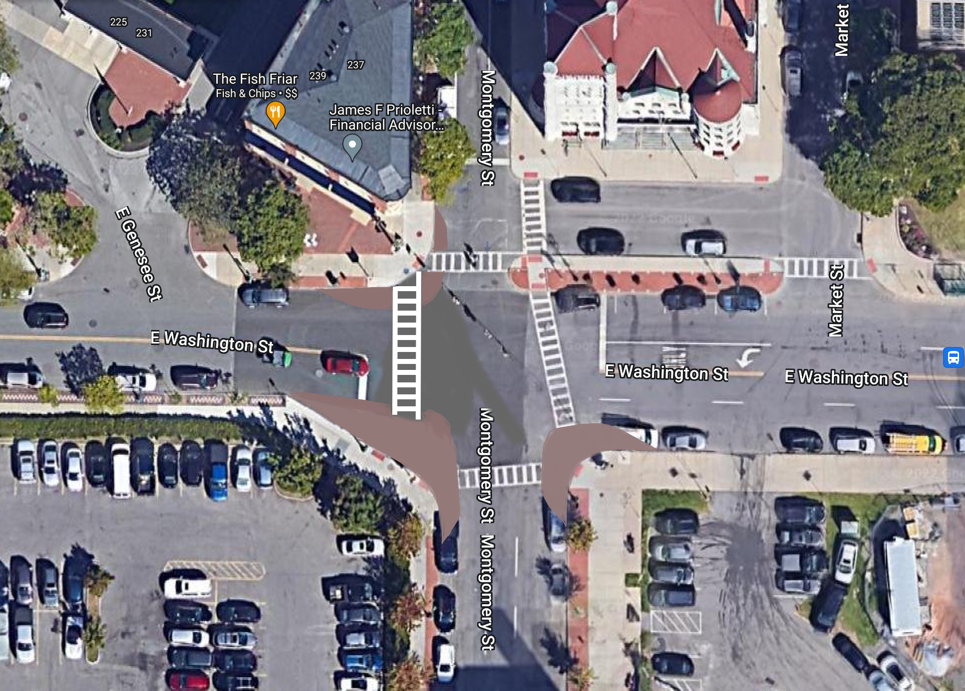
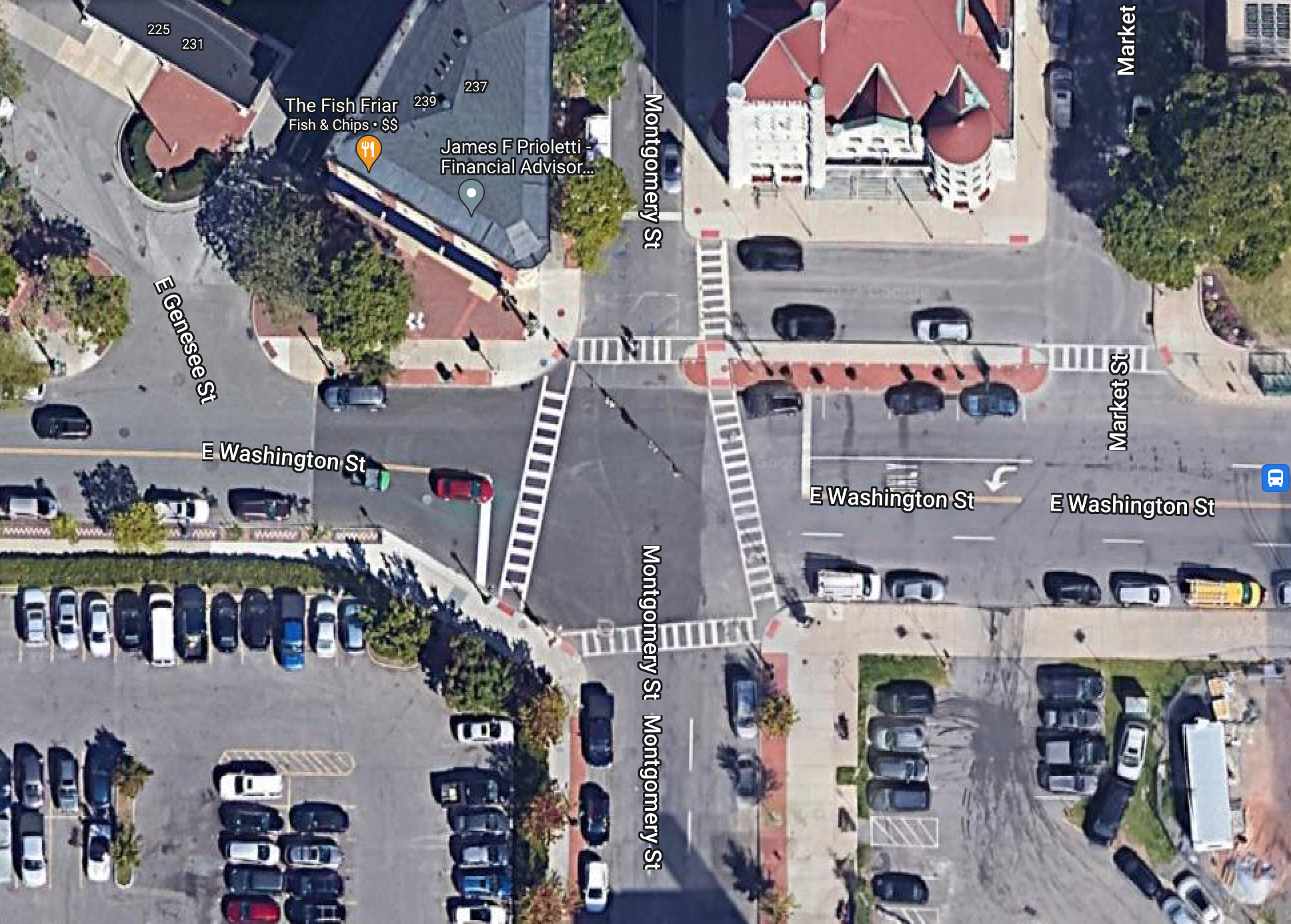
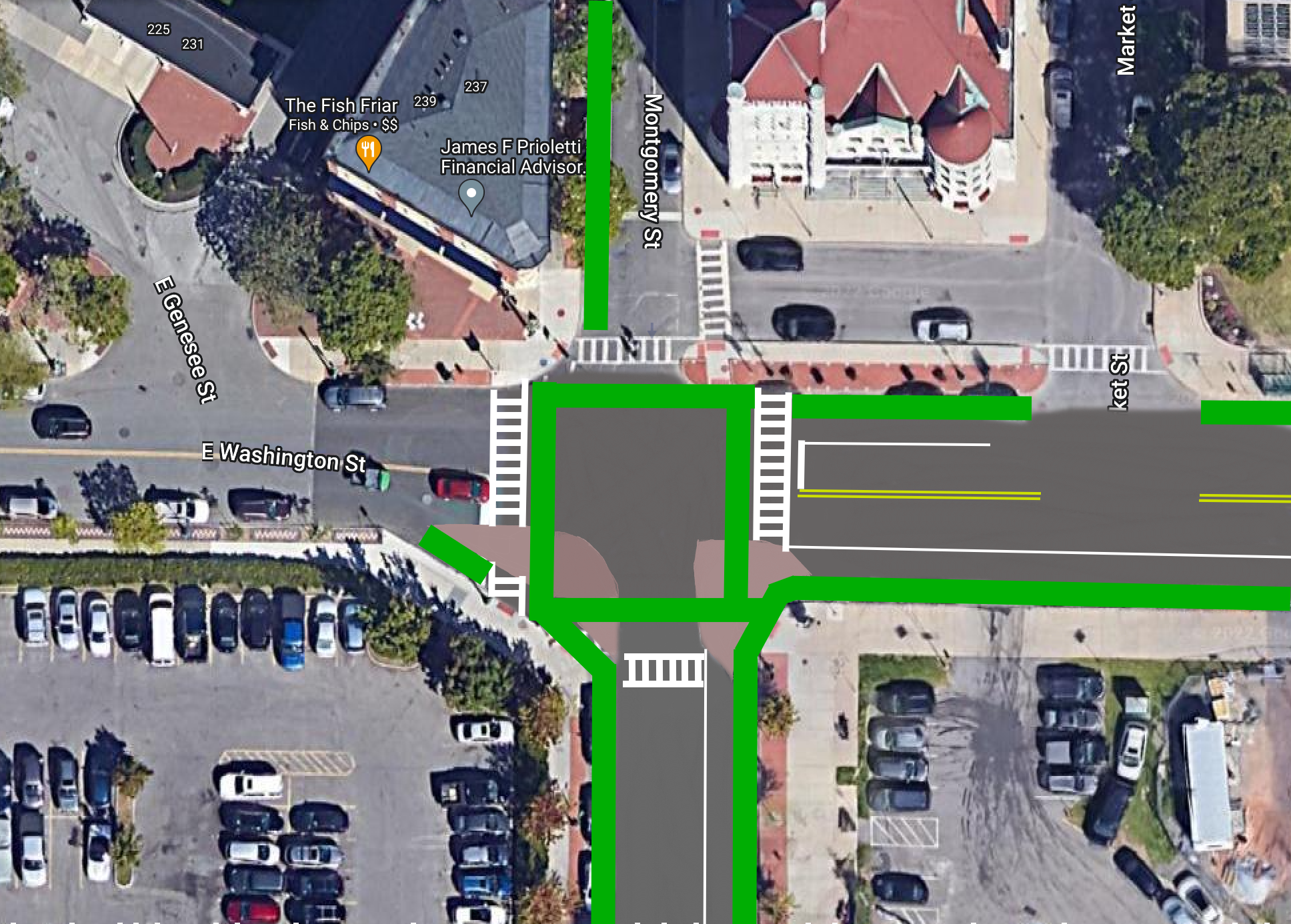
While Downtown has several large parking garages, surface lots still account for a large share of parking for residents and employees alike. Its time for us to rethink that. Most able bodied adults can walk straight across Downtown Syracuse in 10-12 minutes, meaning anywhere is a fairly close walk. The City should look to build a couple new garages, or a cheaper vertical lot that is commonplace in New York City, to begin freeing up development space. As mentioned in Intersections Part Two, the two parking lots across the street from City Hall are prime locations for new development. City Hall Commons, just a block away, is likely to go up for sale soon, with a residential conversion likely as it sits squarely within Hanover Square, one of the more desirable neighborhoods Downtown.

City Hall parking lot.jpeg
City Hall parking lot After.png
City Hall parking lot.jpeg City Hall parking lot After.png

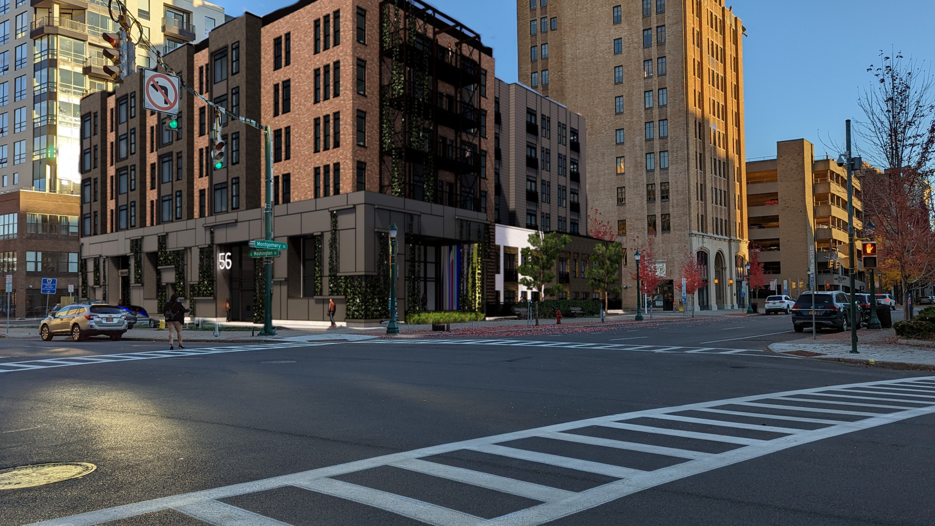
As Downtown is one of the places where we can really add density, not just 4 and 5 story buildings, but up to 8 and 10 stories each across the neighborhood with retail and office mixed in. While Downtown apartments have been continually increasing in price, we should be looking to the recent examples of The Smith and Corbett Corner for ways to approach creating more affordable housing in an increasingly dynamic neighborhood.

In addition to these opportunities, the BluePrint 15 project, which is working to update the public housing neighborhood just south of Downtown. This project aims to keep residents within the neighborhood while improving their access to services and amenities, as well as create more of a mixed-income neighborhood. This is an ongoing project that should be a model for all of the future developments within the City.

Inner Harbor / The Ballpark

The Inner Harbor and the area around NBT Bank Stadium have continually interested me in terms of development. Both sites sit close to Downtown, border the Regional Market, and have easy access to major transportation infrastructure, including the Regional Transit Center, 

Cor Development has been dragging its feet in pursuing their build out plans for the inner Harbor up to this point, but any fear of lack of demand should go out the window now. Their initial site plans call for over 400 residential units, mixed between apartments and townhouses, across the site.  This likely results in homes for over 600-700 people. If built out, with the large parking lots in the designs, the residential area would reach a density of roughly 18,000 people per sq mile. But, as I will discuss in Part Two, those parking lots are larger than what will be needed if we truly commit to a transit oriented development style, with the right transit in place. Cutting those parking lots in half and adding additional townhouses would provide additional home ownership opportunities, at more manageable prices, while adding to the walkability of the area.

Should this prove successful, the two large lots across Solar St, which are roughly the same size as the proposed residential development, will almost certainly spark further development at similar levels of density.

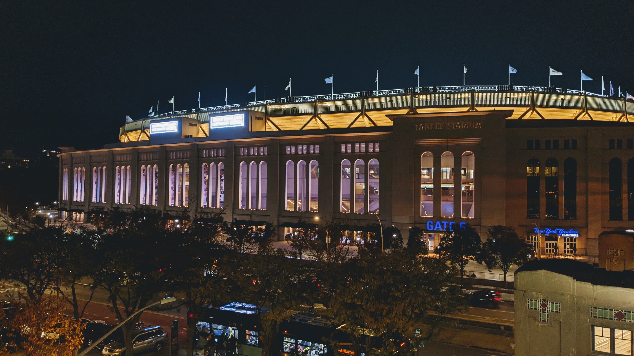
Now, over to the ballpark. I’ve continually advocated for the redevelopment of the large parking lot that surrounds the stadium, arguing that it would help create a deeper tie to the team in the community, encourage additional uses of the stadium beyond baseball, and create an opportunity for people, like me, to live near the ballpark. As someone who used to live just three blocks away from Yankee Stadium, its an experience many people, especially baseball fans, would relish. Today, there is nothing quite like that. Even the neighbors closest to the stadium must first walk through a sea of asphalt and cars to get to the ballpark, hardly an inviting entrance.

Syracuse Developmental Center

Earlier this year (2022), the City of Syracuse signed an agreement with the Albanese Organization to redevelop the former Syracuse Developmental Center into a mixed-use neighborhood. Some concerns were raised about the number of housing units that may be built in the development, with some preferring a final build out closer to 300 instead of the initial 600 envisioned. If we’re looking to provide housing at all income levels, pushing for closer to 600 homes, with an emphasis on townhouses and apartments, would make that more feasible  and more attractive for the developer. 

Sky Top

Syracuse University’s long term vision is to consolidate students and academics onto its Main Campus, leaving behind its sprawling South Campus, which is currently home to over 2,400 students on roughly 150 acres. While the University probably has plans to maintain the land for potential future athletic facility development of some sort, it should, instead, open up the land for redevelopment. The sheer amount of land is something that is hard to come by in a well developed urban center, with close proximity to many of the region’s largest employers. 

The existing apartment complex is very suburban in nature; small townhouses surrounded by parking and wide open spaces, similar to those found along many major arterials throughout the County. While these buildings could be repurposed as is, the current development style is not ideal for transit access and walkability. Adding commercial nodes and further infill development would help create a more self-sufficient neighborhood oriented towards transit and active transportation options.

Near East Side

One of the places already experiencing a building boom is the E Genesee St corridor as student housing continues to pop up. This general trend should be encouraged, as it frees up many of the homes in the University Neighborhood for families to move back into. But we should also look to create a better mix of buildings and housing types. Currently the trend is to build large, monolithic buildings, such as the Theory or the upcoming Laurel. These buildings do offer some street level activity along their fronts, but their sides are dominated by parking structures which deaden the block as you walk by. Some additional large scale development may be warranted in these areas, but we should look behind the Theory for a better approach.

View fullsize The Theory
The Theory
View fullsize Uncommon Apartments
Uncommon Apartments

Uncommon Apartments, which faces E Fayette St, renovated the former Sylvester building, built in the late 1800s, and expanded it. The building is around a quarter of the size of the Theory, yet its commercial spaces have already been leased and the building generates significantly more activity on the street level. We should look for ways to encourage buildings of this scale throughout the area, especially as more development opportunities appear once the I-81 project is completed.

Other Neighborhood Development

While the areas identified above have significant space for development opportunities, many other neighborhoods still provide opportunities for denser levels of development. Part of this needs to be encouraged through zoning, and specifically the elimination of single-family zoning citywide. There is no reason two-family homes should not be allowed in any neighborhood. But we also need to encourage different housing types.

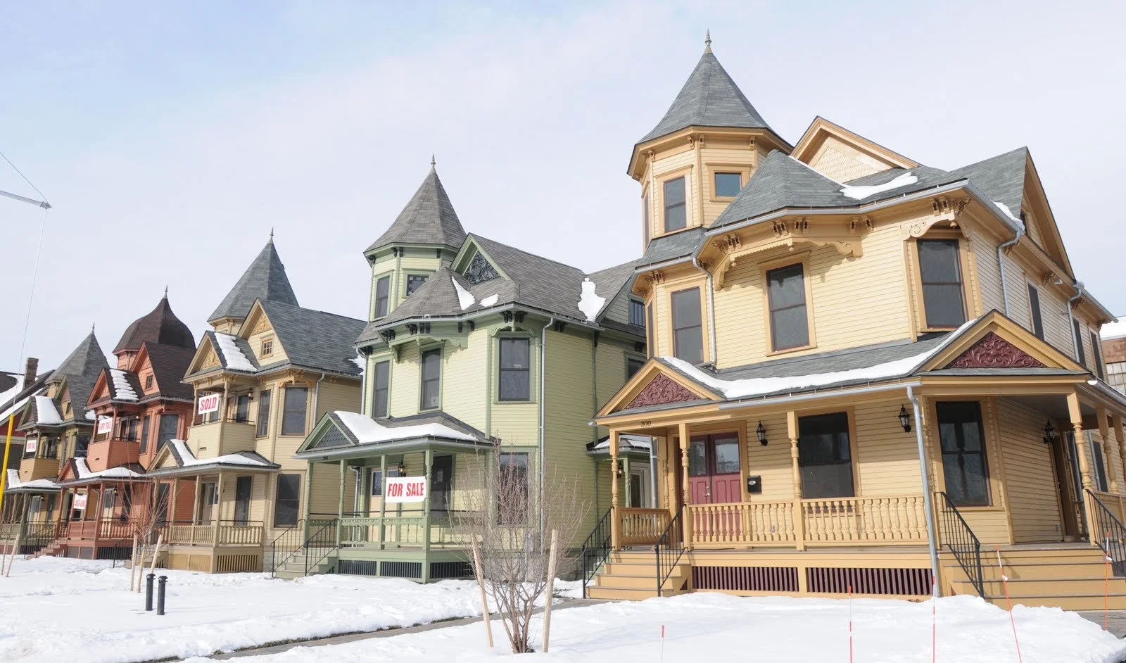
One of the projects that has excited me in recent years was the announcement of new townhouses in the Tipp Hill neighborhood. The project would take the lot formerly occupied by a flower shop and turn it into seven townhouses that would be sold to own. Sadly, this project has hit roadblocks in recent years, but there’s still a positive momentum. Larger lots like this should be eyed for townhouse development in every neighborhood. Adding a few extra households through a few townhouses per block would go a long way to our density goals while increasing homeownership opportunities.

Tipp Hill Before.png
Tipp Hill After.png
Tipp Hill Before.png Tipp Hill After.png

Inner Ring Suburbs

The City of Syracuse is not the only municipality ripe for infill development. Many of the inner ring suburbs, those closest to the central city that were typically developed early on and still maintain some transit oriented features, have stagnated in population and have commercial spaces that are low hanging fruit for redevelopment. The County’s housing presentation did not emphasize development within these towns, favoring many of the outer suburbs, like Clay and Cicero, instead. This is a missed opportunity and we should make sure we focus development in these areas first.
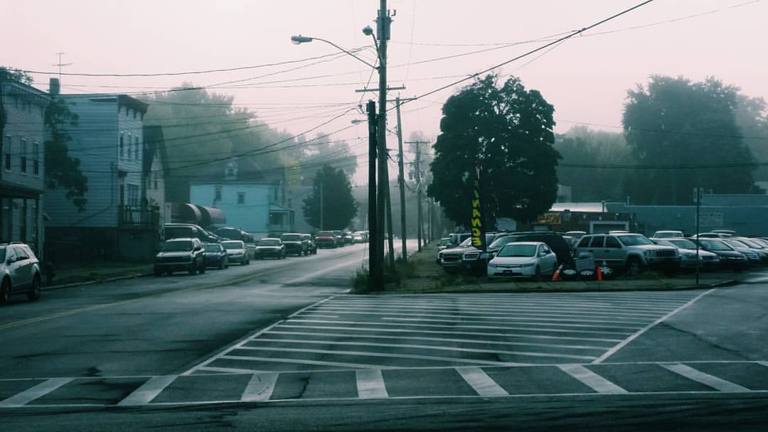
Mattydale

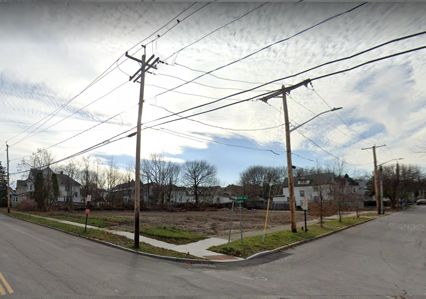
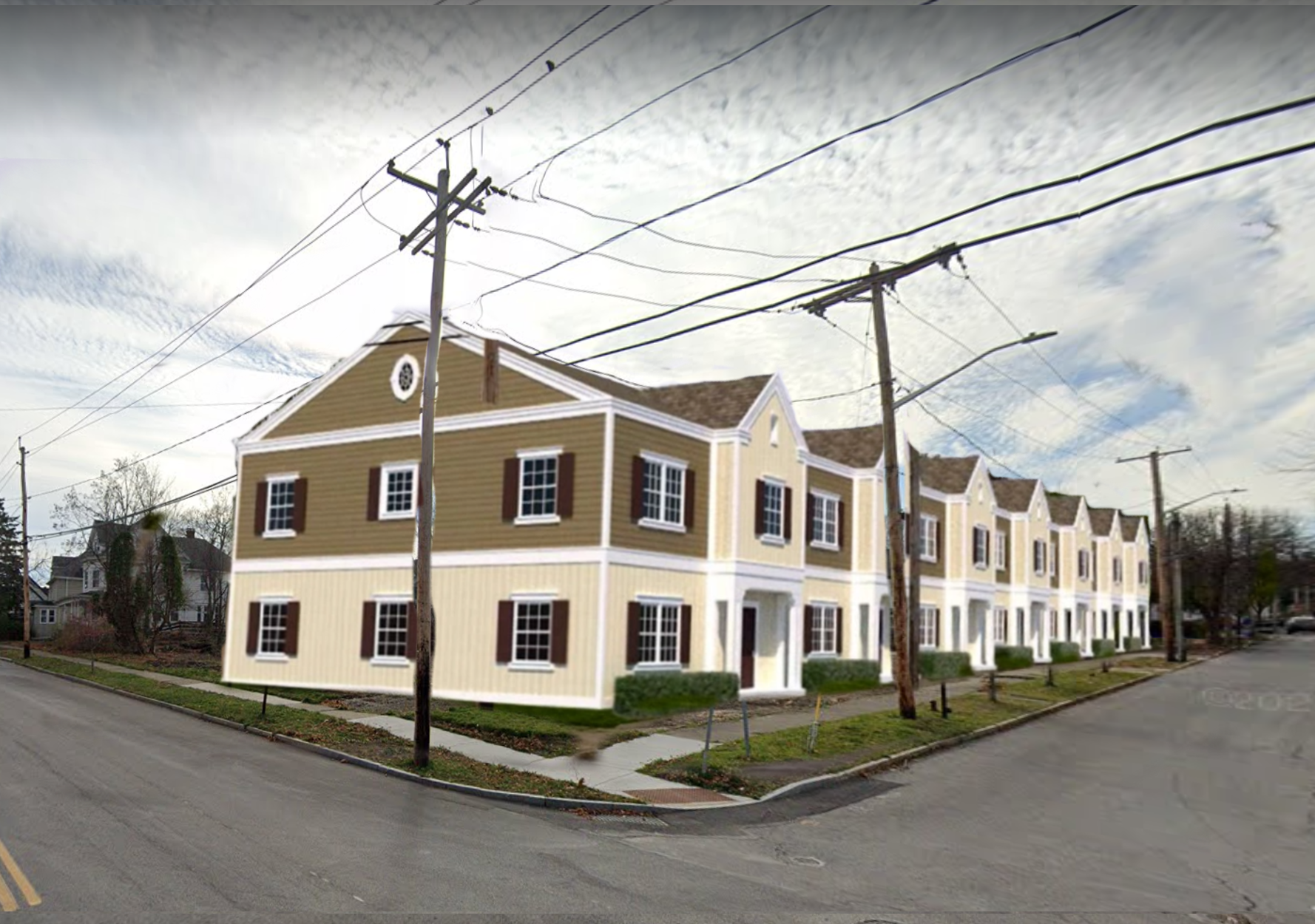
The hamlet of Mattydale is one of the prime locations for future development, especially in terms of more affordable and accessible housing. The hamlet sits just north of the City with access to nearby highways and opportunities for expanded bus access. Yet, as suburbanization has expanded further out from the City, the retail plazas within Mattydale have slowly been vacated, with some just outright demolished. As a result, the already overbuilt Route 11 has become even more of a mini highway bypassing the neighborhoods.

Screen Shot 2022-10-26 at 8.27.39 PM.png
Screen Shot 2022-10-26 at 8.27.57 PM.png
Screen Shot 2022-10-26 at 8.28.12 PM.png
Screen Shot 2022-10-26 at 8.28.27 PM.png
Screen Shot 2022-10-26 at 8.28.41 PM.png
Screen Shot 2022-10-26 at 8.28.59 PM.png
Screen Shot 2022-10-26 at 8.27.39 PM.png Screen Shot 2022-10-26 at 8.27.57 PM.png Screen Shot 2022-10-26 at 8.28.12 PM.png Screen Shot 2022-10-26 at 8.28.27 PM.png Screen Shot 2022-10-26 at 8.28.41 PM.png Screen Shot 2022-10-26 at 8.28.59 PM.png

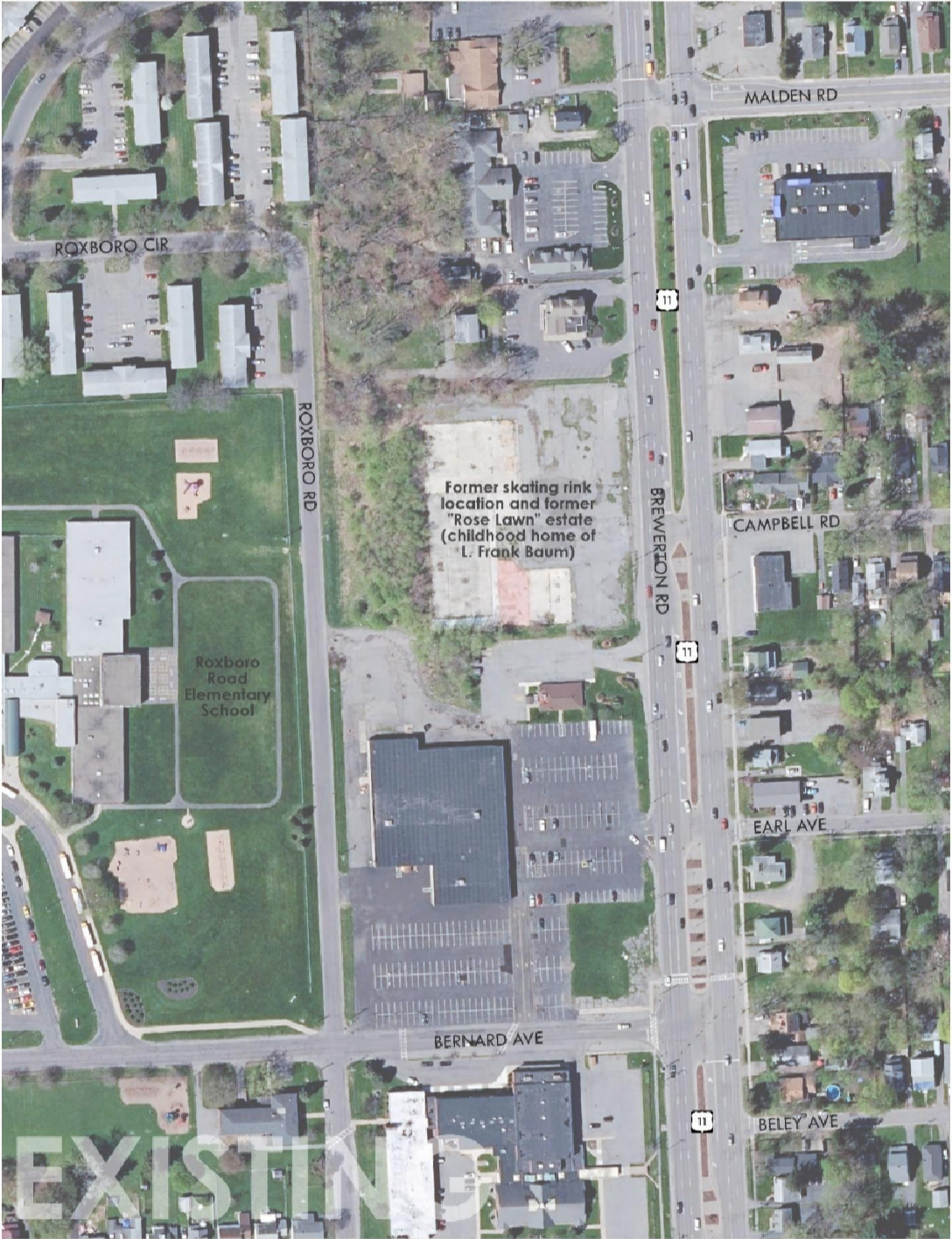
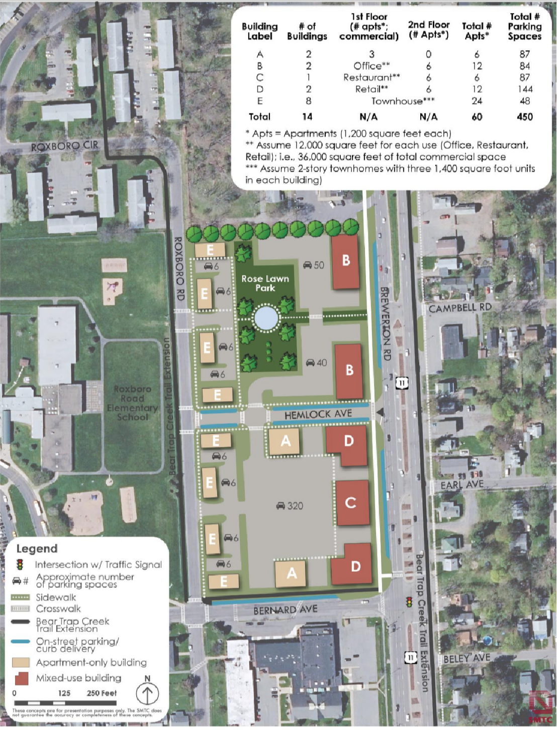
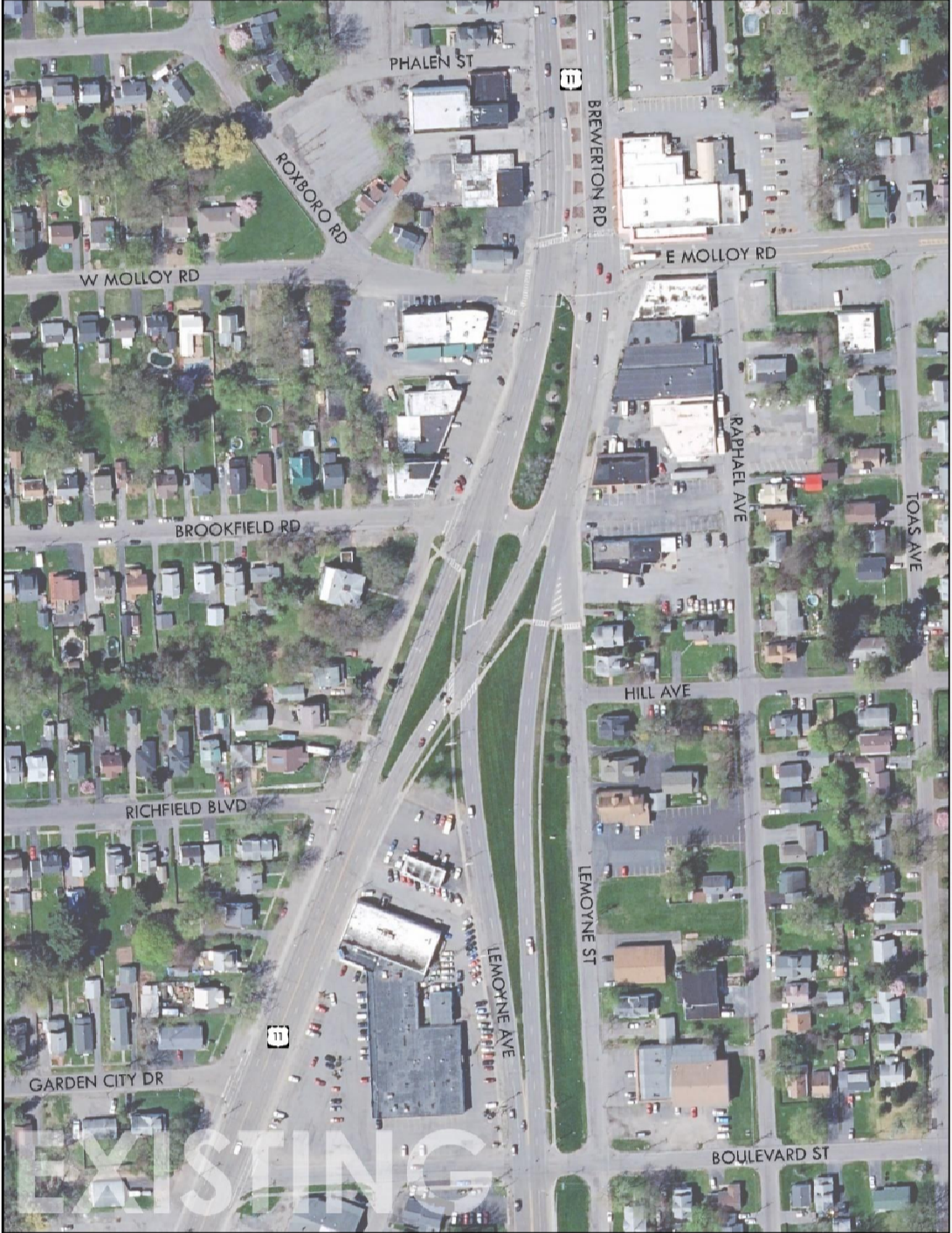
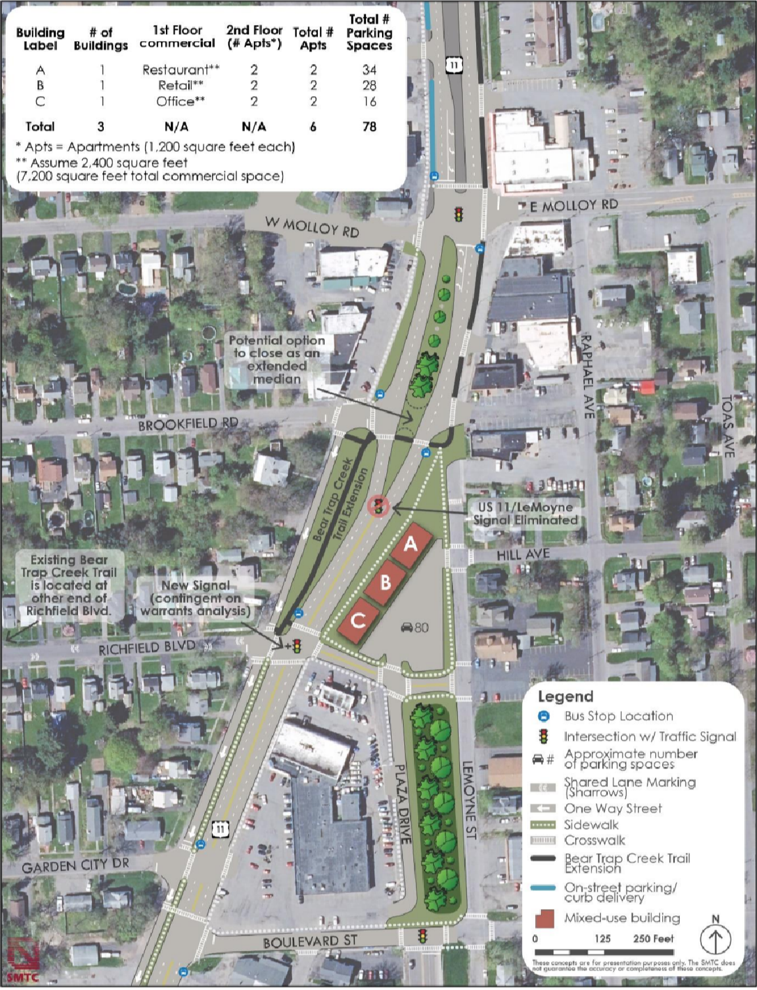
In 2022, the Syracuse Metropolitan Transportation Council (SMTC) completed a plan that looked at Route 11 to evaluate opportunities for infill development and right-sizing the mega stroad that splits the hamlet in half (which will be revisited in the transportation post). The plan calls for two story apartment and mixed-use buildings at three different sites that are either currently empty or vastly underutilized, resulting in roughly 150 additional housing units. This would account for the vast majority of the 200 additional units the County believes the Town of Salina can build out. Even then, this plan is conservative due to the zoning restrictions in place. The large sea of parking required by the current zoning code reduces the positive impacts this revelopment can bring. A simple correction would be to keep the parking generally as recommended, but add one to two more floors to each proposed building, increasing the number of residents within a walkable distance to the amenities already present within the hamlet and increasing the likelihood of more being built.
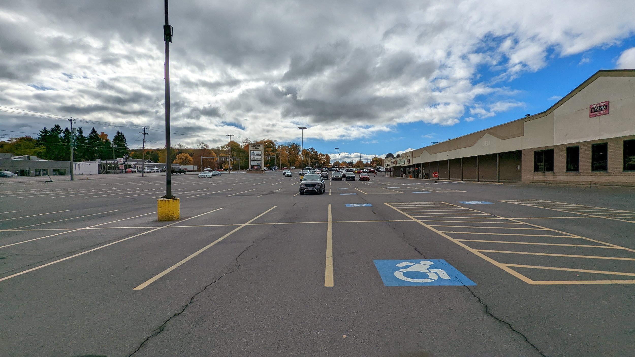
Westvale Plaza

Just west of the City line, Westvale Plaza is a perfect example of a mid-century commercial center. Fairly compact in size, compared to its more modern counterparts, and fronted by a large, expansive parking lot. In 2019, the Town of Geddes and Village of Salina published a joint comprehensive plan that envisioned this commercial node as a mixed-use development that filled in portions of its parking lots with further commercial space and revamped the existing plazas as mixed-use buildings. 

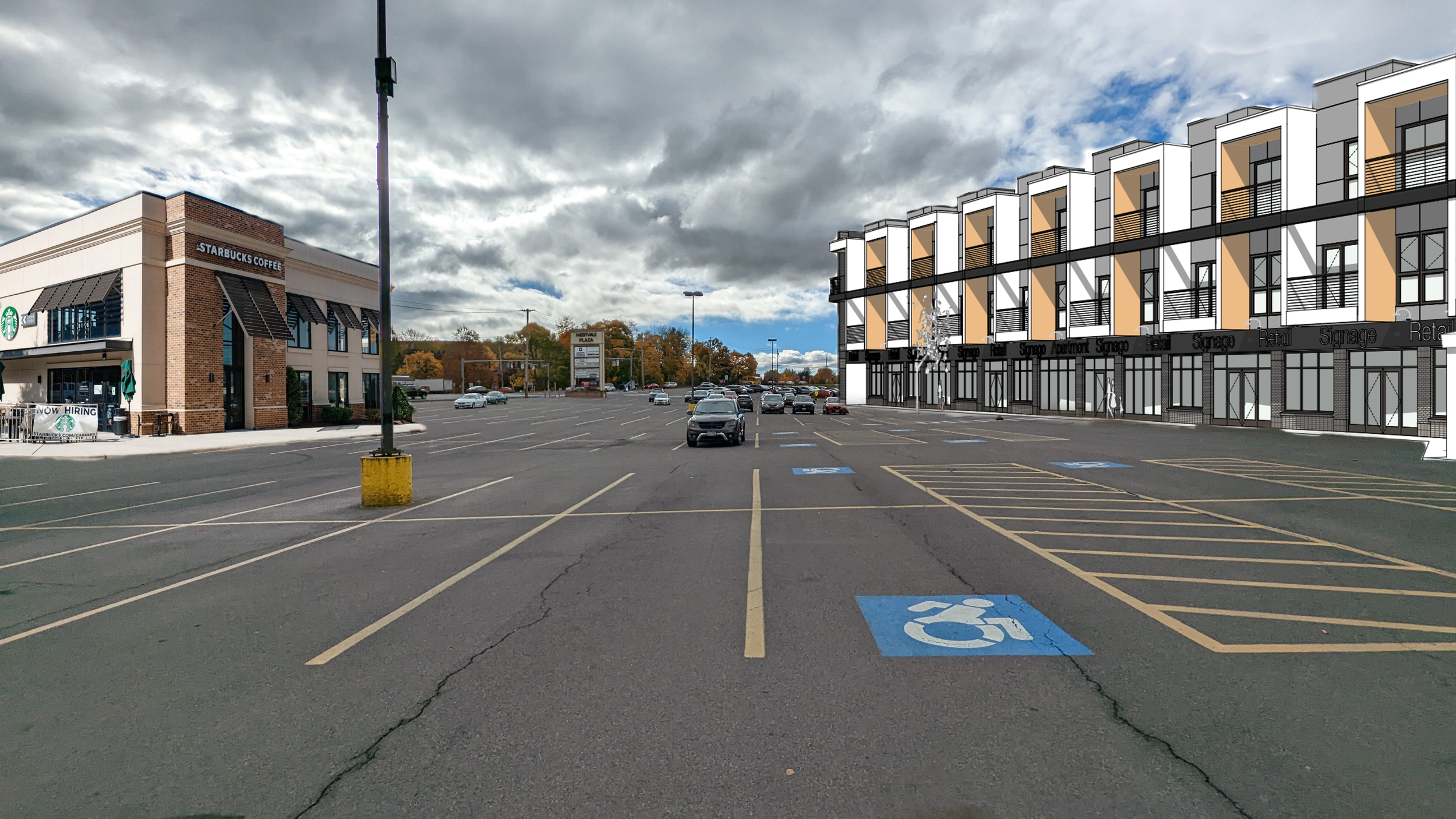
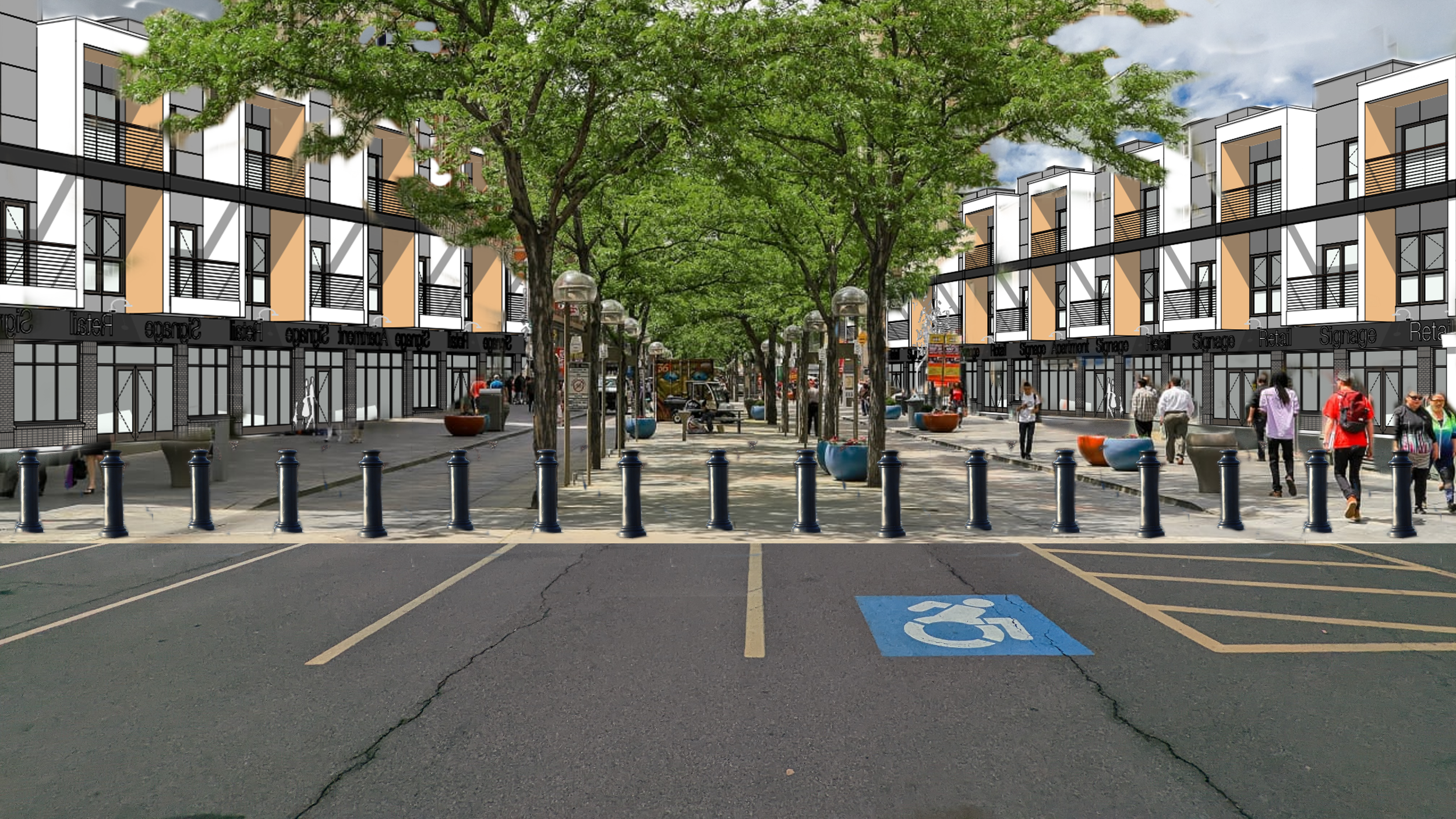
Concept site plan from the Town of Geddes and Village of Solvay Comprehensive Plan

While the Village of Geddes already has a more traditional Main St north of this area, along Milton Ave, the Westvale Plaza area is centrally located to fairly large population centers and is located along an important bus corridor. No exact plans or redevelopment options were explored within the comp plan, but the current plaza’s footprint (parking included), of roughly 14 acres, could easily handle 200 - 300 units of housing, which is far more than what the County currently envisions for the Town of Geddes (100 units). Using the County’s average renter occupancy of ~2 people per unit, at the high end (600 people housed) that would result in a density of around 27,000 people per sq mile. While this is high, consider that the Theory (the apartment building near SU campus mentioned previously) houses over 600 residents on less than 2 acres.

Westvale Plaza.jpeg
Westvale Plaza light.png
Westvale Plaza. Afterpng.png
Westvale Plaza.jpeg Westvale Plaza light.png Westvale Plaza. Afterpng.png

A less intensive redevelopment, while maintaining the same number of new units, would see the nearby Geddes Plaza and other commercial properties redeveloped as well.

Shoppingtown Mall (District East)

In the summer of 2021, a long awaited redevelopment of Shoppingtown Mall was announced: a mixed-use development with over 500 units of housing known as District East. I have few notes on this proposal, based on what is known publicly at this time, as its location and intent align perfectly with what we should be looking for in terms of development opportunities. It is located along a well used, and easily improved, transit corridor; the Empire State Trail (EST) runs directly behind the property, creating easy access through active modes of transportation; and the development instantly becomes a new downtown for the Town of Dewitt.

View fullsize Rendering of District East
Rendering of District East
View fullsize Site plan for District East
Site plan for District East

What should be encouraged is the further redevelopment of commercial properties along Erie Blvd E. Marshall’s Plaza, nextdoor to Shoppingtown Mall, has continually seen infill commercial development, reducing its parking lots in favor of more commercial activity. Other plazas, which have been less successful recently, should look to do the same, but add a mix of housing and office space. The Erie Canal, which was later replaced by Erie Blvd, was once the economic engine of the region. With a well planned redevelopment along the corridor, Erie Blvd can once again become an economic engine instead of, as the New York Times described it, “a rundown stretch of strip malls and muffler shops.”

Outer Suburbs

As mentioned above, the County is emphasizing development of single-family homes in the outer suburbs, which are the most difficult places to serve with transit and provide services. While I believe these areas should not be the focus of development, their close proximity to the White Pines Commerce Park make them attractive to many. So let’s look at places that can handle infill development and lend themselves to a more transit oriented development style. Many places will still emphasize single-family homes, but we should ensure they’re built in a denser fashion than what current local zoning laws permit.

Luckily, many good plans exist for these areas and we can only hope and encourage that they be developed accordingly. 

Rt 11 Corridor

In 2020, the SMTC worked with the Town of Cicero on a plan for the Route 11 corridor through the town. This plan identified infill development opportunities of over 1,600 units of housing, primarily apartments and townhouses, directly behind current commercial developments along Route 11. The aim of this plan was to identify opportunities to create housing that would encourage residents to walk, bike, or take transit to already existing nearby commercial centers. 

What was not planned for during this study, was the study area to be within a very short distance of the new Micron development. As such, this development proposal, nearly twice as many units as envisioned by the County for the Town of Cicero, should be thoroughly considered as it has already been vetted by community members. A developer and more detailed plans would be needed, but the general concept should be encouraged.

Great Northern Mall

North of Syracuse, Great Northern Mall has struggled financially for years, especially after the expansion of Destiny USA. In the summer of 2022, a developer announced a plan, similar to that of District East, to redevelop the struggling mall into a mixed-use center with roughly 500 housing units. While this location is less ideal than Shoppingtown, its close proximity to the Micron site makes it a perfect western anchor to any additional bus service added to the corridor, especially if the Route 11 developments noted above are followed through.
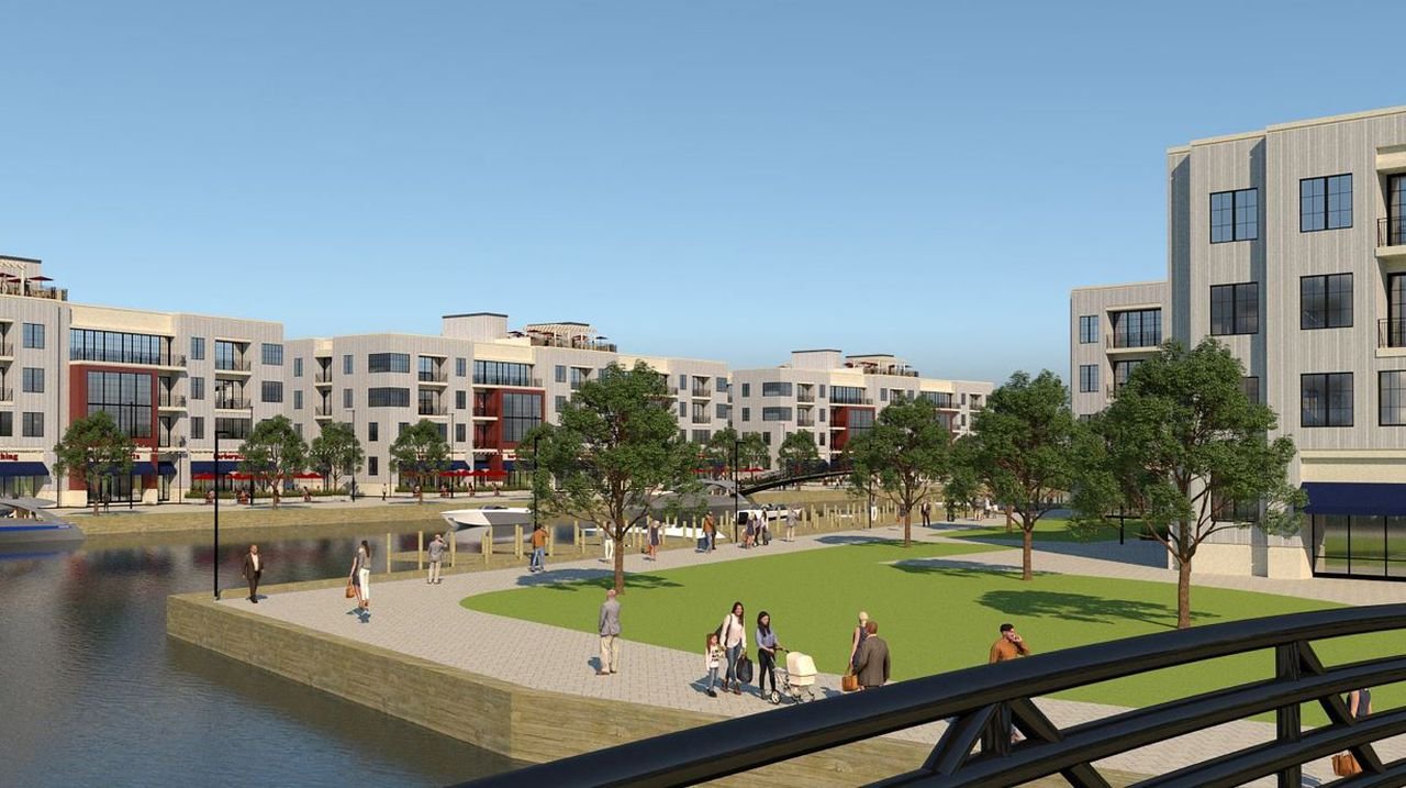
Brewerton

The final location I’m looking to emphasize in terms of housing development is also home to an existing proposal, but this one is unique. Onondaga County is a fairly landlocked county, even with access to several lakefronts. As a result, any development along the available lakefronts that offer up multi-family housing options is worth pursuing. The same developer that is looking to redevelop Great Northern Mall has staked out a plan along Oneida Lake for a mixed-use community, with an emphasis on multi-family housing. Currently, the plan also calls for a large number of single-family homes, but the plan would be enhanced if it switched out detached homes for townhouses. This would allow the hamlet of Brewerton to become a true northern anchor to any public transit enhancements made to accommodate the Micron development. As the hamlet sits on the northern reaches of Route 11, the increased development along this important route will lend itself to more walkable and transit oriented development (which will be discussed further in the next blog).

View fullsize Rendering of proposed Brewerton development
Rendering of proposed Brewerton development
View fullsize Site plan of proposed Brewerton development
Site plan of proposed Brewerton development

Doing Housing Right

Each of the neighborhoods identified above are prime locations for expanded housing and denser development, but we need to be open to gentle increases in density throughout the county. This is the first time in 50+ years that Onondaga County must confront a dramatic increase in population and we can’t afford to let suburban sprawl take over as it has in recent years. Construction on Micron will begin in 2023-2024, and the I-81 project will begin by the end of this year. We must act quickly to alter our zoning codes and create a more unified housing policy to encourage these dense development opportunities. New York State should also follow California’s lead on allowing accessory dwelling units and two-, three-, and four-family homes in all neighborhoods. We also need policies tied to transportation infrastructure that will make the dense developments discussed above possible. And this tees up our next discussion: with all of this new housing development, what does this mean for our transportation networks? And what can we do to make sure public transit and active transportation options play a major role in our region’s future?

In Urban Planning, Housing
Comment

Color My World: Why Cities Should Embrace the Colorful

September 30, 2022

The City of Syracuse has been on a mural painting craze in 2022, with a City sponsored program (City as Canvas) funding murals in eight different neighborhoods and local businesses funding their own artworks. This continues a trend of murals popping up in cities across the country. As I’ve traveled through various Rust Belt cities over the past year, murals have been an increasingly popular way to liven up spaces around vacant lots or parking areas next to recently renovated buildings. They bring color and character to spaces that once sat empty for decades, and I am all about it. But, we shouldn’t just think of murals when we look for ways to brighten up our cities. We should be embracing color in everything we do - on our buildings, our roadways, our parks. Let’s take a look at different ways cities have embraced color and point out opportunities across Syracuse where color can be added to our everyday lives.

Murals

Murals have been part of the human experience for thousands of years. Nearly every great civilization has used murals to showcase different aspects of their culture - whether its the power of the gods, the value of the state, or key historical events. 

Cities across the United States have embraced murals over the last several decades. Philadelphia, like many other older industrial cities, has seen murals as a form of reinvestment in each of its neighborhoods. Over the past 35 years, over 4,000 murals have been painted across the city, making it one of the largest collections of murals in the world. Closer to home, Buffalo, NY’s Albright Knox Art Gallery has been funding public murals across the Queen City since 2014. While some of the most powerful murals cover the entirety of a building’s facade, they can also be small, hidden gems meant to engage people as they walk around their neighborhood. This mixture is what makes murals so engaging. They surprise viewers and keep the urban environment exciting in a positive way. 

Syracuse has plenty of examples of murals in all shapes and sizes. A massive mural depicting local basketball legends was just recently completed in Downtown Syracuse, created by a world famous muralist. At the same time, the City as Canvas program has looked to borrow a page out of the New Deal’s Works Progress Administration (WPA) by putting local artists to work on murals in each neighborhood. This is a model the City should continue to use beyond the initial eight murals. Partnering with local businesses and institutions, the City should create a fund to paint five to ten new murals each year, depending on the sizes proposed, and hire local artists to get the work done. A prime location for a series of murals would be the elevated train tracks that cut through the City, both through Armory Square and across the Southside. While coordinating with the railroad to get the effort kickstarted may be difficult, the color and life that the project would bring is worth the effort. 

View fullsize Community Garden Mural - NYC
Community Garden Mural - NYC
View fullsize Parking Lot Mural - NYC
Parking Lot Mural - NYC
View fullsize Syracuse Elevated Freight Rail
Syracuse Elevated Freight Rail
View fullsize The Atrium
The Atrium

A personal wish of mine is to see the Atrium, which sits on the south end of Clinton Square, covered in murals. It is currently the ugliest building in Downtown Syracuse, but covering it in murals would elevate it to become one of the jewels of our city. Its blank walls, flush windows, and fairly smooth brick exterior could provide an excellent canvas.

But we should remember that murals are not the only way to bring color to our buildings.

Colorful Buildings

View fullsize Philadelphia Rowhouses
Philadelphia Rowhouses
View fullsize DC Rowhouses
DC Rowhouses

One thing you’ll notice the more you watch HGTV is the feeling that every house ends up being one of three colors: white, grey, or tan. These are the same colors most homeowners associations (HOAs) will allow. There might be some color added on a door or a darker trim around the windows, but we are increasingly seeing a homogenous look to our neighborhoods.

Now having some homogeneity in our built environment can be a good thing. Row houses, brownstones, Victorian homes are all often found in duplicates or groups of similar structures. The repetition can be part of the charm of a neighborhood, such as Brownstone Brooklyn. But if we start to take a wider look around the world, we start to see color playing a much larger role in these structurally homogenous neighborhoods, making Brownstone Brooklyn’s brown variations an outlier. Cities across the world, including many older American cities, have embraced color in their neighborhoods, resulting in bright, friendly neighborhoods. Philadelphia and Washington, D.C., as seen above, both showcase homogenous neighborhoods that embrace bright colors to add character and warmth.

View fullsize Sister Houses
Sister Houses
View fullsize The Hudson Building
The Hudson Building
View fullsize Victorian on James St
Victorian on James St
View fullsize Pond St Businesses
Pond St Businesses

Syracuse has some examples of this, with the most prominent being the five Sister Houses in the Park Ave neighborhood. These beautiful old Victorian homes are identical except for their color palettes. Back in Downtown Syracuse, the Hudson Building has also worked to differentiate itself through color, bringing a bold, forest green to a streetwall filled with red brick. Color doesn’t always have to be bright, but going beyond the traditional color palettes help invigorate a space. We should encourage building developers to utilize materials that can be painted easily and updated to reflect the personalities of the tenants inside. Keep the designs simple and infuse them with life through paint.

Paint is not the only way to bring color to a building. Many taller buildings in downtown business districts have embraced light displays to enhance their skylines. These lights are often coordinated with one another to celebrate holidays, sporting events, or just bring awareness to different causes. While these light shows are beautiful to behold, we must get better about using the lights properly to not interfere with bird migrations and other natural occurrences. 

Colorful Streets

We may not think of our streets as a place for any colors beyond black, yellow, and white, but they are public spaces and public spaces should embrace color wherever they can. Some may be more functional (bus and bike lanes) while others more decorative (street murals and painted plazas), but they all function to bring color and life to our cities.

When thinking of the more functional colorful elements, bus and bike lanes are often the first to come to mind. Often referred to as Elmo and Kermit due to their bright red and green colors, these lanes serve the important function of providing spaces for residents to get around outside of a private vehicle, giving them priority where possible. Also, as an avid Muppets / Sesame Street fan, I appreciate the references that bring a bit of childlike wonder to infrastructure. These are essential tools for every city, and they bring the added benefit of color with them. When you look at streets filled with bus and bike lanes, the visual appeal and interest of the space increases substantially.

View fullsize Brick Patterned Crosswalks and Colorful Barriers
Brick Patterned Crosswalks and Colorful Barriers
View fullsize S Salina St Bike Lanes
S Salina St Bike Lanes
View fullsize Seattle Painted Curb Extensions
Seattle Painted Curb Extensions
View fullsize Rochester Piano Crosswalk
Rochester Piano Crosswalk

Other functional colorful elements tend to be focused around intersections. Using brick or stone pavers for complete intersections, or specifically in crosswalks. Painted crosswalks (which is still frowned upon by federal agencies and the MUTCD) have been embraced by cities across the country. Rochester, NY celebrated the Eastman School of Music by painting a piano style crosswalk just outside its doors.

Other cities have embraced paint as a way to extend the pedestrian realm, through painted plazas and curb extensions. Seattle, WA has an extensive network of painted curb extensions that embrace colorful designs to draw the attention of drivers. Syracuse will be embracing the idea of a painted plaza in the near future right in front of City Hall, after it awarded the design to another local artist.

This is not the first time Syracuse has painted its streets. In 2017, Syracuse hosted the World Canals Conference. It celebrated by painting a canal themed mural outside of the Erie Canal Museum, harkening back to the waterways that built the City. These murals were short lived due to the wear and tear of traffic, but we should look for streets to pedestrianize and fill with color that will last without cars driving over them.

Natural Colors

View fullsize Burnet Park in Fall
Burnet Park in Fall
View fullsize Basilica of the Sacred Heart of Jesus
Basilica of the Sacred Heart of Jesus

Up until now the main focus has been on how to bring color to our man made structures, but we should never forget to embrace the color and life that nature can bring into a community. 

At the moment, we’re entering into the heart of autumn, my personal favorite season. Oranges, reds, and yellows burst from the trees across the region, making for a beautiful sight. Different trees showcase different colors during this time and the mix of trees not only creates a more vibrant scene, but also a healthier one for the trees as they help reduce the spread of tree borne diseases.

Community gardens, such as the Syracuse Rose Garden, are another perfect example of natural colors bringing people together in a space of beauty. The groups that help upkeep these spaces help build community through the action of gardening and the result of a beautiful garden to be admired. 

Many of these spaces take the addition of color to an extra level through the inclusion of art. The Lipe Art Park, while light on trees and flowers, embraces the use of art through a linear park. The Onondaga Creekwalk is beginning to explore similar opportunities, especially under the overpasses between Downtown and Franklin Square. Should a multi-use path eventually connect these two spaces, as is being explored in an ongoing study, the City of Syracuse will soon provide its residents with an active commuting corridor surrounded by art and color that would be a national example. 

These are all just some examples of how we can embrace color and art in our urban spaces, but we need to provide opportunities for communities to use these tools to fit their own visions. Get rid of the HOAs and embrace colors that showcase the personality of your neighborhoods and your City as a whole.

In Civic Pride, Housing, Walkability
1 Comment

A Look Back from 30: Why City Planning

August 30, 2022

I’m hitting a milestone this year - 30 years old - and it seems like the right time to reflect on what brought me to this moment. One of my favorite podcasts, Talking Headways, asks each of their guests “What got you interested in cities?” For those of us in the planning profession, I think this is an excellent question for us to reflect on from time to time. What made us decide that we wanted to dedicate our professional lives to improving the communities we live in? Well, as I look at 30, I think this is the perfect time to reflect on the inspirations that brought me into city planning and maybe encourage others to jump in too. If not professionally, all of us should be looking at the places we live and working to improve it little by little - your home, your street, your neighborhood, your city.

View fullsize New Yankee Stadium
New Yankee Stadium
View fullsize Old Yankee Stadium
Old Yankee Stadium
View fullsize Coors Field
Coors Field
View fullsize Wrigley Field
Wrigley Field

Baseball

Syracuse, being a small- to medium-sized, was still big enough to get a kid interested in cities with all of its historic buildings, easy to walk to parks, and an ever diversifying population. But the real spark of interest came with traveling to much larger cities to catch a baseball game or two - Pittsburgh, Cleveland, Toronto, New York. As anyone who reads this blog has figured out by now, baseball is a truly urban sport, and these yearly trips to great urban ballparks inspired an exploration into cities and their histories. The sights and sounds surrounding the excitement of the games were more interesting to me than the games themselves. Our trips may have been built around baseball games, but they were excuses to experience much, much more. Museums, shows, music - the things that make cities cultural hubs, no matter the size. 

On top of that, they were the first experiences using robust transit networks. Riding the subway for the first time was much more exciting than my trips on OnTrack. When the 4 train first comes above ground to reveal Yankee Stadium, the old Yankee Stadium, is one hell of an entrance. OnTrack’s Game Day Express could have had similar vibes, but the low frequency and slow pace made it much more of a novelty than a true transportation option. Even so, I continue to think of ways that OnTrack could be revived into a fully functional system.

But beyond the culture and the transit experiences, it was architecture that first pulled me in. 

View fullsize IMG_20171009_200457.jpeg
View fullsize IMG_20200126_000802.jpeg
View fullsize original_04952f7f-80a5-4613-9f3d-1031a16217a0_PXL_20220827_170023939.jpeg
View fullsize ESB.jpeg

Architecture

“Nothing is higher than an architect,” according to George Costanza, even if I would later realize that episode was the first time I ever heard of a city planner as a career. At the moment I agreed with him, but there was a lot more to learn. Architecture is what helps shape a place and informs how we can use it. Skyscrapers quickly became an obsession for me, even if Syracuse’s tallest building is only around 330ft tall. The quest to rebuild the World Trade Center site took this interest in skyscrapers even further as I followed all of the design submissions closely. My third grade teacher, Mrs. Bukowski made sure to share with me any newspaper or magazine articles she found about the project. The sheer size of the site and the meaning of the structures was like building a mini city within a city. The whole project was an introduction into modern architecture and city building as a whole. The history of the original towers, how the city grid was disrupted to accommodate the mall, and how the City looked to stitch itself back together after a tragedy.

View fullsize Old Syracuse.jpeg
View fullsize S Salina St above.jpeg

All of this pushed my interest in cities further, to the point where I decided to build a miniature city of my own. Not quite as detailed as a model train set, but I slowly bought up dollar store model churches and homes, along with miniature models of famous skyscrapers, before building my own creations out of whatever I could find at home. In some ways, the result is similar to the community planning approach laid out in Dream, Play, Build by James Rojas and John Kamp, using whatever I could find to help create my ideal city. Looking back, I had already started to look beyond Costanza’s obsession with architecture and started to focus on how buildings worked together to form spaces and create distinct neighborhoods. Just if I knew city planning was a career.

But maybe that interest in how the built environment influenced us really came from the shows we saw on TV growing up.

Childhood Shows

I won’t get too deep into how the shows of my childhood shaped my thinking about cities, mostly because I’ve already done that. But I can’t skip over just how important the representation presented to kids in the 1990s was. After decades of shows focusing on the suburban experience, suddenly urban settings became popular again. Already Sesame Street was proving that relating to kids living in the city was important and ripe for storytelling. Mr. Rogers, while less urban than Sesame Street, pulled directly from his experiences in Pittsburgh, right down to the trolley reflecting the city’s famous inclines.

Hey Arnold took urban childhood shows to a new level, telling stories that really can’t be replicated in more suburban environments. Still, people think fondly of that fictional city and its distinct neighborhoods. But the urban influences went beyond shows aimed at kids. Seinfeld, Friends, the Cosby Show, Frasier, even Boy Meets World (the college seasons closer to downtown Philly especially) focused on characters in urban environments. We grew up with stories set in cities, so is it really any wonder that our generation has been (somewhat) slower to move to the suburbs than others?

This interest in storytelling did change my initial plans to pursue architecture, instead pursuing film and television production, but in some ways it ended up giving me a wider perspective that would eventually lead me into planning.

Media Production

I ended up pursuing an undergraduate degree in film and animation at the Rochester Institute of Technology, which grew into an interest in eventually working on Sesame Street. One of the side effects of this decision was the opportunity to travel to cities across the country and in Europe. I experienced living and working in DC, New York, and Los Angeles, as well as across Upstate New York. The over reliance of driving in the outer DC suburbs was an eye opening experience for me, and I grew to love riding the metro as a way to avoid it. I did my best to live in LA without a car, opting to ride transit or bike wherever I could. I still believe LA’s metro system is underrated, even if there is definitely room for improvement. 

NYC showed me just how freeing it could be living without a car, even if the trains didn’t always sync up with an overnight work schedule. But on my days off, the train gave me a chance to explore almost anywhere in the City for just $2.75. And I made sure to see as much as I could (mostly whatever free events I could find).

But it was my time spent in Albany that started to remind myself why I was interested in cities in the first place. I worked at a 24 hour news station that covered news across the state. Similar stories continually crept up during my time there - dangerous streets leading to crashes that impacted innocent people walking, cities looking for new ways to improve their downtown cores to attract new investments, and a continued focus on preserving the industrial past that once made the cities growing and prosperous. 

View fullsize Albany street at dawn
View fullsize Spectrum Theatre in Albany
View fullsize Master control room
View fullsize Troy Opera House

At the same time, Albany was the first place I lived after the Bronx, which was a giant change. I had gotten used to moving about without a car and walking everywhere. While Albany, and the surrounding Capital Region, had plenty of great urban neighborhoods, the connectivity had been broken up decades ago, much like cities across the country. It led me to wonder why I felt this disconnect. Luckily, Market Block Books in historic downtown Troy had a section of books dedicated to urban planning. The first two books I picked up, that remain two of the most important books I have ever read, include Street Fight by Janette Sadik-Khan and Walkable City by Jeff Speck. It was the first time someone really explained why certain areas, usually the more historic neighborhoods, invited you to spend time while others felt sterile and removed. 

Over the next two years, and moves back to Syracuse and then out to LA, I found myself reading any book I could find on the subject. I ended up producing short videos for a city council candidate in Syracuse focused on urban planning issues and ideas. Eventually, while living in LA, I decided that media production wasn’t where my passion was, but instead I wanted to head back east and dive into planning.Within months I was back in NYC studying urban planning at CUNY Hunter College.

Hindsight really is 20-20 sometimes. Looking back, it’s easy to see that urban planning was always going to be my passion. My films and scripts at RIT focused on city environments. An interview at NBC Universal had me continually bringing up impacting communities and being good stewards (probably worked against me when they were looking for creative ways to make money). But I’m happy with the path I took at the same time because it gave me different ways to look at the issues. 

So I apologize if this ends up being a long story with an obvious ending, but I hope it gives you a chance to reflect on your own experiences with cities and your city in particular. And if you have an interest to keep reading and exploring, I want to end this post with some recommendations of my favorite books, podcasts, and YouTube channels that have truly helped shape my thinking on the subject. I hope they can inspire and inform you the way they have done so for me.

Book Recommendations

These recommendations will be broken down into a couple different categories . To keep the lists short, I will only be noting my three top choices in each category.

How Our Society is Built

  1. The Sum of Us: What Racism Costs Everyone and How We Can Prosper Together - Heather McGhee

  2. The Color of Law: The Forgotten History of How Our Government Segregated America - Richard Rothstein

  3. There Are No Accidents: The Deadly Rise of Injury and Disaster―Who Profits and Who Pays the Price - Jessie Singer

Active Transportation

  1. Street Fight: Handbook for an Urban Revolution - Janette Sadik-Khan

  2. Walkable City: How Downtown Can Save America, One Step at a Time - Jeff Speck

  3. Building the Cycling City: The Dutch Blueprint for Urban Vitality - Melissa Bruntlett and Chris Bruntlett

Summaries of City Issues

  1. The Death and Life of Great American Cities - Jane Jacobs

  2. Triumph of the City: How Our Greatest Invention Makes Us Richer, Smarter, Greener, Healthier, and Happier - Edward Glaeser

  3. The High Cost of Free Parking - Donald Shoup

Podcast Recommendations

While there are dozens of podcasts I listen to that touch on urban planning subjects, I wanted to give my top five (okay six) that are the most accessible and interesting to a casual listener.

  1. The War on Cars

  2. We Built It That Way

  3. The Strong Towns Podcast

  4. Ghost Train

  5. 99% Invisible / Nice Try!

YouTube Recommendations

Similar to podcasts, many YouTube channels focus on urban planning and architecture issues, but here are my top five that will make you want to watch even more.

  1. Not Just Bikes

  2. City Beautiful

  3. About Here

  4. Oh the Urbanity!

  5. Stewart Hicks

As a bonus, not just because it had a crossover episode with Not Just Bike but because its one of the most excellent channels on YouTube: Climate Town.

1 Comment

Let's Talk About Intersections, Part Two

July 31, 2022

In Part One we looked at intersections as the key to making our streets safer. For Part Two, we will take a closer look at some specific intersections within the City of Syracuse. Now there are hundreds of intersections that could use safety upgrades, but within this post I will be looking only at three. These are not deep dive planning or engineering studies, but instead ideas based on my lived experiences using these intersections and I feel they could be improved. I will also note that there is a geographic bias to these selections, with two being on Grant Boulevard on the Northside of the City. Having grown up just off Grant Boulevard (and having written three blog posts about it - Part I, Part II, Part III), its a good stand in for many of the neighborhood main streets across the City. The third intersection sits right outside of City Hall, which should be used as a model intersection for the rest of the City to follow. 

Grant Boulevard / Kirkpatrick Street

Just west of Butternut Circle (which is currently being re-built as a more traditional intersection) sits Grant Middle School, home to around 1,000 students in grades 6-8, on the corner of Grant Boulevard and Kirkpatrick Street. The intersection is controlled by a 4-way stop and sees fairly light traffic. Across the street, the old St. Francis / Gingerbread House campus sits empty, but ready for redevelopment. This intersection is representative of intersections of many around schools within the City and could set a good example for how to increase safety for kids walking to and from school.

Grant - Kirkpatrick.png
Grant - Kirkpatrick - BUMP OUTS.png
Grant - Kirkpatrick.png Grant - Kirkpatrick - BUMP OUTS.png

A first option, which would be cheap and easy to install, would be a painted bump out with vertical delineators at each corner. This technique has been used in cities across the country, including extensively in New York City and Hoboken, NJ. Bump outs would help define the corners and ensure people looking to cross are not obstructed by cars parked too close to the intersection. This would also narrow the visual roadway which has been shown to prompt drivers to slow down.The painted bump outs could eventually be improved to be fully curbed and including green space, similar to what can be seen along Water Street as mentioned in the previous blog post.

Grant - Kirkpatrick.png
Grant - Kirkpatrick - RAISED INTERSECTION.png
Grant - Kirkpatrick.png Grant - Kirkpatrick - RAISED INTERSECTION.png

A second, more ambitious option, would be the installation of a raised intersection. The raised intersection slows traffic, similar to a speed bump/table, while also elevating people on foot so they are more visible. The crossing would be further enhanced by utilizing stamped brick pavers to mark the intersection, which acts as an additional traffic calming measure.

Both of these improvements should be explored for intersections around all schools in the City. While many of these schools are set within residential areas with fairly light traffic, they are magnets for kids and families whether school is in session or not. By emphasizing pedestrian movements in this way, the schools and the public park space that surrounds them become even safer destinations for parents to let their kids venture to on their own.

Washington Street / Montgomery Street

Washington Street reaches a width of 56 feet as it passes in front of City Hall. For a street that only carries around 4,500 vehicles per day, this is absurdly wide. To understand why Washington Street is so wide, you need to know that trains used to run straight down the center of it until the 1930s. When the train tracks were finally relocated to where I-690 presently runs, the City maintained the street at this same width, as many cities have been reluctant to reduce already built rights-of-way. And so here we are with a lightly used street in front of arguably the most important building in the City that creates uncomfortable crossing conditions for people looking to enter its doors. The City is already working to improve this entrance through blocking off a small pull-off area and painting it to create a small, welcoming plaza. But there’s still work to be done when it comes to getting people to its doors.

Washington St  - Montgomery St.png
Washington St  - Montgomery St - BUMP OUTS ONLY.png
Washington St  - Montgomery St.png Washington St  - Montgomery St - BUMP OUTS ONLY.png

Similar to the first recommendation for Grant / Kirkpatrick, the addition of bump outs, whether painted or curbed, is vital. Currently, people waiting to cross struggle to see cars coming from the west due to the awkward angle the curb line takes. Often, its made even more difficult due to cars parked close to the crosswalks. Extending the curb out will help define where cars are allowed to park, shorten the distance people need to cross, as well as increase the visibility for everyone. This is something easy to do and would help create a more inviting approach.

Washington St  - Montgomery St.png
Washington St  - Montgomery St - BIKE LANES.png
Washington St  - Montgomery St.png Washington St  - Montgomery St - BIKE LANES.png

Getting more ambitious, we should go beyond just the intersection and rethink the streets that connect into it. Washington Street could easily be reduced in size for most of its length through Downtown Syracuse. Keeping the street to a single lane in each direction would allow for the addition of a parking protected bike lane along each curb. While there are bike lanes on Water Street and Fayette Street, neither of those streets offer a protected route through Downtown, and do not have the space available for protection to be added, making this an important addition to the network. At the same time, Montgomery Street, south of City Hall, is a three-lane one-way street that sees less than 3,000 vehicles per day. Along the side of City Hall, Montgomery Street is already a single lane one-way street. Keeping the street to those same dimensions would provide space for additional bike lane connections from the Empire State Trail on Water Street into the heart of Downtown. With the addition of these bike lanes, this intersection becomes a prime candidate for the City’s first protected intersection.

Grant Boulevard / Teall Avenue

In the 2021 City of Syracuse Safety Assessment, SMTC identified the Grant Boulevard / Teall Avenue intersection as a priority intersection due to its crash history. Drivers often speed to get through the light, cars move through the slip lanes quickly without looking for people on foot or bike, and the signal timings do not favor easy pedestrian crossings. 

Grant - Teall wide.png
Grant - Teall wide - ROUNDABOUT.png
Grant - Teall wide.png Grant - Teall wide - ROUNDABOUT.png

With this in mind, this could be a prime candidate for a roundabout. While the roundabout may require some minor eminent domain to fit, it would allow traffic to move freely at lower speeds and improve pedestrian access. People on foot will be able to cross shorter distances and only need to look in one direction at a time while their visibility to drivers will be increased. Cyclists, meanwhile, will be able to use roundabout in traffic with greater ease as the speeds will be much easier to manage. As part of this change, the Mobil gas station will be required to close two of its driveways, forcing drivers to use the entrances further from the intersection. This, again, will improve safety as drivers will not be competing with intersection movements and have more time to react. While the slip lanes will continue to exist, the pedestrian islands will be enlarged and the lanes will be narrowed. Sidewalks, or potentially a shared use path, should also be added along Woodlawn Cemetery’s property to increase accessibility through the area.

Beyond the intersection, the structures of the streets connecting through the intersection warrant significant changes.Teall Avenue north of the intersection is a four lane roadway with a speed limit of 35 mph. This roadway only sees a little over 5,000 cars per day, a number easily handled by one lane in each direction. Retrofitting this corridor with a road diet (one lane in each directions separated by a turning lane) would handle the traffic levels with ease and would make turning into and out of the businesses along the roadway easier. It would also provide space needed for bike lanes, but the addition of bike lanes would be better paired with a reduction curb cuts that would need more consideration.

These are just three examples of changes, both big and small, that could help improve safety and accessibility in Syracuse. Some can be applied to similar locations across the City, while others are a little more specific to the issues of that location. But the main takeaway should be that we have tools to improve how we move through our city and we should be encouraging each other to think outside the box on how to use them. Brainstorm your own ideas and share them to help start a conversation.

In Walkability
1 Comment

An extra wide Clinton Street allows for cars to travel faster than needed, often resulting in cars coming to a stop on top of the crosswalk.

Let's Talk About Intersections, Part One

June 30, 2022

If you’re like me, seeing a truly well designed intersection is exciting. More than likely you’re not as nerdy as I am and you’ve got other things that keep your attention, only noticing an intersection when there’s an issue. But intersections are the most important thing for a city to get right if they want to keep people safe. This goes for people in cars, on bikes, or simply walking across the street. And for most intersections, we have a lot of room for improvement.

We could look across the Atlantic for inspiration, and some of that will come in later in this piece, but I think it’s more instructive to look at positive examples right here in America.Towards the end of June 2022, articles began to appear celebrating Hoboken, NJ for reaching four years of zero traffic deaths. For comparison, Syracuse, NY, whose population of 148,000 is just under 3x Hoboken’s 54,000, experienced over 40 traffic fatalities in the same timespan. 

So what is Hoboken doing right? 

When it comes to intersections, the City has focused on ensuring that everyone has the ability to see everyone else. This may seem like a simple concept, yet you can walk out to most intersections and find barriers. Signs clutter the corners, cars are parked far too close to the intersection, curb radii are too large forcing pedestrians to cross long distances where they may not be seen by oncoming vehicles, etc. A key way to improve this issue is through “daylighting.”

Daylighting is the process of moving obstructions away from the intersection. You’ll often see signs that state “No Stopping Here to Corner.” These signs are an attempt at daylighting, but with very little influence on driver behavior. Walk in a busy neighborhood and you’ll often see a car parked exactly where it’s told not to. Hoboken has taken the task of daylighting more seriously through their extensive use of curb extensions. This might be paint paired with flex posts to define the space, or, better yet, concrete extensions of the sidewalk. Curb extensions not only enhance visibility of pedestrians and cars, they also slow vehicles down as they enter a tighter space. As humans, we naturally slow down in confined spaces being extra cautious not to hit the sides built up around us. This is why highway lanes are wider than local streets, or at least should be. 

Bike racks and corrals have also been used to daylight intersections, clearing sitelines for drivers and pedestrians while creating a convenient space for cyclists to park.

View fullsize Water Street Bump Out
Water Street Bump Out
View fullsize Water Street Pinch Point
Water Street Pinch Point

Syracuse has some great examples of curb extensions too, they’re just few and far between. But where they are placed, they make a significant difference. A prime example is right outside City Hall on Water Street; concrete curb extensions paired with a planted furnishing zone to provide shade and extra definition to the space. 

Just down the road, Syracuse has made use of another traffic calming technique, the pinch point. While this isn’t at an intersection, its worth noting how the same principles of a curb extension can be applied mid-block where people have a reason to cross, such as getting to a museum or their office.

View fullsize Raised Intersection
Raised Intersection
View fullsize Raised Crosswalk
Raised Crosswalk

Going back to Hoboken, and several other communities across the country including Philadelphia, there have been intersections that have been taken up a notch, literally. Raised intersections, as seen in the above photo found on Streetsblog, bring cars up to the height of the sidewalk, similar to a speed bump. These intersections enhance visibility for people on foot while slowing drivers down. A narrower version of this approach is the raised crosswalk, which keeps people on foot at the higher level of a sidewalk while drivers are forced to slow down to go over the sidewalk. This can be seen in the photo from Cincinnati above.

In the Netherlands, specifically Amsterdam, combinations of raised intersections and crosswalks are seen throughout, typically forcing drivers on the main street to slow down as they turn onto residential side streets.

Now that we’ve made the jump to some international examples, let’s take a look at probably the best design for intersections for all users; the Dutch intersection. A more universal name for it is the protected intersection, as it creates barriers that protect both cyclists and pedestrians as they use the intersection.

View fullsize Syracuse Bike Intersection
Syracuse Bike Intersection
View fullsize Dutch Intersection
Dutch Intersection

Let’s take a look at the two photos above. The one of the left is from Syracuse where two bike lanes meet in Downtown. This is typically how American cities handle this type of intersection, with both lanes starting and ending at the intersection with no real separation between cars and bikes. Now when you look at the graphic on the right, you’ll see an extra level of separation. Not only is the bike lane protected, but a concrete island stretches between the two crosswalks forcing drivers to take wider, safer turns. At the same time, cyclists and pedestrians are moved up further in front of drivers before they cross. This gives them a chance to begin crossing before cars get into the intersection. Ottawa, Canada has been at the forefront of this style of intersection in North America, with some even appearing before bike lanes are installed.

One thing these intersections require is the removal of curbside parking, either by eliminating parking all together or creating floating parking lanes, which Syracuse has struggled to embrace in the past. But things are changing and the City is putting forth a true effort to create safer bike infrastructure. 

While you may not find intersections as interesting as I do, it's important to recognize when they’re done well and what benefits they bring. Create spaces where people of all ages and abilities feel safe to move around the city. Quiet your streets by slowing down cars and encouraging other modes of travel. Embrace an all around healthier city and self by creating safe spaces. We may not officially have a Vision Zero policy in Syracuse, but advocating for and implementing these improvements can get us on our way there.

In Part Two, I’ll take a look at some specific intersections to explore what we might be able to do to improve them for everyone.

The intersection of Washington and Montgomery in Downtown Syracuse was originally due to train tracks that ran down the center of the street. Now pedestrians are pushed off to the side as the prepare to cross, out of sight of cars and obstructed by trees, lamps, and signage.

In Transportation, Walkability, Urban Planning
Comment
← Newer Posts Older Posts →

Recent posts

Featured
PXL_20241010_211844719.jpg
Jan 30, 2026
Let's Do Good
Jan 30, 2026
Read More →
Jan 30, 2026
PXL_20250830_182821521.jpg
Sep 15, 2025
Urbanism Lessons from the Great White North
Sep 15, 2025
Read More →
Sep 15, 2025
Carousel.jpg
May 27, 2025
Destiny USA and the City
May 27, 2025
Read More →
May 27, 2025
PXL_20240805_141743149.jpg
Jan 1, 2025
All Cities Are Beautiful
Jan 1, 2025
Read More →
Jan 1, 2025
PXL_20241005_135224129.jpg
Nov 6, 2024
A Healthy Future for the Regional Market
Nov 6, 2024
Read More →
Nov 6, 2024
PXL_20240728_191254239.jpg
Jul 31, 2024
Renters Matter, Too
Jul 31, 2024
Read More →
Jul 31, 2024
Vista view.jpeg
Mar 21, 2024
The Valley of the Sun - A Land of (Sub)Urban Extremes
Mar 21, 2024
Read More →
Mar 21, 2024
Manlius Cinema.jpeg
Jan 31, 2024
The Movie Theater at the Urban Core
Jan 31, 2024
Read More →
Jan 31, 2024
Clinton Square Christmas Tree at night.jpeg
Nov 30, 2023
The Case for a Holiday Village
Nov 30, 2023
Read More →
Nov 30, 2023
PXL_20230817_220739294.jpg
Oct 31, 2023
The Walk: To Middle Ages
Oct 31, 2023
Read More →
Oct 31, 2023
Ballpark.jpeg
Sep 7, 2023
The Walk: To the Ballpark
Sep 7, 2023
Read More →
Sep 7, 2023
PXL_20230813_213112525.jpg
Aug 14, 2023
The Walk: To Tipperary Hill
Aug 14, 2023
Read More →
Aug 14, 2023

Powered by Squarespace