• Blog
  • Blog Index
  • Video Work
  • About
Menu

Thomas Bardenett

Urban Planning - Writer - Filmmaker
  • Blog
  • Blog Index
  • Video Work
  • About

Armory Square in Syracuse. NY

Winter Is No Time To Retreat

October 29, 2020

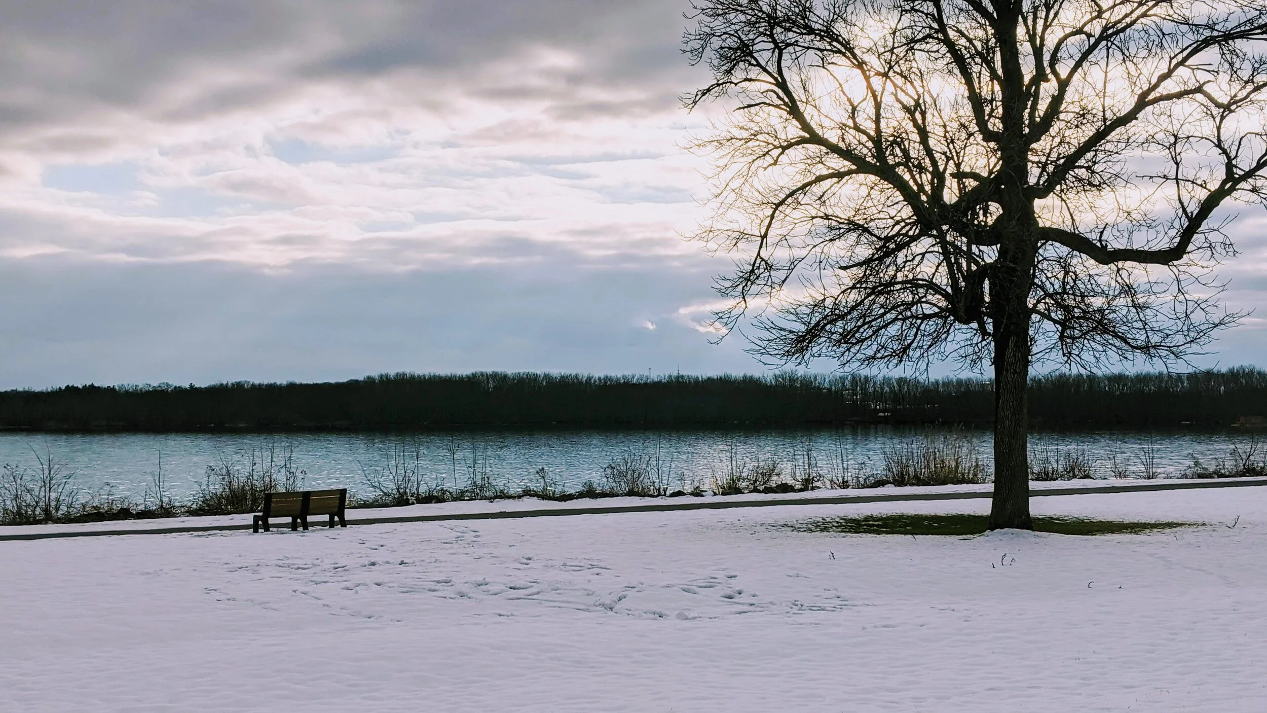
Year after year we find ourselves retreating to our homes as soon as winter sets in. The cold brings us indoors, often with friends and family close together, and we hear constant complaints about the weather. This year, in 2020, we need to fight this urge to do the same. This year we need to reacquaint ourselves with winter and embrace it in order to protect ourselves and to help our communities thrive.

Syracuse, like many cities in the Northeast and Midwest, is looking to embrace outdoor dining and activities in winter like never before. Recently the Onondaga County Executive stated his intent in helping restaurants maintain their outdoor spaces to help reduce the transmission of Covid-19 throughout the community. While this pandemic has increased the importance of this move, we shouldn’t be looking at this as a one-off experience this winter. Instead we should look at this winter as a chance to experiment and build a new relationship with the season that defines Syracuse.

Let’s take a look at Armory Square where the city has successfully implemented an open streets program on the weekends for the last few months. Shutting down these streets have helped restaurants expand their seating to more than make up for the reduced indoor capacity caused by state health mandates. Weekends on these blocks have become more lively than normal and have the atmosphere of a festival at times, showcasing the demand for new open spaces in our urban core. There’s little reason that this program should not be continued throughout the winter with some modifications to help keep people warm.

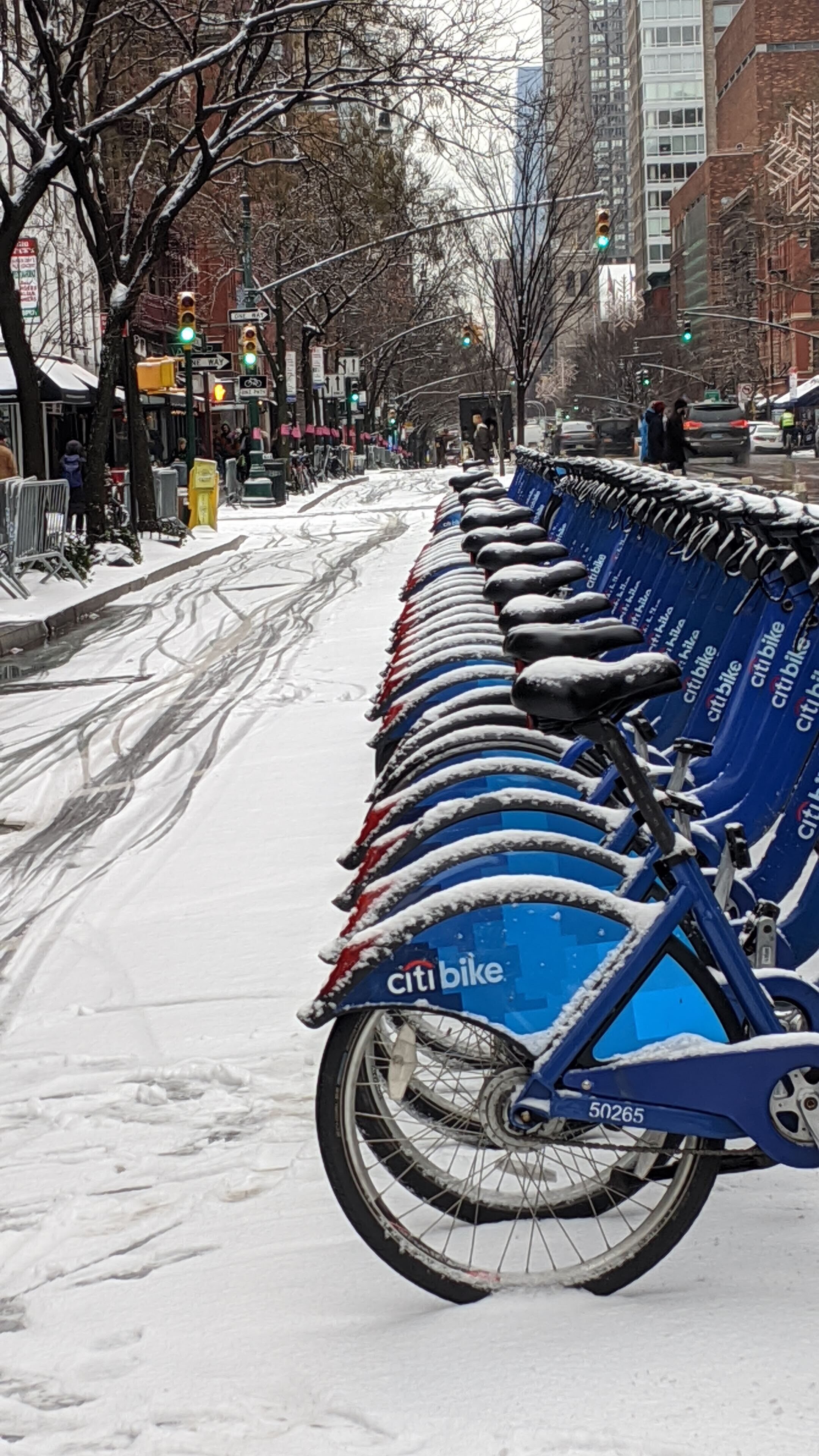
Heat lamps and coverings can go a long way in creating comfortable spaces for diners to enjoy. Simple barriers, perhaps tents with a couple walls down to block the wind, can create intimate spaces. You can look to New York where many of the curbside dining options that have sprung up have already utilized barriers and coverings to extend their usage through poor weather. Some as simple as plastic walls under tents, or all the way up to intricately themed booths that extend the indoor experience seamlessly outdoors. 

Outdoor dining options around New York City

Currently the only parklet dining options in Syracuse do not make use of any coverings and feel temporary. Adding solid roofs, planters, wood decking, etc., can go a long way in making the dining experience in these parklets feel more cohesive and less vulnerable to the traffic around them. This should be employed on the open streets as well. But while these booths can help extend the dining experience, we should also look to make use of the entire street, keeping it closed to traffic long term.

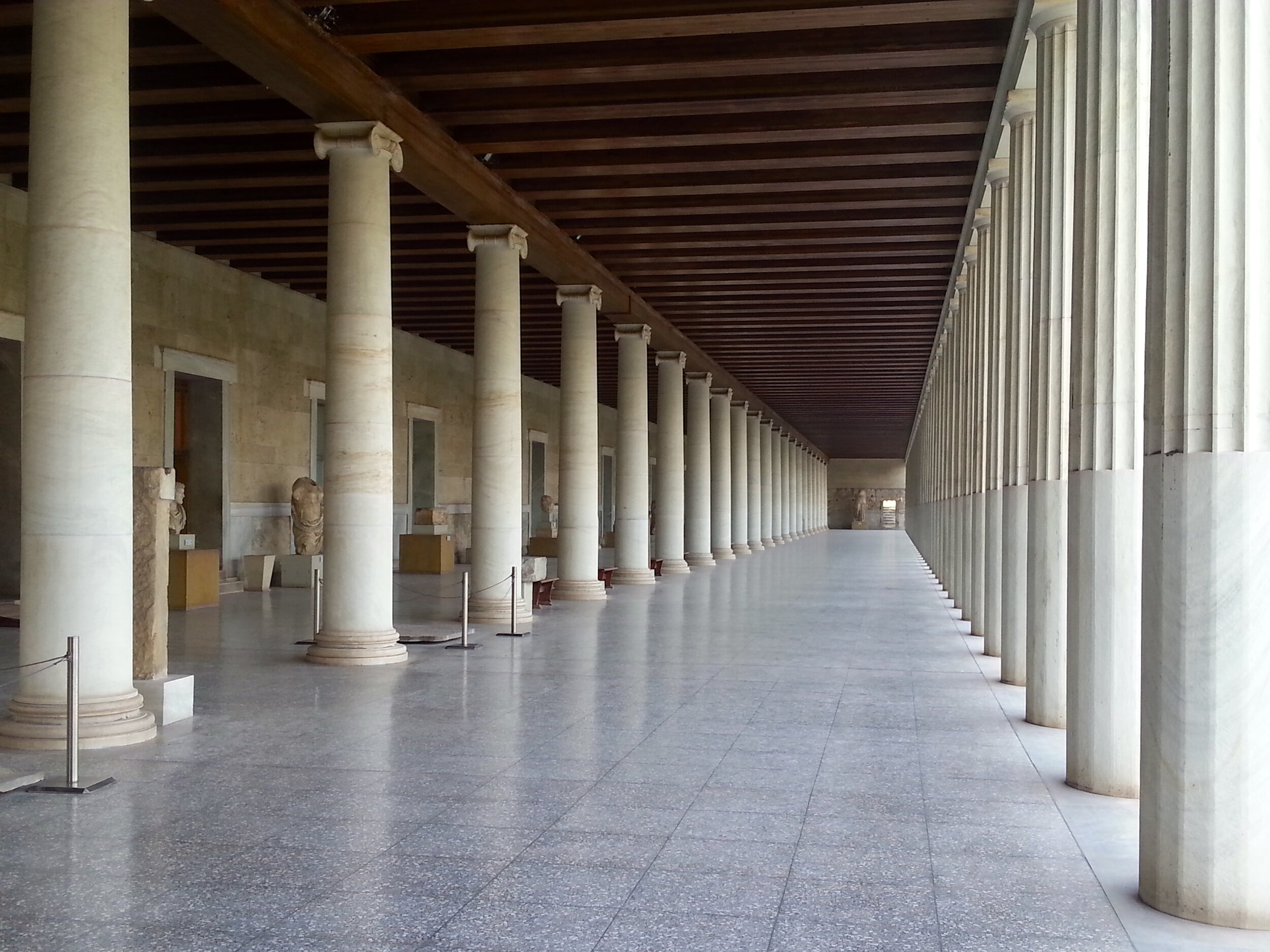
Sidewalk Labs explored the idea of using a modern version of STOA in our urban environments to help protect people in our cities during inclement weather. STOA is a traditional architectural feature of covered walkways, like those in many older Italian and Spanish cities. These walkways make it possible to actively participate in city life without running to our cars for protection. A simplified version of this could be utilized to connect these new dining booths with the buildings, reducing the amount rain or snow reaching the sidewalk while still permitting air flow onto the streets.

View fullsize Classical STOA
Classical STOA
View fullsize Modern STOA from Sidewalk Labs
Modern STOA from Sidewalk Labs

Outside of the dining booths, and in the middle of the street, should be gathering places. Fire pits, Adirondack chairs, tables with heated blankets (as showcased in this City Lab article) surrounded by lights could help create an inviting atmosphere. Combating our desires to retreat inside in winter not only requires us to provide outdoor heat but also to amp up the lighting. Along with these gathering spaces we need to permanently end the ban on unsealed containers in certain areas. Allowing visitors and residents to walk freely between restaurants and bars in specific locations will help keep any one space from becoming overcrowded as patrons feel free to move around instead of laying claim to a single spot. 

These ideas shouldn’t just be kept to Armory Square, but should be used throughout the city. Some restaurants have invested in bubbles around tables, while others, in some European countries, have created mini greenhouses around tables adding to the visual aesthetic of the area. Perhaps its time for Syracuse to open up a permanent rooftop bar and mimic the lighted igloos that have become popular Instagram spots in New York.

For a city that continually wins the title of “Snowiest City in the Country” we should be leading the country on how to embrace winter during this pandemic and beyond. Simple changes and bold decisions can reshape how we feel about this season. Perhaps even turn what many see as a reason to leave the area into one that attracts others to it.

View fullsize Hudson River in Winter
Hudson River in Winter
View fullsize Onondaga Lake in Winter
Onondaga Lake in Winter


In Urban Planning, Syracuse
Comment
IMG_20200816_134103.jpg

To Fight the Climate Crisis We Need: To Start Right Now

August 25, 2020

For the summer of 2020 I will be releasing a series of articles reflecting on some of the things cities, and urban planners specifically, can be advocating and planning for to help in our fight against the climate crisis. These pieces will reflect on our transportation networks, the need for urban living, and protecting our natural resources while bringing them into the city. While these are not comprehensive of everything that needs to be done to turn the tide of this crisis, they will provide a different vision of what our world could be like if we commit to a different form of development.


At times the climate crisis feels too large to tackle with too many pieces that need to be addressed all at once. Many will point to the role of multinational corporations and their outsized impact on the environment, noting that 100 companies have been found to be responsible for 71% of emissions since 1988. They believe that these corporations should be forced to change while changing very little about their own behavior. Yes, those corporations need to be forced to change, but since the biggest culprits are gas giants like Exon and BP, our behavior impacts their decision making. I’ve spent this summer going through big picture ideas of how we can reshape our cities to help fight this crisis, but for the last piece in this series I want to focus on a few specific things we can do right now that will get us on our way.

Syracuse Bike Plan
Syracuse Bike Plan
Rochester Bike Master Plan
Portland Bike Plan 2030
Hunter College Bike Plan for QCD11

Implement Your City’s Bike Plan

Every city I have lived in has some form of vision plan for an extensive bike network, yet very few have made significant progress implementing them. The planning has been done, the desired routes have been identified, yet we continue to wait. Some are waiting for funding to add protected bike lanes and streetscape elements along the routes, while others are stifled by backlash from communities worried about parking. But now is the time to jump start those plans.

Protected lane on Northern Boulevard in Queens, New York using a jersey barrier.

Protected lanes can often be done in low cost ways, such as using flex posts or parking blocks. Some places have even opted for jersey barriers which, while not visually appealing, offer high levels of protection for people on bikes. You can also make use of parking protected lanes that only require slightly more paint than a standard lane. Parking protected lanes often come with controversy due to drivers being uncomfortable with the new parking design, but cities shouldn’t be quick to revert back at the first sign of pushback. People can adapt and learn.

We should also remember that most lanes that cities have proposed are just standard lanes, simply requiring paint on the ground. Cities should be looking at their bike network plans every time a street is repaved, putting in their planned lanes as they go along. Even if these lanes are not fully connected initially, they’ll help build out the network faster and encourage their use.

Begin a Bus Network Redesign

Buses remain the backbone of our public transit systems, carrying the vast majority of transit riders in the country. They are also the most versatile transit mode, allowing them to adapt in a short period of time.Yet, as discussed in the earlier piece on public transit, few have significantly changed their networks to reflect the current geography of the communities they serve. This must change in order for these services to meet the needs of their current riders while attracting new riders, which is vital as we look to get more people out of their cars.

While complete redesigns can take several years, the process is much faster and cheaper and can be just as, if not more, effective than building out a rail network. New York, for example, has been working through its redesign process over the last few years, borough by borough, and has begun implementing some of these changes already. Smaller systems should be able to make these changes even faster and should start the groundwork now.

Consider Your Impact When Deciding Where to Live

In the previous piece I dug into the issues with single-family only zoning and our current suburban development patterns. Many of the changes needed to help fix this system will take time, including revamping zoning in municipalities, incentivizing more affordable housing in different forms, and implementing an urban growth boundary, but for those of us who may be moving sometime soon and have the economic ability, consider where you live and its impact on the environment. Whenever possible look for housing close to your work, perhaps along a transit line or bike network. Consider fixing up an older home purchased from your local land bank, or look for rentals (as we begin to decouple home ownership from wealth building, as it is in most of the world). You don’t need a large home for all of those family gatherings you hope to have, no matter what HGTV tries to sell you. Admit to yourself that most of that space will remain empty 98% of the time and find a more functional/efficient way to use a smaller space instead. While the apartment in the video below may be an extreme, we should be looking for ways to use our spaces in different ways to suit our varying needs.

Buy Small, Efficient Vehicles

Although we need to move quickly towards a future without personal vehicles to make the biggest impact on the climate crisis, many of us still live where cars are needed to different extents. If you are one of the millions of Americans in that situation, the next car you get should never be an SUV or pick-up truck (unless you work in construction). As noted in previous pieces, SUVs and trucks are held to much lower emissions and efficiency standards than sedans, making our overwhelming shift to these vehicles even more dangerous. Some will argue they are more efficient than ever before, but that’s a low bar to clear. 

Others will argue that they need them due to the harsh winters their cities experience. As someone who has lived in Syracuse, NY for most of my life and has driven through Upstate New York through heavy snow and ice, you don’t. Instead you should consider whether it is vital for you to drive that day, if there is another way for you to get to your destination (perhaps the bus in some cases) if the trip is vital, or spend some extra time shoveling out your vehicle as many of your biggest issues come with simply getting out of your parking space. This also ties in with where you live, as the further out you live the less transportation options you tend to have to reach your destinations, making it far more likely for you to need to drive in bad weather.

Kids sitting in front of an SUV illustrating the size of the blind spot the taller hoods create.

Source: ABC 7 WJLA https://wjla.com/features/7-on-your-side/7-on-your-side-children-killed-accidentally-run-over-by-vehicles-with-blind-spots

Still others will argue that they need the bigger vehicle to keep their children safe when driving. While this seems logical, the simple act of you driving that vehicle puts everyone else’s life at risk, including your kids as soon as they are not within the confines of your vehicle. SUVs and trucks have dangerous blind spots, as demonstrated by the image above where every child in front of that car is impossible to see by the driver. SUVs and trucks are also far more likely to kill anyone they strike, regardless of speed, due to the increased height of their hoods. Instead of striking someone at their legs, they hit directly in the chest of most people, if not their heads, causing far more internal damage, often leading to death. If we want people to walk and ride bikes more often, which is needed to truly fight the climate crisis, we need to make sure they are safe while doing so. These increasingly large vehicles put everyone’s life in danger, which has been shown by the sharp increases in pedestrian deaths over the last decade, coinciding with the increased adoption of these vehicles. Part of this is caused by the increased security drivers feel in these vehicles, which results in riskier driving maneuvers and more aggressive driving in general. (Consider picking up a copy of Crash Course by Woodrow Phoenix, which is an excellent illustration of the dangers of our current road networks).

While hybrid vehicles have been shown to have the negative effect of encouraging people to drive more, they are still a better option for most families. For others, opting out of ownership and relying on car share services, such as Via, should be considered, although this is only a true option for those living in cities with a decent level of saturation in this market. 

Make Our Covid Open Streets Permanent and Open More

The last immediate recommendation I have is to simply make some of the changes we’ve made to adapt to our new Covid-19 reality permanent. Cities across the country, of all sizes, closed off streets to traffic to open them for people to walk, bike, and dine out to great success. We shouldn’t turn back now, even in winter. Adding heat lamps and coverings can help extend outdoor dining throughout the winter helping restaurants keep their capacities up while avoiding risky indoor dining options. 

Open streets in New York have helped small businesses reach new customers and keep them alive while encouraging people to explore their neighborhood businesses more than ever before. Rethinking our streets as places for people instead of cars can help shift our relationships with our neighborhoods, helping us stay local and explore places on foot instead of feeling the need to drive. This only works if we expand these programs so that everyone is within walking distance of an open street network. 

Together, each of these actions can have significant impacts on our use of fossil fuels, helping to break the influence of those major corporations that have caused so much damage while improving our quality of life and increasing our sense of community. This isn’t just about saving ourselves and future generations from harm, but also about deciding to invest in a better future, one that is more communal and supportive than the me-centric suburban sprawl we currently endure. 

In Climate Crisis, Transportation, Housing, Urban Planning Tags Climate Crisis
Comment
A combination of single-family and multi-family homes in Syracuse’s Tipp Hill neighborhood.

A combination of single-family and multi-family homes in Syracuse’s Tipp Hill neighborhood.

To Fight the Climate Crisis We Need: A New "Standard" American Home

August 11, 2020

For the summer of 2020 I will be releasing a series of articles reflecting on some of the things cities, and urban planners specifically, can be advocating and planning for to help in our fight against the climate crisis. These pieces will reflect on our transportation networks, the need for urban living, and protecting our natural resources while bringing them into the city. While these are not comprehensive of everything that needs to be done to turn the tide of this crisis, they will provide a different vision of what our world could be like if we commit to a different form of development.


Single-family zoning found itself in the spotlight over the summer as people began to consider its racial origins through redlining practices and federal/local subsidies. Others began to turn a more critical eye towards this suburban ideal in the name of conservative economic practices, noting that the suburban experiment’s highly subsidized nature and over regulated zoning policies should upset anyone who claims to want less government interventions in private property. You can also look to the negative health effects associated with suburban living, primarily from the more sedentary lifestyle commuting requires and the increased stress levels driving produced. All of these arguments are valid and should be considered when evaluating where we choose to live, how our cities/towns choose to regulate private property, and where our tax money is sent. But we must also consider the impact our housing choices have on the environment, and perhaps living in “greener pastures” is actually the least “green” thing you can do. 

View fullsize Single-Family Zoning in NYC
Single-Family Zoning in NYC
View fullsize ReZone Syracuse Map
ReZone Syracuse Map

First, to alleviate the concern that I’m advocating for all single family homes to disappear. Eliminating single-family only zoning would simply allow for two-family, three-family, or even four-family homes to be built in every neighborhood, along with single-family homes. Last year, Minneapolis did just that, with an eye on breaking down racial and economic barriers that have been in place for nearly a century. This has been a crucial piece needed to improve access to affordable homes across the city. Many would be surprised to know that New York City still has large areas zoned for single-family only, even amidst an affordable housing crisis. The City of Syracuse continues to perpetuate the use of single-family only zoning in their ReZone project, as many residents argue about protecting the “character of the neighborhood,” which is a common racial dog whistle. Any concern for “neighborhood character” is moot since many multi-family homes look very similar to their single-family counterparts. 

Now, if we look at single-family zoning, and suburban living as a whole, from an environmental perspective the issues mostly arise from the consumption and destruction of resources. Over the last century the average American home has grown significantly in size (from around 1300 sqft. in 1960 to nearly 2700 sqft. in 2014), and many have taken up larger and larger lots. While large lot size requirements grew out of racial and economic segregationist policies, they have also resulted in pushing people further and further apart. Due to both of these factors, emissions related to travel are significantly higher in suburban areas. A report by Ed Glaeser and Matthew Kahn noted that, when controlling for family size and income, gas consumption per year per family decreases by 106 gallons when population density doubles. To showcase just how different our cities and suburbs are built, consider that Syracuse’s citywide density (5,604 people per sq. mile) is nearly five times as dense as its most populous suburb, Clay (1,216 people per sq. mile). Or, you can look at some of Syracuse’s inner ring suburbs, Geddes and Salina, where Syracuse is nearly three times as densely populated (1,813 and 2,186 people per sq. mile respectively), or more than double the density of the surrounding villages, like Baldwinsville (2,293 people per sq. mile). This emissions calculation doesn’t even take into account those who use transit, walk, or bike to get where they need to go, which would reduce the climate impact of Syracuse even further as its density and proximity to job centers/daily shopping needs allows for these alternative methods to be viable options for many trips.

Source: Bloomberg City Lab

Source: Bloomberg City Lab

Beyond the issues related to commuting, single family homes themselves consume far more energy than multi-family units. The chart above demonstrates the differences in energy consumption between an average suburban home, along with the multiple cars used to connect it to the wider community, and condo units located in urban centers, with fewer cars needed to complete needed trips. Even without factoring in the vehicles, or type of vehicles, the homes themselves consume significantly less energy. One of the main reasons for this difference simply comes down to size. Every year the National Association of Home Builders (NAHB) constructs a dream version of the American home with the aim of setting standards for new home construction. While energy efficiency has been at the forefront of many of the newer homes, they have also grown to grotesque sizes (around 11,000 sq.ft. in 2018). While these homes are not standard by any means, they’re often used to gin up demand for many of the showcased products and styles, and, most importantly, space. This is even as the average family size has dropped by over 30 percent, resulting in fewer people occupying even more space and filling it with unnecessary purchases. You can often see this on display on HGTV with people demanding more space to host parties or have”family get togethers”, which may see that space used a handful of times per year if that, often leading these home buyers further out of the city centers adding significantly to their commutes. There’s also the effect of sharing cooling and heating amongst stacked units instead of needing to individually heat and cool multiple buildings when all of the homes in a community are detached.

The location of many of these new developments adds a third layer of harm to the environmental equation. Recent years have seen some of the worst wildfires in California history, partially amplified by the climate crisis, but also amplified due to human encroachment. As communities have sprawled outward, many have begun to live in what is known as the wildland-urban interface, the areas right at the edge of the wilderness. Not only does this increase the risk of natural disasters to the people living in these communities, but it also destroys valuable natural habitats. While many in the “back-to-the-land” movement have argued that we need to live amongst nature and move out of urban centers, the result of such movement has cost wildlife millions of acres of natural habitat and has increased rates of extinction. While we need to bring nature into our communities, ideally plant life, we should be looking to contain our own outward growth and green the spaces we already occupy. 

View fullsize Inwood, Manhattan
Inwood, Manhattan
View fullsize Syracuse University Hill
Syracuse University Hill

Our current growth patterns are unsustainable in every way. Instead we should be aiming to provide more variety in our housing options and to reduce our excesses by focusing on infill projects. In most communities your only housing options are either a single-family detached home or an apartment. Some older cities still have row houses or semi-detached homes available. Condos make appearances throughout the country, but in small numbers. Part of this is due to the American obsession with home ownership, while other countries have focused on long-term leasing as a form of stability. We need to destigmatize renting and provide renters the same benefits that homeowners have in terms of tax deductions, as well as decoupling wealth accumulation from our homes. As stated previously, we need to remove single-family only zoning, along with minimum lot size restrictions, perhaps even instituting lot size maximums. We need to shift government subsidies away from suburban expansion and towards urban infill projects, rewarding developments that do not build excess amounts of car storage but instead invest in pedestrian and cycling infrastructure, or build along transit routes.

Portland's Urban Growth Boundary
Portland's Development

One final piece we need to embrace for this new housing to take hold is the urban growth boundary. Without restricting new construction to defined areas we will only continue to experience dangerous sprawl. Urban growth boundaries prevent greenfield development and encourage infill instead. The most famous American example of the growth boundary is in Portland, Oregon, but even that is too loose as most of the area inside the boundary is occupied by single-family only zoning and has been expanded fairly routinely. To give you an idea, Portland’s density (4,740 people per sq. mile) is still significantly less dense than that of Syracuse (yet it also has some of the highest bike ridership numbers in the country, proving that intense density is not needed for a bikeable city). Every Rust Belt city, and more importantly its metropolitan area, should have a growth boundary as populations have stagnated or declined. To have new development further away from the city without an increase in population is irresponsible environmentally and economically. It should also be significantly easier to implement in such cities, as opposed to many of the faster growing cities across the country (although it’s even more important to implement in those cities now rather than later). 

When you combine all of these policies you begin to open the door to more housing at all income levels while reducing the environmental strain. When paired with the many transportation policies already discussed in this series you begin to see a more sustainable way forward with comfortably dense communities built around walking, cycling, and transit use. This is a vision that is increasingly seen as the way out of the current pandemic without doubling down on the failures of auto oriented development of the last century.

In Climate Crisis, Urban Planning, Housing Tags Climate Crisis
Comment
Citi Bike.jpg

To Fight the Climate Crisis We Need: To Design Cities For People

July 27, 2020

For the summer of 2020 I will be releasing a series of articles reflecting on some of the things cities, and urban planners specifically, can be advocating and planning for to help in our fight against the climate crisis. These pieces will reflect on our transportation networks, the need for urban living, and protecting our natural resources while bringing them into the city. While these are not comprehensive of everything that needs to be done to turn the tide of this crisis, they will provide a different vision of what our world could be like if we commit to a different form of development.


Our current American cities, which are characterized by generally dense populations of people, are not built for those people. As I have mentioned in the previous pieces in this series, over the last century we have given over more and more space to cars while depriving people of needed public spaces. We’ve heard that it was required as our economies grew so that people could move more efficiently through our communities. High speed access to city centers and subsidized car storage once there were needed to ensure the success of our cities, or so the thinking went. Turns out we bled our cities dry of what makes them unique and vital; people. In their place we pumped in toxic exhaust and destroyed our physical and economic health. Activists have tried to wrestle back some of this space for people to walk and ride bikes, pointing to successes in European cities and some American cities who have experienced minor success. Slowly we began to see bike lanes pop up here and there, but no major overhauls or increases in ridership across most of the country.

And then the pandemic hit.

Suddenly many people started to look around and notice that they didn’t have adequate spaces to get out and enjoy the outdoors in their communities. Sidewalks were in disrepair or non-existent. Bike lanes, if there were any, were filled with trash, cracked pavement, or blocked by cars. Even so, bikes sold out across the country, with many stores having months long wait lists for their next shipment. Finally, many of us were on the same page: We need to start designing cities for people. Not only will this shift benefit people on a day-to-day basis, but it will also help us fight the looming climate crisis that threatens the entire world.

View fullsize Source: NACTO
Source: NACTO
View fullsize Source: TNMT
Source: TNMT

The two charts above demonstrate some of the benefits of giving over more space to people to walk and ride bikes. Walking and biking can transport three to four times more people than mixed traffic can. Not only that, but they can do so without producing significant amounts of carbon (only really seen through the actual manufacturing of bikes). 

Before someone brings up the argument that they’ve never seen that many people on bikes in an hour, yet often see cars backed up, let’s think of why there aren’t more people riding. On your average city street you have cars driving over 30mph, rolling through stop signs, taking tight turns with little to no regard for anyone trying to cross the street (even in states like New York where pedestrians have the right-of-way, yet always seem to be running to avoid cars). Now you’re on a bike with cars driving too close to your side, pushing you towards the parked cars where someone flings open their door without looking, causing you to run into it and injure yourself when you luckily don’t get hit by the car driving less than a foot to your left. Without safe bike infrastructure most people will not feel safe using a bike as a way to get around. This doesn’t mean that people aren’t interested in riding bikes more, and in fact there’s been studies across the country that point to over half of respondents wanting to ride more but citing safety as the major reason that they don’t.

Now think about your average trips you make throughout the day; to the gym, to the grocery store, to work, out to eat, etc. While your work commute, depending on where you live, could be a decent distance, perhaps over 10 miles for some, most of those other trips are within 5 miles of your home. A study by the Transportation Research and Education Center shows that 60% of trips are under 5 miles, and close to 40% are under 2 miles. These are distances easily performed on a bike, or even walking. While grocery shopping may seem cumbersome on a bike, there are plenty of bike attachments and designs that are specifically made for moving packages, groceries, and small children.

Or you may think, we live in a place with terrible winters and there’s no way riding a bike in winter makes sense. Well, for some people that may be true, you can look to the Netherlands, Finland, Sweden, or even Canada, and find large numbers of people who ride bikes in much worse climates than our own. What it comes down to is priorities and infrastructure. Many European countries that experience harsh winters prioritize clearing snow and ice off of sidewalks and bike lanes before they ever touch vehicle lanes. This is a specific policy that elevates more efficient and environmentally friendly forms of travel over the most harmful forms of travel (private vehicles).

Example of a bike boulevard intersection. Lanes are narrow with a small rotary that fits within a traditional intersection.Source: Small Town and Rural Design Guide

Example of a bike boulevard intersection. Lanes are narrow with a small rotary that fits within a traditional intersection.

Source: Small Town and Rural Design Guide

We don’t need to have bike lanes as beautiful and heavy duty as those seen in Europe and some American cities (even though we can hopefully get more like that soon). In many communities we simply need streets that slow down cars and prioritize access to people riding bikes or walking. Bike boulevards provide opportunities to improve access with minimal interventions, primarily focused around intersections. Bump out islands and small rotaries help prevent cars from taking tight turns or speeding through intersections. As a result, people on bikes and on foot are given improved visibility that allow them to enter intersections in a safer manner with some form of barrier between them and cars. While these interventions are normally put on side streets (as is emphasized in the Rochester Bicycle Master Plan), a network of bike boulevards that connect to commercial corridors could help people who ride get to destinations safely on a parallel street.

View fullsize Buffered Lane
Buffered Lane
View fullsize Protected Lane - Curbs
Protected Lane - Curbs
View fullsize Sharrows
Sharrows
View fullsize Protected Lane - Flexposts
Protected Lane - Flexposts

Even with a network of bike boulevards, a true network of protected bike lanes is vital. Too often cities paint lines and put in a bike stencil and feel that is enough. Or, even worse, put in sharrows on busy roads. Not only do sharrows not help with safety, they have actually been seen to increase the risk of injury for people on bikes. Paint does not keep a car from hitting you, or from parking in the lane blocking your right-of-way. Parking protected lanes significantly increase the safety for people riding, driving, and walking, but are often controversial due to driver “confusion” and have been taken away after complaints of not understanding how to park. Even putting up flexposts with a buffer provides a level of comfort for riders that painted lines do not, as it’s a more visual cue about the right-of-way. Protected lanes have been shown to see 6x more growth in ridership than unprotected lanes, and they also reduce all forms of crashes, whether car-to-car or car-to-bike, by over 44%. 

We’ve seen what works and what brings people out to walk and ride more. We’ve seen cities roll out new bike lanes in a matter of days, shutting down streets to cars and seeing people flock to their newly reclaimed spaces. Yes, for Americans this will be a significant shift in our thinking and how we build out our infrastructure. But if we truly want to tackle the climate crisis, providing more safe spaces for people to ride bikes and walk is one of the most important changes we can implement. Not only will it reduce our carbon emissions, but it will also improve health, improve happiness, and provide opportunities for us to interact with one another face-to-face and make connections that help build community. We can start this change now with minimal investment; just roll out some cones, paint some lanes, and start teaching kids how to ride.

In Climate Crisis, Transportation, Urban Planning Tags Climate Crisis
Comment
BX20 bus in Inwood, Manhattan

BX20 bus in Inwood, Manhattan

To Fight the Climate Crisis We Need: To Revamp Our Transit Networks and Make Them Free

July 13, 2020

For the summer of 2020 I will be releasing a series of articles reflecting on some of the things cities, and urban planners specifically, can be advocating and planning for to help in our fight against the climate crisis. These pieces will reflect on our transportation networks, the need for urban living, and protecting our natural resources while bringing them into the city. While these are not comprehensive of everything that needs to be done to turn the tide of this crisis, they will provide a different vision of what our world could be like if we commit to a different form of development.


In the previous installment of this series, we looked at electric vehicles and their shortcomings in regards to addressing the climate crisis. We must recognize that breaking our cultural obsession with owning a personal vehicle is the only way to fully tackle the scale of this crisis. Instead, rethinking our public transit networks to work better with the modern form of our cities and making them fare free can help us avert the worst of what is predicted.

Many people will argue that autonomous vehicles will solve many of these issues and convince people to give up ownership, but we can’t wait for that technology to improve to the point where that’s even feasible. As close as we continually hear the technology is, the truth is it’s much further away as designers realize the extreme difficulty of designing a vehicle to operate in such a complex environment. Even if the technology was available and safe, the efficiency of individual cars, even if its a shared fleet, pales in comparison to a properly run public transit system, as laid out in the graphic from NACTO below.

nacto-street-capacity-diagram.jpg

Now imagine if we truly invested in our public transit systems and designed them in a way that fits our modern cities. Many of our transit networks have not been updated in decades, and often continue to follow the same paths streetcars laid out over 100 years ago. As you’d guess, no city is the same as it was 100 years ago; people live in different places, businesses have clustered in different patterns, and the pace of life has changed. Yet, only a small number of cities have taken on the difficult task of revamping their transit networks to reflect how their communities have evolved. 

Houston, Texas is usually held up as an example of a city who took on an ambitious bus network redesign that worked, reworking their network into more of a grid with frequent connections and less of a central focus on the downtown core. But mid-size cities have also started to revamp their networks, with an understanding that their central cores are no longer the only employment centers. One local example is Rochester, NY, who’s transit provider, RTS, spent the past few years rethinking how their service will work. They did their best to balance coverage and frequency (which is the central dilemma agencies must consider, and is laid out well in the book Better Buses Better Cities), ramping up frequent service on 10 routes that serve that busiest corridors, while reimagining what service could be in the outer reaches of their service area. With an on-demand service using small vans to connect to fixed route services or, for a slightly higher price, curb-to-curb service within designated zones. 

Then you can look to Albany, NY which has looked to develop some of the best bus rapid transit (BRT) lines in the country, showing that a smaller mid-size city can provide service on par with much larger cities. CDTA, Albany’s transit provider, began with the BusPlus Red Line which connects many of the region’s dense neighborhoods and employment centers, seeing ridership climb along the corridor over 20%, to nearly 4 million riders a year. Since then, CDTA has expanded BRT service along two more routes, proving that better bus service can attract riders at a much lower cost than rail service. 

View fullsize METRO Houston Bus Map
METRO Houston Bus Map
View fullsize RTS Rochester Map
RTS Rochester Map
View fullsize CENTRO Syracuse Map
CENTRO Syracuse Map
View fullsize CDTA Albany BusPlus Map
CDTA Albany BusPlus Map

That’s not to say that rail service isn’t necessary in some cities, including Buffalo, NY which I’ve written about previously, but instead it's an argument in favor of cities exploring new uses for the bus first. Boston’s MBTA has been on the forefront of implementing BRT pilot programs, showing to riders and drivers alike that bus lanes and better service can help everyone. By using traffic cones to change traffic patterns to provide designated bus lanes, MBTA has improved on-time performance and sped up buses along with shortened timelines for public outreach on capital projects by demonstrating the changes being discussed while taking in real-time feedback from riders. 

Improving service, primarily frequency (at least a bus every 15 minutes) and speed, will attract new riders and convince some drivers to switch modes, but in order to convince more people to take transit we must make it economically attractive as well. This comes in two ways; stop subsidizing driving and make transit free. 

Our current legal and economic structures highly prioritize car usage, which has resulted in the decimation of the urban core in many cities. Parking lots have destroyed once walkable neighborhoods and have pushed residences and businesses further away from one another, resulting in people needing to drive to get to their destinations. Zonings that prioritize single family detached homes, which have a deeply racial history, are some of the main culprits for this new dispersed development pattern. The impact of our housing choices will be covered in a later installment. I also won’t focus on parking too much, but the following video from Vox and this interview with Donald Shoup in City Lab help lay out the many reasons free parking, or even the very low priced on-street parking that does exist, harms our economy and our environment.

Not only does free parking benefit those who drive, workers taking other forms of transportation rarely get free transit passes or other economic benefits for walking, biking or riding transit instead of driving. Drivers also benefit from tax breaks for buying electric cars, even though those cars still cause many of the same issues gas powered cars do. There are no tax incentives towards riding transit, even if it benefits the economy/environment more. If this doesn’t show you how much our governments have prioritized driving over all other transportation methods, consider that speed limits are set by those breaking the law. Other than the maximum (usually 65 or 70) and minimum (30 in most places, unless petitioned otherwise) limits that states set, speed limits are set by the 85th percentile rule, which incentives people to drive faster so that the speed limit gets raised.

Another major issue is the artificially low price of gas, which does not take into account its negative impacts on the environment, and the gas tax. The idea of the gas tax was originally to help cover the maintenance costs of the interstate highway system, but has failed to do so. With better gas mileage and a push towards electric vehicles, the gas tax will become even less of a funding source for maintaining roads, meaning the maintenance will have to come out of the general tax funds, forcing non drivers to pay a larger share of the costs when contributing far less to the wear and tear of the roadways. Charging people by miles traveled will help with this deficit, but should also be coupled with a plan to make transit free and get people out of their cars to begin with.

If you want people to opt into transit use you must make sure it’s frequent and easy to use. Once we change our networks to function more frequently, we then want to make it as easy to use as possible. The best way to do that is to simply make it free. Free transit may reduce costs in the long run with the elimination of fare payment systems, buses spend less time idling as passengers board wasting less energy, and no need for the policing of passengers to detect fare evaders. With most transit agencies already being subsidized to some degree, it wouldn’t cost much to cover the rest. In Central New York, to make CENTRO fare free, at its current service level, it would cost around $50 per household per year in its service counties, about as much as one fill up for a pick up truck. This fee would be much higher in cities with higher farebox recovery rates, such as NYC or Chicago, but advocating for reduced prices and congestion pricing should be able to help.

Our current transportation system will never solve the climate crisis. Unless we’re willing to make bold changes to how transit works and what transportation methods we subsidize we won’t make a meaningful difference in our fight.

4 Train at 161st Street-Yankee Stadium station in the Bronx

4 Train at 161st Street-Yankee Stadium station in the Bronx

In Climate Crisis, Urban Planning, Transportation Tags Climate Crisis
1 Comment
← Newer Posts Older Posts →

Recent posts

Featured
Carousel.jpg
May 27, 2025
Destiny USA and the City
May 27, 2025
Read More →
May 27, 2025
PXL_20240805_141743149.jpg
Jan 1, 2025
All Cities Are Beautiful
Jan 1, 2025
Read More →
Jan 1, 2025
PXL_20241005_135224129.jpg
Nov 6, 2024
A Healthy Future for the Regional Market
Nov 6, 2024
Read More →
Nov 6, 2024
PXL_20240728_191254239.jpg
Jul 31, 2024
Renters Matter, Too
Jul 31, 2024
Read More →
Jul 31, 2024
Vista view.jpeg
Mar 21, 2024
The Valley of the Sun - A Land of (Sub)Urban Extremes
Mar 21, 2024
Read More →
Mar 21, 2024
Manlius Cinema.jpeg
Jan 31, 2024
The Movie Theater at the Urban Core
Jan 31, 2024
Read More →
Jan 31, 2024
Clinton Square Christmas Tree at night.jpeg
Nov 30, 2023
The Case for a Holiday Village
Nov 30, 2023
Read More →
Nov 30, 2023
PXL_20230817_220739294.jpg
Oct 31, 2023
The Walk: To Middle Ages
Oct 31, 2023
Read More →
Oct 31, 2023
Ballpark.jpeg
Sep 7, 2023
The Walk: To the Ballpark
Sep 7, 2023
Read More →
Sep 7, 2023
PXL_20230813_213112525.jpg
Aug 14, 2023
The Walk: To Tipperary Hill
Aug 14, 2023
Read More →
Aug 14, 2023
Arts and Crafts Festival 2023.jpeg
Jul 31, 2023
The Walk
Jul 31, 2023
Read More →
Jul 31, 2023
PXL_20230515_144325643.jpg
Jun 21, 2023
Lessons from the North
Jun 21, 2023
Read More →
Jun 21, 2023

Powered by Squarespace