• Blog
  • Blog Index
  • Video Work
  • About
Menu

Thomas Bardenett

Urban Planning - Writer - Filmmaker
  • Blog
  • Blog Index
  • Video Work
  • About
Green Lakes State Park

Green Lakes State Park

To Fight the Climate Crisis We Need: An Understanding of What is at Stake

June 18, 2020

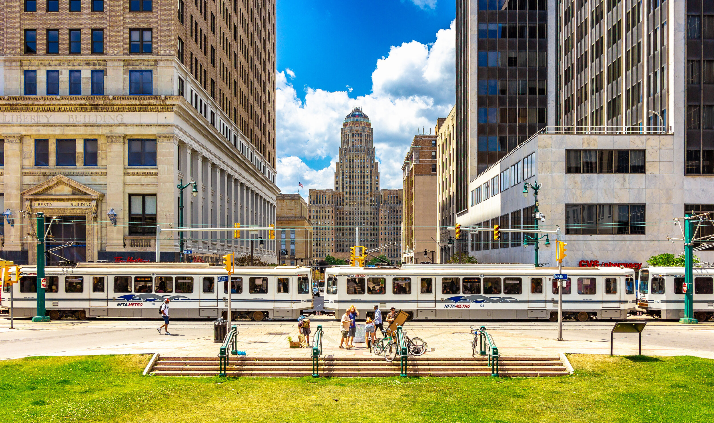
The climate crisis was headline news heading into 2020 with the record setting wildfires in Australia, flooding in Africa, and the increased speed of deforestation in the Amazon. By March a new existential threat, one with more immediate repercussions for many of us, took hold; COVID-19. The planet shut down, people stopped traveling, and we hunkered down to ride out one of the most widespread pandemics in modern history. As a result we began to see what might be possible when we approach a worldwide crisis with bold moves. As people stayed home, Los Angeles experienced its cleanest air in decades, cities in India were able to see the nearby mountains for the first time in a generation, and you could finally see the marine life in Venice. While we are nowhere near out of the woods with the pandemic, we should be working to ensure that the new normal we return to is better than the one we left, and that means taking on the climate crisis head first.

This summer I will be reflecting on some of the changes cities, states, and countries can take to help address the climate crisis, but to begin I want to look at some of the most devastating consequences of inaction may be.

Let’s think about some of the major natural disasters that we’ve experienced over the last several years. The wildfires in California have been some of the most devastating in history and their intensity can already be linked to climate change. California’s temperatures have risen by more than 1.5 degrees Celsius over the last century, more than worldwide average, which has lengthened the fire season by up to 75 days due to longer periods of drier conditions. Hurricane Harvey, which devastated Houston in 2017, was found to produce 38 percent more rainfall than a storm of its strength typically would if the world wasn’t warming, far more than even the original predictions of scientists. Superstorm Sandy in 2012 was one of the first major storms where scientists were able to prove a connection to climate change through the use of modeling systems. While these are American examples you can look around the world to find similar stories. Each of these stories will become less unique as time goes on, and some will look minuscule compared to what could happen if we don’t begin to act.

In 2018, the UN’s Intergovernmental Panel on Climate Change (IPCC) published a report that demanded that we make significant changes by 2030 or risk experiencing a hellish future. The Paris Agreement in 2015 had the world commit to keeping temperatures below a 2 degrees Celsius rise, with a push to cap it at 1.5 degrees Celsius. As of 2018 we were on track to exceed a 3 degrees Celsius rise. Without significant changes the world will see food shortages, water shortages, and an increased risk of all forms of natural disasters. If we have any hope of reaching those targets we must reduce our emissions by 45 percent when compared to 2010… We’ve increased them since then.

But let’s look at some of the other issues associated with climate change. One of the most discussed is sea level rise. Scientists are expecting at least four feet of sea level rise just from the warming that is already taking place across the planet. Many cities are already experiencing nuisance flooding on a regular basis, dropping home values so far that they’re unable to sell them, such as in many of the poorer neighborhoods in Atlantic City. And this rise in sea levels isn’t taking place uniformly. The below video from The Verge helps explain why the melting of the glaciers is even worse for some areas of the world, like New York. Many cities have developed plans to build up barriers to help protect against this risk, but they have been rightfully criticized for emphasizing the protection of wealthier areas while leaving poorer communities and communities of color at increased risk. New York’s Big U project will protect the southern tip of Manhattan up to the Lower East Side. While this does protect a large low income neighborhood, it does not address the issues in Eastern Queens and South Brooklyn where the majority of Superstorm Sandy’s devastation hit. Even in Atlantic City an ongoing construction project is working to protect the casinos and summer homes along the oceanfront while leaving the low income neighborhoods on the bayside of the city vulnerable.

We can also think about air pollution and the increased likelihood of illnesses that will come from climate change. Most of us picture Los Angeles or 1970s New York, or even worse would be Pittsburgh in the 1940s, when we think of smog and air pollution. Beijing famously had to deal with their smog issues before the 2008 Summer Olympics out of fear of harming international athletes during the competition. Now India is trying to get a handle on their dangerous levels of pollutants. While these are very visible signs of pollution we must consider some of the less visual signs, such as higher asthma and cancer rates. These primarily show up in less affluent communities and minority communities, the reasons for which can be traced back to many racial policies of the past. As a result of this pollution, these communities are far more susceptible to diseases, especially respiratory viruses such as COVID-19. But even if you don’t live in one of these communities, the climate crisis will increase the frequency and severity of pandemics for all of us. The warmer climate and our development patterns have shrunk the natural habitats for many wild animals, bringing us closer together, shrinking biodiversity, and increasing the likelihood of a disease transferring from one species to another.

View fullsize 1970s New York City
1970s New York City
View fullsize Los Angels
Los Angels
View fullsize 1940s Pittsburgh
1940s Pittsburgh

If all of this is still not enough to convince you, or perhaps more importantly those in positions of power, to take action, the climate crisis will also cause economic devastation throughout the world. One report from the UN estimates that the United States will see its economy shrink by over 10 percent by 2100 due to the climate crisis. Other reports have put the worldwide cost up to $69 trillion dollars during the same period. While shifting how our economies function and revamping our transit networks, electric grids, and land use policies will carry a significant cost, it will end up driving our economy in the long run. Already the solar industry in the US employs more people than the coal and gas industries combined.

Now I did not cover all of the severe impacts that the climate crisis will bring, but I hope the ones I did mention help illustrate how serious of a crisis we are facing. In the coming weeks I’ll be discussing some ways that we can begin to address this crisis, primarily focused on how our cities function and develop, with an aim to begin a dialogue about what our future should look like.

In Climate Crisis, Urban Planning
Comment
Source: NFTA Metro

Source: NFTA Metro

The Buffalo Metro: Finishing Phase One

May 21, 2020

Cities across the country have poured money into expanding light rail systems for several decades, with few achieving the success they had promised. While there are many reasons for the success or failure of each individual project, one of the most prominent reasons is the lack of connectivity between where people live and where people work. One system that has achieved this balance, on a small scale, is the Niagara-Frontier Transportation Authority’s (NFTA) Metro Rail, located in Buffalo, New York. With just over six miles of track, the system has a per mile ridership on par with many more transit rich cities throughout the country, and is advancing an expansion proposal that will further connect vital economic centers, finally completing what was once known as Phase One for metro. Buffalo’s metro expansion offers up an example of light rail transit that can both drive ridership and development along the corridor, something the city of Buffalo has recognized it needed for decades.

The Queen City

Buffalo’s long economic downturn obscures the immense prosperity that the region experienced for the first half of the Twentieth Century. Located at the western terminus of the Erie Canal, and on the eastern shore of Lake Erie, Buffalo was a central shipping hub connecting the East Coast with the Midwest. Millions of bushels of grain passed through the city’s ports every year, leading to the development of large grain mills along the shore. By the beginning of the Twentieth Century, Buffalo surpassed Minneapolis in terms of its grain output [1]. Ship building, steel and iron production, and meat packing plants quickly grew along with the city, which was one of the ten largest cities in the country at the turn of the century [2]. Buffalo would reach its peak population of over 580,000 residents in 1950 [1], the same year the last of the city’s original streetcars would end operations [3]. 

A shift away from shipping and towards the use of trucks and trains to move freight removed the geographic advantage the city enjoyed for over a hundred years [1]. In 1970, manufacturing accounted for over 35 percent of employment in the metropolitan region. By 2014 that share had dropped to around 10 percent, as manufacturing moved towards the south or internationally to find cheaper labor [4]. As the labor market changed, the demographics of the city changed with it. Since 1950, the population of the city has plummeted, losing over 100,000 people in the 1970s alone [1]. As of 2018, the population of Buffalo has stabilized around 256,000 residents, less than half of its peak population [5]. During this time of decline, the city began exploring ways to reinvigorate its urban core and connect its rapidly growing suburbs to downtown. By the late 1960s, a plan for a regional rail network had emerged as a desirable method of  drawing investment back into the city.

The Original Metro Plan

Source: Forgotten Buffalo, “Metro Report: Niagara Frontier’s 1995 Transit System”

Source: Forgotten Buffalo, “Metro Report: Niagara Frontier’s 1995 Transit System”

Governor Nelson Rockefeller [R] was an early supporter of the plan to bring rail transit back to the city of Buffalo, with an eye towards connecting the newly constructed SUNY University of Buffalo (UB) campus in Amherst with the downtown core [6]. A combination of federal and state funding was awarded to begin studying the proposed corridor, two-thirds of which came from the Urban Mass Transit Administration (UMTA). As planning evolved, NFTA was created in 1967 in order to bring all modes of public transportation in the Buffalo metro area under one roof, including the Port of Buffalo and the two international airports in the region [7]. By 1973, a proposal for an extensive regional heavy rail network was unveiled, titled “Metro Report: Niagara Frontier’s 1995 Transit System,” [7] laying the groundwork for the only major investment in rail transit in New York state outside of the New York metropolitan area.

Over the course of multiple phases the planned network would reach a total length of 46 miles, connecting Buffalo with its largest suburbs along with a line directly to Niagara Falls, New York. The first phase, known as the Blue Line, would run from Downtown Buffalo northeast to the SUNY UB North Campus in Amherst, the most populous suburb of Buffalo, almost entirely along the Main Street corridor, for a total of 12 miles. The route required the removal of 99 families, 78 businesses, and the acquisition of 130 structures, with plans to run service as frequently as every two minutes during peak periods with connections to bus routes at every station [7]. Phase Two would include a new line that headed directly north out of the city into the town of Tonawanda toward Niagara Falls, along with an extension of the Blue Line to the north and south. Future phases would look to expand into the metropolitan region including the Cheektowaga Corridor heading east, the Hamburg Corridor heading south, and the Richmond Corridor to the northwest [7].

A Need to Scale Back

As soon as the regional plan was published, hope for the ambitious network to be completed began to fade. Governor Rockefeller would leave the governor’s mansion to become the Vice President of the United States, removing the plan’s strongest ally in the state government. At the same time, the town of Amherst pulled support from the plan, citing concerns over mass transit bringing “urban ills” to their community, a devastating blow as one of the network’s major destinations, SUNY UB North Campus, is located within its borders [6]. 

Federal funding is key to the success of any transit plan of this scale succeeding, which proved to be the final blow to the initial ambitions of this network. Concerns over Buffalo’s shrinking size and economic downturn, coupled with the federal government’s new found reluctance to invest in public transit projects resulted in the project scaling back considerably [3]. Phase One was scaled back from a 12 mile route to just under 6.5 miles, ending at the city’s border at SUNY UB’s South Campus. Another major alteration was the switch from heavy rail to light rail, significantly reducing the cost of infrastructure along the route [6]. Even with this switch, the plan still called for amenities similar to heavy rail systems, such as raised platform boarding and prepaid fares. With these changes, UMTA agreed to fund the project in 1976 at an estimated cost of $336 million [8], eventually growing to $530 million ($1.24 billion today) [6].

Source: Knight, Kenneth G. “Buffalo’s Light-Rail Rapid Transit System”

Source: Knight, Kenneth G. “Buffalo’s Light-Rail Rapid Transit System”

Construction began in 1979 with the downtown street level tracks opening to the public in 1984. This 1.2 mile stretch would operate as a transit mall and provide free service to those using the system at the six stations within this zone. The final 5.2 miles of track, all underground, would not be opened to the public until 1986, bringing the total length of the line to 6.4 miles [6]. Upon its grand opening, Rep. Henry J. LaFalce [D], of Tonawanda, believed the new system would only succeed if two extensions were added to the route [3]. Those extensions never came, and as a result this network remains one of the shortest lines in the country.

Current State of the Metro

Source: Mapa-Metro

Source: Mapa-Metro

Even with its shortened line, Buffalo’s metro has enjoyed healthy ridership throughout its existence, although it has experienced a gradual decline in ridership overall. In the early 1990s Metro Rail’s share of all transit usage in the region was around 25% [9], with ridership peaking in 1991 at 8.5 million annual riders [6]. Today Metro Rail accounts for around 17% of total ridership, with around 4.5 million annual riders. Even with this decline, the system functions with a higher per mile ridership than most light rail networks throughout the country, with just under 2,500 riders per mile, even when compared to cities many would deem transit rich, such as Portland [10]. 

Many factors contribute to the continued success of the network, including its connectivity and fare pricing, while the service hours may be a hindrance. Unlike many of the recent investments in light rail and streetcar systems, Buffalo’s Metro Rail successfully connects residential neighborhoods with some of the larger economic centers in the region, including Downtown Buffalo and two of the SUNY UB campuses, South and the medical campus. Within a 15 minute walk, riders are also able to reach many cultural destinations, such as the Buffalo Zoo, Delaware Park, and the Elmwood neighborhood, which is known for its local culture [9]. A flat fare system also benefits riders, with both buses and Metro Rail costing $2 per ride, with all day and monthly passes available, keeping it easy and affordable for most riders using the system. One thing that may be holding back some ridership numbers is service ending at 1am, even on the weekends. With bars and restaurants being open until 4am, an early service end may be preventing some from considering Metro Rail as a transit option on their night out [11].

While ridership is comparatively high, the original intent of the network, to boost economic development in the urban core, is only now starting to see some success. For over 40 years, Main Street through Buffalo has been emptying out, leaving vacant storefronts and buildings along the corridor. Over the last several years, Buffalo has followed the national trend of seeing reinvestment in central cities, with a large portion of the local investment coming from SUNY UB and its medical campus [6]. Due to the line’s central positioning, NFTA has seen this as an opportunity to capitalize on the reinvestment, looking for private partners to revamp some of its older, dated stations [6]. 

Not all of the new developments in Buffalo have been positive for Metro Rail. Over the last few years, the city has been reintroducing cars to Main Street, with a plan to completely revamp the downtown portion of the corridor in the next several years. The mayor of the city has touted this reintroduction of cars as an economic boon for the community, and believes it is a major reason for the reinvestment that has been occurring there [12]. This claim is tough to prove, when considering the overall momentum cities have experienced over that same period of time, but its effects on Metro Rail can be seen with falling on time performance [13]. This decreasing reliability impacts the mode choice of residents, while continuing to promote the use of cars over transit. Yonah Freemark writes in City Lab that, “Increases in transit use are only possible when the low costs of driving and parking are addressed, and when government and private partners work together to develop more densely near transit stations.” [14] This current action by the city, with support from Senator Schumer, has done the exact opposite in terms of promoting the use of transit within our central cities. At the same time, NFTA has been working to develop a plan for expanding Metro Rail into the suburbs to finally connect to SUNY UB North Campus, with full support from Governor Andrew Cuomo [D]. 

Expansion Plans

Source: NFTA Metro

Source: NFTA Metro

New York State’s transportation funding formula does not take into account Buffalo’s unique position as the only community in Upstate New York to have rapid rail transit, leaving the system’s state funding on par with cities that only operate buses [15]. As a result, NFTA has been arguing in favor of expanded funding, pointing out that the proper maintenance of Metro Rail is vital in terms of gaining access to federal funding for capital programs in the region. As a response, the state awarded NFTA a $100 million grant to fund needed repairs and upgrades throughout the system including trackbed replacement, implementation of a new fare collection system, vehicle upgrades, and a new video surveillance system [16]. In 2017, Governor Cuomo announced Phase Two of the Buffalo Billion program, with $215 million going towards revitalization and smart growth programs. Around $5 million of that new funding was earmarked for environmental reviews and preliminary engineering for a Metro Rail extension program [16]. 

The expansion program aims to extend Metro Rail by 6.5 miles, reaching SUNY UB North Campus and beyond, just north of I-990. Ten new stations, including three on the North Campus, will help to connect high density job and residential centers [17]. With over 30,000 students and 14,000 employees [9], the three SUNY UB campuses are vital economic centers for the entire region. The newly extended line will allow students and employees to commute between campuses in under 20 minutes, one of the major reasons ridership is predicted to rise to around 45,000 commuters per day [18].

Not only does this $1.2 billion plan look to increase ridership, but it is again seen as an economic development tool and a way to lure in younger generations who are looking to live in more affordable cities where owning a car is optional [6]. With the majority of the new route being at grade, the hope is the stations will drive up commercial activity in the surrounding areas. The towns of Amherst and Tonawanda, which the proposed extension runs directly between along Niagara Falls Boulevard, support the plan with an eye towards investment along the corridor. Over $1.7 billion of investment is expected to follow, with an increase of $310 million in property value [18].

Source: New York State, Buffalo Billion

Source: New York State, Buffalo Billion

FTA Puts Up a Roadblock

Even with this positive outlook, the plan received a significant setback in early 2020. The Federal Transit Administration (FTA) left Metro Rail’s extension off of its New Starts program report, denying the project a grant for the Project Development phase. Without acceptance into the New Starts program, federal grant money will remain unavailable to NFTA, requiring the agency to reapply with an adjusted plan [19].

NFTA had been exploring alternative routes and construction methods, with an aim of reducing costs by around $200 million. Underground construction is to be reduced from around 10,000 feet to 3,900 feet, moving most of the construction for the project to street level. Keeping as much of the construction within the right-of-way, along with slight rerouting, will also help reduce the cost of construction along with reducing the amount of disruption residents and businesses will experience [18]. Without the acceptance into the 2020 New Start program, NFTA remains hopeful of gaining approval in the near future, although acquiring any Fully Funding Grant Agreement from the FTA before 2025 seems unlikely [19].

Although the project is experiencing a significant setback, it remains a promising prospect for the Buffalo region. In pushing for this expansion, NFTA looks to make good on its promise of Phase One from the original 1973 plan, finally connecting some of its most populous suburbs and largest employers with the city center. If what we ask of transit projects is to connect people with destinations and provide frequent service, Metro Rail in Buffalo is looking to do just that. With a fully realized Phase One, Metro Rail may be able to begin living up to the promises it made nearly five decades ago and begin to justify the extensive network that was once envisioned.


Sources

[1] Glaeser, Edward L. “Can Buffalo Ever Come Back?” City Journal, Autumn 2007. https://www.city-journal.org/html/can-buffalo-ever-come-back-13050.html

[2] Encyclopedia Britannica. “Buffalo, New York.” Accessed April 15, 2020. https://www.britannica.com/place/Buffalo-New-York

[3] Gargan, Edward A. “Buffalo Trolley Line Clangs to a Start.” The New York Times, October 10, 1984. https://www.nytimes.com/1984/10/10/nyregion/buffalo-trolley-line-clangs-to-a-start.html

[4] Bacheller, John. “The Decline of Manufacturing in New York and the Rust Belt.” Policy By Numbers. October 26, 2017. https://policybynumbers.com/the-decline-of-manufacturing-in-new-york-and-the-rust-belt

[5] World Population Review. “Buffalo, New York Population 2020.” Accessed May 1, 2020. https://worldpopulationreview.com/us-cities/buffalo-population/

[6] Byrnes, Mark. “A Struggling Metro System’s Big, Vague, Self-Destructive Idea.” City Lab, August 24, 2018. https://www.citylab.com/design/2018/08/a-struggling-metro-systems-big-vague-self-destructive-idea/567634/

[7] Forgotten Buffalo. “Transit Development Program.” Accessed March 10, 2020. http://www.forgottenbuffalo.com/forgottenbflofeatures/metrorail1973.html

[8] Knight, Kenneth G. “Buffalo's Light-Rail Rapid Transit System.” Niagara Frontier Transportation Authority. Accessed March 11, 2020. http://onlinepubs.trb.org/Onlinepubs/sr/sr182/182-007.pdf

[9] Horbovetz, Arian. “Buffalo’s Metro Rail: What Transit Should Be.” The Urban Phoenix, December 6, 2018. https://theurbanphoenix.com/2018/12/06/buffalohardworkingrail/

[10] Bliss, Laura. “A U.S. Transit Atlas That Ranks the Best (and Worst) Cities for Bus and Rail.” City Lab, November, 28, 2018. https://www.citylab.com/transportation/2018/11/best-transit-american-cities-bus-rail-subway-service/576739/

[11] Mapa-Metro. “Metro of Buffalo.” Accessed March 10, 2020. https://mapa-metro.com/en/united-states/buffalo/buffalo-metro-rail-map.htm

[12] Buffalo Rising. “The Next Phase of Cars Sharing Main Street Gets Underway.” August 27, 2018. https://www.buffalorising.com/2018/08/the-next-phase-of-cars-sharing-main-street-gets-underway/

[13] NFTA-Metro. 2017-2018 Annual Performance Report. Accessed May 3, 2020. https://metro.nfta.com/media/nclhoayl/annualperformancereport-18.pdf, p. 8

[14] Freemark, Yonah. “Have U.S. Light Rail Systems Been Worth the Investment?” City Lab, April 10, 2014. https://www.citylab.com/transportation/2014/04/have-us-light-rail-systems-been-worth-investment/8838/

[15] Smith, Sandy. “Buffalo Argues It Deserves Light Rail Funding — And Gets It.” Next City, April 3, 2019. https://nextcity.org/daily/entry/buffalo-argues-light-rail-funding

[16] New York State. “Buffalo Billion: Light Rail Extension Study.” Accessed March 10, 2020. https://buffalobillion.ny.gov/light-rail-extension-study

[17] WSP. “Planning Underway to Extend Buffalo Light Rail.” Accessed March 10, 2020. https://www.wsp.com/en-US/insights/extending-light-rail-in-buffalo

[18] McCarthy, Robert J. “NFTA Proposes New, Cheaper Route for Metro Rail Extension to Amherst. The Buffalo News, November 20, 2018. https://buffalonews.com/2018/11/20/nfta-proposes-new-cheaper-route-for-metro-rail-extension-to-amherst/

[19] Penner, Larry. “NFTA Denied FTA New Starts Qualification.” Railway Age, February 21, 2020. https://www.railwayage.com/passenger/light-rail/nfta-denied-fta-new-starts-qualification/

In Transportation, Urban Planning, Buffalo
1 Comment
South Salina Street in Syracuse, NY

South Salina Street in Syracuse, NY

Dense, Mixed-Use Neighborhoods Are Even More Important Now

April 3, 2020

In the time of COVID-19 we have repeatedly heard the phrase “reducing the density” as a way to combat the virus. While staying a safe distance apart from one another is important during this time, the phrasing may lead to the wrong conclusions about dense, urban development. This should not be seen as an indictment of urban living, but instead a call to arms to rethink how our cities function and who public space is meant for. 

As social animals, we crave access to others, even if the way we interact and how big of a social dose we need varies. Our current urban and inner ring suburban infrastructure limits our ability to share open spaces with one another at safe distances. Newer, far flung suburban neighborhoods may have more personal open space for people to occupy privately, but they reduce the social interactions we desire with others. 

It is likely that a major infrastructure bill and jobs program will materialize as a way to build back our economy. This is the moment to rethink how our urban spaces work and advocate for changes that will not only improve our day-to-day lives but also function better in times of crisis. We shouldn’t double down on the development patterns of the past, but instead look to figure out how to improve the future. In some ways, this could be the beginning of a Green New Deal that progressives have been arguing for. Here are a few ideas that we should explore:

View fullsize 2020-04-03 05.06.58 2.jpg
View fullsize 2020-04-03 05.07.03 2.jpg
View fullsize 2020-04-03 05.07.25 2.jpg

True Neighborhood Units

Over the last several decades we’ve moved away from neighborhood businesses and schools, and we’ve emphasized distance away from others. Suburban development has been almost entirely residential with large commercial plazas attracting residents from miles away to a centralized location. Even though these plazas, which are dominated by regional and national chains, often cut the price of the distribution of goods and lower the prices of products, there are several downsides to this development style, beyond hurting small, local businesses.

As we emphasize the need to avoid close encounters with others, these centralized shopping centers make this impossible. Many communities only have one or two options for basic necessities, such as groceries, resulting in thousands of customers flocking to this single point. When a worker, or shopper, tests positive for the virus, this news now affects a wide swath of communities, making it difficult to track down how the virus may have spread. Locally, the Dewitt Wegmans, the largest Wegmans around, had an employee test positive. Figuring out who may have interacted with this employee, and then who they in turn may have infected, becomes complicated as customers spread out across the region.

A true, complete neighborhood helps simplify this process, with the added benefits of promoting locally owned businesses and a sense of community. First to define what I consider a neighborhood in this context. While most will consider a neighborhood to be related to a common history, culture, or defined by a specified boundary, but in this context I’m looking to consider a neighborhood as anywhere that you can walk to within 15-20 minutes, or up to 30 minutes in some cases. For this neighborhood to be considered complete you should be able to access grocery stores, pharmacies, small home improvement stores, along with a neighborhood bar or restaurant. A true neighborhood should provide you easy access to your daily necessities on foot.

This is how neighborhoods functioned in the past, developing close knit communities that often created distinct cultures and traditions, until we began subsidizing suburban development patterns that pushed us further and further apart. At the same time, these neighborhood units would make it easier for ourselves to isolate communities during a pandemic like we’re experiencing today and stop its spread. With most residents frequenting the stores closest to them, it becomes easier to track down customers and enforce quarantines should someone catch the disease. For communities outside of the infected area daily routine errands can continue mostly uninterrupted as long as they stay within their neighborhood unit.

Rezoning efforts that promote neighborhood business corridors and mixed-use development can spark the creation of these neighborhoods that should also be supported through tax incentives for local small businesses. Even with a new focus on localized businesses, they won’t be able to succeed if we don’t change the way people live and interact with their neighborhood.

The Return of Townhouses/ Row Houses/ Brownstones

One of the major reasons our neighborhood units began to break apart has been the emphasis on single family detached homes and the ever increasing size of the standard lot. While dense urban neighborhoods remain, they’ve become less and less common outside of major cities. Upstate New York cities have seen their populations decline and with it the population density. Even when new urban housing is built, they’re often apartments located either in the downtown neighborhoods or near local universities. Due to this, our housing options have dwindled to two primary housing types: single family detached homes or apartments. This leaves a lot to be desired, especially for people who would like to own a home but also want a more urban living style. This is why we must encourage the development of modern urban townhouses (or row houses or brownstones depending on your preferred terminology). 

Row houses in Pittsburgh, PA. Source: PittsburghSkyline.com

Row houses in Pittsburgh, PA. Source: PittsburghSkyline.com

Some cities have an excellent remaining stock of townhouses, with New York, Pittsburgh and Philadelphia coming to mind, but many mid-size cities no longer have a large housing stock in this style. If you’re looking for townhouses around Syracuse you’re often stuck looking in suburban developments that are poor in terms of walkability to run errands. We should be looking to correct this fact and provide opportunities for the development of urban townhouses. Right now it’s unclear whether or not townhouses are allowed under Syracuse’s zoning laws, or even the rezoning proposal. We should be more specific about how townhouses fit within our urban environment, and encourage their use near existing business corridors and proposed business corridors.

Now you may be asking why townhouses should be a part of our new urban development pattern. There are several reasons why townhouses should be an integral part of cities, but the main factor is that they provide home ownership opportunities at denser levels of development. A typical household in Syracuse has a lot around 40 ft. wide and 110 ft. deep. Townhouses typically have a lot only 25 ft. wide, allowing for nearly double the built density while still providing a decent amount of private outdoor space for residents. This increased density creates a more visually interesting and vibrant environment while still providing a significant amount of private space, but, more importantly, it makes a 15-20 minute neighborhood commute possible. At the current densities of most neighborhoods, there just isn’t enough people to provide the critical mass for businesses, other than corner stores, to survive from local commerce only. 

As these densities increase, along with the amount of local commerce, we must ensure that there is plenty of space for residents to spread out and engage with their communities, even in times where social distancing is required.

A Network of Bike Boulevards and Mixed-Use Paths

One of the few promising developments happening during this pandemic is the new emphasis on expanding public spaces for people on foot. New York City has started a pilot program shutting down a number of blocks along Park Ave. so that residents can get out and walk while keeping extra space between one another. This builds off of the success of the 14th Street Busway also in NYC, and the Market Street Busway in San Francisco. We’re starting to see leaders acknowledge that we have plenty of public spaces within our cities, but we’ve given over too much of it to cars. 

Screen Shot 2020-04-03 at 11.30.50 AM.png

Communities across the country are seeing an increase in the number of people walking around their community as a way to get out and get fresh air during this time, but many do not have safe spaces to do so. An article out of Cleveland noted that many suburban residents were heading into inner ring suburbs or the city to walk on sidewalks since their own communities don’t have any. A Guardian article notes that joggers and walkers are now competing for a finite amount of space available on a sidewalk. We can even look in our own communities where our neighborhood sidewalks are often, at their widest, maybe 5 ft. wide, making it difficult to walk next to someone and completely impossible to keep proper distance away from one another during this time where 6 ft. is considered the minimum. In more usual times, these sidewalks often discourage people from walking as they prevent us from socializing how we wish to, bring us too close to strangers, and often make us feel as though we’re invading private property even though we’re in a public space. Now that more people are looking for accessible public spaces and making use of our current infrastructure, there may be a new demand for better, more plentiful spaces.

View fullsize Bike Boulevard in Lawrence, KS
Bike Boulevard in Lawrence, KS
View fullsize Bike Boulevard Design
Bike Boulevard Design
View fullsize Bike Boulevard in Berkeley, CA
Bike Boulevard in Berkeley, CA

In this light we should consider remaking our neighborhood streets to emphasize pedestrians and cyclists and restrict the use of cars. This may sound crazy in a country that has been dominated by cars for almost a century, but there are many examples for us to build from. Barcelona, Spain has created a series of superblocks, routing traffic around the edges while only allowing local traffic to enter the blocks. Berlin, Germany has begun experimenting with new pedestrian malls that are essentially parks surrounded by storefronts.

We should explore creating a network of these spaces to provide plentiful amounts of open space for people to enjoy and interact with their communities, no matter the distance restrictions placed upon us. Bike boulevards, which are streets with quieting measures like speed pillows and small roundabouts, could be implemented on a small budget throughout cities to slow down traffic and provide safe spaces for people to walk and ride bikes. We may even wish to explore closing entire streets to traffic, which has already been done in Syracuse along Onondaga Creek. We should identify streets that are underused but provide helpful connections to convert into mixed-use paths that connect to bike boulevards, resulting in a vast network available to residents throughout the city. 

View fullsize IMG_20181103_135037.jpg
View fullsize IMG_20181022_155755.jpg
View fullsize IMG_20181103_135331.jpg

The End Result

By combining mixed-use development, neighborhood business corridors, middle to high density housing, and more open space for pedestrians and cyclists, we can create a more sustainable city for the future, less reliant on cars and more resilient to health crises. Although I haven’t touched on public transit specifically, it should not be forgotten. Our public transit system is already vital to our economy, and should become even more integral moving forward. It’s been deemed an essential service and carries many of our essential employees to work throughout this crisis. We need to ensure that they are funded at a level worthy of an essential service.

Don’t be fooled into thinking that density is our enemy when it is in fact a solution to many of our modern problems. Countries far denser than the United States have proven that they can handle a crisis better than us; from South Korea to Singapore to Germany. It’s their policies and their sense of a common good that comes from living close to your neighbors that has helped them during the time of COVID-19. We should take time to learn from them and improve upon them to make an urban environment that truly works for people.

In Urban Planning Tags COVID-19
Comment

Little Neck Bay in Northeastern Queens, NY

Bike Lanes in Northeastern Queens

February 24, 2020

Over the course of four months, as part of an eight member team, I helped produce an in depth look at how bike lanes and pedestrian improvements could benefit a corner of New York City that is often overlooked when it comes to transportation projects. Tucked away at the far eastern border where Queens meets Nassau County, Community District 11 (Auburndale, Bayside, Douglaston, Douglas Manor, East Flushing, Hollis Hills, Little Neck, and Oakland Gardens) often shares much more in common with smaller cities across the country than with the rest of New York City. Nearly every family has access to at least one car, and those who travel by public transit are primarily using the bus. Beautiful parks and green spaces populate the area, and most homes have small backyards for kids to play in. These are scenes you don’t associate with the largest city in the country, yet here it is.

Our eight member team, assembled as part of the Planning Studio requirement for attaining a Masters in Urban Planning from CUNY Hunter College, took on the task of bridging the gap between the community and NYC DOT with hopes of bringing needed improvements to the area’s transportation network. While I don’t wish to get into the details of the plan (which you can read at the link below), I look to briefly reflect on what was learned through this process.

Improving Livability in Northeastern Queens: A Vision for Complete Streets

A protected bike lane along Northern Boulevard. The implementation of this needed infrastructure caused a rift between the community and NYC DOT.

There Is Space for EvERYONE

American cities have continually overbuilt our roadways, especially on the local level. While this has become a common place notion among planners over the course of a few decades, we still have not fully grappled with how to repurpose this space and do so without making communities feel as though they are losing something. This doesn’t mean that a bike lane should be placed on every street with excess space. It doesn’t even mean that we always need a bike lane to begin with.

During our outreach to the public and our in person observations, we came to realize that many streets within the neighborhood are already safe for riding bikes, even without infrastructure there. This is the case for countless neighborhood streets across the country where only residents drive and usually at very slow speeds as they approach their homes. These are the streets millions of kids learn how to ride their bikes for the first time. By acknowledging this to the community we also gained their trust that we weren’t going to be putting infrastructure where it wasn’t needed. We made clear that only wanted to intervene where it was important to improve safety or help direct riders.

Old in Body, Young at Heart

We were continually surprised at the number of people over 65 who ride bikes everyday, including an 86 year old man who rides his bike everyday. It was a good reminder that all spaces should be accessible to all ages. While I continually find myself considering how children interact with spaces, primarily due to my background of working in schools, those same considerations should be shown for our aging neighbors. Just because they are getting older does not mean they don’t plan on staying active within their neighborhood. Positioning bike infrastructure and pedestrian improvements as a way to encourage a more active lifestyle and improve safety can be one way to encourage a conversation about how we interact with our environment.

Stay Involved

One of the most important decisions our team made was to stay in active contact with the local transportation committee. While our client may have been the DOT, we knew that we needed to be even more involved with the community. By showing up to meetings, reaching out for conversations, and staying in touch, we were able to bring our plan to the community and have a real discussion about our report. They may not have agreed with everything in our final report, but they found many proposals that they were interested in pursuing. We continually emphasized that the purpose of our plan was to start a conversation, and now the community and DOT have a common point of reference to work from.

While we always wish that we could’ve contacted more residents and gained even more insight into the needs of the community, we believe our commitment to involving the committee members throughout helped shape our plan in a tangible way. And while I cannot speak for every member of our team, I do believe that many of us would be happy to continue fielding questions about the plan proposals and findings to help the community move forward.

In Transportation, Urban Planning
Comment

Corner of Park St. and Hiawatha Blvd. on the Northside of Syracuse, NY two blocks from Destiny USA and NBT Bank Stadium, and across the street from the Regional Market. This busy intersection lacks crosswalks, pedestrian signals, and proper sidewalks.

Minor Pet Peeves and Easy Fixes

January 20, 2020

While I often write about big picture ideas and how to reshape neighborhoods, many times the small details that affect our daily lives get overlooked. These details may not affect everyone, and many may not even notice them, but they are simple issues to fix and its time our cities work to get the small things right before moving on to big picture items. Although these issues will be specifically about Syracuse, NY, many of these issues can be found in cities across the country.

Pedestrians in all directions told not to walk at the corner of Park St. and Butternut St. on the Northside of Syracuse, NY

Pedestrians in all directions told not to walk at the corner of Park St. and Butternut St. on the Northside of Syracuse, NY

Sync Up Pedestrian Signals with Traffic Lights

As a pedestrian you’re at your most vulnerable as you cross the street. You must trust cars taking turns will see you and that drivers will obey the traffic signal above. The issue comes when you don’t know when it is safe to cross. You’re told to wait for the walking sign, so you hit the beg button and wait your turn that may or may not come. After a while you’re forced to risk crossing without the signal and run to the other side. I hate when I see people running across the street when they have the right-of-way, but they still feel as though they are the ones doing something wrong and so they run.

This is all too common of an occurrence and can be simply fixed by syncing the pedestrian signals with the lights. You should never have to push the beg button to get across the street, and you should never see the “Do Not Walk” sign while traffic moving in your same direction has a green light. Moving to a system that is timed properly, and where the solid “Do Not Walk” sign does not appear until the traffic light are at yellow, will reduce confusion for pedestrians and drastically increase their safety.

It will also make drivers feel safer. When you’re stopped at a traffic light and someone approaches the corner, with the current signal system you don’t know what decision they are going to make. They may decide to cross because they don’t know how much longer the green light will last. With properly timed signals they know if there’s enough time to cross or not, cutting down on those mad dashes across the street and making everyone feel safer in the process.

Bus stop along Grant Blvd. on the Northside of Syracuse, NY without any sidewalk nearby, yet still labeled as Handicap Accessible

Bus stop along Grant Blvd. on the Northside of Syracuse, NY without any sidewalk nearby, yet still labeled as Handicap Accessible

Not All Bus Stops are Handicap Accessible

Every single bus stop sign in Syracuse has a Handicap Accessible logo on it. Perhaps this is because our buses kneel and can accommodate people with walking disabilities, but it’s also a lie. Yes, the bus can accommodate those with special needs, but where those riders must wait and how they get there cannot.

One perfect example is Grant Blvd. near Woodlawn Cemetery. There are no sidewalks along the cemetery and no concrete waiting spaces for people to stand. Centro has labeled these stops as Handicap Accessible even though no one in a wheelchair or has trouble walking can feasibly get there, especially not in the winter time where you must wait in snow mounds or in the road.

While Grant Blvd. is a prime example of poor planning for stops, other stops have smaller issues that reduce their accessibility to those with disabilities. Again, wheelchairs do best on hard surfaces, yet most of our stops require riders to walk on grass (or snow in winter) to get on the bus. Every bus stop, should it be labeled Handicap Accessible, should have an extended sidewalk that goes to the curbside, allowing for easier access for those in need.

No crosswalks at a busy intersection just a few blocks from Lemoyne Elementary School in Syracuse, NY

No crosswalks at a busy intersection just a few blocks from Lemoyne Elementary School in Syracuse, NY

Crosswalks at Every Stop Light and Every School

Paint is the cheapest tool a department can use when reshaping streets, and it is all that is needed in order to make intersections safer for pedestrians. High visibility crosswalks should be present at every traffic signal in the city and at every corner directly connected to a school. These are the places that pedestrians, many of them children, must cross, and yet we do a poor job of visually providing them safe spaces to cross. Every corner that touches the block a school is located on should have crosswalks in order to signal to drivers that students have the priority in this space. Traffic signals should also require crosswalks as they are the only opportunities for pedestrians to cross safely without moving vehicles to dodge. Without the crosswalk markings pedestrians are treated as unwelcome nuisances to drivers. (A big picture idea is that we need to reshape our streets so that cars are unwelcome and pedestrians own the space).

A poorly kept sidewalk on the Westside of Syracuse, NY. Not an uncommon site throughout the city, often forcing people into the streets to walk.

A poorly kept sidewalk on the Westside of Syracuse, NY. Not an uncommon site throughout the city, often forcing people into the streets to walk.

Sidewalks Wide Enough for Three People

In all honesty I’d prefer even wider sidewalks, but I’ll say wide enough for three people should be the bare minimum. One of the things that makes walking downtown or in cities like New York and D.C. pleasurable is the fact that you can comfortably walk next to someone and not constantly rearrange to allow someone to pass. You can maintain a conversation and be fully engaged in the moment, instead of looking ahead and knowing you’re going to shift or be uncomfortably close to someone passing by.

Some will argue that those areas need the wider sidewalks due to commercial entities and higher traffic volumes, which are both correct. But there are plenty of people who walk around their neighborhoods, or would like to do so more often, but are eventually forced into the street due to poorly maintained, narrow sidewalks. If you want people to walk more, or you yourself want to walk more, providing comfortable sidewalks is the easiest way to achieve that.

Yes, we need to change our zoning laws and allow for mix-use development, but since this is a piece about pet peeves and more small scale fixes I’ll let you read more about that in my previous piece.

In Urban Planning, Syracuse
1 Comment
← Newer Posts Older Posts →

Recent posts

Featured
Carousel.jpg
May 27, 2025
Destiny USA and the City
May 27, 2025
Read More →
May 27, 2025
PXL_20240805_141743149.jpg
Jan 1, 2025
All Cities Are Beautiful
Jan 1, 2025
Read More →
Jan 1, 2025
PXL_20241005_135224129.jpg
Nov 6, 2024
A Healthy Future for the Regional Market
Nov 6, 2024
Read More →
Nov 6, 2024
PXL_20240728_191254239.jpg
Jul 31, 2024
Renters Matter, Too
Jul 31, 2024
Read More →
Jul 31, 2024
Vista view.jpeg
Mar 21, 2024
The Valley of the Sun - A Land of (Sub)Urban Extremes
Mar 21, 2024
Read More →
Mar 21, 2024
Manlius Cinema.jpeg
Jan 31, 2024
The Movie Theater at the Urban Core
Jan 31, 2024
Read More →
Jan 31, 2024
Clinton Square Christmas Tree at night.jpeg
Nov 30, 2023
The Case for a Holiday Village
Nov 30, 2023
Read More →
Nov 30, 2023
PXL_20230817_220739294.jpg
Oct 31, 2023
The Walk: To Middle Ages
Oct 31, 2023
Read More →
Oct 31, 2023
Ballpark.jpeg
Sep 7, 2023
The Walk: To the Ballpark
Sep 7, 2023
Read More →
Sep 7, 2023
PXL_20230813_213112525.jpg
Aug 14, 2023
The Walk: To Tipperary Hill
Aug 14, 2023
Read More →
Aug 14, 2023
Arts and Crafts Festival 2023.jpeg
Jul 31, 2023
The Walk
Jul 31, 2023
Read More →
Jul 31, 2023
PXL_20230515_144325643.jpg
Jun 21, 2023
Lessons from the North
Jun 21, 2023
Read More →
Jun 21, 2023

Powered by Squarespace